

Coastal walks are elemental. You’re passing through a space where sky and sea and land meet. Sometimes it’s delightfully sunny; other times, you’ll be buffeted by wind and rain. We’ve walked the British coast in shorts and t-shirts, and cooled off with an ocean dip and an ice cream afterwards. But there’s also something special about being the only person on a windswept beach in the dead of winter, and watching the waves crash against the shore.
There are some amazing long-distance national trails across the UK coastline, including the 630-mile South West Coast Path and the 870-mile Wales Coast Path. There’s even an initiative to join them together into one epic coastal trail. We’ve selected coastal hikes that can be completed in a day, but with many connected to these longer routes, it’s easy to stretch them out into multi-day adventures.
Considering that there’s over 11,000 miles of coastline in mainland UK (and thousands more in its offshore islands), selecting just 10 coastal walks was difficult. Our final choices evoke a sense of the geographic diversity of the UK’s coastline. The walks take you across moorland and around deserted peninsulas; past sunken ships and around islands.
The UK’s Best Coastal Walks
Coastal Walks in the England
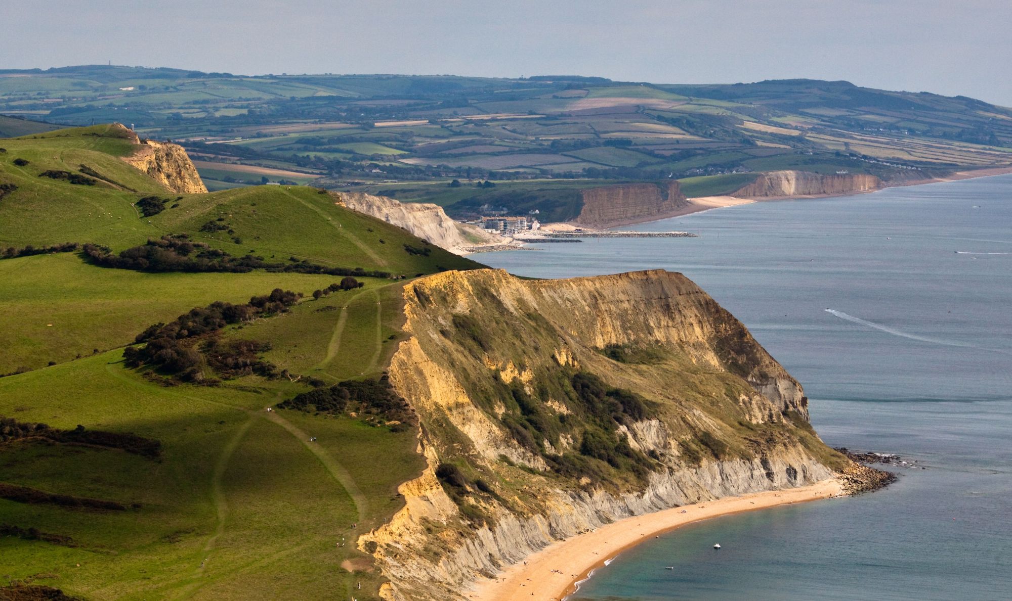
1. Seatown to West Bay, Dorset
Distance: 8 miles
Walking Time: 3-4 hours
This walking route is one of our favourite South West Coast Path walks. It takes you through one of the most picturesque stretches of The Jurassic Coast, an Area of Outstanding Natural Beauty beginning in Exmouth, Devon and ending at Old Harry Rocks in Dorset. It was designated a UNESCO world heritage site in 2001, as the rocky coastline reflects 185 million years of the earth’s history.
Begin your walk at Charmouth Beach, where you’ll see people hunting for fossils at low tide. You’ll climb up Stonebarrow Hill and then up to Golden Cap, the highest point of the Jurassic Coast at 191m. You’ll be treated to an amazing panorama of Lyme Bay - the steep cliffs, shingle beaches and patchwork fields. Do the walk on a blustery autumn day and it'll definitely blow away the cobwebs!
Descend to Seatown, where you can have a quick break for a swim (and a pint at The Anchor Inn). The coastal path leads you back up Doghouse Hill, once the site of a neolithic settlement around 10,000 years old. You’ll continue along the clifftops on a clearly defined path for several miles, passing a ruined tower on your left hand side. You’ll descend to Eype Beach, before completing the walk at West Bay.
To return to Charmouth, you can either retrace your steps on foot or catch the X53 bus back to the town (plan your bus route here).
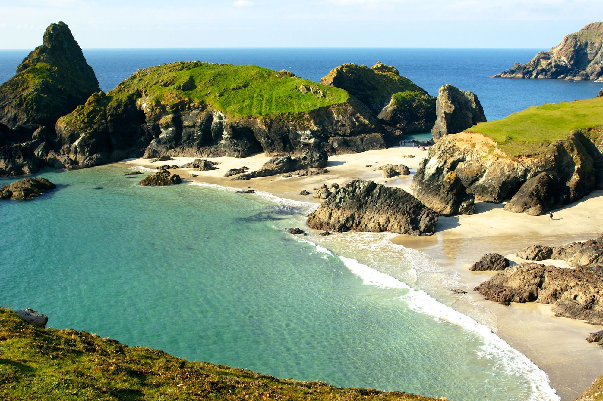
2. The Lizard Peninsula Circular Walk, Cornwall
Distance: 7 miles
Walking Time: 3 hours
One of our favourite Cornish coastal walks, taking you around mainland Britain’s most southerly point, the Lizard Peninsula. We love the contrast between the rugged coastline and the clear turquoise sea - the peninsula has a more off-the-beaten-track feel than other parts of Cornwall.
Start the walk at Kynance Cove - there’s a national trust car park where you can leave the car for the day. The cove has been voted one of Britain’s best beaches, thanks to its white sand, rock formations and clear seas (it’s a great place to swim after you’ve finished the walk). Strike out east along the coastal path, passing above Pentreath Beach. Keep your eyes peeled for gannets, guillemots and shearwaters offshore. After around a mile and a half you’ll reach Lizard Point and the Lizard Lighthouse.
Continue along the coast path for another couple of miles - you’ll pass Lion’s Den, a 12m hole in the cliffs, and the Old Signal Station at Bass Point. From here, take the path to the left and follow it inland to Lizard village. You’ll pass the village green and from can follow the footpath back to Kynance Cove. There’s a former fisherman’s cottage above the beach which has been converted into a cafe, perfect for refreshments.
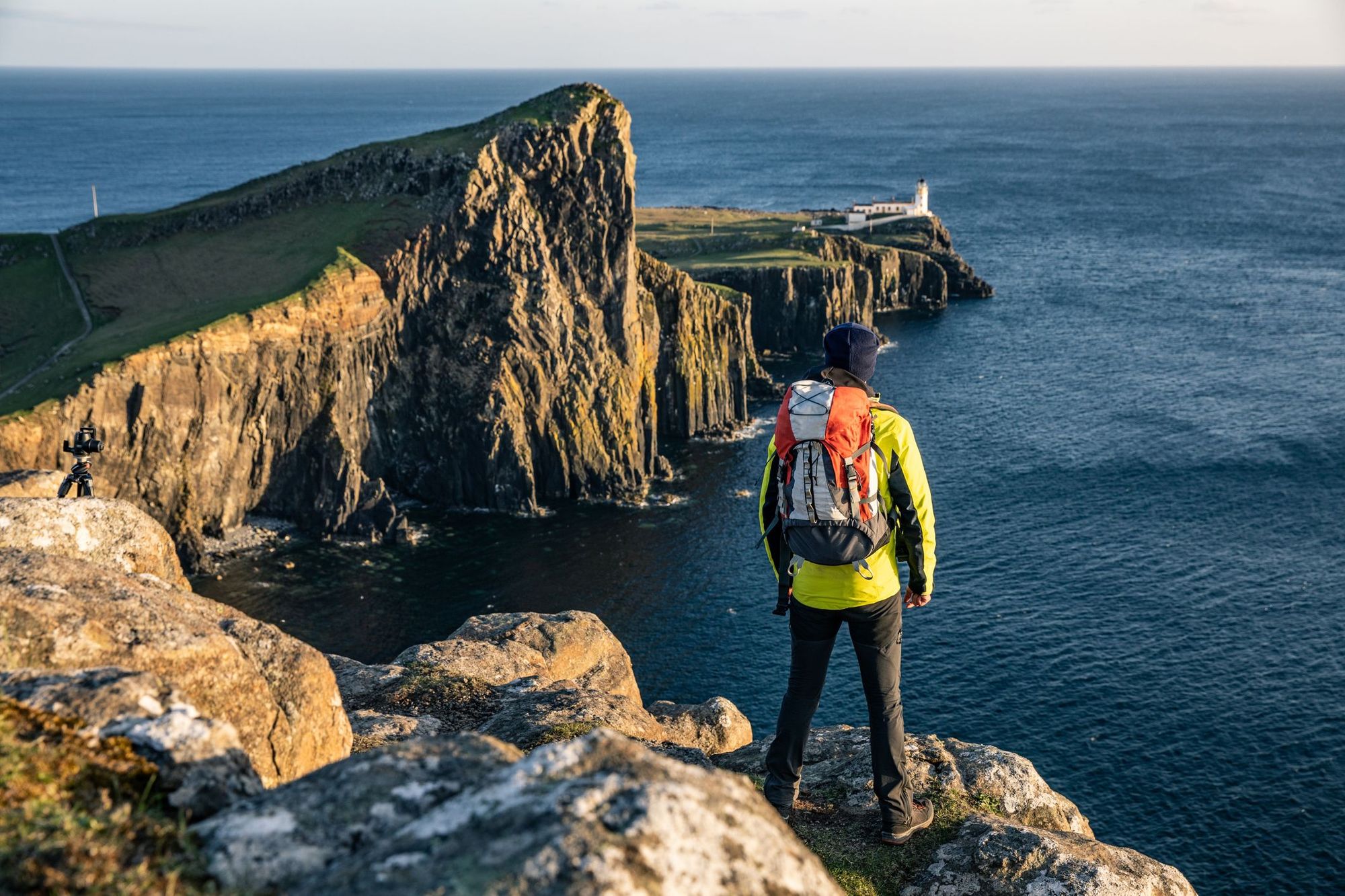
3. Minehead to Porlock, Somerset
Distance: 9 miles
Walking Time: 4-5 hours
This hike is the first stage of the South West Coast Path, a 630-mile trail through Somerset, Cornwall, Devon and Dorset. The first section runs through Exmoor National Park, which has some of the highest cliffs in England (rising to 250m), so expect some steepish ascents and jaw-dropping clifftop views.
You’ll begin the walk on Minehead seafront, and follow it west as it zig-zags up North Hill; the most strenuous section of the day’s walk. Pause to admire the view - on a clear day you’ll be able to see all the way to Wales. By now, you’ll have reached open moorland. Keep an eye out for some of Exmoor’s rare species of flora and fauna, including red deer and whitebeam trees, which are unique to the National Park.
After a mile or so, the path divides. You can either take a gentle route inland to Selworthy Beacon, or take the more strenuous “rugged path”, which hugs the side of the cliffs and provides more dramatic views (take a guess which one we’d recommend) - this will add some extra time to your journey. The two paths eventually meet, and descend steeply downhill to Porlock Bay. Get the number 10 bus or the open-top Exmoor Coaster bus back to Minehead - they run regularly.
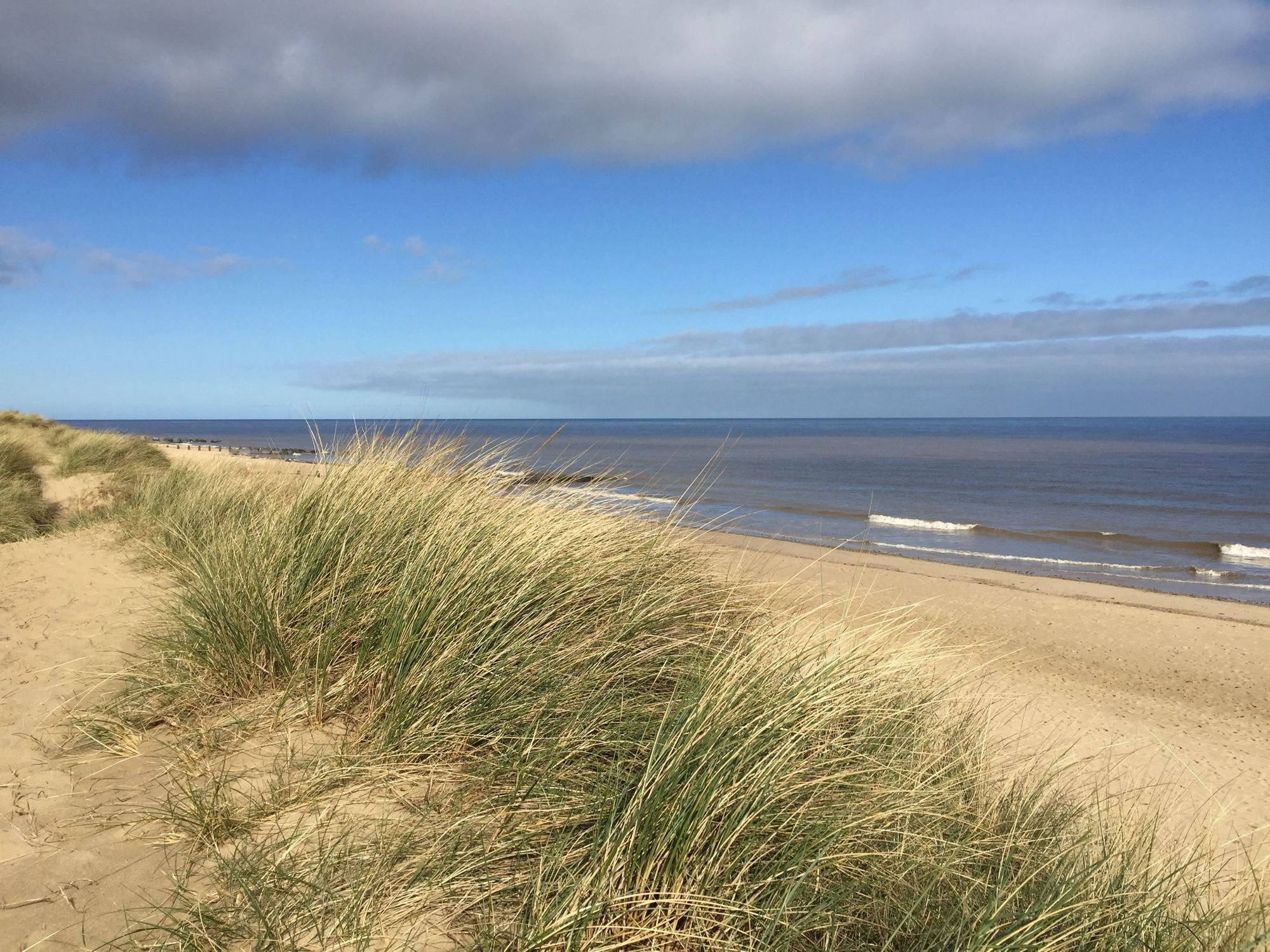
4. Horsey Windpump to Waxham, Norfolk
Distance: 7 miles
Walking Time: 3-4 hours
There’s a special place in our hearts for the windswept Norfolk coast, with its wide skies, miles-long beaches and the churning waves of the North Sea. Horsey Gap is a particular favourite, as it’s home to a thriving colony of Atlantic grey seals between October and April (they swim offshore year round).
Park at Horsey Windpump and cross the road - go through the gates to start the walk. Follow a path across the field. Turn left, climb over the stile and cross the next field. You’ll emerge onto a farm track. To the left is the Nelson Head, a cosy, welcoming pub where you can stop for lunch on the way back. Turn right, then, when the track forks, take the left hand path. Follow this grassy track past hedgerows and fields (in the autumn, you can forage for blackberries and sloes here) until you reach Horsey Gap.
Scramble through this gap in the dunes and you’ll find yourself on the beach, unless it’s between November and January, which is breeding season for the seals. During this period, you won’t be allowed onto the beach - you’ll be able to follow a path along the dunes, and look down at the seal colony.
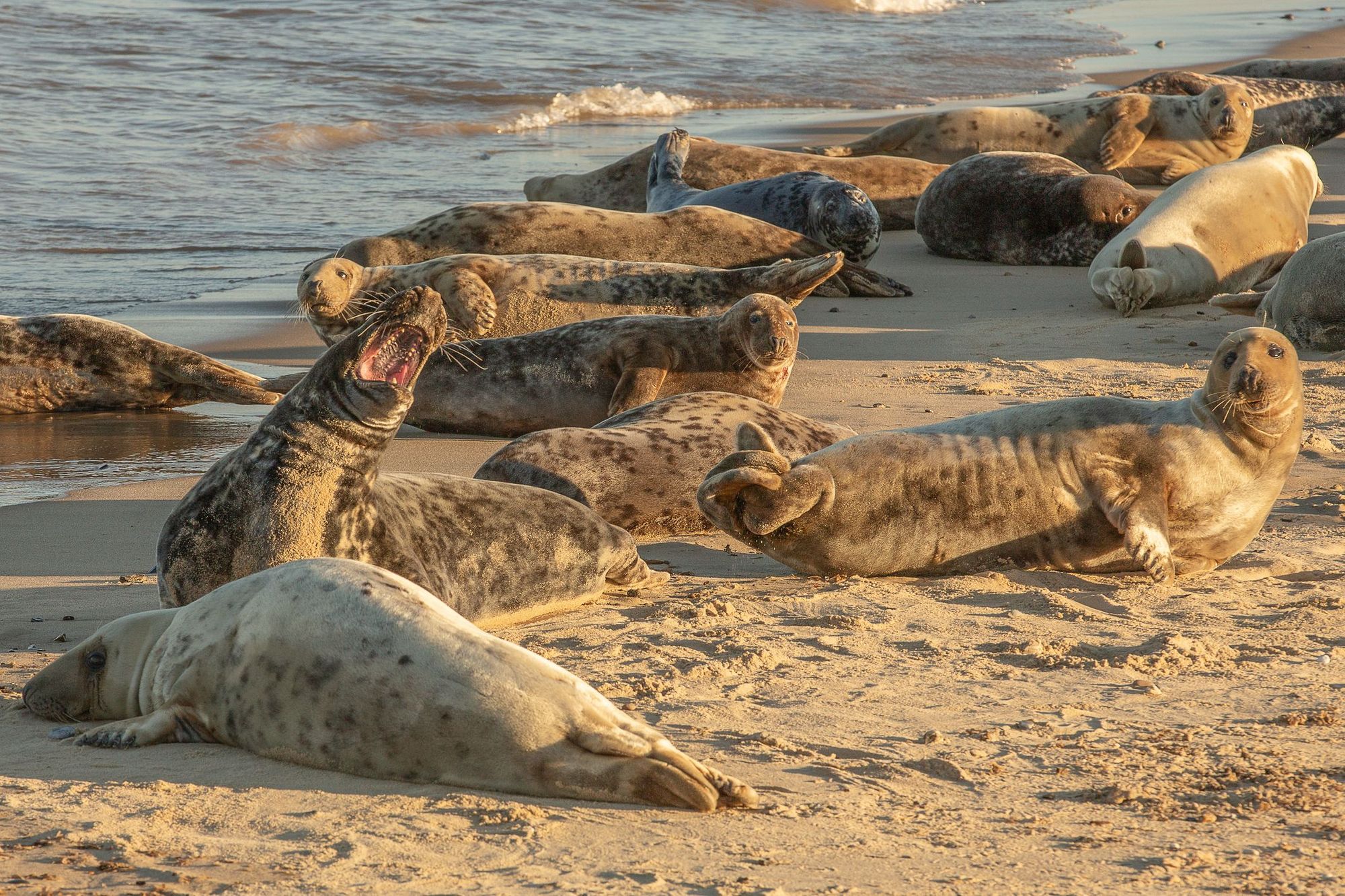
However, from January to March it’s possible to walk along the beach, and get a really good view of the thousands of seals that have come onshore. Make sure not to get too close to them - if you see a seal that appears to be injured, make a call to the Friends of Horsey Seals Rescue Team.
Head north until Horsey Beach becomes Waxham Beach, our favourite wild swimming beach in Norfolk. You can keep on walking along the beach until it reaches Sea Palling (a popular resort village), or turn around and follow the coast path back over the dunes until you reach Horsey Gap. From here, retrace your steps to the car.
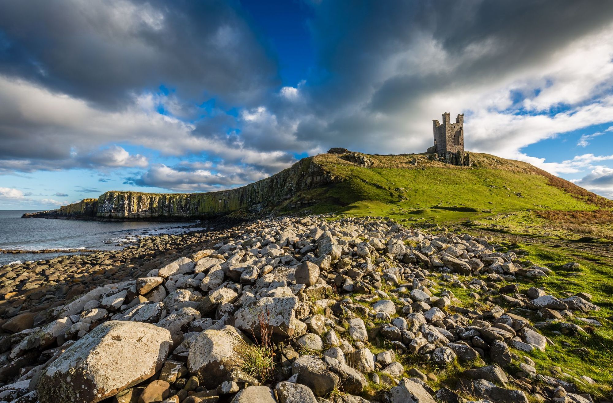
5. Craster to Seahouses, Northumberland
Distance: 10 miles
Walking Time: 3-4 hours
This hike is the third stage of the Northumberland Coastal Path, a 62-mile hike past austere castles, rocky headlands and sandy beaches and through two nature reserves. It begins in Craster, a small town renowned for its smoked kippers, and heads up the coast to Seahouses.
Head north from the harbour - after around a mile, you’ll reach the striking ruins of Dunstanburgh Castle on a remote headland. Follow the path round the corner to Embleton Bay, which is surrounded by dunes. Next up is Newton Pool Nature Reserve, and then a gorgeous stretch of sand known as Beadnell Bay. Walk through the village of Beadnell (where you can stop for refreshments) - from here it’s just a mile and a half along the coast to Seahouses.
From Seahouses it’s possible to take a boat trip out to the rugged Farne Islands, where you should be able to spot puffins and seals. To return to Craster, you can take bus 418, X15 or X18 - use Traveline North East to plan your journey.
Coastal Walks in Wales
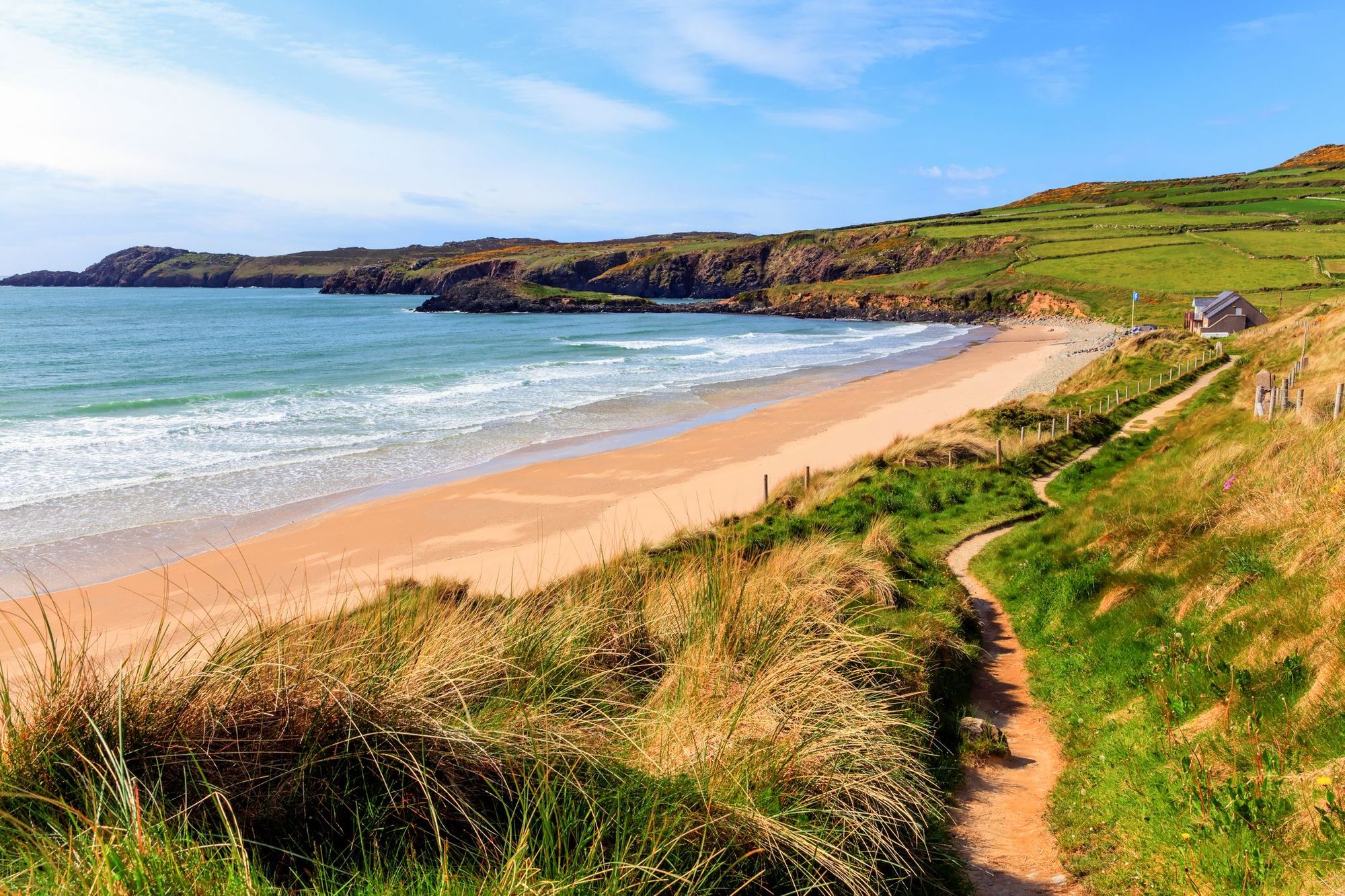
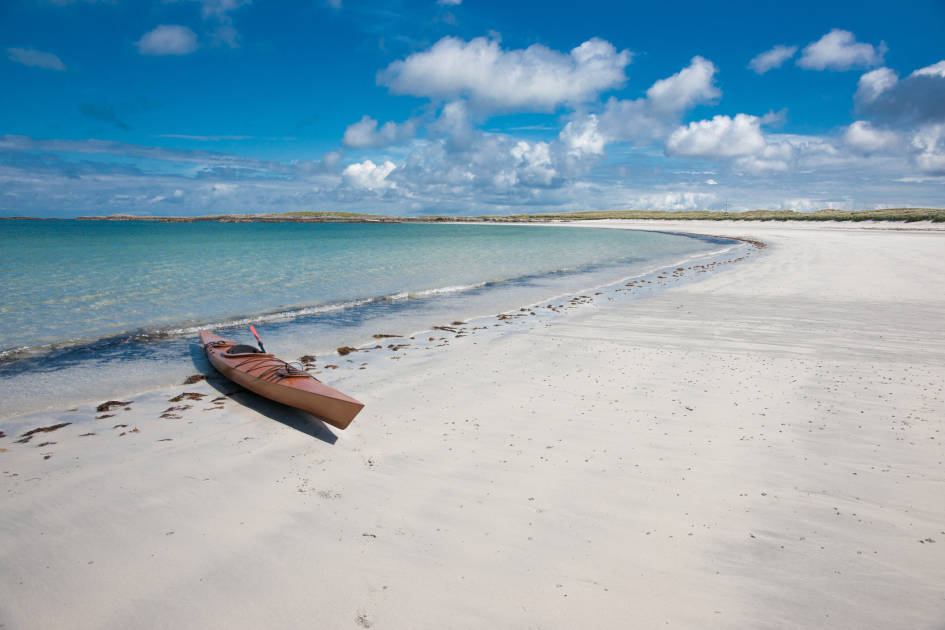
6. St David’s Peninsula Circular Walk, Pembrokeshire
Distance: 10.5 miles
Walking Time: 4-5 hours
The 186-mile Pembrokeshire Coast Path offers up some of the best and most varied coastal walking in the UK, passing Iron Age Forts and Celtic Chapels; wild beaches and sheltered coves. St David’s Peninsula encapsulates both the history and diverse landscapes of the wider area - in the summer, the clifftops are carpeted in colourful wildflowers.
Start the walk off in St Davids (The UK’s smallest city), and head south on Goat Street, until you reach St Non’s Bay and the Pembrokeshire Coast Path. Head west along it, tracing the peninsula. After a couple of miles you’ll reach picturesque Porthclais Harbour, followed by Porthlysgi Bay. The path then takes you around the Treginnis Peninsula; you’re walking over rocks that are 600 million years old.
You’ll now be walking along the northern side of the peninsula, and following the coastal path up towards Whitesands Bay, a picturesque blue flag beach with a cafe where you can stop for refreshments. From here, follow the B4583 inland past Whitesands Camping; take the first right after the golf club onto an unmarked lane (Feidr Chwech-Erw) and follow it for just over a mile back to St Davids.
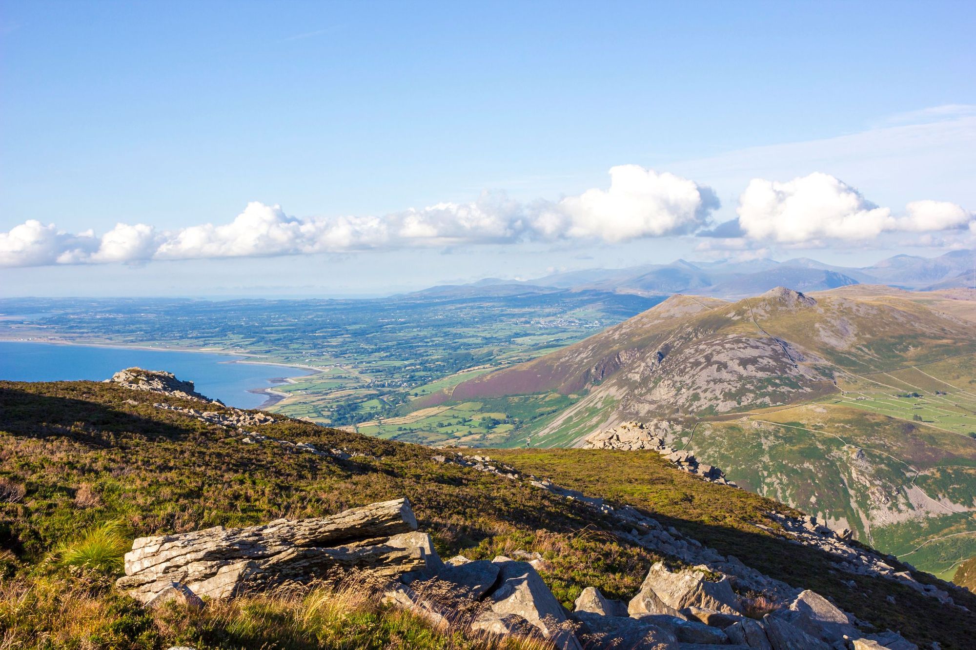
7. Aberdaron Circular Walk, Snowdonia
Distance: 9.3 miles
Walking Time: 5 hours
Most of our favourite hikes in Snowdonia are through its mountains, but there are also some fantastic coastal hikes in this national park. We’d particularly recommend the Aberdaron circular walk on the gorgeous Llŷn Peninsula, which offers panoramic views of the ocean on one side and Snowdonia’s craggy peaks on the other.
Begin by walking west along the Wales Coast Path - it’ll take you away from the village and to Porth Meudy. From here, follow a cart track next to a stream inland, and up towards a farm. You’ll follow the path up Mynydd Anelog, a hill with an elevation of 191m. Pause to admire the view of the peninsula - looking south you’ll see Bardsey Island.
The path descends to the other side of the Llŷn, and rejoins the coastal path. Travel north up the coast, eventually reaching Porthor, a secluded cove renowned for its shipwrecks and smuggling tradition. You’ll follow the road inland through the car park, then turn right at the junction. Turn left along a cart track, and when you reach another lane, turn right towards Cyll y Felin. Cross over the road and turn left, returning to Aberdaron through a pleasant river valley.
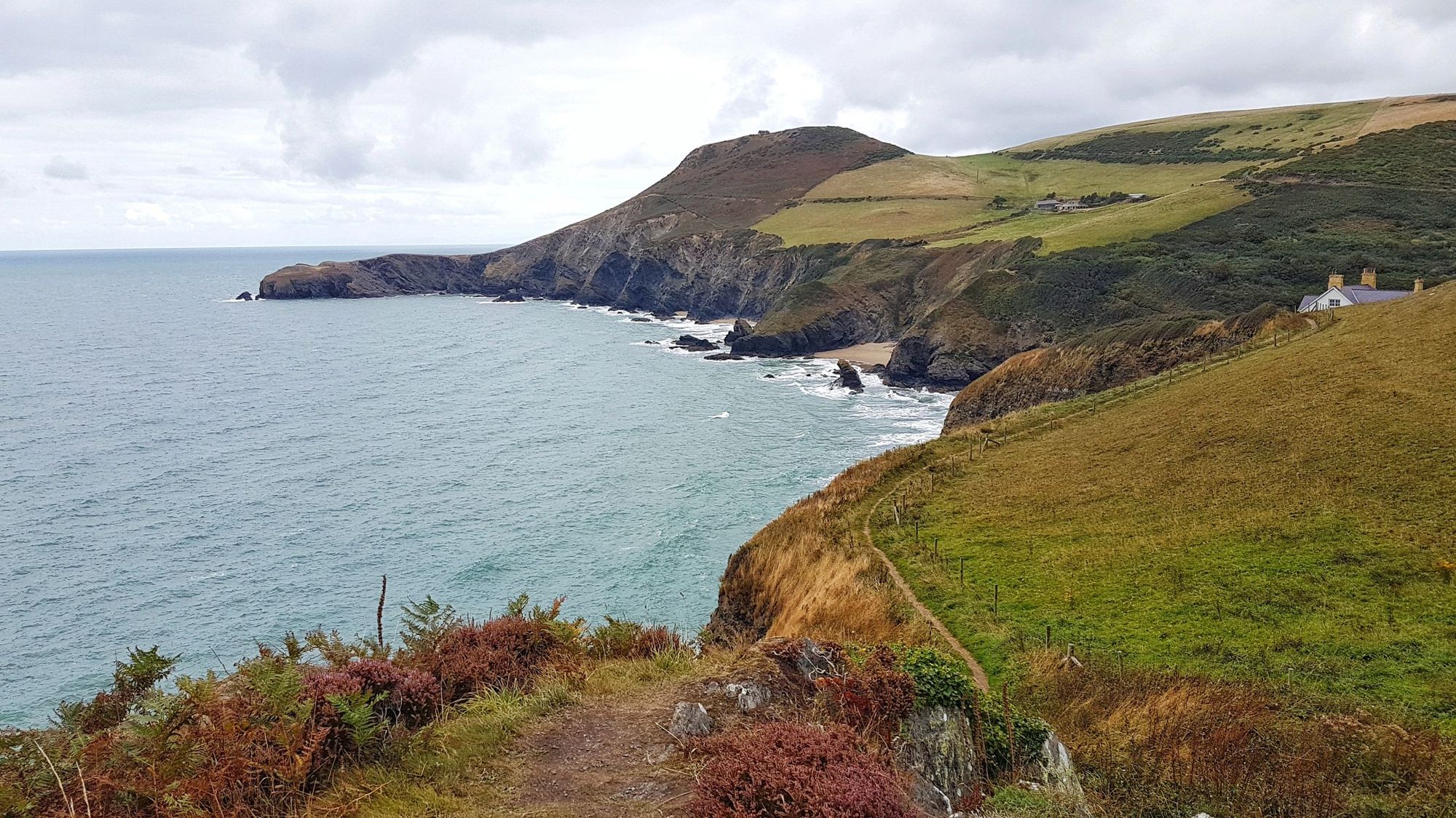
8. Llangrannog to New Quay, Ceredigion
Distance: 9.4 miles
Walking Time: 4-5 hours
In peak season holidaymakers flock to Pembrokeshire and Snowdonia, but Ceredigion - the county in between them - sees far fewer tourists. It’s one of our favourite spots in Wales to visit for the colourful market towns, the quiet beaches and the epic coastal walks. This day hike is our favourite part of the Ceredigion Coast Path, a 60-mile stretch of the Wales Coast Path. It takes you from Llangrannog to New Quay (not to be confused with the Cornish resort of Newquay).
Set off from Llangrannog across vertiginous cliffs, passing the small peninsula of Ynys Lochtyn. The path clings to a steep slope and then passes through a wooded valley until you reach Cwmtydu, a secluded cove where you might see Atlantic grey seals. This is the walk’s halfway point.
Follow the path as it leads past Castell Bach, an iron age hillfort close to the cliffs, and the valley of Cwm Soden. As you round the headland to descend into New Quay, you’ll pass Bird Rock, an important seabird breeding area. An old coastguard hut has been restored to make a lookout point - keep your eyes peeled for kittiwakes, razorbills and more.
To return to Llangrannog, you can take public bus 552. However, be aware that it only runs on Thursdays, Fridays and Saturdays, so outside of those days you could book a taxi (or shuttle with two cars).
Coastal Walks in Scotland
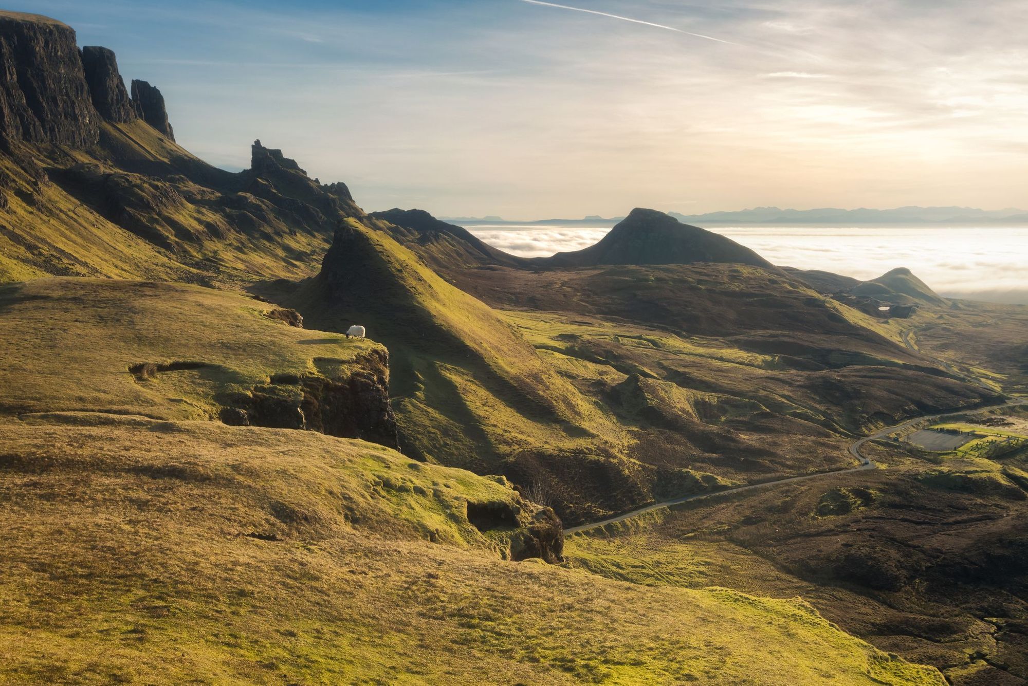
9. The Flodigarry and Quiraing Hike, Isle of Skye
Distance: 6.3 miles
Walking Time: 4 hours
The Isle of Skye in Scotland is a walker’s paradise, with dramatic rock formations, craggy mountains, forests, waterfalls and lochs. And, of course, it has hundreds of miles of coastline to be explored. One of the most popular walking areas is the Quiraing, an ancient landslip on the island’s north coast. It has a well-trodden loop circuit through the escarpments - our version is slightly longer, beginning at a quieter start point.
Begin the walk at the Flodigarry hike parking lot and follow the grassy path signposted ‘Maoladh Mar via Quiraing’. Continue along the path, which skirts several lochs (ignoring the right hand turn after your first fence crossing). The next time the path splits, bear right to stay on it. After around a mile, turn right off the path onto a smaller path - this skirts the bottom of the cliffs and then ascends up to the Trotternish Ridge. It’ll descend sharply and you’ll turn left to walk underneath the cliffs you just crossed.
Ignore the right hand turn to ‘The Prison’ and continue straight. As you pass a cairn, you’ll see the iconic ‘Old Man of Storr’ (a finger-shaped rock formation) on your left. The path ascends and descends until it forks. Take the right hand fork to rejoin the path that took you over the cliffs - from here, simply retrace your steps towards the car park. It’s a short walk to the seashore at Flodigarry, where intrepid wild swimmers can brave the cold water for a dip.
10. The Ardnish Peninsula, West Coast of Scotland
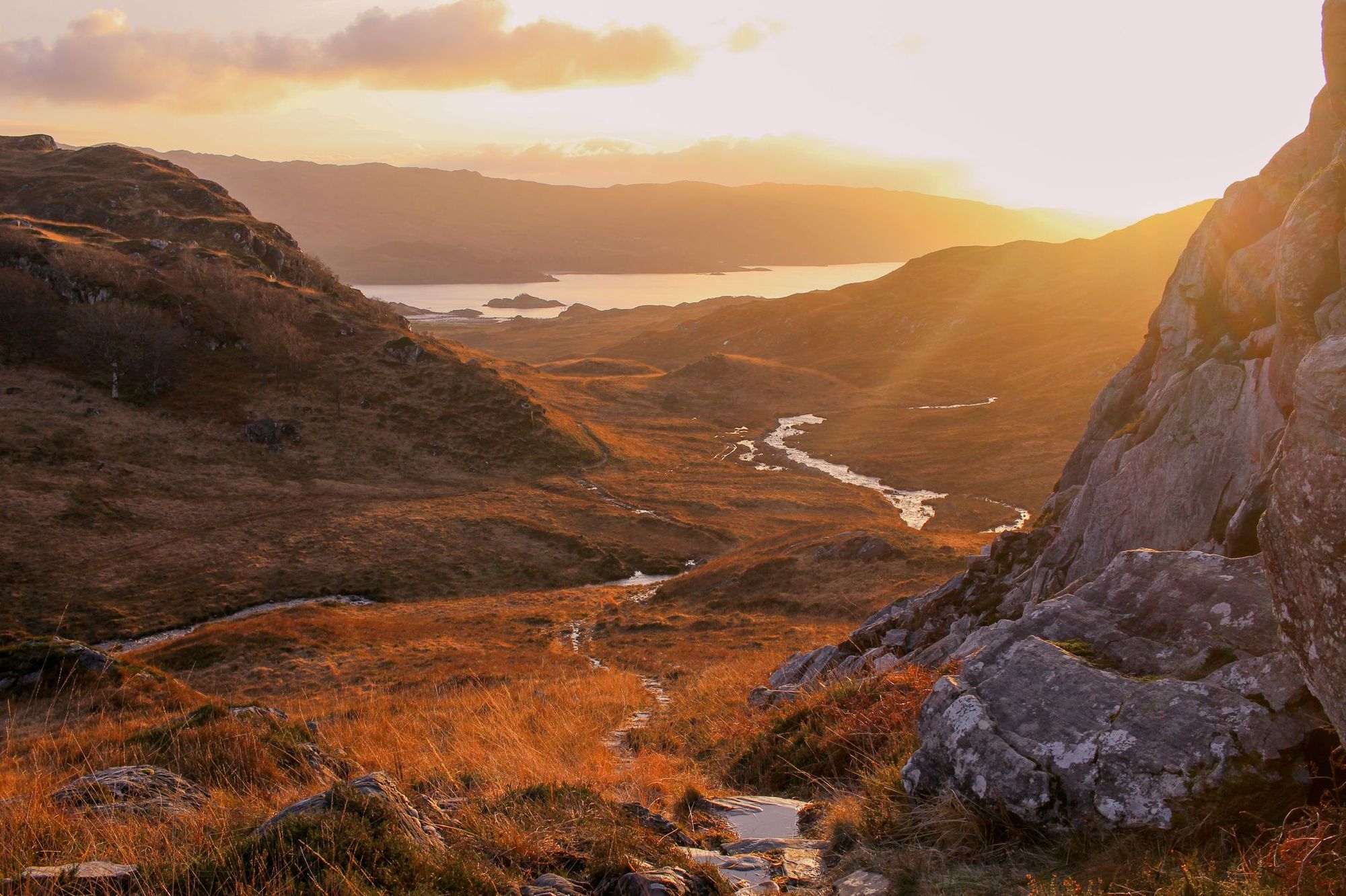
Distance: 7.7 miles
Walking Time: 4-5 hours
The wild Ardnish peninsula juts out into the glassy waters of Loch Ailort. Uninhabited since 1943, it has a remote feel to it - look out for sea eagles soaring over the ruined houses hugging the curve of Peanmeanach Beach. This circular hike takes you down the southern side of the peninsula and back along a clearer path to the north to avoid retracing your steps, but if you feel uncomfortable going off-piste, then take the track both ways. To do this, follow the footpath signed to Peanmeanach from the parking layby off the A830.
For the more adventurous route, start the walk from Lochailort Railway Station and head along the track behind it (taking you over the hill behind the road, which is better than walking along it). After around a mile, head down the track to Polnish. Pass the car park and a few buildings on the loch shore - when you reach the first stream, head up to higher ground. You should emerge at a sheep fold. Climb the next hillock, where you should be able to see Lochan a Bhealaich. Take a bearing and make your way towards it. You’ll pass by two other small Lochans - keep them on your right as you head to Loch Doire a’ Ghearrain.
Trace the southern side of the loch across boggy ground until you spot a gap in the hills to the southwest - follow it down to reach Peanmeanach, an abandoned fishing village next to a stunning bay. The Mountain Bothies Association maintains a bothy here, where you can camp overnight. Once you’ve relaxed for a while, head back to Polnish along the clearly demarcated track.
11. Eshaness and Tangwick Circular Walk, Shetland
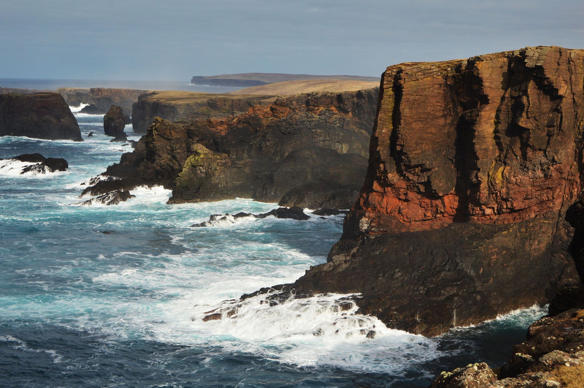
Distance: 8.5 miles
Walking Time: 4-5 hours
The far-flung Shetland Islands are closer to Norway than they are to Edinburgh. Considering that the archipelago consists of over 100 islands and islets, there are thousands of miles of coastline to be explored. We particularly recommend the exposed volcanic peninsula of Eshaness, which can be circumnavigated in a day,
Start at the Eshaness Lighthouse car park, and walk north along the road to the sea cliffs. Follow the path to the right, until you reach the deep inlet of Calder’s Geo, where you might spot puffins. Continue along the coastline, passing impressive stacks, arches and caves. The cliffs will get lower until you reach Croo Loch. Continue on round the next couple of headlands. Eventually you will reach a fork - leave the coast path and take a minor road inland.
After a mile, you’ll reach the main Eshaness road - turn left and then take the next right to Tangwick. This will lead you to a seventeenth century manor house and back onto the southern coast of the peninsula. Follow the track round to the right until you reach a blowhole called Fiorda Taing (look out for otters around here). Continue on around the peninsula - the path will slowly ascend and soon you’ll find yourself back at Eshaness.
It is possible to do this walk car-free. You can catch a bus from Lerwick to Hillswick, and then a feeder bus (21F) out to Eshaness. Check the Shetland Travel website to plan your journey.
A Coastal Walk in Northern Ireland
12. Ballintoy to Giant’s Causeway, County Antrim
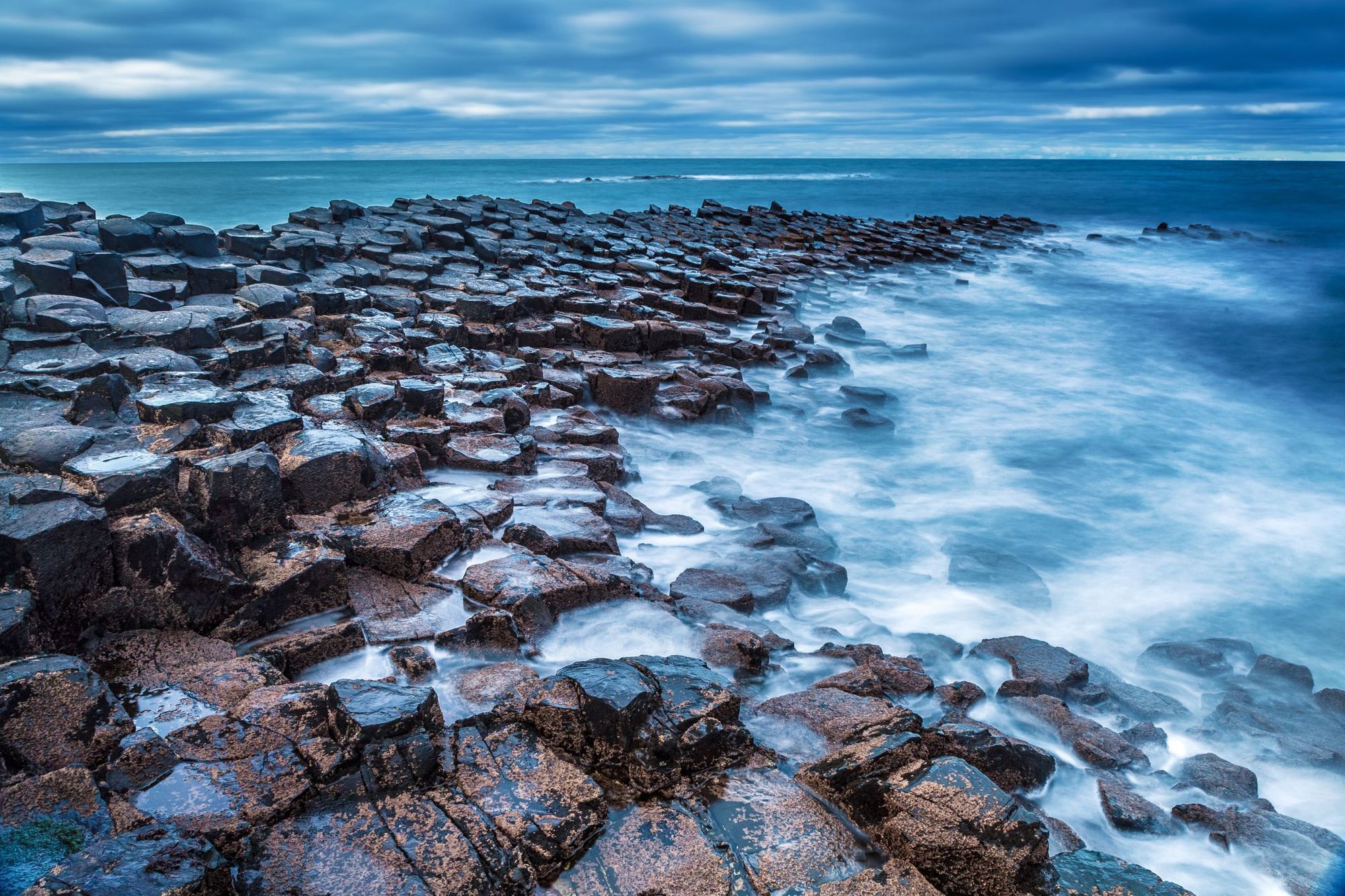
Distance: 10 miles
Walking Time: 5 hours
The Causeway Coast is a dramatic stretch of coastline that’s buffeted by Atlantic waves. It’s well-known for its UNESCO-designated Giant’s Causeway rock formations, one of the most popular tourist attractions in Northern Ireland. But The Causeway Coast Way is a 33-mile trail that leads you away from the crowds and over wild headlands, past ruined castles and striking rock formations.
Our favourite section starts at Ballintoy and leads to Giant’s Causeway. Begin by crossing Ballintoy harbour. The trail leads out across the shoreline, passing a series of impressive sea stacks. Follow the narrow pass along the base of the cliff to get onto White Park Bay - the trail hugs the curve of this sandy bay. It reaches Portbraddan and passes St Gobban’s Church, said to be the smallest church in Ireland.
You’ll pass through a sea arch at Gid Point and shortly afterwards, reach Dunserverick Harbour. Follow the road upwards for 150m, then across the fields to Dunserverick Castle. The next part of the trail is wonderfully isolated - you won’t see another road until Giant’s Causeway, 5.5 miles later. Follow a grassy path as it curves around a series of headlands, offering excellent views of Rathlin Island and the offshore sea stacks; Bengore Head (100m) is the highest point on the Causeway Coast.
After passing Benbane Head, you’ll enter the UNESCO-designated Giant’s Causeway site. You’ll pass a number of landmarks, including the rock formation known as Nurse and Child, and a sunken Spanish Armada vessel lying offshore. At the centre of these is The Grand Causeway, a series of hexagonal basalt columns that form an offshore plateau. Walk up the hill to catch a bus from the main road - the Causeway Rambler (402) will take you back to Ballintoy.
Inspired? Check out our huge range of adventure holidays in the UK!