


Trekking Annapurna is one of the most immersive ways to experience the mountains in Nepal. If you’re planning a trip to the region, you have remarkable high mountain views and deep mountain valleys to look forward to, whether you'll be walking the Annapurna Circuit circuit trek or hiking to Annapurna Base Camp (also known as the Annapurna Sanctuary). These are long-distance routes, lasting a couple of weeks at least; each is packed with teahouses, Tibetan temples, subtropical lowlands and big, spiky mountains along the way.
The route is akin to hiking a Himalayan highlights reel.
The Annapurna massif is home to some of the highest mountains in the world, and the legendary Annapurna Circuit is the most famous route in the region. It circles the entirety of the Annapurna Massif and is often considered one of the best walks on the planet. The route is akin to hiking a Himalayan highlights reel.
The elevation gain along the 118-mile (190km) Annapurna Circuit is huge. It starts in a little town called Besisahar at 760m (2,493ft), while the high point is a climb up to the Thorong La Pass (5,416m/ 17,769ft). Of course, altitude is going to have an effect while you’re hiking. But at the same time, it is that elevation gain that gives the trekking in Annapurna its calling card; that array of views and climates which brings tropical warmth one day and snow the next.

In this guide, we’ll dig a little deeper into trekking in Annapurna. We’ll compare the two main routes, the Annapurna Circuit and Annapurna Sanctuary treks. As well as this, we’ll touch on a few other hikes in the Annapurna Conservation Area. We’ve also got you covered with planning and logistics, whether that’s what permits you need or how to get to the trailhead.
Please note: On the 1st April 2023, the Nepal Tourist Board (NTB) made changes to the trekking laws for all foreign trekkers, cyclists, and mountain climbers visiting Nepal's mountain regions and national parks. All trekkers (solo or in a group) must now be accompanied by a licensed guide. To learn more about what this means for you, read our update on the Nepal trekking requirements.
Table of Contents
About Annapurna: Map & Basics
Annapurna is located in north-central Nepal within the Annapurna Conservation Area in the Himalayas. It is part of the Annapurna mountain range, and is home to one peak over 8,000m (26,246ft) - Annapurna I, which rises to 8,091m (26,545 ft) and is the 10th highest mountain in the world.
There are also 13 peaks in the massif which rise over 7,000m (22,966ft) and 16 more over 6,000m (19,685ft). The Annapurna massif is 34.1 miles (55km) long and is met by the Kali Gandaki Gorge, the deepest gorge in the world, in the west. That gorge separates the Annapurna from the Dhaulagiri, the seventh highest mountain in the world. The Marshyangdi River then meets the Annapurna Massif on the north and east, with the Pokhara Valley to the south.
The Annapurna Massif is named after Annapurna, the goddess of food and nourishment. It was said that Annapurna was the daughter of Himavat, king of the mountains. Hence why she ended up lending her name to these peaks.
Which Trek Route: Annapurna Circuit or Annapurna Sanctuary?
Most trekkers heading to Annapurna tend to do either the Annapurna Circuit trek or the lesser-known Annapurna Sanctuary trek. But what's the difference between the two?
Annapurna Circuit
- Duration: approximately 16 nights
- Walking time per day: 4-8 hours
- Difficulty: Challenging
- Accommodation: Tea houses trek
- Highest altitude: 5,416m (17,769ft)
In a nutshell, the Annapurna Circuit is a circular route through the Annapurna ranges, beginning and ending in Taal. It takes you around the Annapurna massif, passing through diverse scenery, including the arid, otherworldly Mustang Valley. As a circuit, you won’t be repeating yourself; there’s new scenery every day.
The Annapurna Circuit is a longer and slightly more challenging trek than Annapurna Sanctuary. It also reaches higher altitudes, topping out at Thorong la mountain pass, situated at an elevation of 5,416m (17,769ft).
Annapurna Sanctuary
- Duration: 13 nights
- Walking time per day: 4-6 hours
- Difficulty: Moderate
- Accommodation: Tea houses trek
- Highest altitude: 4,130m (13,550ft)
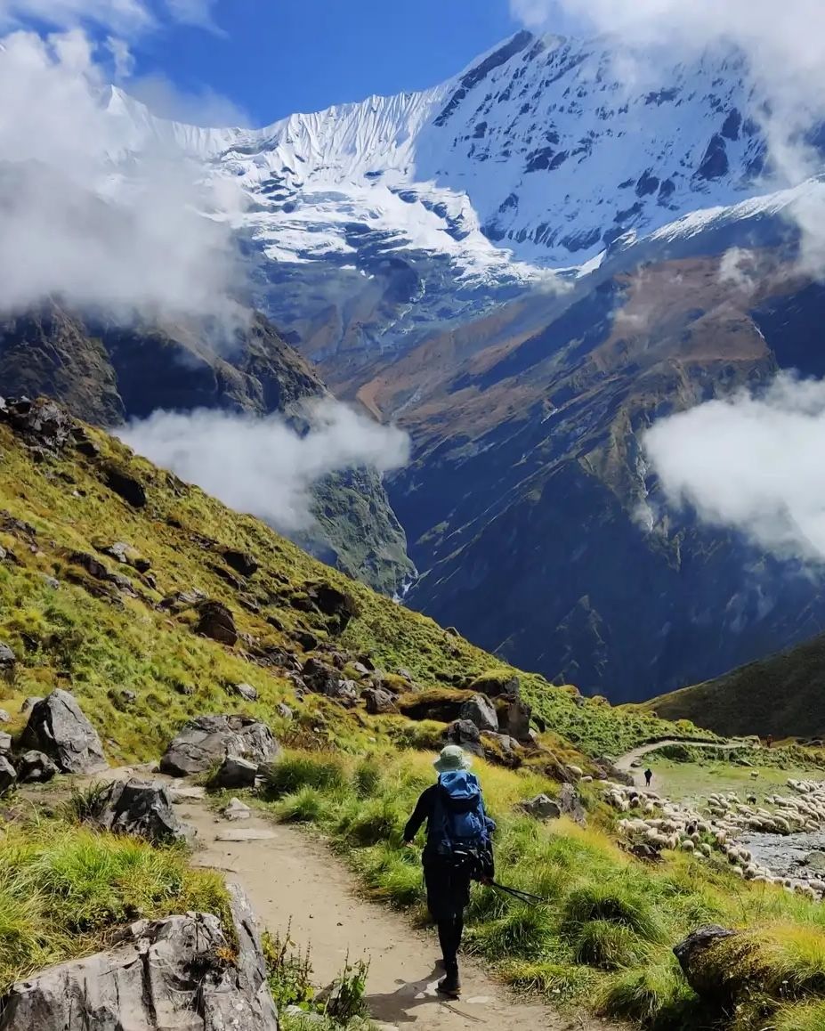
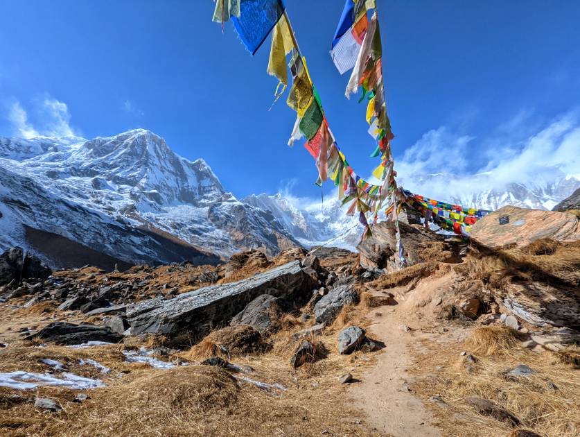
Meanwhile, the Annapurna Sanctuary Trek takes you through the Annapurna Sanctuary, a high oval-shaped glacial basin surrounded by the Annapurna massif, towards Annapurna Base Camp. You’ll see some of the most awe-inspiring mountains in the region, and you’ll also be hiking through the Annapurna Sanctuary, an area of high ecological diversity.
However, you will be doubling back on yourself and end up seeing some of the same places twice. Of course, the nature of an out-and-back means you will still get two completely different perspectives on the route you're walking.
The Annapurna Sanctuary is slightly less challenging than the Annapurna Circuit, mainly because it stays at lower elevations; the highest point being Annapurna Base Camp at 4,130m (13,550ft). However, you’ll still need to be physically fit and have some experience with multi-day trekking.
Which Trek Should I Choose?
Whether you choose the Annapurna Circuit or Annapurna Sanctuary depends on what you’re looking for. When it comes to landscapes, the former has more diversity and the latter more of a ‘wow factor’ with its mountain views.
The main two considerations are the amount of time you have, and the level of challenge you’re looking for. Those who want a challenging trek and have in excess of two weeks might prefer to tackle the Annapurna Circuit. Those with less than two weeks looking for a more moderate option should choose Annapurna Sanctuary.
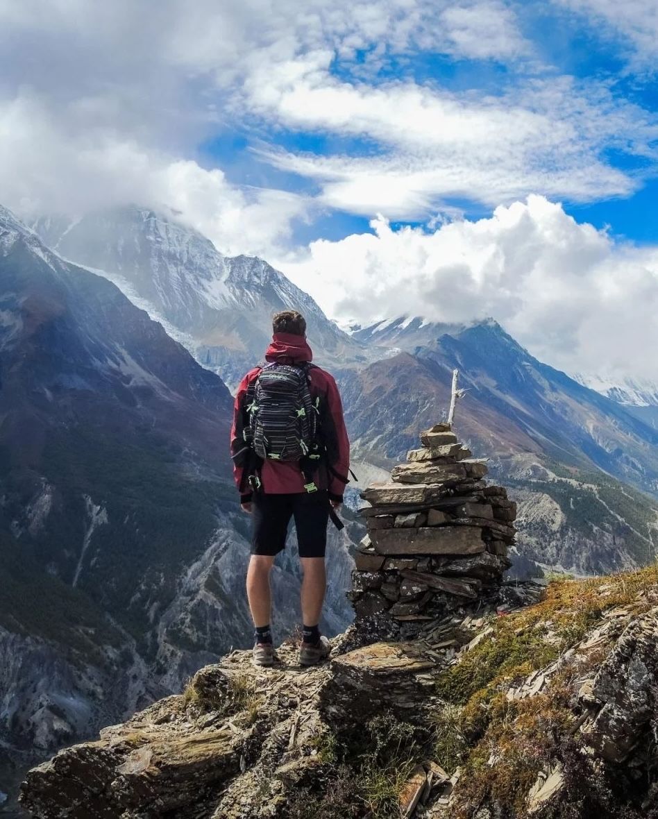
The Annapurna Circuit: Core Route Details
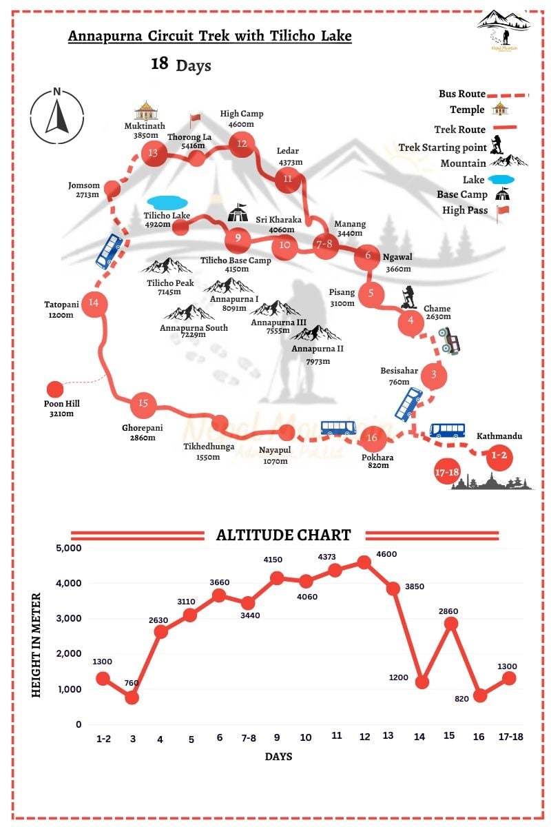
The Annapurna Circuit is a long-distance trekking route that circles the Annapurna mountains. Depending on what route you choose, it can take anywhere from 12 to 22 days, and span from 80 to 143 miles (130km to 230km). As this map of the Annapurna Circuit shows, there are several possible detours, such as a trip to Tilicho Lake or an ascent of Poon Hill.
Much Better Adventures, like many companies, offers a slightly condensed version of the classic route, making it achievable in less time but still covering the best bits of the trek (including crossing the Thorong La mountain pass) and crucially, avoiding the latter section - which has been impacted by road construction. Our version of the Annapurna Circuit sees visitors cross the Thorong La and then fly back to Pokhara from Jomsom. This means you see the same highlight reel of the Himalayas, but not the roadworks on the way home.
If you're walking the Annapurna Circuit solo, you can detour to the Annapurna Sanctuary then rejoin the circuit, but it’ll add days to your journey. You can also go quicker by sticking to dirt roads the government have installed (somewhat controversially). This means you miss out on the scenic high mountain passes, though, which for most people, are the highlight of the trip.
The Annapurna Circuit is almost always hiked anticlockwise. This means that the altitude gain day by day is a lot slower. For this reason, and others, crossing Thorong La Pass is a lot safer this way.
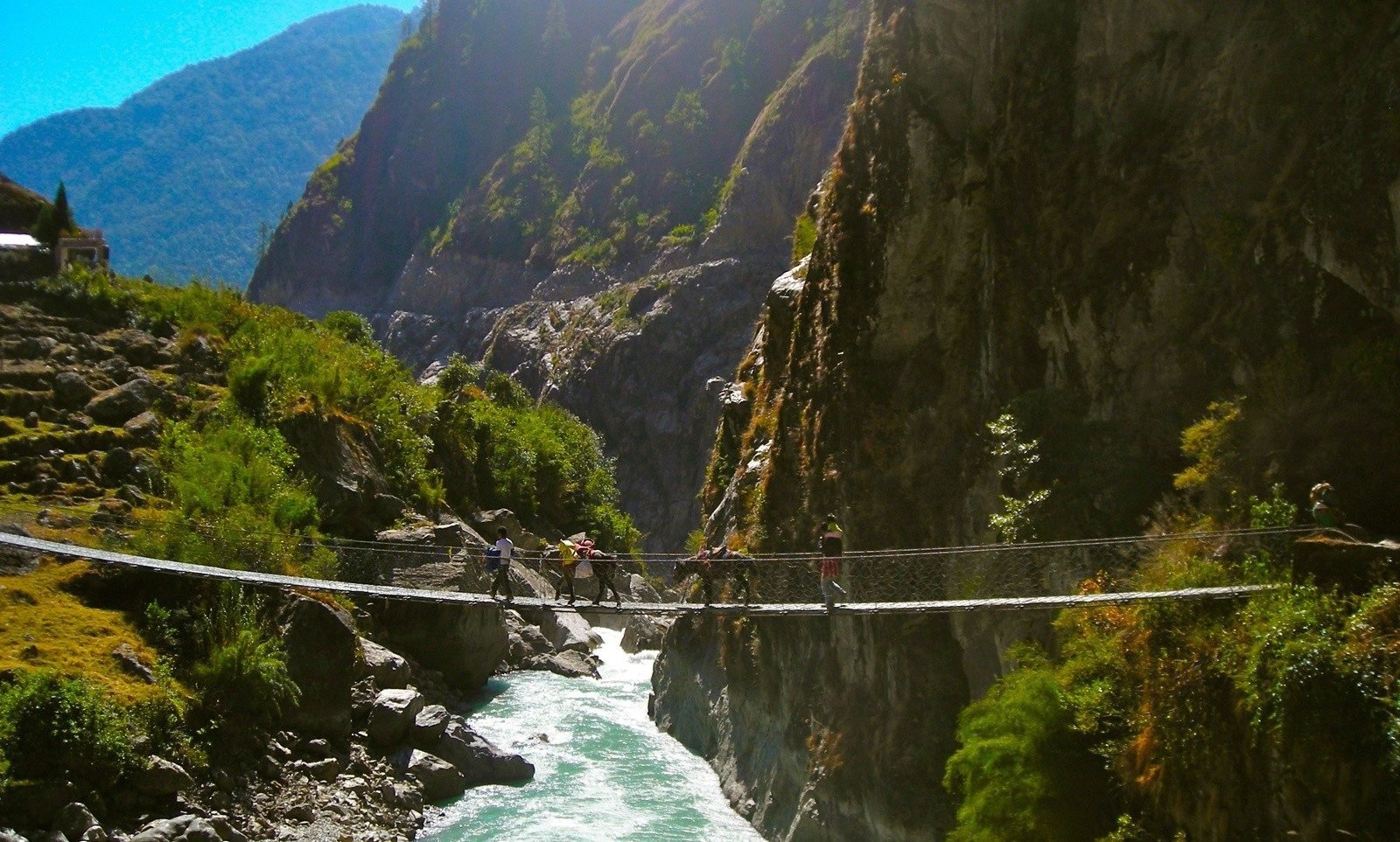
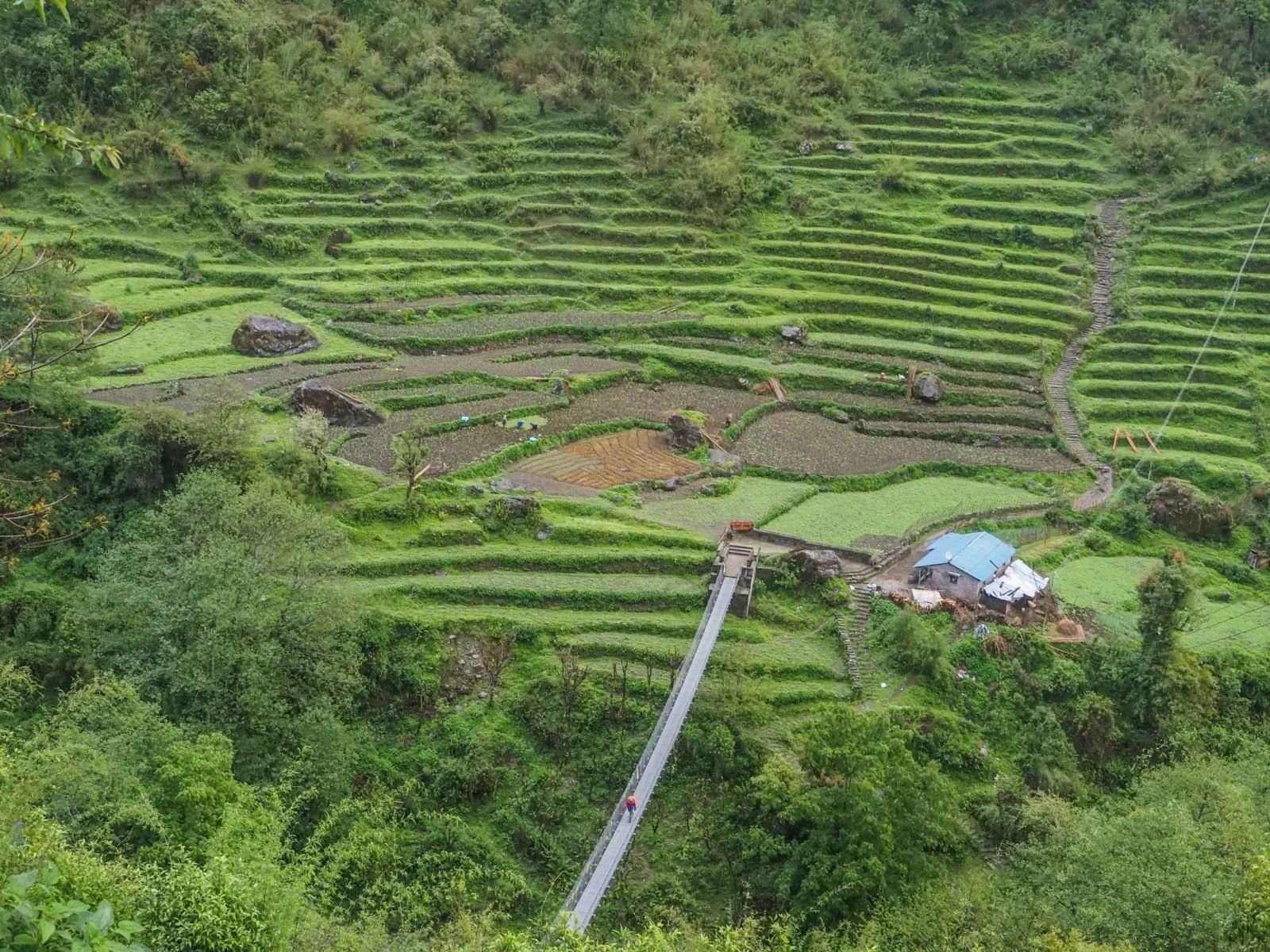
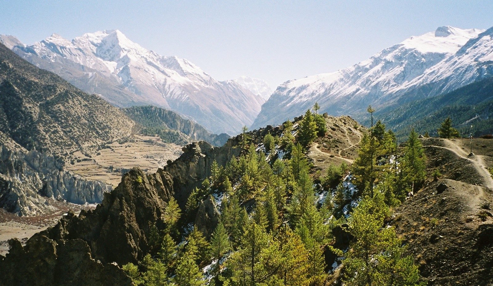
The route begins in subtropical valleys where lush forests, terraced rice fields and waterfalls dominate the scenery. Villages along the lower stretches, such as Bhulbhule and Chamje, are inhabited by Gurung and Magar communities, offering trekkers a first glimpse into the rich cultural mosaic of the region. As the path follows the Marsyangdi River upstream, dramatic cliffs and snowy peaks gradually come into view.
As the trail gains altitude, the vegetation thins, and trekkers enter drier alpine landscapes marked by pine forests, rugged cliffs and wide valleys. Passing through towns like Pisang and Manang, the scenery becomes increasingly dominated by towering Himalayan giants, including Annapurna II, Gangapurna, and Tilicho Peak.
Manang, a major acclimatisation stop, provides panoramic views and a chance to explore glacial lakes and monasteries. The route also showcases the stark contrasts of the region: green forests give way to arid plateaus reminiscent of Tibet, while traditional stone villages sit against backdrops of immense peaks.
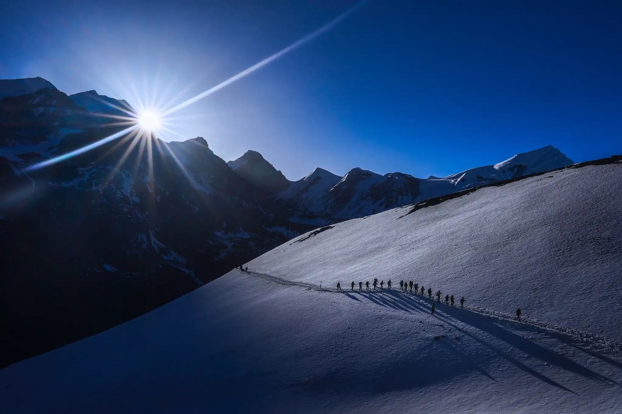
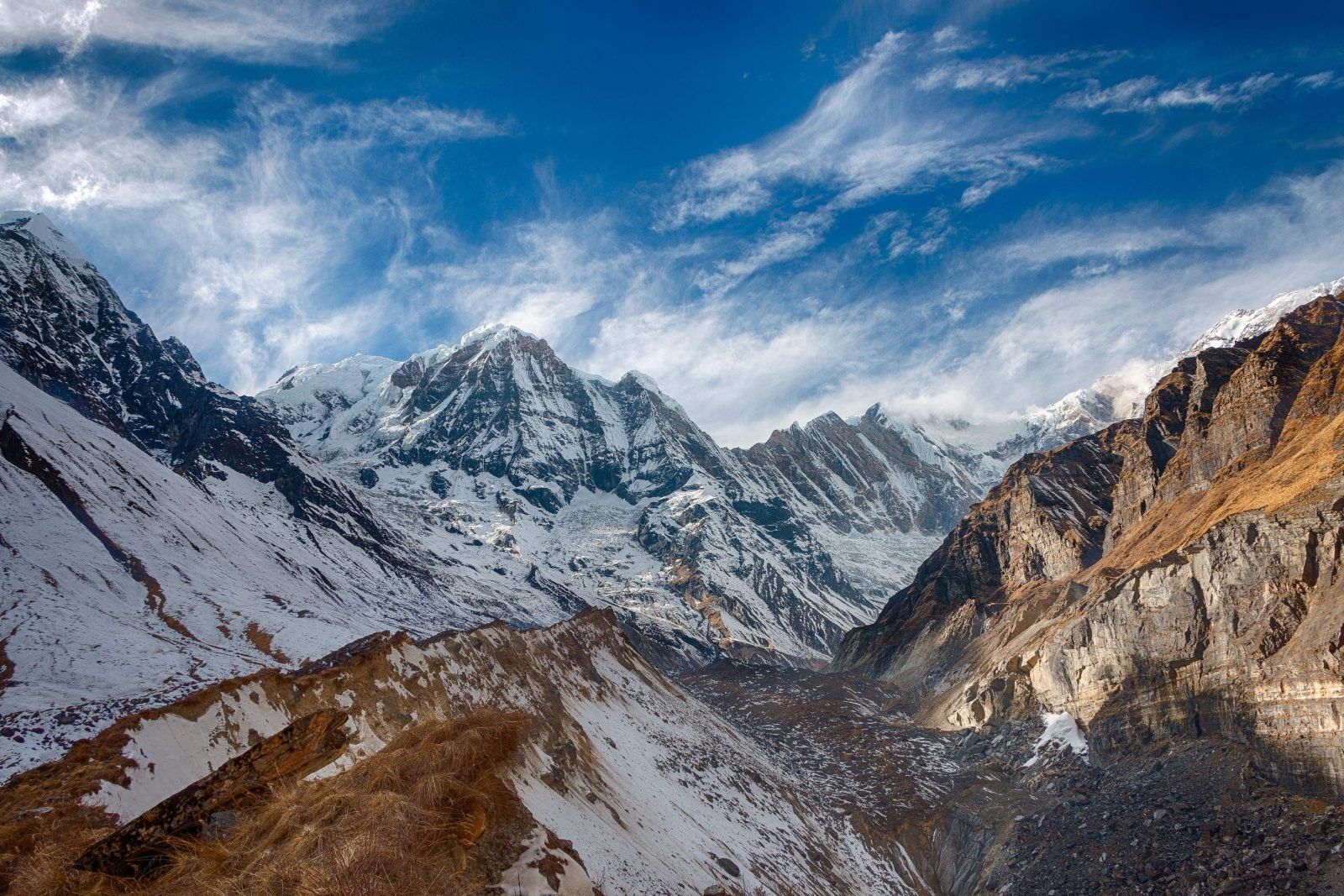
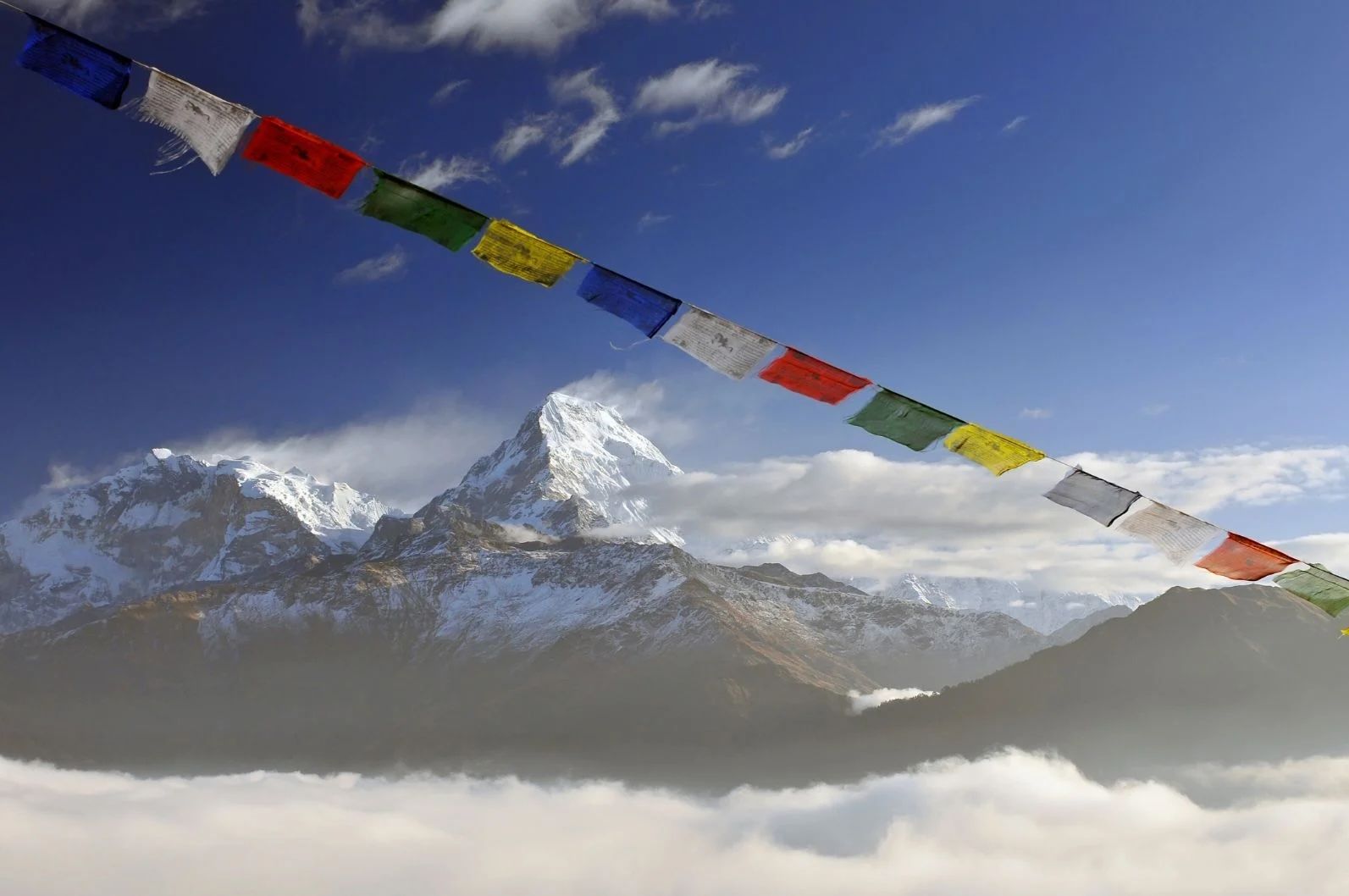
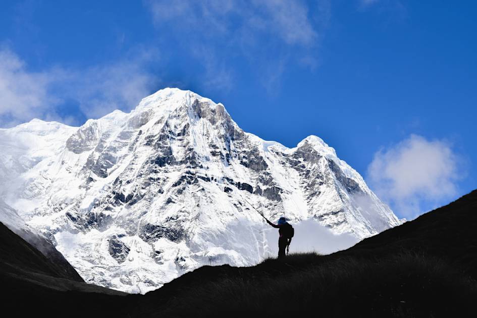
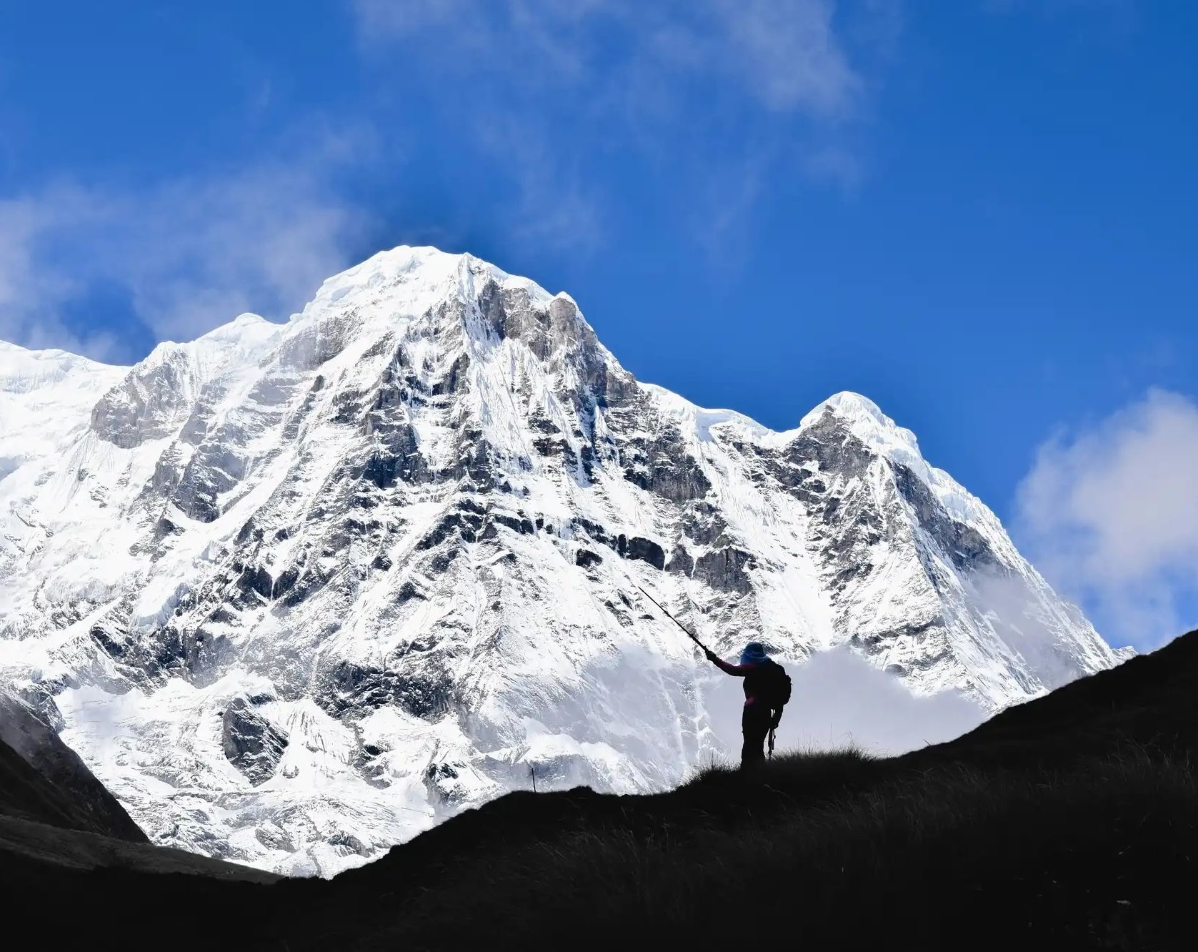
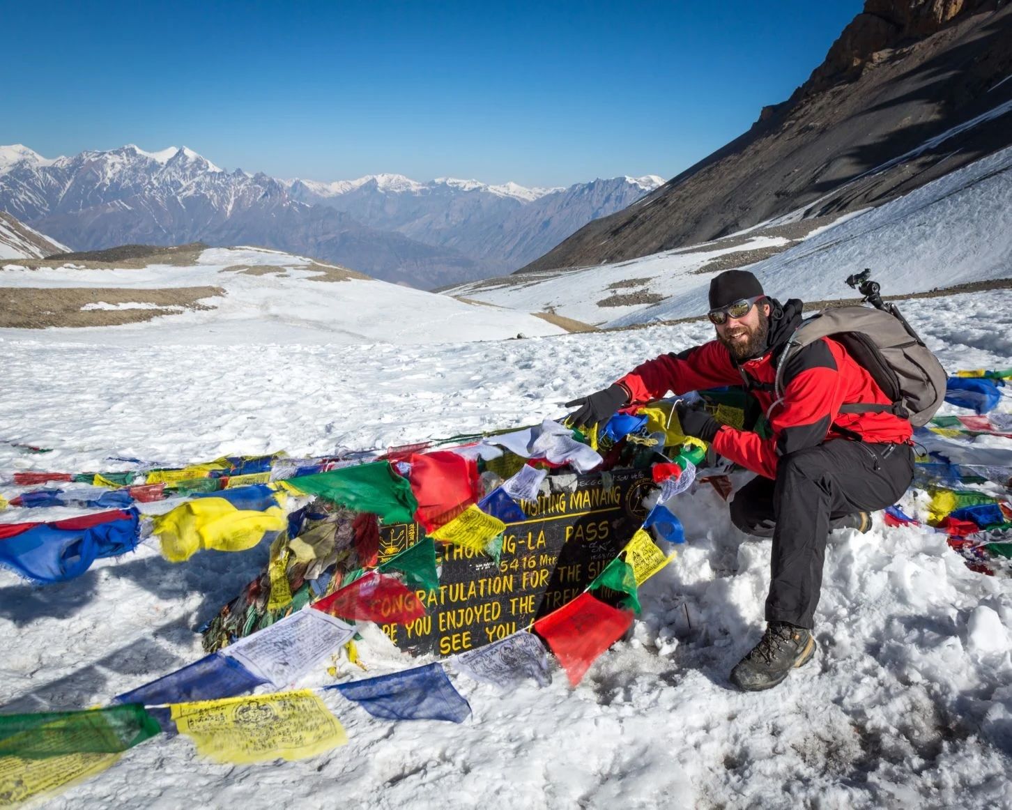
The literal highlight of the Annapurna Circuit is the crossing of Thorong La pass (5,416m/17,769 ft), the highest point of the trek. This section requires an early morning ascent, often over snow and ice, with views that stretch across the Annapurna and Dhaulagiri ranges.
The descent from Thorong La leads into the sacred town of Muktinath, revered by both Hindus and Buddhists. From there, the path enters the Kali Gandaki Valley, one of the world’s deepest gorges, flanked by the colossal Annapurna and Dhaulagiri massifs. As the trek winds down toward Jomsom and beyond, the scenery shifts again, blending windswept deserts, orchards and traditional villages.
This section requires an early morning ascent, often over snow and ice, with views that stretch across the Annapurna and Dhaulagiri ranges...
Nights are spent in local tea houses. Rooms at the tea houses are normally twin-share, with decent space and a common area with a fire. These are where you’ll meet plenty of other trekkers. The food is delicious too. Dal Bhat, a traditional dish consisting of rice and lentils, is often offered on an all you can eat basis.
As mentioned, many trips on the Annapurna Circuit will be different from one another. Some take detours or shortcuts. Some people take longer to acclimatise. Others take a day out to rest and recover. So every journey is different, but here’s a breakdown of a traditional 19-day route plan for the Annapurna Circuit.
- Kathmandu to Besisahar (drive).
- Besisahar to Bhulbhule.
- Bhulbhule to Jagat.
- Jagat to Dharapani.
- Dharapani to Chame.
- Chame to Pisang.
- Pisang to Manang.
- Acclimatisation and Exploration at Manang.
- Manang to Yak Kharka.
- Yak Kharka to Thorung Phedi Base Camp.
- Throng Phedi Base Camp to Muktinath via Throng-la Pass (5416m).
- Muktinath to Kagbeni.
- Kagbeni to Marpha.
- Marpha to Larjung.
- Larjung to Ghasa.
- Ghasa to Tatopani.
- Tatopani to Ghorepani.
- Ghorepani to Tikhedhunga.
- Tikhedhunga to Nayapul and drive to Pokhara.
- Read: A Guide to Walking the Annapurna Circuit in Nepal for a firsthand description of the entire route, by writer Josh Edwards.
Alternative Annapurna Routes
The Annapurna region is a paradise for trekkers, with numerous routes through its valleys and foothills. Aside from the Annapurna Circuit and Annapurna Sanctuary, there are numerous other multi-day treks in the region. Some of these can be added on to the Annapurna Circuit trek and make for spectacular detours.
The Poon Hill-Ghorepani Trek
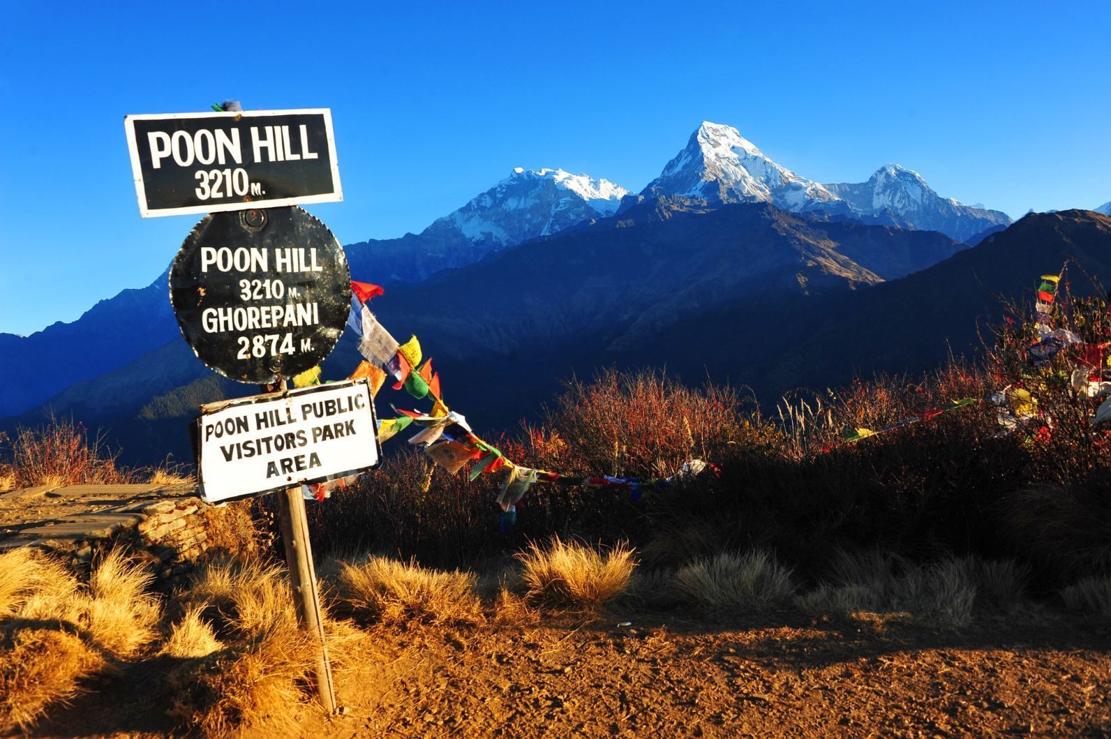
The Poon Hill-Ghorepani Trek is one of the best Annapurna short trekking options. It's actually known as an ‘easy’ option in the Annapurnas, but that isn’t necessarily true. There are some steep ascents, including a pre-dawn climb to the top of Poon Hill (3,210m/10,531ft) for a sunrise view.
The first part of this trek passes through ethnic Magar villages with terraced farmland and trails shaded with thick woods. It culminates with a hike from Ghorepani to the top of Poon Hill, from where views of Annapurna South, Annapurna Fang, Machapuchare (Fishtail), Annapurna II, the Lamjung Himal Range, Dhaulagiri, Tukuche Peak and Dhampus Peak can be seen. Allow a minimum of three days for the Poon Hill trek, although four or five are more comfortable.
Lake Tilicho
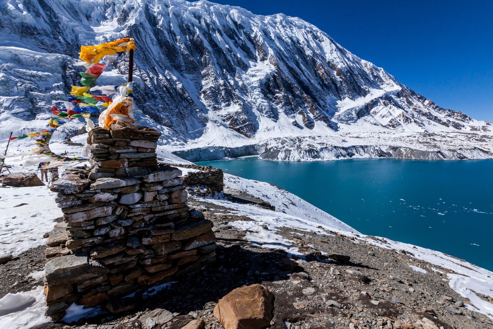
The trek to Lake Tilicho is actually a detour from the Annapurna Circuit route. From the village of Manang, continue to Tilicho Base Camp (3,734m/12,250ft) and then on to Tilicho Lake (4,919m/16,138ft). The detour is a worthwhile trip in its own right, as Tilicho Lake is often called the most beautiful in Nepal.
It is the highest lake of its size in the world, and its pristine blue-green waters are surrounded by snow-capped peaks. From the lake, continue on the Annapurna Circuit over the Thorong La and down into Lower Mustang.
Planning & Logistics
When to Hike Annapurna
The best times to hike the Annapurna Circuit and the Annapurna Sanctuary are October to November or April to May. During these seasons everything tends to be pretty dry, the skies are clear, and it won’t be unfathomably cold up high.
Between those two seasons, in the winter, things are often clear and the scenery spectacular, but thick snow can lead to the closure of Thorong La for days on end.
June-September is the rainy season and typically the least crowded time on the circuit. It doesn’t actually get as much rain as you might expect, given that it’s called “the rainy season”. Much of the circuit is in a rain shadow, so the northern parts of the circuit are actually relatively dry, but the southern part of the trail does get quite wet.
The benefits of going at this time of year are that there are a lot less people around and the flowers are out in force, but clouds are more likely to obstruct your views of the scenery.
Altitude & Acclimatisation
Much of the trekking in Annapurna, be that the Circuit or the Sanctuary route, takes place at altitudes of over 2,500m (8,202ft). By the time you reach the highest point on the Annapurna Circuit at 5,416m (17,769 ft), there’s only half the amount of oxygen that you get at sea level. High altitude affects everyone differently, but most people will find themselves getting breathless more easily, thanks to the thinner atmosphere.
It’s well worth taking this into consideration in your day-by-day planning for the trek and leaving a day or so during your hike to acclimatise to the altitude. Properly-trained and experienced guides are invaluable on this front. They’re able to pace you properly up the mountain and get you to safety if the worst happens and you do need to turn back.
What to Pack
During the warmer months, you'll experience temperatures from 15-23°C at the lower altitudes on the trek (below 2,500m/ 8,202ft). But as you climb up above 4,000m (13,123ft) it'll drop below 10°C. And the highest point of the trek, Thorung La, may well be below freezing. So even during summer time, you'll need warm clothes. Pack layers, including thermals (preferably merino), a fleece midlayer, a midweight down jacket and a waterproof jacket.
It’s imperative that you pack a decent pair of hiking boots. Make sure they’re worn-in, as new boots might give you blisters, which you don’t want on the trail.
Avoiding the Roads While Hiking
The Annapurna area was opened to trekkers in 1977, and work on the roads began as early as 1980. There were originally 23 days on the trek, and of those, only five days on the Annapurna Circuit are now completely road-free. The dusty roads are there because of the idea that with easier access comes increased tourism.
As you’d expect, the roads have been controversial, but they aren’t overflowing with traffic. Hikers can expect to see a handful of 4x4s pass each day if you’re on dirt roads. They’re not the kind of roads you’d want to drive down in your mate’s 109-year-old Fiat Punto.
In many cases, the roads can be completely avoided by using the alternative hiking trails. The New Annapurna Trekking Trail (NATT) system was created by hikers Andrées de Ruiter and Prem Rai in collaboration with the Annapurna Conservation Area Project (ACAP) to show trekkers the best ways to follow the trail without too many roads. They are waymarked in blue and white, or in red and white.
Permits
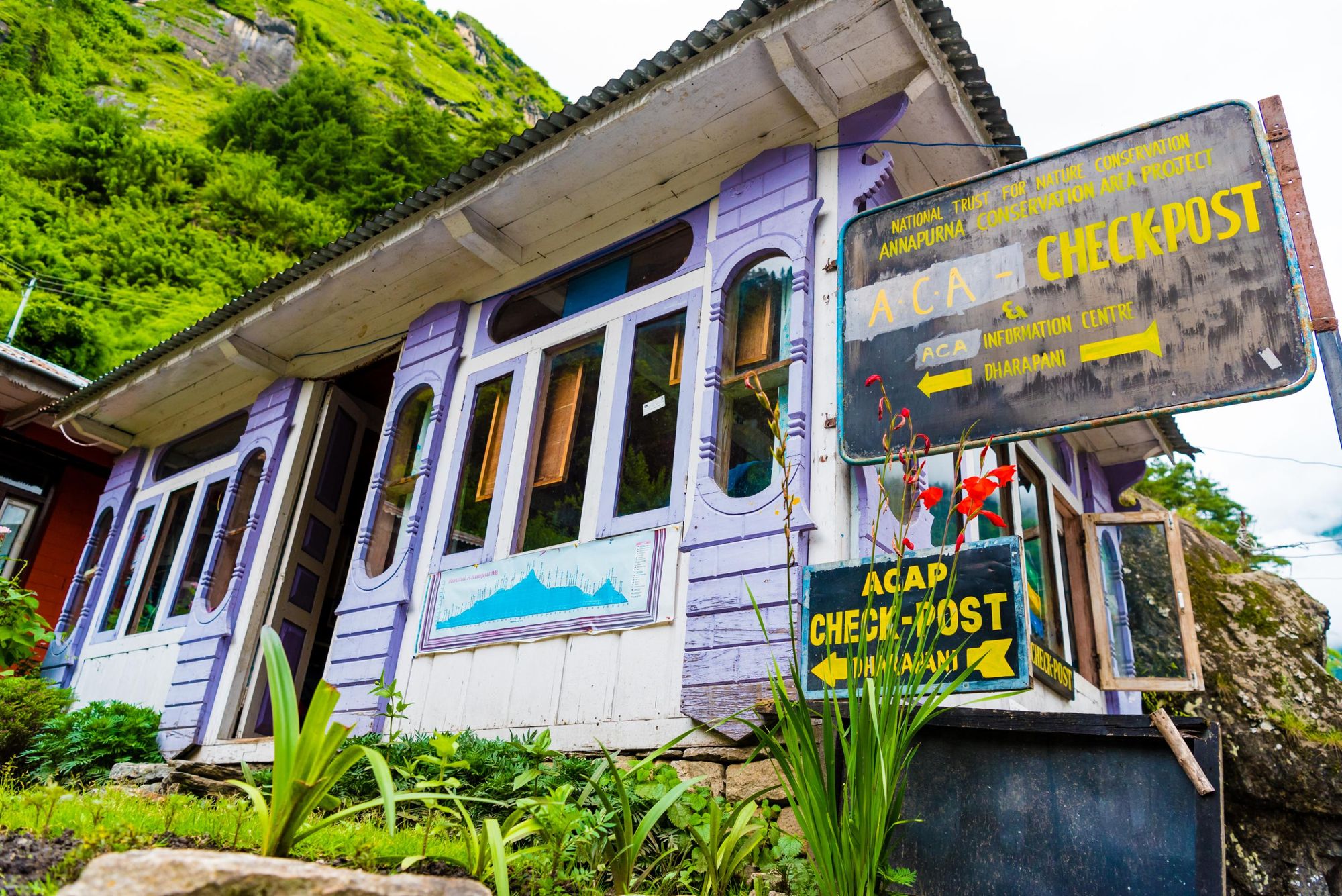
New trekking regulations in Nepal, effective from 2023, have streamlined the permit process for the Annapurna Circuit. Trekkers now only require the Annapurna Conservation Area Permit (ACAP), issued by the National Trust for Nature Conservation (NTNC). This permit costs NPR 3,000 (£15.70/ $21) for foreign nationals, with children under 10 exempt. The ACAP contributes to conservation efforts, community development, and trail maintenance.
The previously mandatory Trekkers’ Information Management System (TIMS) Card has been discontinued. A new government mandate requires all foreign trekkers to be accompanied by a licensed guide or to book their trek through a registered trekking agency. This ensures trekkers' information is properly documented for safety and security. Most trekking agencies will handle the application and payment for the ACAP on behalf of their clients.
How to Get to the Annapurna Circuit
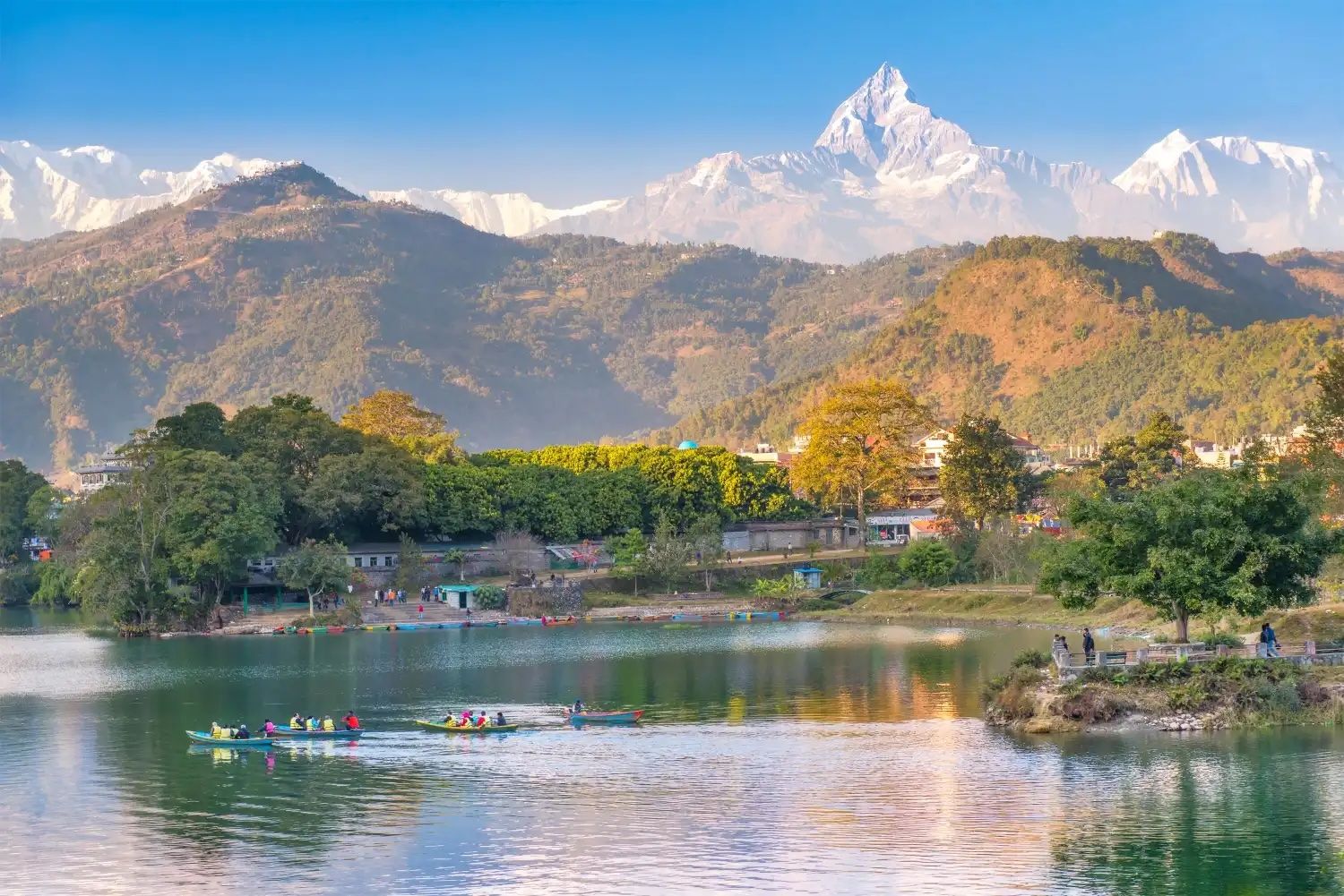
From Kathmandu, the capital of Nepal, most people’s next step is making the 124 mile (200km) journey to Pokhara. Pokhara is a beautiful little city on Phewa Lake in Central Nepal and the gateway to Annapurna.
It only takes 25 minutes to fly to Pokhara from Kathmandu, so don’t get too comfy in your plane seat. Try to sit on the left, too. That way you’ll get great views of the Annapurna, Manaslu, Ganesh and Langtang Himals.
If you’re feeling a bit more environmentally friendly, or looking to save your cash, you can grab a bus from Kathmandu to Pokhara. This takes seven hours (without delays). The winding bus route is beautiful. It passes through small bazaars, rural Nepalese landscapes and follows the Trishuli River. That said, the roads can get bumpy.
From Pokhara, it’s only a few hours drive to Besisahar, where the trail starts. You can also get a bus from Kathmandu directly to Besisahar. The direct bus ride from Kathmandu to Besisahar is actually a slightly shorter bus ride. It takes six and a half hours.
A lot of people tend to hang out in Pokhara after completing the circuit, as that’s where the trek ends for a lot of hikers. It’s a fun city with great restaurants, coffee shops, yoga aplenty and views to spare.
FAQs
How Many Summits Does Annapurna Have?
Annapurna has six major summits. The highest is Annapurna I at 8,091 meters (26,545 feet), followed by Annapurna II, III, IV, South, and Gangapurna. These peaks form part of the greater Annapurna massif in the Himalayas.
How Difficult is the Annapurna Circuit Trek?
The Annapurna circuit is often rated as ‘challenging’, as you’ll be hiking for five to seven hours a day over multiple days, at altitudes of up to 5,416m (17,769 ft).
However, the difficulty of the Annapurna Circuit depends as much on your fitness, mentality and route as it does experience. With the addition of the dirt roads, more people are starting to cut days off their trek from the get-go. There are now options to jump in a jeep and ride to a point it would’ve taken days to hike to before (cheating?). There are also often options to follow quicker dirt roads (and still get stunning views) instead of taking the full mountain trail.
Many people hire a porter to carry their luggage for them, too, which removes a bit of the burden. Choosing the right local guide is important in this regard though. It ensures that the porters you use will be paid and looked after fairly and that they’ll have proper training and weight limits.
Why is Annapurna 1 so Dangerous?
Annapurna I is in the history books for two main reasons. Firstly, it was the first mountain ever summited over 8000m, by French mountaineer Maurice Herzog and his team in 1950. On a grimmer note, Annapurna I also has the greatest fatality rate of all 14 eight-thousander mountains. There’s a ratio of 34 deaths per 100 safe returns. Hence why most people go around it, rather than up it.
How Long to Walk the Annapurna Circuit?
The Annapurna Circuit takes between 12 to 22 days to complete, and spans from 99.4 miles (160km) to 143 miles (230km), depending on what route you choose. The traditional hiking route, avoiding roads and sticking to trails, tends to take 19 days.
How High is Annapurna Base Camp?
Annapurna Base Camp is located at an altitude of 4,130m (13,550 ft). You’ll stay there while hiking the Annapurna Sanctuary trek.
Inspired? Trek the Annapurna Circuit with us, or check out our Annapurna Sanctuary trek. You can even combine the Annapurna Circuit with a safari in Chitwan.