
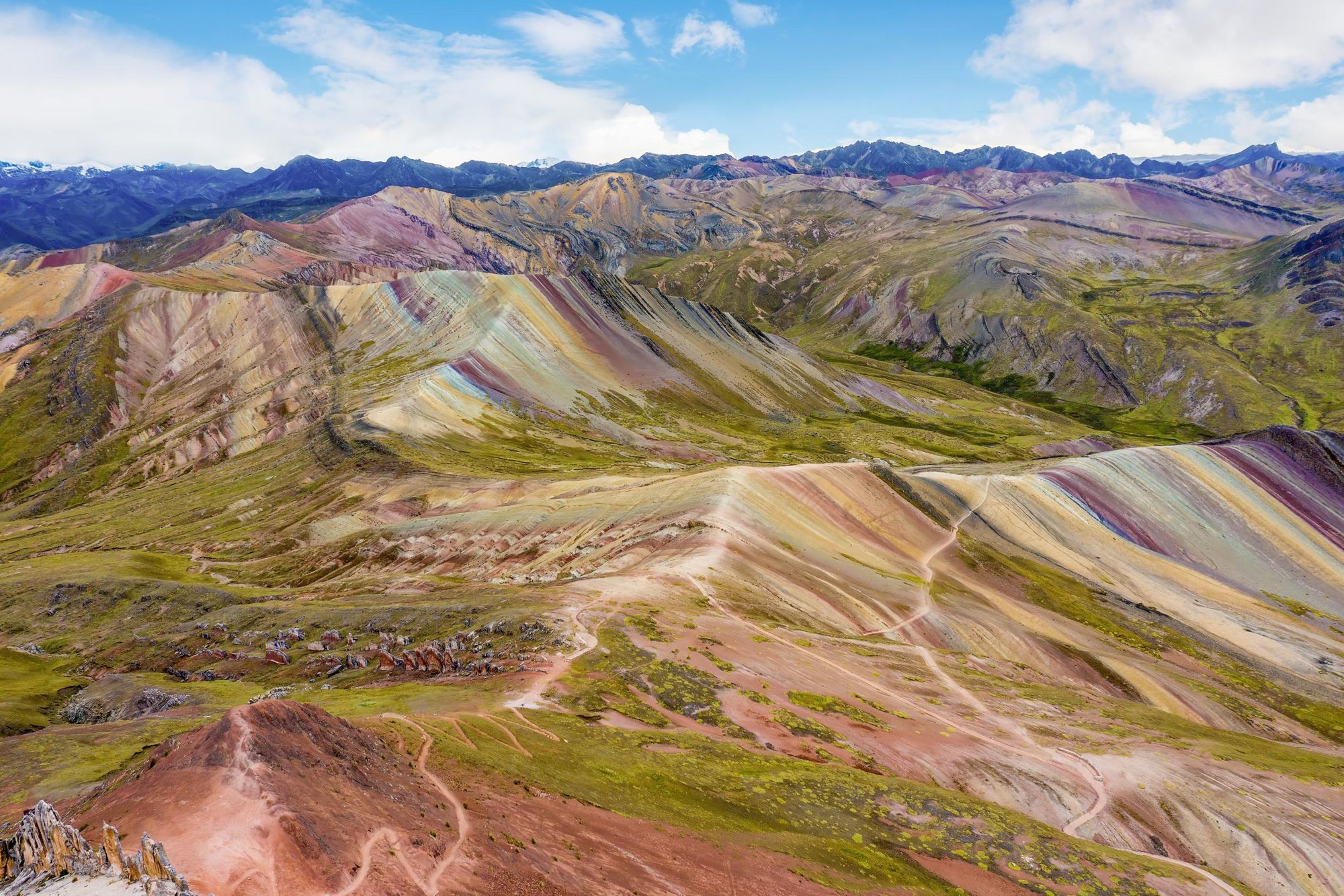
Palcoyo Mountain (4,900m/16,070ft) is nestled in the heart of Peru's Andes. It is a geological masterpiece striped in extraordinary ochre, green and rust-red hues. While the nearby Vincunca, known as ‘Rainbow Mountain’ often steals the limelight – making for a popular guided day trip from the nearby city of Cusco – it’s become somewhat busy, bordering on overtouristed. Palcoyo provides a much quieter alternative to take in the natural spectacle.
The striking colours of these mountains can be explained through geology.
The formation of Palcoyo began around 65 million years ago, when the area was covered by a shallow sea. As time passed, sedimentary layers began building up under the water. Volcanic activity underneath the earth’s crust introduced new minerals to these layers, and caused them to lift and tilt into mountains. As the different layers of mineral-rich sediment were exposed to the light, they began to oxidise and change colour.
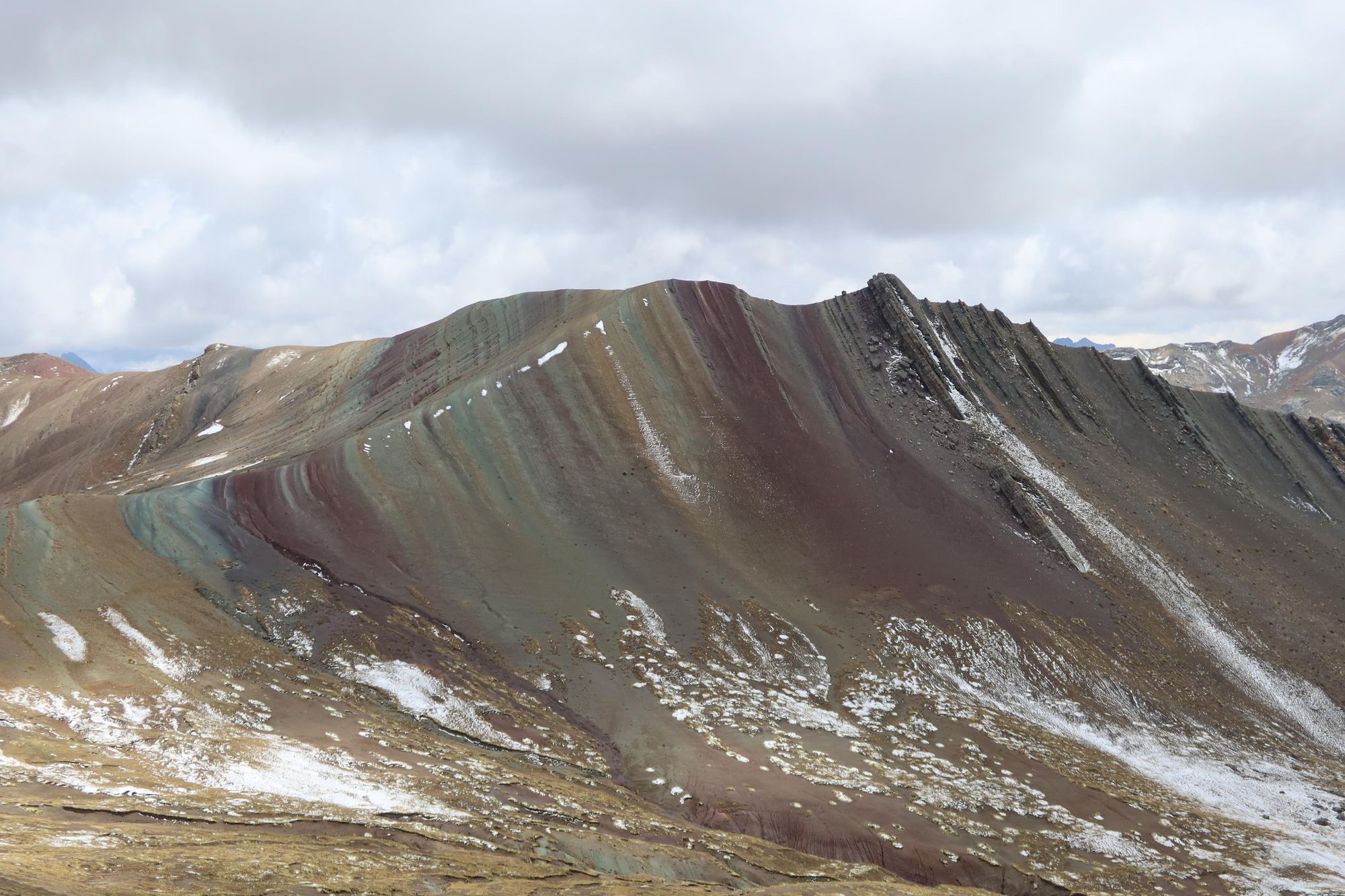
Each colour on the mountain tells a different geological story. Iron oxide creates red rust hues, while iron sulphide minerals create bright yellow colours and the green layers are due to iron magnesium and copper oxide.
Most people visit Palcoyo with a local guide, who will drive you along the mountain roads to the trailhead. You can reach the summit of Palcoyo via a short, easy hike (the only difficulty you’ll encounter is trekking at high altitude). As you strike out along the path, you’ll see local villagers and herds of alpacas grazing on the mountainside.
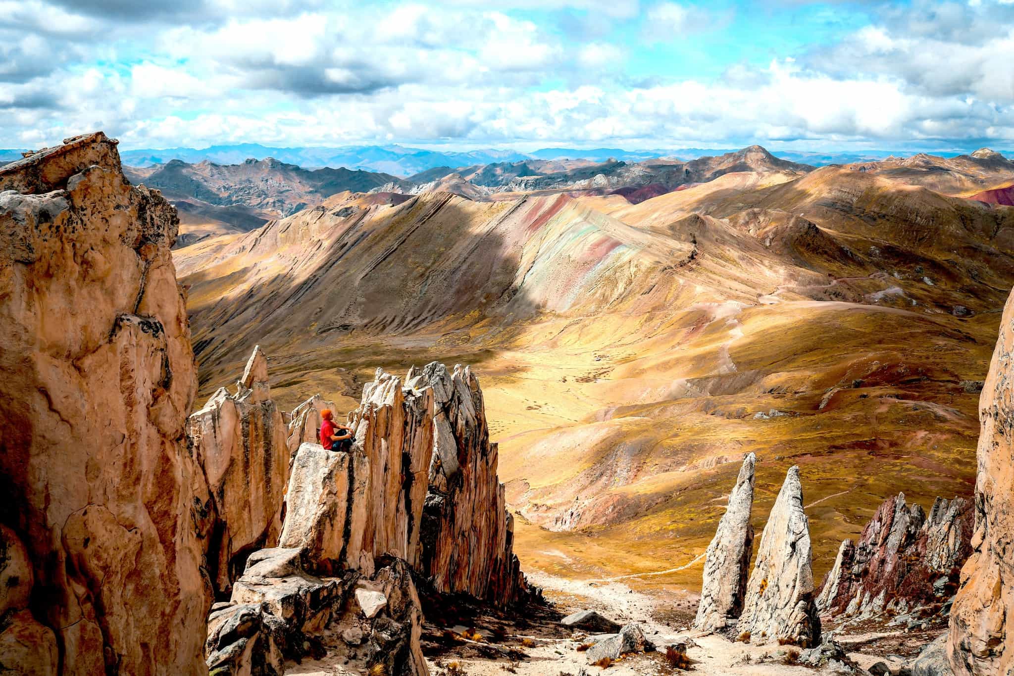
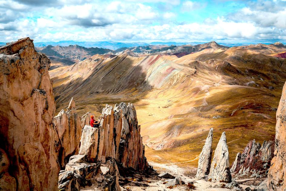
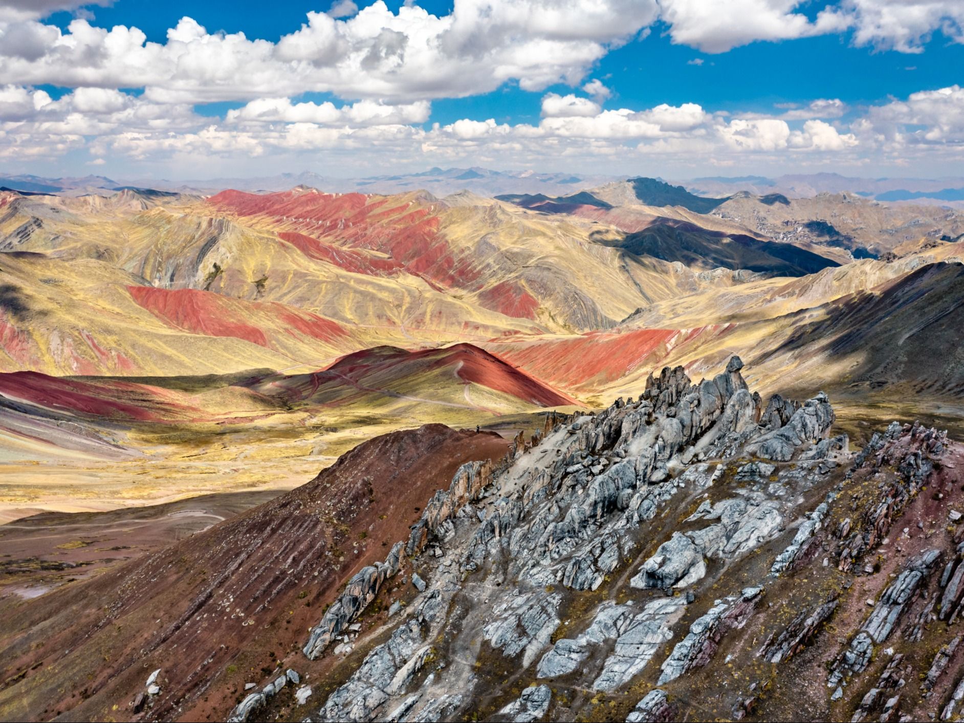
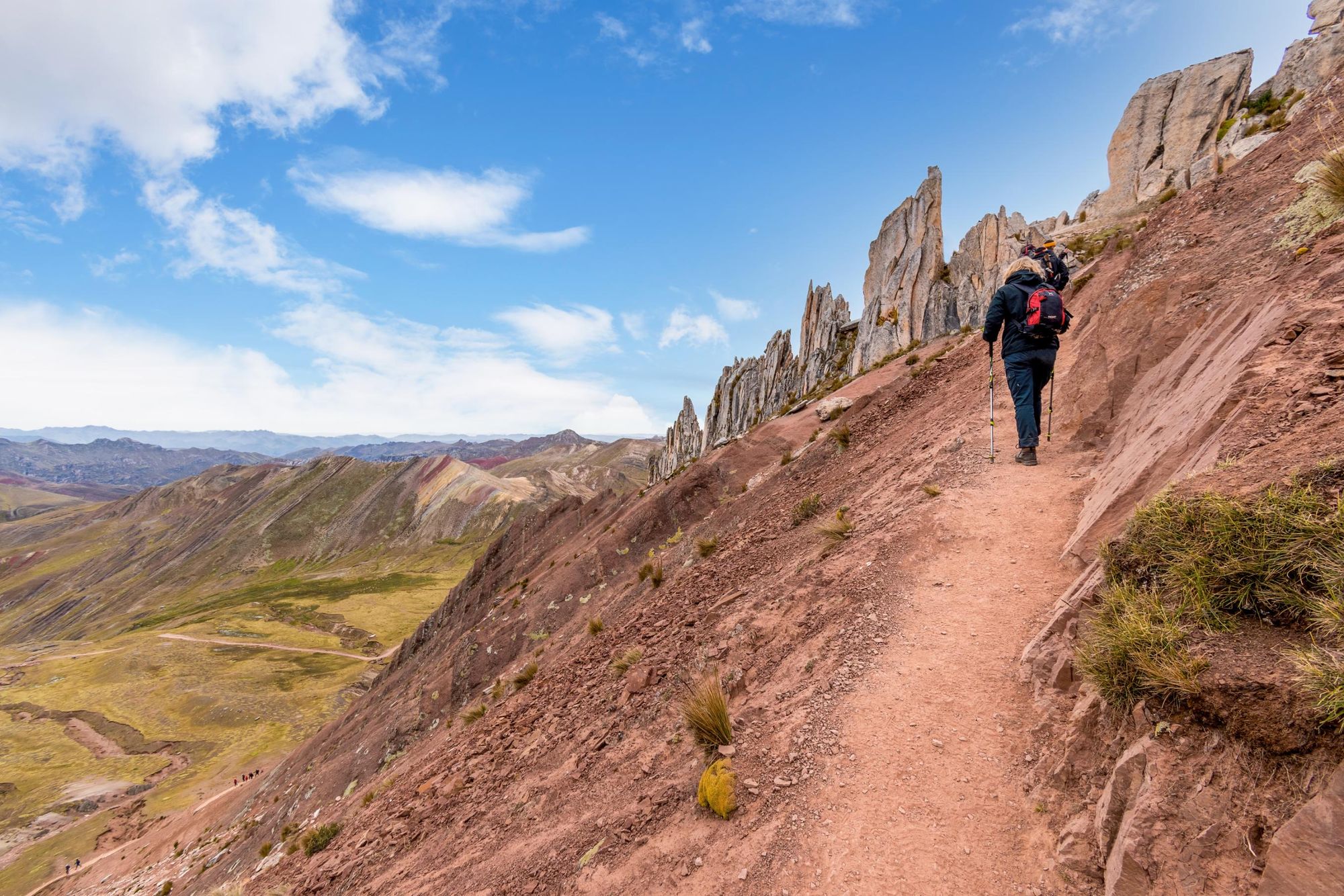
It’s just 150m of ascent to the summit, where a view of a spectacular multi-coloured ridge stretches out in front of you. Beyond it lie the snow-capped peaks of the Andes, dominated by Ausangate Peak (6,348m / 20,827ft). The trail then leads you past a rock formation known as the Stone Forest, where tall jagged rocks seem to sprout like trees from the ground.
It’s a unique, otherworldly landscape. So why does it only see a handful of visitors a day?
It’s a unique, otherworldly landscape. So why does it only see a handful of visitors a day? Part of the reason for this is that Palcoyo’s colourful slopes have only been exposed in the past few decades – since the glacier covering them melted due to climate change. However, Vinicuna was exposed at a similar time – it became rapidly popular thanks to Instagram; perhaps Palcoyo will one day receive the same levels of interest.
If you’re interested in hiking this ‘alternative rainbow’ mountain, here’s everything you need to know to plan your trek.
Where is Palcoyo Mountain?
Palcoyo Mountain sits high in the Peruvian Andes, around 4,900m (16,076 ft) above sea level, in the Cusco region - it’s 76 miles (125km) southeast of the capital Cusco. It’s part of the same mountain range as the more famous Vinicunca but remains a lesser-known alternative.
Palcoyo vs. Vinicuna
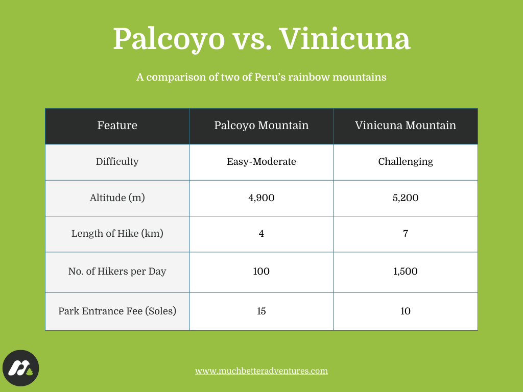
Both Palcoyo and Vinicuna are part of the Vilcanota Mountains in the Peruvian Andes. They are both known as ‘rainbow mountains’, thanks to their striped hues of red, pink, orange and green (the result of different mineral deposits). Vinicuna's colours are slightly brighter, although Palcoyo is considered to have better views, thanks to the multi-hued peaks and valleys surrounding it.
So, if you're considering going to the area, which mountain should you visit?
Vinicuna offers a more challenging hike at higher altitude. However, it sees significantly more footfall than Palcoyo, especially during peak season. Palcoyo, then, will appeal to travellers who prefer to get off the beaten track, while Vinicuna will appeal to those looking to tick iconic spots off the bucket list.
The Palcoyo Mountain Hike
- Distance: 2.4 miles/ 4km (out and back)
- Walking time: 2-3 hours
Your guide will pull up at the trailhead, a small parking lot by the side of a mountainous dirt road. You'll begin hiking up the well-defined path that gradually ascends uphill. From the trailhead, begin hiking up a well-defined path that gradually ascends uphill. Unlike Vinicunca, where the ascent is steep and demanding, the Palcoyo trail offers a much gentler incline (around 150m/492 ft of ascent in total). You’ll pass herds of alpacas grazing the rolling foothills.
The path meanders upwards through a valley, with views of the Andean highlands stretching into the distance. Within the first 15 to 20 minutes of walking, you’ll reach the first viewpoint; a small plateau that provides an initial glimpse of the multi-colored ridges ahead. Bands of red, ochre, yellow, and green streak across the mountainsides, formed over millions of years by sedimentary deposits.
As you leave the first viewpoint behind, the trail gently ascends toward the main Palcoyo ridge. Every few steps offer new and increasingly dramatic perspectives of the rainbow-coloured formations, and as you climb higher, the scale of the surrounding landscape becomes even more impressive. On clear days, the mighty Ausangate Mountain – one of the highest peaks in Peru – can be seen in the distance, its snow-capped summit providing a striking contrast to the vibrant earth tones of Palcoyo.
The path remains relatively easy to navigate, with only minor elevation gain. Reaching the ridge takes a further 25 to 30 minutes. You’ll have a panoramic view of the Palcoyo range, with its rainbow ridge lines and distant glaciers.
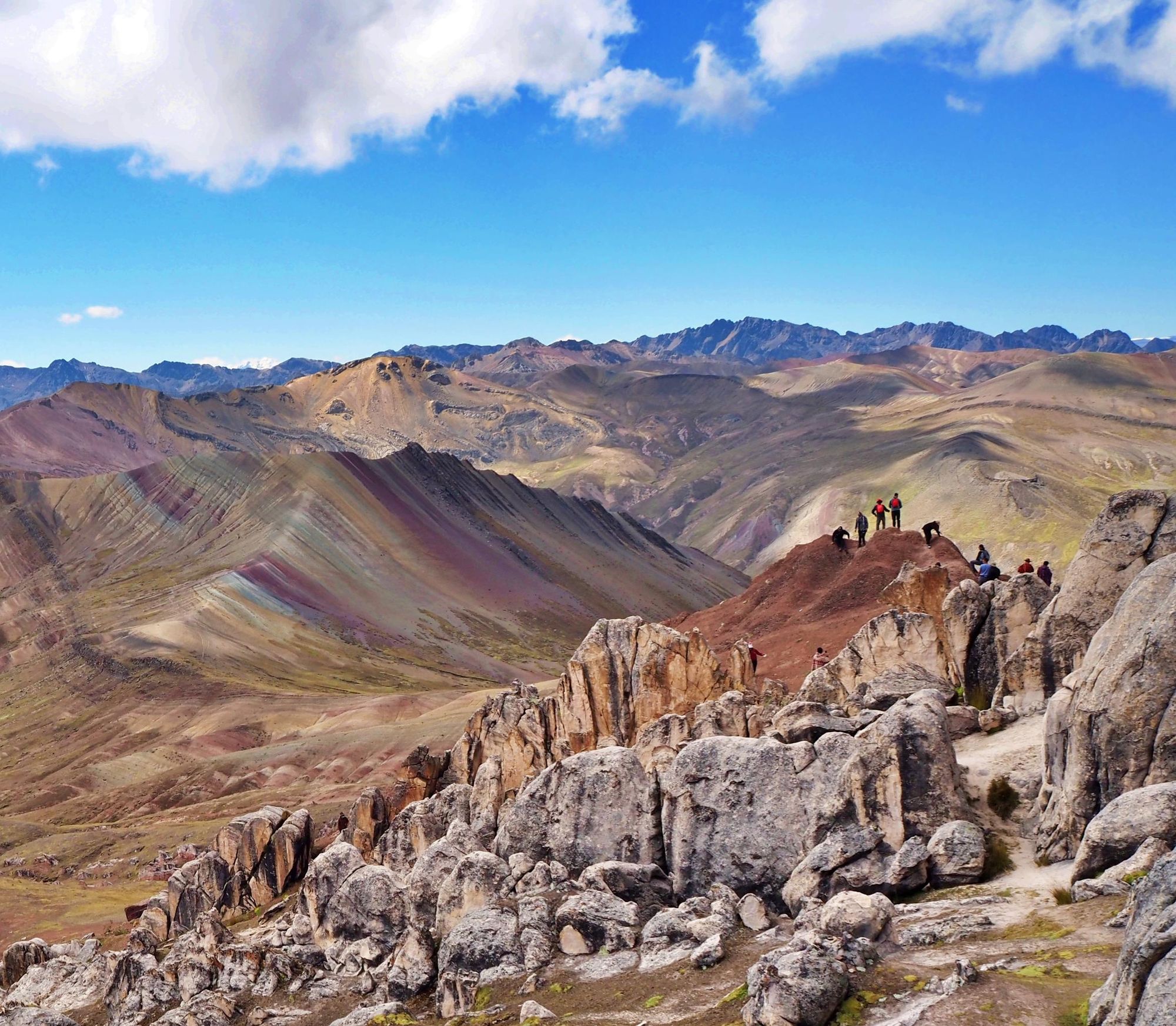
For those looking to explore a little further, an optional detour leads to the fascinating Bosque de Piedras, or Stone Forest, an unusual rock formation located just beyond the main viewpoint. Jagged, weathered stone spires rise from the ground, shaped over centuries by wind and erosion. The short hike to the Stone Forest takes about ten minutes and involves a slightly steeper ascent, but it’s worth it for views of the smooth multicoloured hills and the towering rock spires. To complete the hike, return the way you came.
When to Hike Palcoyo Mountain?
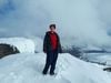
The best time to hike Palcoyo Mountain is during the dry season between May to October, when skies are clear. However, during the coldest months of the dry season (June to August) you might experience snow on the trails, so we recommend the warmer months of May, September and October.
During the wet season, you might experience snow, mist and cloud as well as rain. Trails can also get muddy, so if you’re planning on hiking Palcoyo, you’ll need good footwear. The best wet season months for hiking are November, when the rains are just beginning, or April, when they’re starting to taper off.
How to Get to Palcoyo Mountain
Palcoyo Mountain is roughly 76 miles (125km) from Cusco, which is between a three to four hour drive. Most people visiting will do so via an organised tour, which includes transportation. The road leading to Palcoyo is a rocky, single-lane track, so few tourists drive there.
To travel to Palcoyo independently, your first step is to reach the nearby town of Checacupe. If you’re coming from Cusco, grab a colectivo (shared taxi) from Avenida Tomasa Tito Condemayla - a journey which takes around two hours. From Checacupe, arrange a taxi to the Palcoyo trailhead. Make sure you get the driver to wait for you while you hike, otherwise you’ll struggle to get back.
FAQs
Is the Palcoyo Hike Difficult?
The Palcoyo hike is considered easy to moderate. It is a short trail (2.4 miles/4km) with a gradual incline, reaching an altitude of 4,900m (16,000 ft). The hike is easier than the Rainbow Mountain trek to Vinicuna due to lower elevation gain and a well-maintained path. However, don’t underestimate it – hiking at high altitude can be difficult, especially for those who aren’t properly acclimatised.
Do I Need to Acclimate Before Hiking Palcoyo?
Yes, acclimatization is recommended before hiking Palcoyo. The trail reaches 4,900m (16,000 ft), where altitude sickness can occur. Spending at least 1-2 days in Cusco or a similar high-altitude location helps the body adjust and reduces the risk of symptoms like headaches and dizziness. Chewing coca leaves is said to help symptoms of altitude sickness – your guide might offer you some!
What Should I Pack for the Palcoyo Trek?
For the Palcoyo trek, pack warm layers, a waterproof jacket, hiking boots, sunglasses, sunscreen, and a hat. Bring water and snacks. Weather can change quickly, so be prepared.
Do I Need to Visit Palcoyo With a Guide?
Visiting Palcoyo without a guide is possible, as the trail is well-marked. However, your guide is trained at spotting the signs of altitude sickness, and will ensure your safety. A guide also enhances the experience by providing insights into the landscape and culture. Organised tours handle transportation, making the trip more convenient.
Are There Bathrooms at Palcoyo?
There are basic toilets near the parking area, which require small change for usage. Bring your own toilet paper.
Inspired? Visit Palcoyo on our Hike, Cycle and Raft to Machu Picchu adventure.