
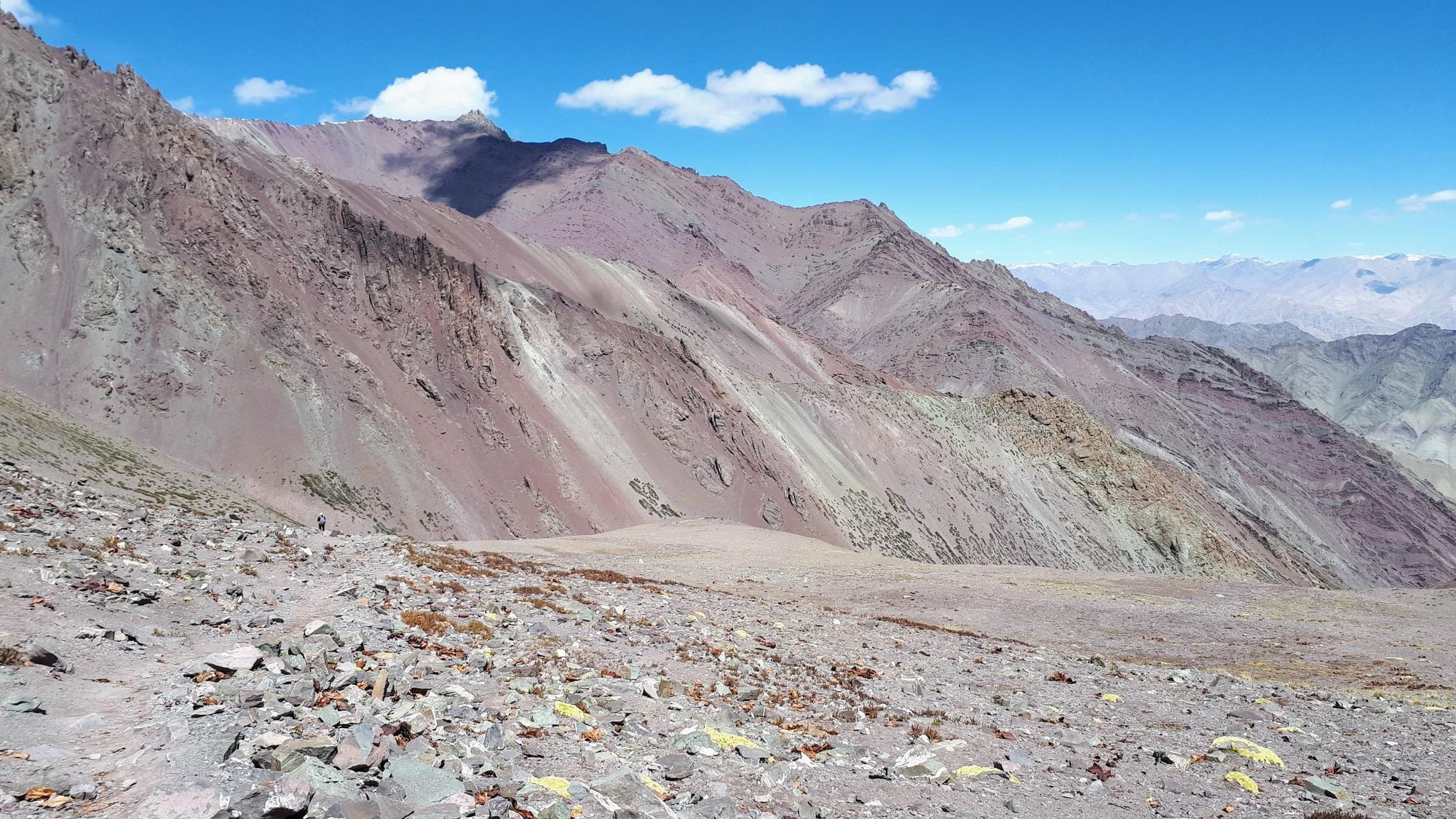
The Markha Valley trek is one of the most popular trekking routes in Ladakh, a region in north India whose name translates to the ‘Land of High Passes’. The Markha Valley is nestled between the Stok Kangri range to the north and the Zanskar Mountains to the south, and the glacial Markha River flows along the valley floor. On the trek you’ll follow the path of the river, encountering remote Ladakhi farming villages, tea tents and monasteries. You’ll gradually ascend higher up into the rust red and purple mountains, until you cross Gongmaru La, a mountain pass which reaches an elevation of 5260 metres.
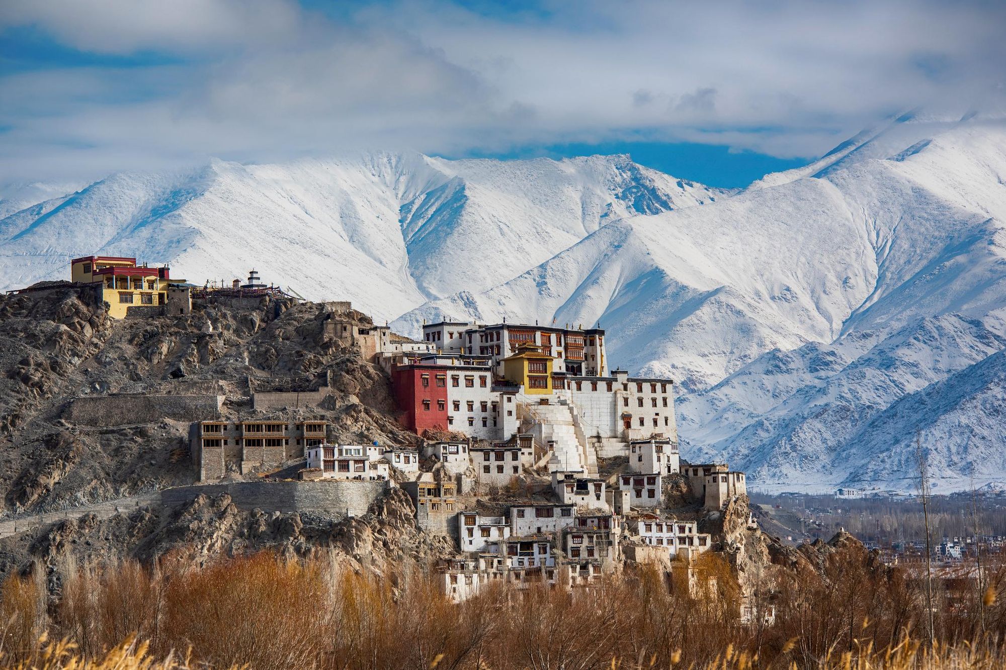
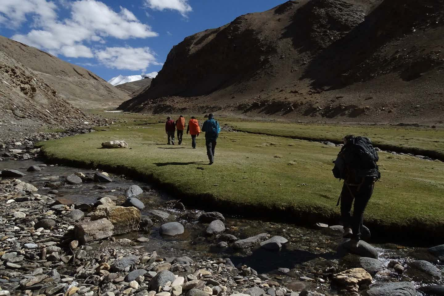
Hiking the Markha Valley Trek a few years ago, I was struck by the contrast between the verdant agricultural terraces and trees along the banks of the river with the high, arid peaks rising up on either side. I was also fascinated by the distinct culture in the region. Once an important stopping point on the Silk Road, Ladakh attracted traders from Tibet, China and the Middle East, and evolved as a cultural melting pot with a majority Buddhist faith. Closed to the wider world for centuries, it only reopened to tourism several decades ago, and still has an off-the-beaten-track feel.
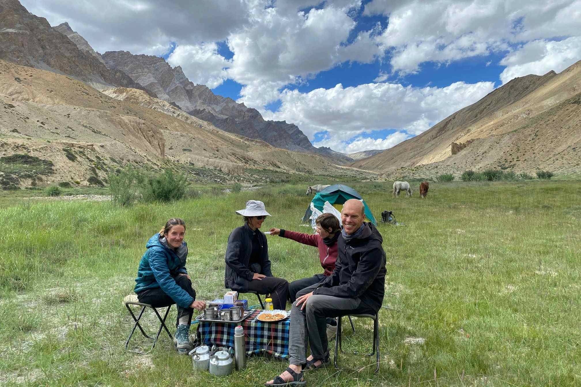
Walking with a guide, I learned how the villagers we met along the trek foraged for wild capers and sea buckthorn alongside growing vegetables at the lower altitudes. I discovered how they made their own yak cheese and spent winters indoors by the fire drinking butter tea - I was even able to try a cup. Not only was the trek a chance to explore a striking high altitude landscape, it was also an opportunity to immerse myself in a unique culture.
This guide offers an insight into the Markha Valley trek, describing the route, providing a packing list and answering frequently asked questions. It also mentions an optional route extension for more experienced hikers - climbing the 6,070m-high UT Kangri. This snowcapped peak has only opened up to mountaineers since 2019, since the nearby Stok Kangri 6,153m is closed to trekkers due to fears of overtourism.
The Markha Valley Trek: Map & Basics
Distance: 48.4 miles (68km) - 70.2 miles (113km)
Days to walk: 5-8
Elevation gain/loss: 4264m up / 3774m down
Highest point: 5,260m
How Hard is the Markha Valley Trek?
The Markha Valley trek involves multiple days of hiking - for up to eight hours a day - over rocky terrain, so a basic level of fitness is required. However, the most difficult part about the route is the high altitude - the trek begins at an elevation of 3,195m, and ascends to a height of 5,260m. At these altitudes, due to reduced air pressure, you’ll be taking in fewer oxygen molecules than your body is used to - this will cause you to feel breathless and tire more easily. It’s for this reason that most variations of the Markha Valley trek begin with a short two to three hour hike - to allow you time to acclimatise.
The most tiring day of the standard Markha Valley trek is the final day, from Nimaling to Shang Sumdo. This is when you ascend the Kongmaru La, a mountain pass of 5,260m - the highest point in the trip - followed by a long, steep descent with an altitude loss of around 1,500 metres. Even the fittest hikers need to stop for frequent breaks on the ascent, and we’d definitely recommend hiking poles for the descent - especially if you have dodgy knees.
If you decide to combine the Markha Valley trek with an ascent of UT Kangri (6,070m), you’ll need to be prepared for a challenging 10-12 hour climb to the summit up scree and snow.
In order to maximise your chances of successfully completing the Markha Valley trek - and the ascent of UT Kangri - we recommend training for a mountain climbing adventure in the gym and on the trails, and making sure you spend enough time acclimatising in Leh, the closest city to the trailhead.
Markha Valley Trek Itinerary: 4 Day Route
The standard Markha Valley trek begins in Chilling and finishes in Shang Sumdo. Most people tend to finish this in five days. However, it’s also possible to start trekking slightly further down the road, in Sara, and do the trek across four days. You can also finish the trek earlier at Chokdo (about 2.4 miles/ 4 km before Shang Sumdo), as it’s accessible to cars along a dirt road.
The route suggested here is for those who are camping - however, it's possible to stay in homestays along this route. It just means you might stop walking a little earlier than suggested, when you reach a village.
Day 1: Sara to Thinles Pa
- Distance: 6.2 miles (10km)
- Hiking time: 2-3 hours
- Elevation gain: 200m up
You'll drive from Leh to the trailhead at Sara. Then, you'll follow a path which runs alongside the milky blue Markha River, with rocky orange escarpments striated with green and purple rising up on either side of you. The ascent is very gradual, but the path eventually climbs up above the river.
This short trek will help you acclimatise to the high altitude on the trail. You'll end the day at Thinles Pa (3,700m), a small hamlet where you'll make camp.
Day 2: Thinles Pa to Hankar
- Distance: 9.3 miles (15km)
- Hiking time: 5-6 hours
- Elevation gain: 550m up
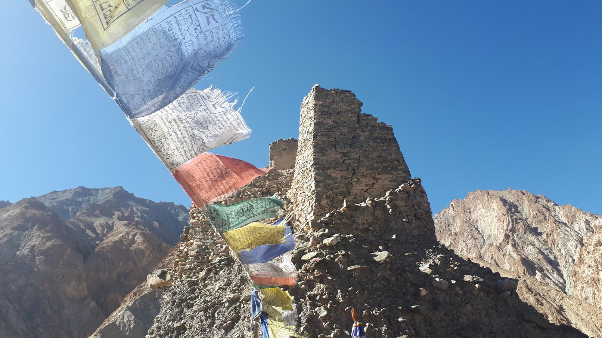
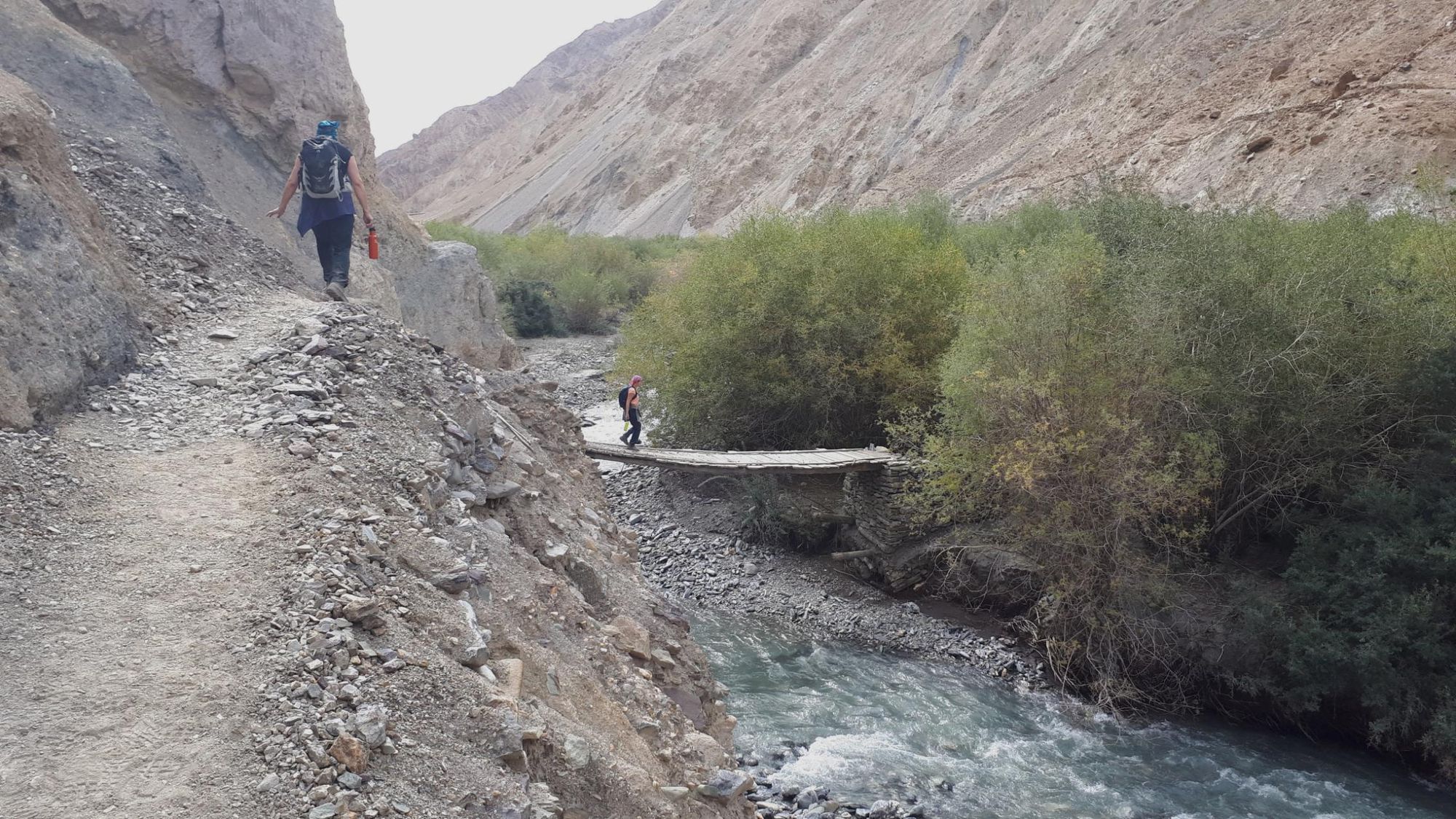
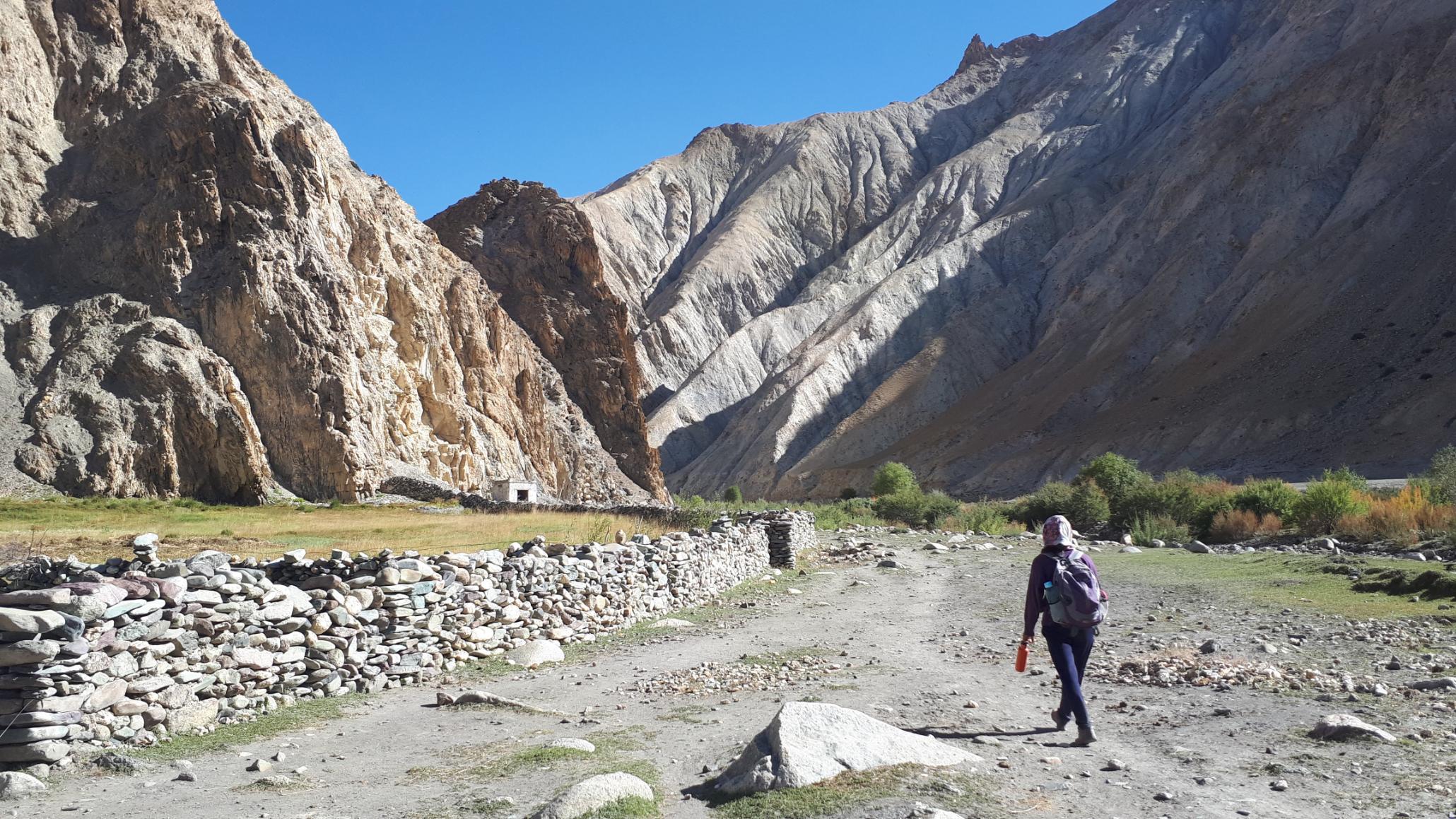
You’ll follow the trajectory of the river, making several crossings over rickety wooden bridges. At points, the bridges aren't useable and you'll need to cross the water on foot - it's literally glacial. Sea buckthorn plants grow near the water, alongside willow and poplar trees. You’ll pass small hamlets and see stone stupas (Buddhist monuments) decorated with prayer flags. Some are painted red and decorated with horned animal skulls, to protect the village.
Rhyolite peaks rise up on either side of you as you hike towards the village of Markha. It's surprisingly verdant, On either side of the banks you’ll see terraced fields of alfalfa and barley; poplar, apricot, apple, willow and walnut trees.
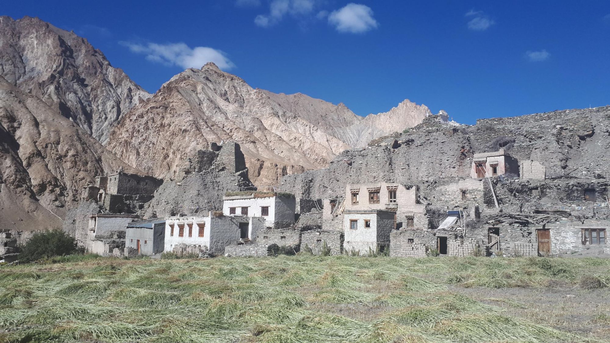
You’ll end the day at Hankar, a village with several homestays and a ruined fort. It’s located at an altitude of 4,264 metres - you’ll notice the air becoming much thinner at this altitude.
Day 3: Hankar to Nimaling
- Distance: 4.9 miles (8km)
- Hiking time: 4-5 hours
- Elevation gain: 600m up
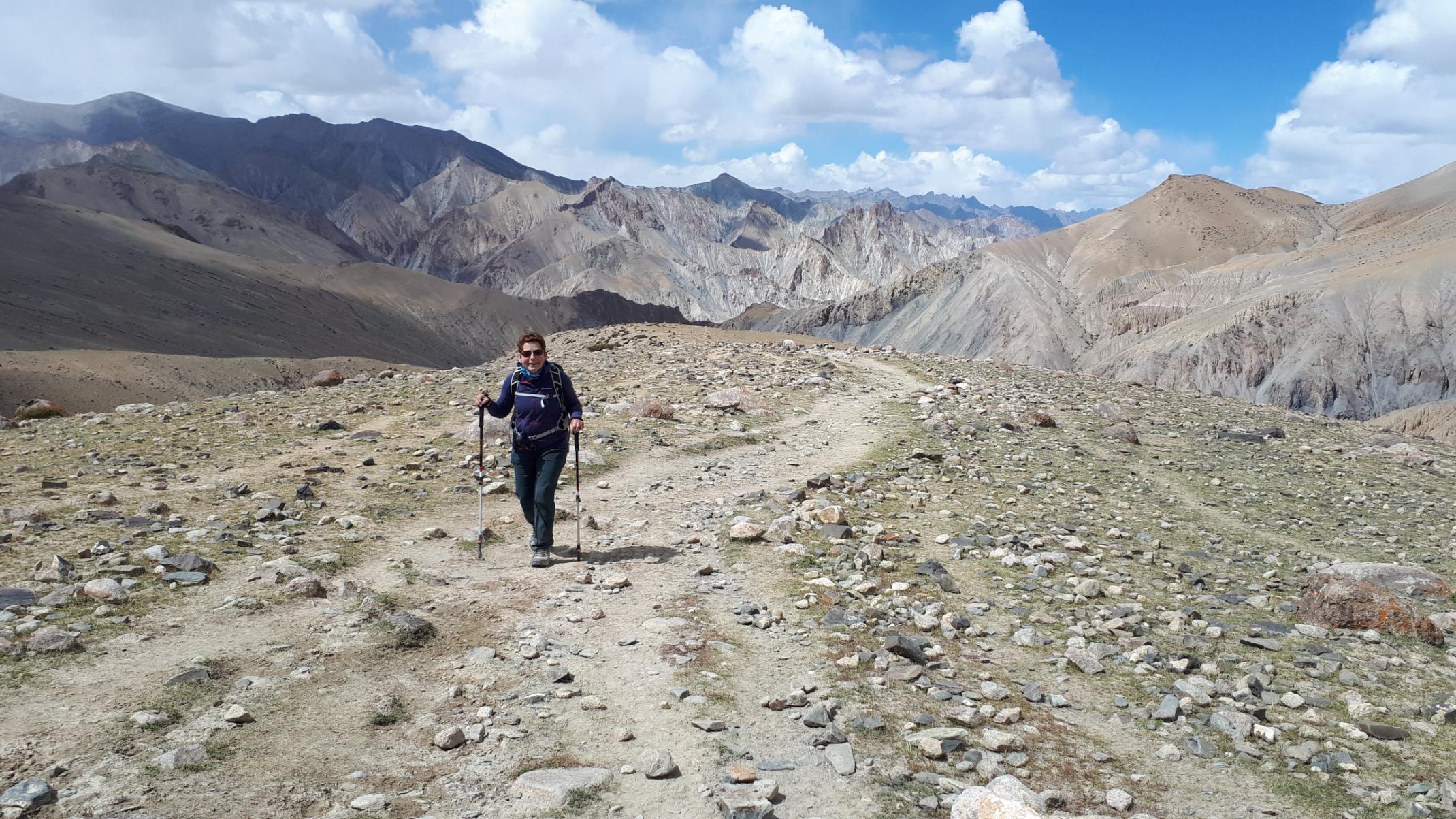
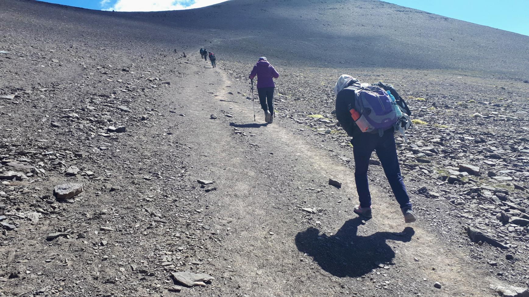
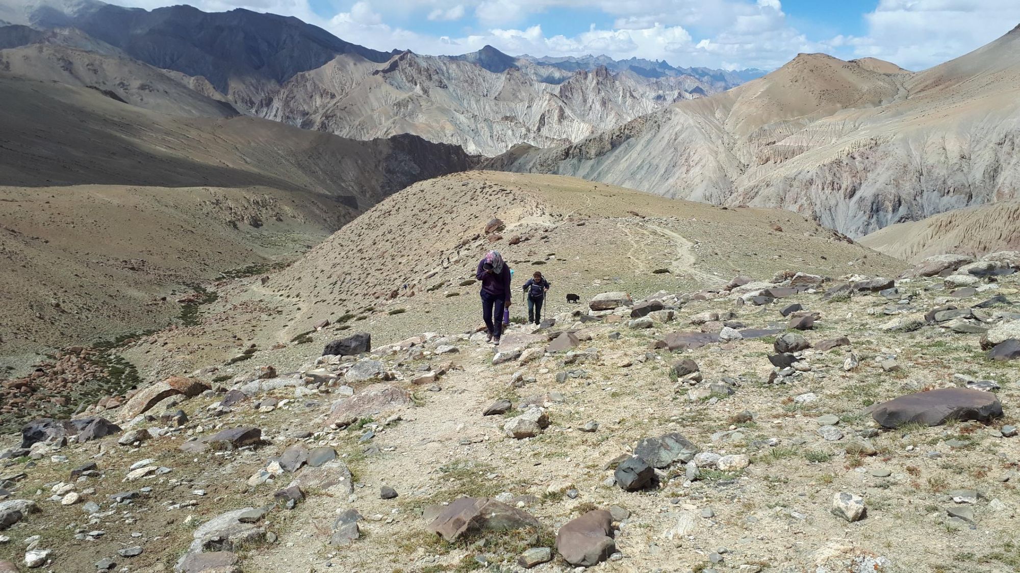
Today you’ll leave the river and Ladakhi villages behind to ascend into the mountains, and the campsite at Nimaling. You’ll pass surreal mushroom-shaped pinnacles and antediluvian folds of rock as you ascend into the mountains. Above the treeline the vegetation is sparse, consisting of little more than wild caper bushes and bright orange lichen that clings to the boulders.
You might see eagles circling in the sky above, and rodents known as pikas scurrying over the arid land. Shaggy yaks range the rocky hillsides, alongside sheep and dzos (a hybrid of cow and yak).
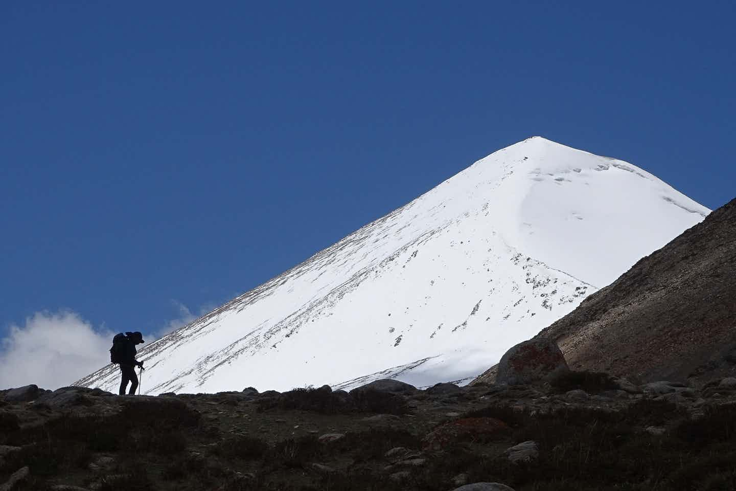
After a steep, lung-bursting climb, you’ll reach Nimaling, a high plateau surrounded by mountains including the glaciated Kang Yatse (6400m), the highest peak in the valley. There’s a seasonal summer campsite here, and no homestays. The Nimaling campsite is located at an altitude of (4,841m), and once the sun goes down, temperatures plummet below zero. Make sure you wrap up warm and get into your sleeping bags early.
Day 4: Nimaling to Shang Sumdo
- Distance: 10.5 miles (17km)
- Hiking time: 6-8 hours
- Elevation gain: 439 up/ 1601m down
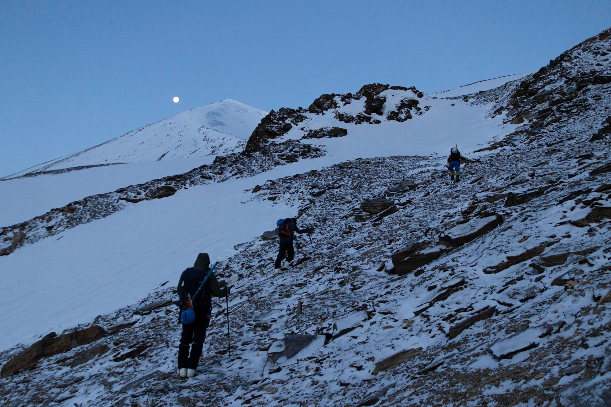
The hardest hiking day so far. As you hike out of the campsite, the path ahead stretches up a steep scree slope to Kongmaru La, known in Ladakhi as ‘the red pass’. The climb to the top is made more difficult by the high altitude - even the fittest trekkers need frequent breaks to catch their breath.
When you reach the top you’ll see stone stacks decorated with a tangle of prayer flags. The reward is a view of jagged rust-coloured mountains stretching to purple silhouettes at the horizon.
Then begins the descent down the other side of the pass, following the trail to its conclusion at Shang Sumdo - 6 or 7 miles of downhill hiking, where you’ll descend almost 1,600 metres. The rocky terrain is hard on the knees, but as the altitude drops you’ll find yourself recovering your breath. When you reach the tiny village of Chokdo you know you’re on the home stretch - after that it’s several miles down a dirt road to Shang Sumdo. You can either stay the night in a homestay here, or arrange for an afternoon pickup to get back to Ladakh.
Markha Valley Route Extension: Spituk Start Point
Some people begin the Markha Valley trek from an alternative start point - the village of Spituk, just a few miles south of Leh. This involves three extra days of trekking, reaching Skiu at the end of the third day and joining the standard route - a total distance of 70.2 miles (113km).
You’ll hike from Spituk along the path of the Indus River. After a few kilometres you’ll veer away from the river to hike through a steep gorge towards the village of Zingchen, where you can stay the night. On the second day you’ll continue hiking through the gorge to the village of Yurutse (4,184m), ascending over 750 metres. The third day takes you from Yurutse over Ganda La, a pass with an altitude of 4,961 metres - and breathtaking views of the Zanskar and Stok mountain ranges - then down to Skiu.
This extension increases the difficulty of the trek as you’re ascending to higher altitudes more quickly than on the standard route. It’s important to make sure you spend enough time acclimatising in Leh before starting out.
Markha Valley Route Extension: Climb UT Kangri
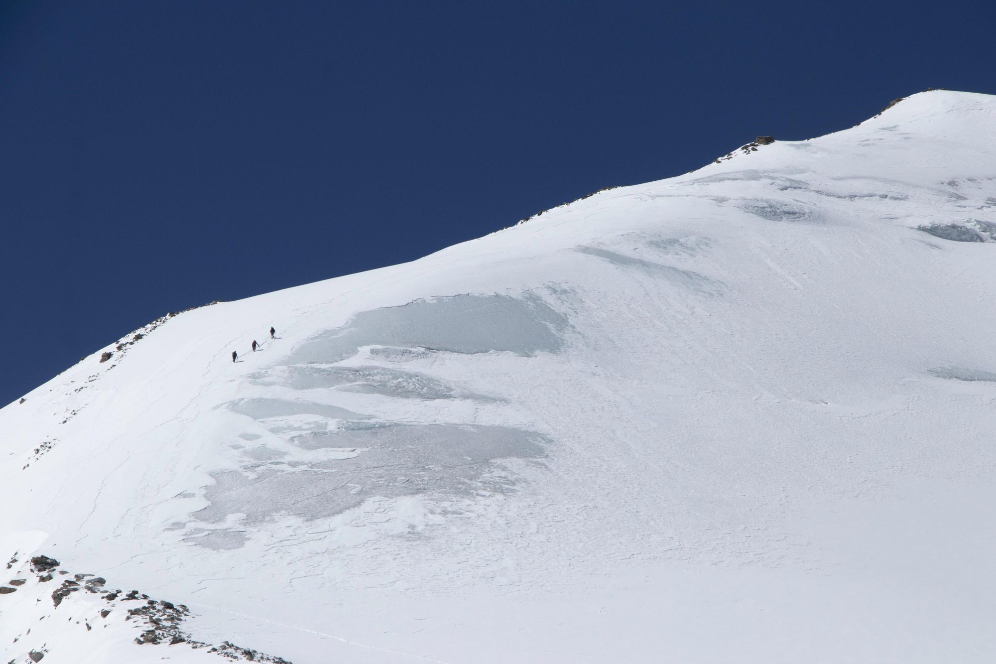
If you really want to test yourself, you can add an extension to the route that takes in an ascent of UT Kangri, a remote 6,070m-high peak which doesn’t require technical mountaineering skills. It’s a relatively new summit on adventurers’ radars - an alternative to Stok Kangri (6,153m), a popular mountain now closed to protect its fragile environment from overtourism.
Hike the standard Markha Valley trek, until day four, beginning at Nimaling. Instead of crossing Kongmaru La you'll cross Lalung La (5,300m) and descend to Chaktsang rather than continuing on to Shang Sumdo. From day 5 you’ll leave the Markha Valley trek and head towards UT Kangri.
Day 5: Chaktsang to Lato
- Distance: 11.1 miles (18km)
- Hiking time: 5-6 hours
- Elevation gain: 500m up/ 1200m down
Continue the descent towards Shang Sumdo, but you’ll turn away from the Markha Valley trail to ascend the Chaksang La Pass (5200m) before heading down towards the village of Lato. There are homestays here, or you can camp by the Kyamur River on the outskirts.
Day 6: Lato to Rumtse Phu
- Distance: 10.5 miles (17km)
- Hiking time: 5-6 hours
- Elevation gain: 850m up
Follow ancient nomadic routes as you trek along the Lato Valley, passing through remote farming villages. You’ll end up at Rumtse Phu, where the locals are known for their horse riding and traditional dance of Gya-Pa-Cho.
Day 7: Rumtse Phu to UT Kangri Basecamp
- Distance: 3.7 miles (6km)
- Hiking time: 4 hours
- Elevation gain: 450m up
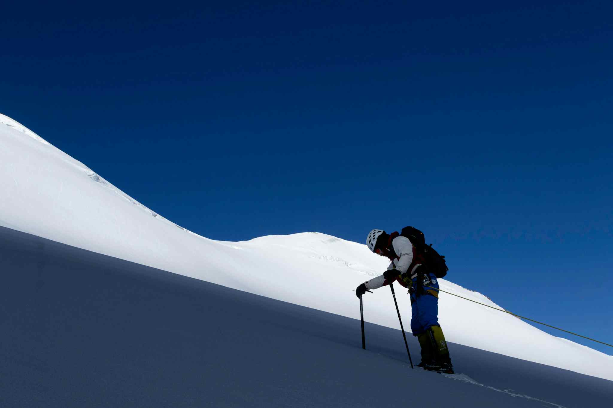
A short but steep walk from Rumtse Phu to UT Kangri Basecamp, located at 5,300m above sea level - a plain surrounded by snowcapped peaks. After lunch, you’ll learn basic mountaineering techniques, such as using crampons and ice axes.
Day 8: Acclimatisation & Mountaineering Practice
We’d never recommend striking out to the summit the day after arriving at basecamp. Instead, spend a day acclimatising and practising using your mountaineering equipment.
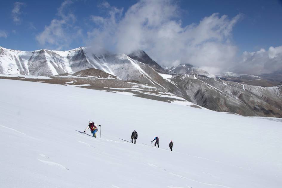
Day 9: UT Kangri Summit
- Distance: 2.4 miles (4km)
- Hiking time: 10-12 hours
- Elevation gain: 800m up/ 800m down
You’ll wake before dawn to get started, because it’s a long, steep climb to the top - made more difficult by the high altitudes. Roped up, in a 1:2 guide to climber ratio, you’ll ascend steep scree and moraine, before crossing snow fields to reach the summit. At the top, enjoy the view of Kang Yatse and Ladakh’s other towering peaks, before descending back to basecamp. You'll stay here overnight before hiking back to Rumtse Phu for your lift home tomorrow.
Do I Need a Guide for the Markha Valley Trek?
It’s possible to trek the Markha Valley independently, without a guide or a porter. However, by doing so you’re going to have to carry all your own gear and food, which makes the hike more difficult. We would not recommend you travel independently if you are new to high altitude trekking. Without a guide, you’ll also miss a chance to learn about the local culture and landscape - and you’ll miss out on the best campsites.
If you are going to climb UT Kangri, you definitely need to do so with a guide - climbing a 6,000m peak is no mean feat, however fit you are. Choose a company that works with a 1:2 guide to client ratio, as you’ll be roped up on the climb, and this will ensure you get the support you need for the summit ascent.
Where Can I Stay on the Markha Valley Trek?
On the Markha Valley trek there are two accommodation options - homestays, or camping. Both have their benefits, as we’ll discuss below. However, it’s important to realise that you can only stay in homestays in places where, well, people have homes. Nobody lives permanently in the higher altitudes found along the Markha Valley trek, such as Nimaling - so here there’s no option but to camp.
Homestays
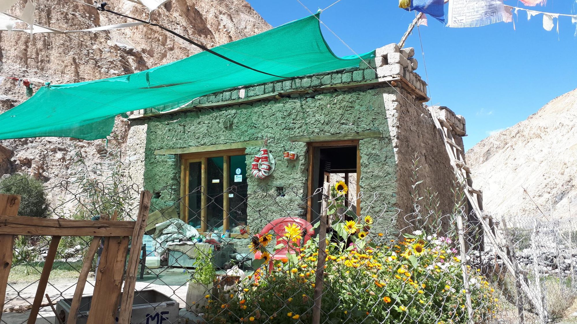
You’ll find homestays along the Markha Valley route, and the trek itinerary is geared around staying in them. Homestays give you a fascinating insight into Ladakhi culture - you’ll eat communally, meals prepared by your host - normally dal, rice and vegetables, noodle soups or momos.
Homestays are allocated according to a fair rotating system, so all the villagers get economic benefit - trekkers just need to tell the villagers they want a homestay, and will be directed to one. Facilities are basic - mattresses on a floor, long drop toilets - but you may be able to borrow a couple of hours’ electricity to charge your phone, or even grab a (likely cold) shower. You’ll also be given breakfast and a packed lunch.
The difficulty of relying solely on homestays is that capacity is limited. Larger groups will often not fit in one homestay - it’s a better option for solo trekkers or small groups. The Markha Valley trek is becoming increasingly popular, especially during the months of July and August, so you might end up sleeping in the dining area, or having to walk onto the next village in search of a bed.
Camping
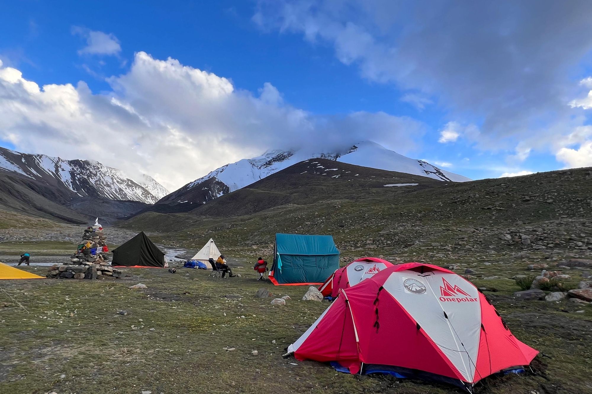
It’s possible to camp along the Markha Valley trail, either wild or in a designated campsite.
Many of the tea tents you encounter along the trek have camping areas, often near streams, where you can pitch your tent. In doing so, you strike a balance between being immersed in nature, and being able to enjoy the tea tent facilities (long drop toilets and refreshments).
Those who camp will need to hire a support crew - cooks, porters and horses to carry the gear (unless you want to carry it all yourself) - included in the cost of a guided trip. Chances are you’ll actually have more variety and nutrition in your meals - fresh salad, soup, tinned fish, pasta - and campsite cooks will be able to cater to dietary needs more easily.
In higher altitude campsites, the temperature drops below freezing some evenings, so make sure that you bring a four season sleeping bag with a hood to stay warm. In places such as Nimaling, where there are no homestays and a semi-permanent campsite, you’ll also be provided with blankets.
When is the Best Time of Year to Hike the Markha Valley?
The best time of year to hike the Markha Valley trek is between late May and mid September. This is the high season, when you can be assured of good weather - although it’s cold at high altitude, the skies are clear.
A high altitude desert, Ladakh only experiences 100 mm of precipitation annually. However, during the colder months it snows a lot - December daytime temperatures are around -11°C in Leh, and can plummet to -40°C as you climb over 5,000 metres. During the winter months, high passes are closed, so anyone attempting the Markha Valley trek will only be able to trek as far as Markha village, before turning around and hiking back the same way.
What Should I Pack for the Markha Valley Trek?
In order to complete the Markha Valley trek, you need to be well prepared with gear and equipment. We recommend that you bring:
- A warm wool hat
- A sunhat
- Sunglasses
- Head torch
- Balaclava
- Worn-in hiking boots
- Mountaineering boots (double layer recommended e.g. G2SM La Sportiva boots) - if climbing UT Kangri
- Trainers or sandals (for river crossings)
- Gaiters
- Base/thermal layers (merino is ideal)
- 1 mid-layer (fleece or similar)
- 1 outer layer/hardshell jacket
- Waterproof trousers and top
- Lightweight trekking trousers
- Insulated hardshell trousers
- Four-season down jacket with helmet-compatible hood (comfort rating down to around -20°c)
- gloves
- 2 x 1 litre water bottles
- Small biodegradable bags to take toilet tissue off the mountains
- Universal plug adaptor
- Power bank
- Walking poles
- Water purification tablets/treatment system
For a full list, check out the kit list section of our Trek the Markha Valley to Summit UT Kangri (6,070m) Expedition.
How to Get to and From the Markha Valley Trek
The closest airport to the Markha Valley trek is Leh, the capital of Ladakh. There are no international flights in and out of Leh, but there are daily flights from Delhi (1 hour 25 minutes).
If you’re travelling on an organised trip, your transport to and from the trek will be arranged for you. Those travelling independently will need to arrange for a taxi from Leh to Chilling (37 miles, 75 minutes’ drive) or Spituk (4 miles, 15 minutes). There are also local buses from Leh to both start points, but taxi prices are very reasonable - between 2,500 to 4,000 rupees, which can be shared between passengers.
When you return from Shang Sumdo, there is a daily bus running back to Leh at around 6pm. There are also several taxis waiting to take trekkers back to Leh - although most people tend to prebook their return taxi while still in Leh.
Inspired? Join us on our expedition to Trek the Markha Valley and Summit UT Kangri (6070m).