

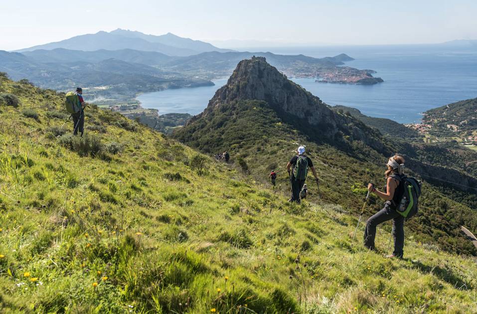
The Grande Traversata Elbana (GTE), also known as the Grand Traverse of Elba, is a 36 mile (58km) route which crosses the mountainous ridge of this Tuscan island - from the east to the west.
“Elba is part of the Tuscan archipelago, so it’s off the coast of Tuscany,” says destination expert Marta Marinelli. “It’s very well known in Italy, particularly as a place where Italians go on holiday during summer. People go to the towns, which are full of culture, but don’t focus so much on hiking here, and it’s still not well known by international tourism - so it’s well preserved. The charm is not impacted at all or exploited by tourism in any way. There’s no mass tourism.”
It basically follows the backbone; the ridge of Elba. You leave from the coast and you arrive at the other coast...
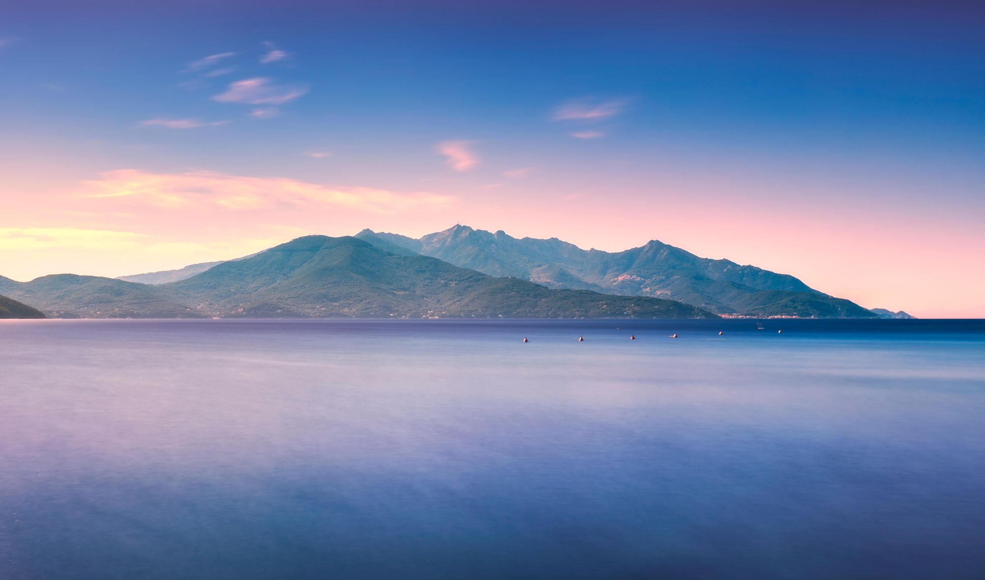
Not a lot of tourists know that there are islands off Tuscany. The archipelago is made up of seven islands, nestled between the Ligurian Sea and Tyrrhenian Sea. Elba is the biggest and all are protected as the Arcipelago Toscano National Park.
- Start point: Cavo
- End point: Patresi or Pomonte
- Length: 36 miles (58km) or 31 miles (50km)
- Days: 3-5
- Elevation gain: 2,685m (8809ft) or 3,265m (10,711ft)
- Best for: Seasoned hikers looking off the beaten path
“Elba is very green,” Marta says. “It is definitely the most mountainous of the archipelago. It’s covered in Mediterranean scrub, so it’s got this very lush feel, which is particularly amazing in spring, when you’ve got all of these wild flowers and the scent of the scrub.”
The most common route for international tourists heading to Elba is to first fly into Pisa then catch a 90-minute train to the port of Piombino. The fastest ferry sailings reach Portoferraio, the main port town in Elba, in around 40 minutes.
“The crossing is short, so it’s very accessible,” says Marta, “but you do have to make that journey from Pisa, which is maybe one reason most people stick to mainland Tuscany.”
The GTE is the most beautiful - but demanding - hiking trail on the island.
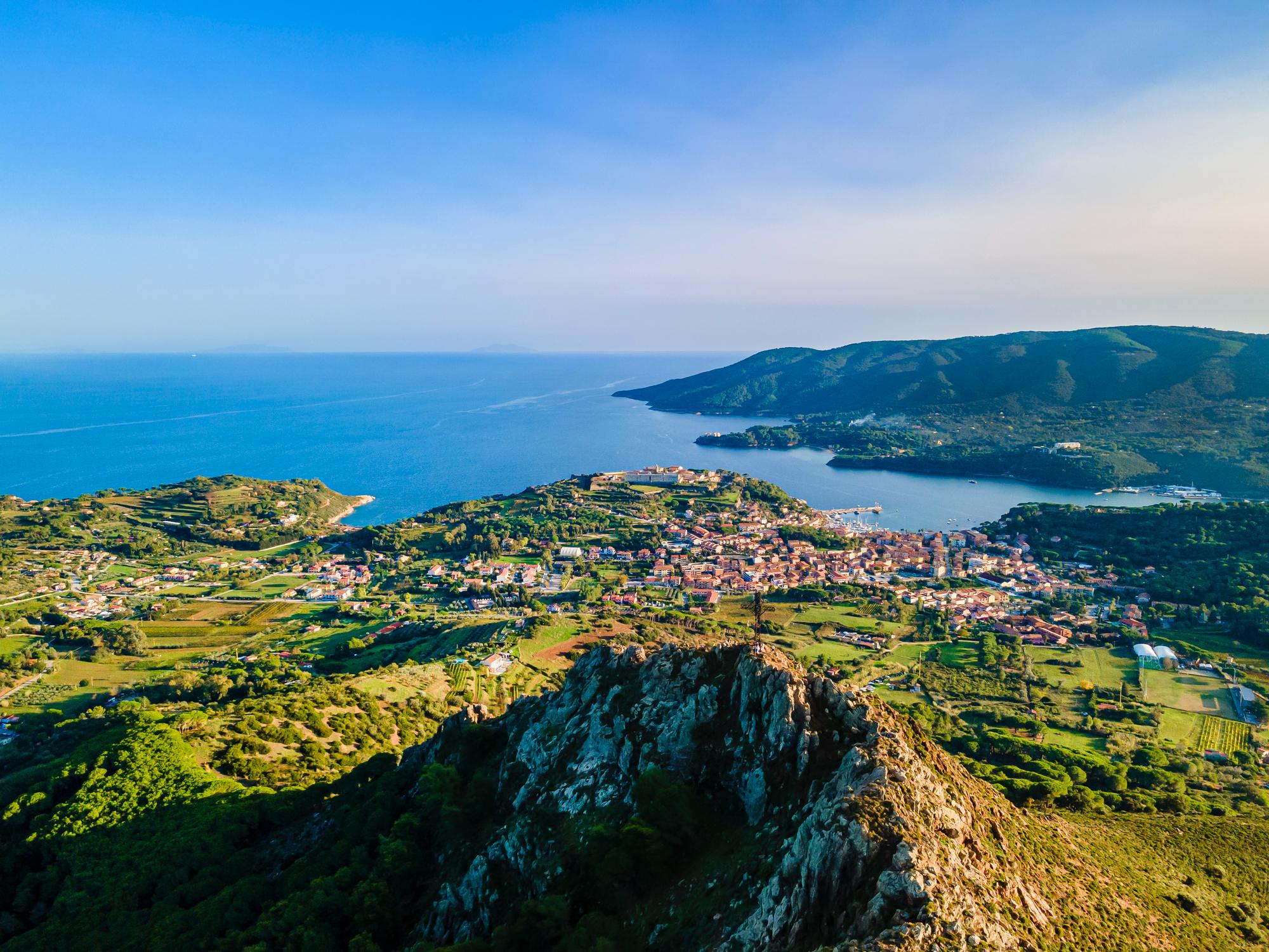
“It's generally crossed from east to west,” says Marta. “So after arriving in Portoferraio, you travel to the town of Cavo, which is on the eastern coast. It's from there that the route starts.”
The route is typically walked in three days, stopping at Porto Azzurro and Procchio. “It basically follows the backbone; the ridge of Elba,” says Marta.
On a clear day, you have a view over Corsica, across to the Tuscan mainland and out over the other islands in the archipelago...
“There are different variants depending on how many days you take, and whether you want to end in Patresi or Pomonte. Either way, you leave from the coast and you arrive at the other coast, which is quite amazing.”
Leaving Cavo, the trek follows a ridge west, climbing above Porto Azzurro and moving in-land to ascend Monte Perone (630m/2,067ft), where you’ll get a beautiful view back down to the rugged coastline and crystal clear Elba water.
You’ll later walk to the base of Monte Capanne, which at 1,017m (3,337ft) is the highest mountain on Elba. The peak is no mean feat to climb from sea level. “It’s a bit of a scramble up, but from the top, on a clear day, you have a view over Corsica, across to the Tuscan mainland and out over the other islands in the archipelago, which is amazing.” From here, the trail divides, with one option taking you up the mountain and over to Patresi on the west coast, and another heading to the village of Pomonte, following a separate ridgeline southwest.
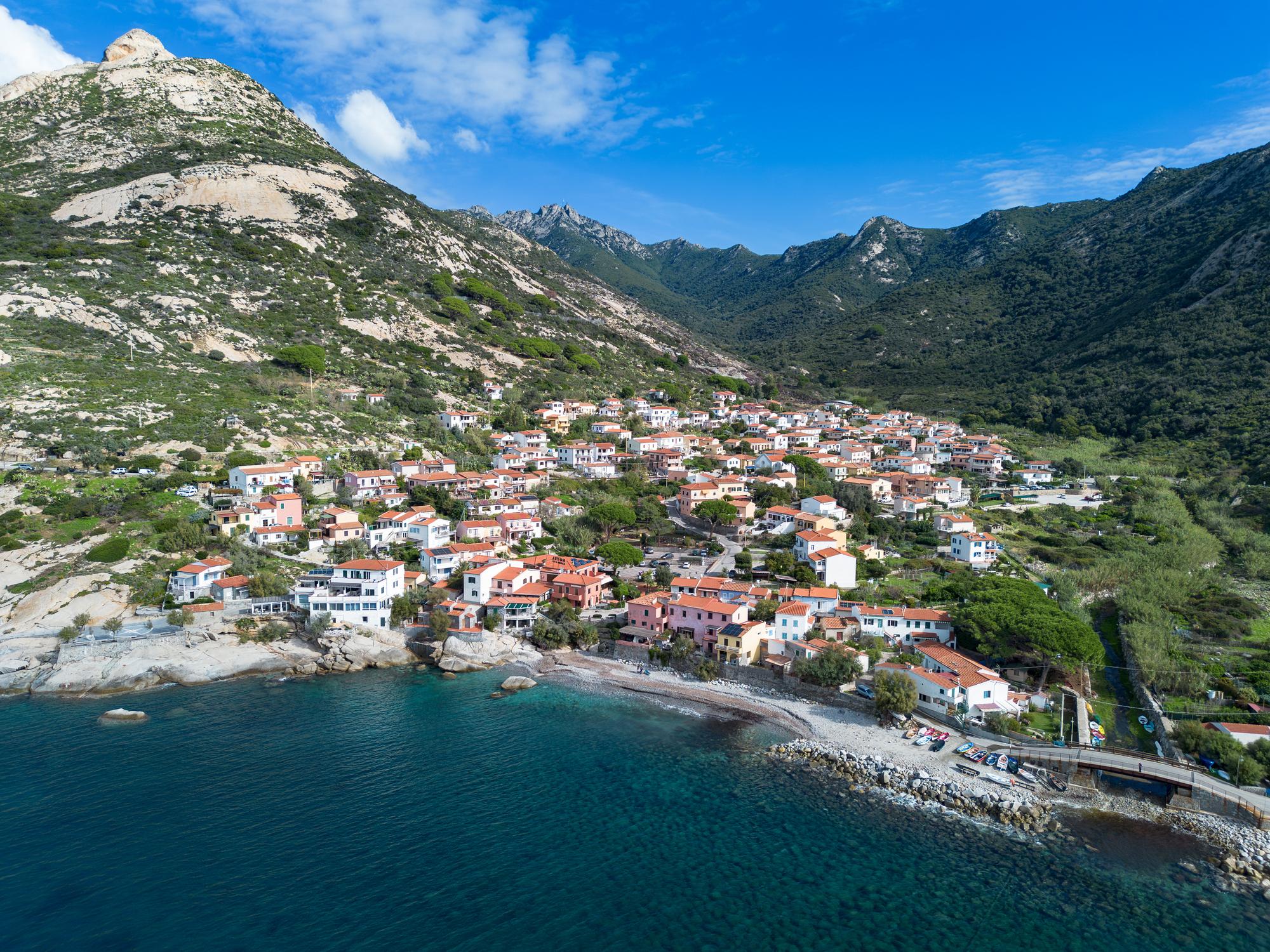
The record for completing the 58km route is a remarkable four hours and 50 minutes, run by Elban Matteo Anselmi - but most mortals take their time as they go. “Generally, people descend from the trail each day, sleep in a town and then retrace their steps in the morning and continue the traverse,” says Marta.
“The route was originally mapped in the 1980s by two guys, Renato Giombini and Mario Ferrari. They put it on a map, so it can be done self-guided but there are disadvantages. There’s no wild camping along the route, so it’s compulsory to descend each night if you’re not doing it all at once, and if you’re self-guided and don’t have a transport, you need to hike with your whole backpack on the route.”
The trail is fully waymarked, but there are no sheltered spots on the way, and limited water sources - so it’s important not to take this trek lightly.
“If you go to hike, the best seasons, by far, are Spring and Autumn,” Marta says. “I would avoid the heat of summer on the GTE Trail. There are no shelters along the route, so nowhere to rest. Sometimes you’ll be under sun, with no water available - so it’s important that you carry everything you need to complete the section of the hike you’re doing each day. You're never too far from the villages, but there are no access points by road, so if you need to get down, you really need to make it on foot - there are no bars or cafes or huts along the route.”
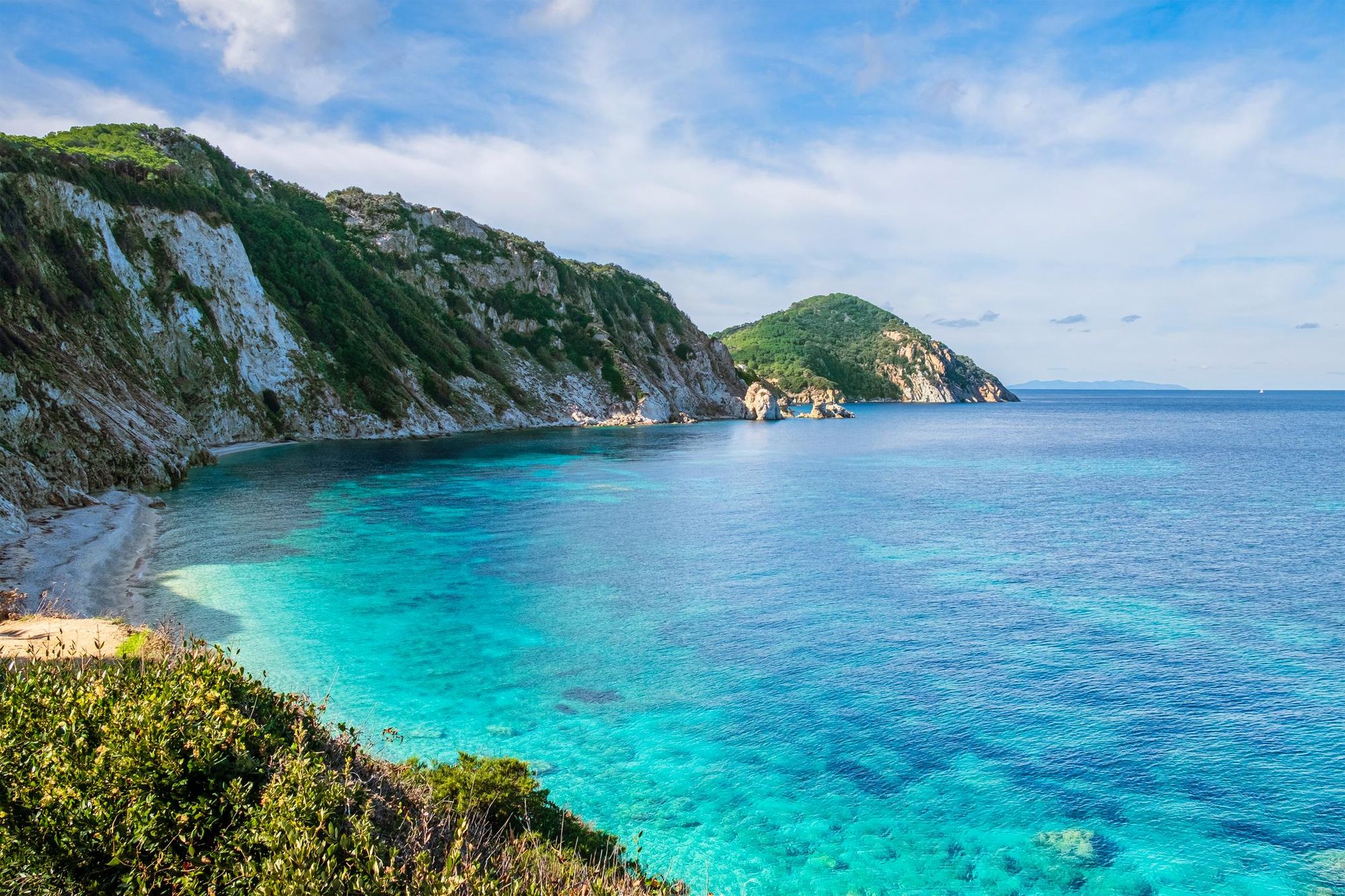
You have the clearest water in Italy; turquoise bays and coasts...
At the end of the walk? Stick around and take in the sun. “It’s nice to mix the culture, food and the beaches Elba is known for,” says Marta. “You have the clearest water in Italy; turquoise bays and coasts, mostly rocky with pebbles, and a few sandy beaches. It's also amazing for snorkelling because it's a protected marine reserve. So ideally you would add some beach time at the end, but even if you don't, you still have the option to swim at the end of each day.”
Inspired? Check out our guided hike on the Grand Traverse of Elba!