
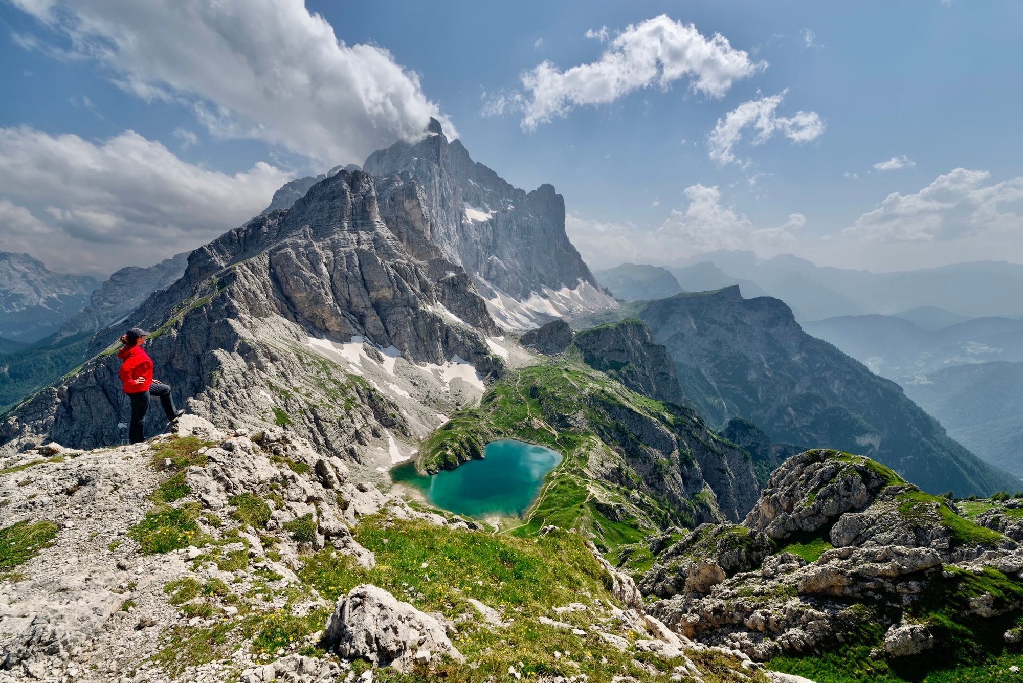
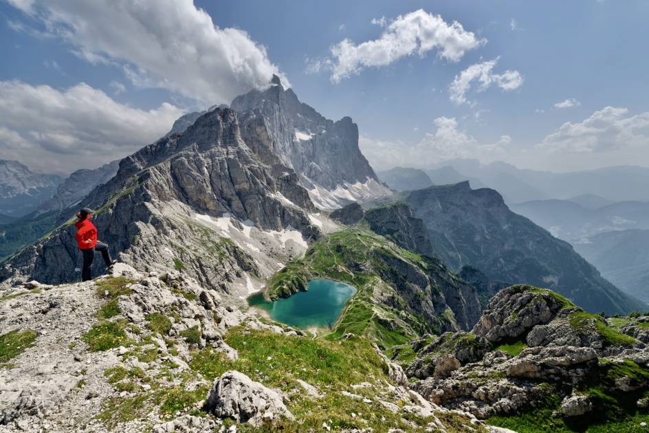
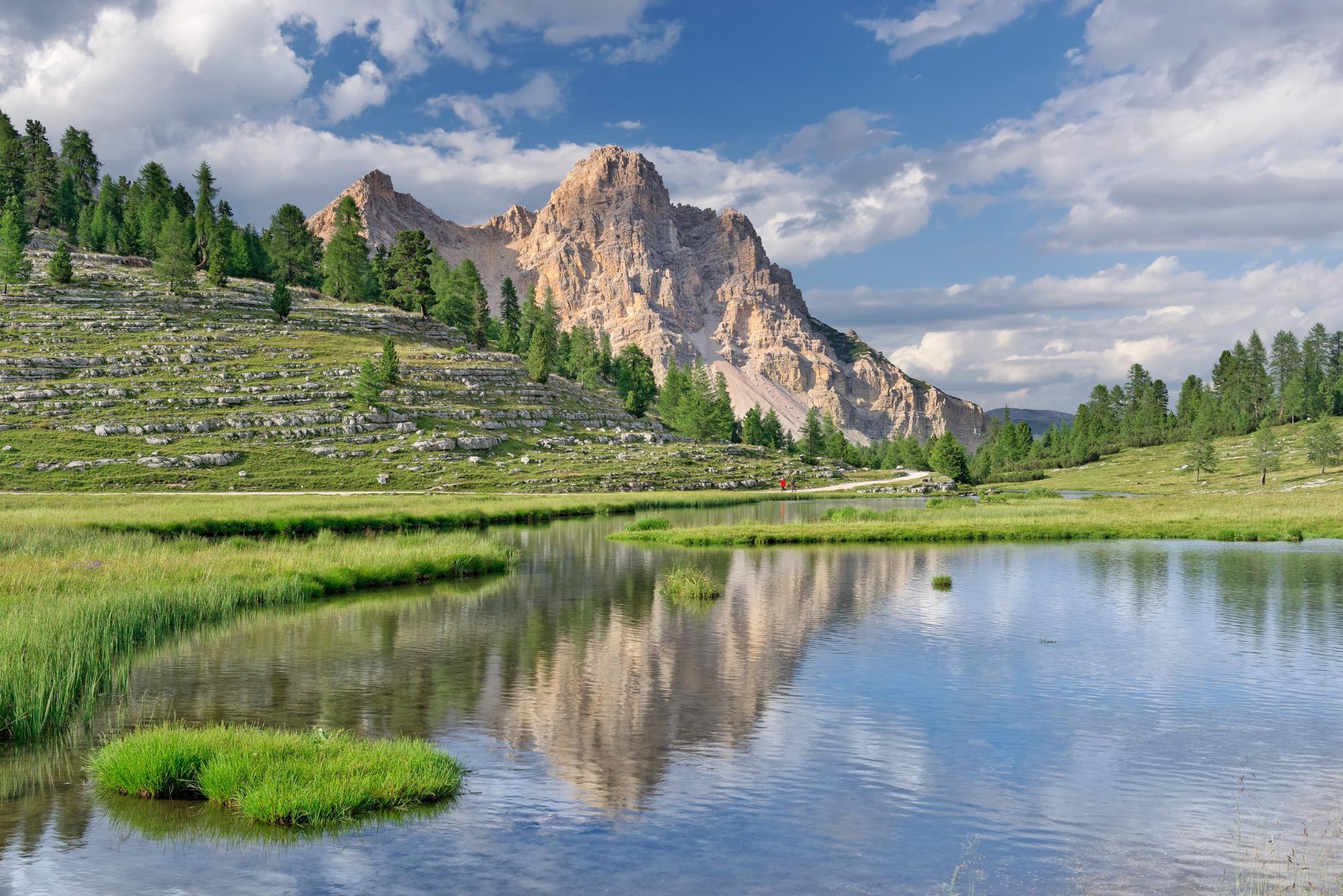
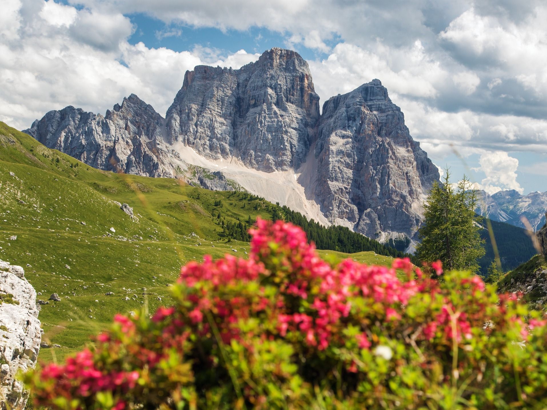
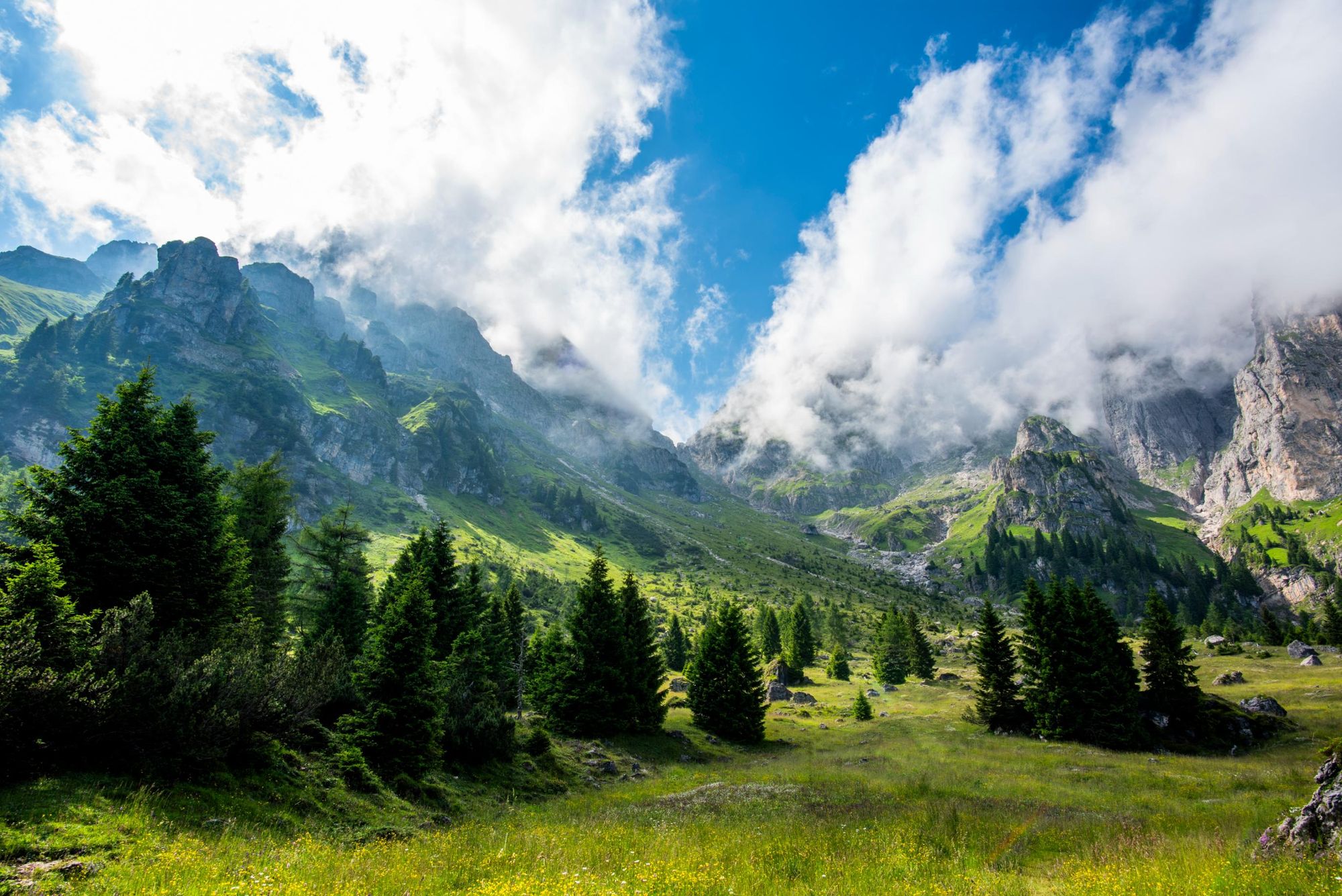
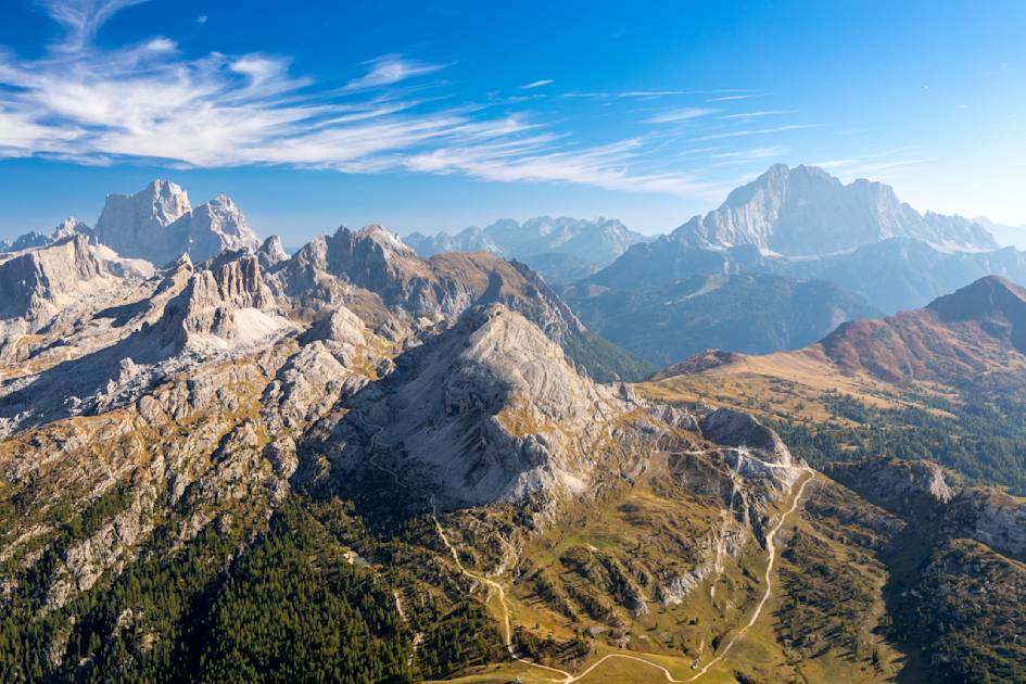
In the Italian Dolomites, limestone mountains and spires tower above deciduous forests and wildflower-filled meadows. When the sun sets, the stony peaks change colour from grey to vibrant shades of pink and orange—a phenomenon known as ‘enrosadira’. One of the best ways to explore this stunning region is on foot, and the long-distance Alta Via 1 trek (also known as the AV1) is among the best hikes in the Dolomites.
Beginning at the breathtaking Lago di Braies, the Alta Via 1 winds through the wild, mountainous terrain of the Dolomites. The path takes you past iconic peaks such as Lagazuoi, Cinque Torri, Monte Pelmo, and Monte Civetta before finishing at La Pissa bus stop. Marmolada, the highest peak in the Dolomites at 3,343m (10,967ft), is visible from certain sections of the Alta Via 1, particularly from higher vantage points near Rifugio Lagazuoi, offering tantalising glimpses of its glacier-covered rock faces.
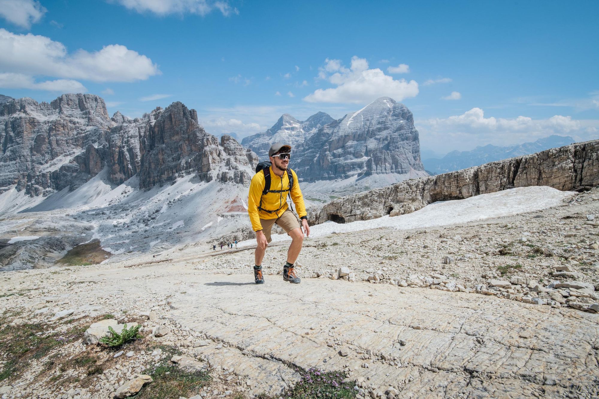
You are always up in the mountains. The terrain is very rough. However, if you are prepared, this is an amazing hike
During World War One, the Dolomites were a battleground for bitter fighting between Austro-Hungarian and Italian troops. As you hike, you’ll encounter remnants of war—ruins of barracks, gun emplacements, and trenches dug into the mountainside. It was these troops who first set up via ferratas in the region to facilitate the movement of goods and soldiers. While there are no via ferratas built into the conventional AV1 itinerary, it is possible to incorporate them into your route if you have sufficient experience or are travelling with a guide.
The Alta Via 1 is well signposted and well maintained, but that doesn’t mean it’s an easy hike. According to Miki Anastasio, whose company runs guided hikes in the Dolomites, you can’t assume it’s a walk in the park.
“You have to be aware that you are always up in the mountains,” she says. “The terrain is very rough. However, if you are prepared, this is an amazing hike. The Dolomites are special. Every hike in this extraordinary place is a life experience capable of leaving its mark.”
In this guide to the Alta Via 1, with Miki’s expert help, we outline the route, discuss accommodation options, and list essential kit recommendations.
Alta Via 1: Map & Basics
- Distance: 71.4 miles (115km)
- Walking time: 9-11 days
- Elevation gain: 6,665m (21,866ft)
- Highest point: Rifugio Lagazuoi, 2,752m (9,029ft)
The Alta Via 1 Route
We’ve divided the Alta Via 1 into 11 stages. For more detailed information on the route, and maps for each stage, we recommend reading Cicerone’s Alta Via 1 - Trekking in the Dolomites guide.
Stage 1: Lago di Braies – Rifugio Biella
- Distance: 3.7 miles (6km)
- Walking time: 3-4 hours
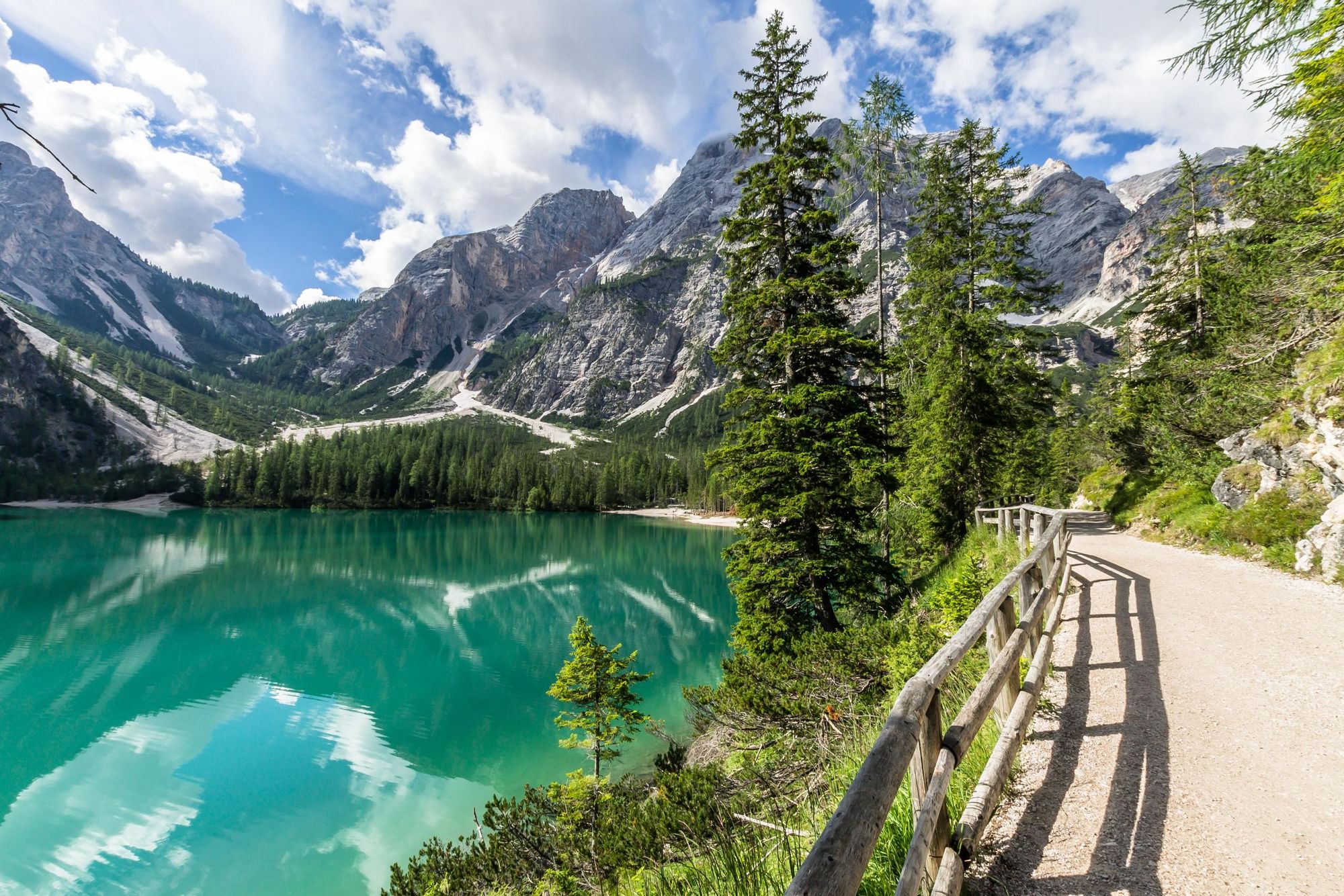
The route begins in the Fanes-Sennes-Braies National Park at Lago di Braies, a turquoise glacial lake ringed by dramatic peaks. The trail ascends through forested slopes and alpine meadows before reaching the rugged terrain of Forcella Sora Forno. From here, a steep climb will take you to Rifugio Biella, located beneath the imposing Croda del Becco (a ‘croda’ is a typical Dolomitian spire, surrounded by gullies.)
“You can extend the day’s hike by climbing Mount Seekofel, which takes around an hour and a half,” Miki says. Mount Seekofel is located at an elevation of 2,810m (9,219ft), so it’s roughly a 400 metre ascent. Some hikers prefer doing this trip on day two, to watch the sun rise, and return in time for the refugio’s hearty breakfast.
Stage 2: Rifugio Biella – Rifugio Fanes
- Distance: 8 miles (13km)
- Walking time: 4-5 hours
A slightly longer hike today, although there’s a gentler ascent profile.
“You hike to the Fànes refuge along the Way of Peace, another long distance trek,” Miki says. “It reaches the Croda del Valùn Blanch from where the view of the Tofane and Val Travenànzes is exceptional.”
The trail crosses the Forcella de Limo pass before descending to the scenic Alpe di Fanes, an idyllic pastureland. The route then continues through a valley before ascending through the forest to Rifugio Fanes.
Stage 3: Rifugio Fanes – Rifugio Lagazuoi
- Distance: 7.5 miles (12.2km)
- Walking time: 5-6 hours
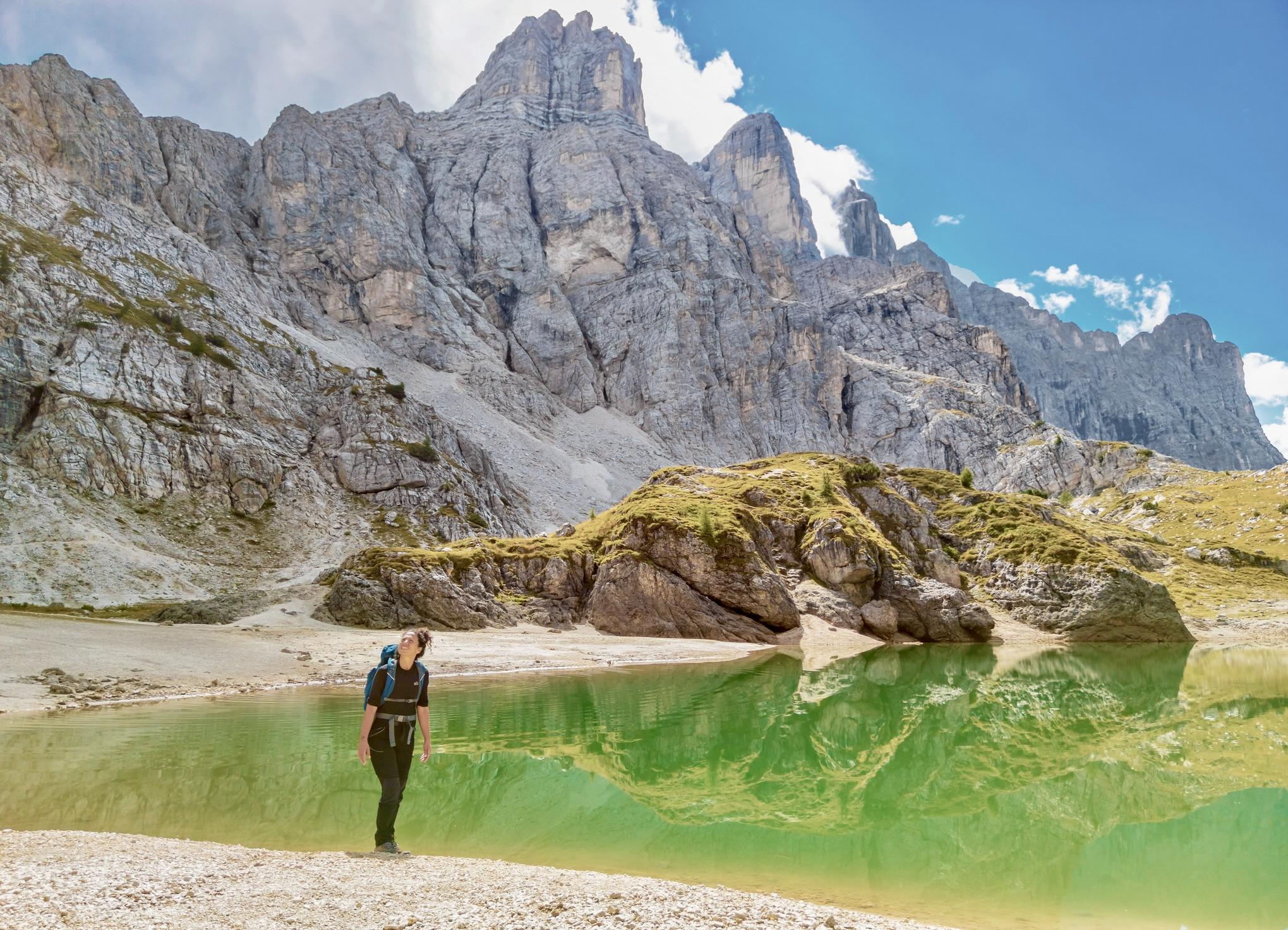
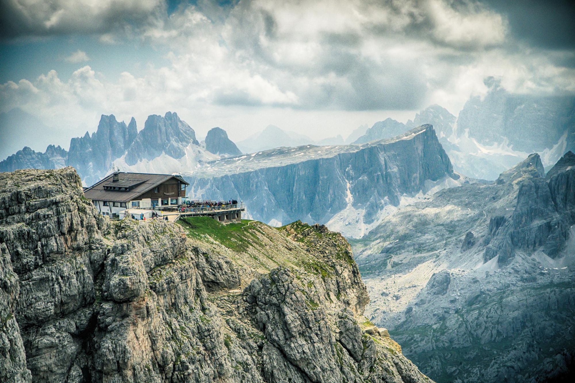
You’ll begin hiking on an old military road, passing green pastures and snow-capped peaks. After a couple of hours you’ll ascend to the Forcella del Lago, where you’ll enter the lunar-like Ampezzo Dolomites. There’s a spectacular view of Lago Laguzoi below you.
From the saddle, you’ll descend through a steep gully to the lake, and then ascend up through the lunar-like landscape towards the Rifugio Lagazuoi, the highest point on the AV1 at a height of 2,752m (9,029ft). The views from the refugio are a worthy reward for your climb, with views over the limestone peaks and the remnants of World War 1 fortifications.
Stage 4: Rifugio Lagazuoi – Rifugio Nuvolau
- Distance: 7.9 miles (12.8km)
- Walking time: 5-6 hours
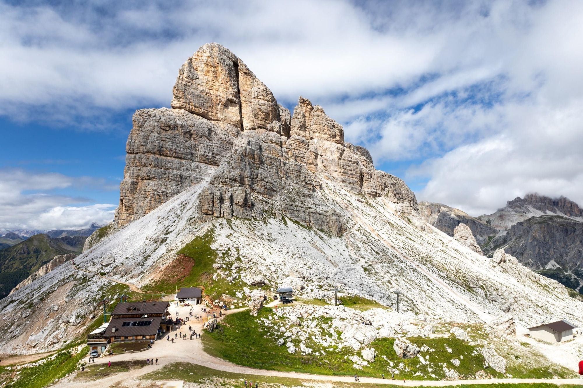
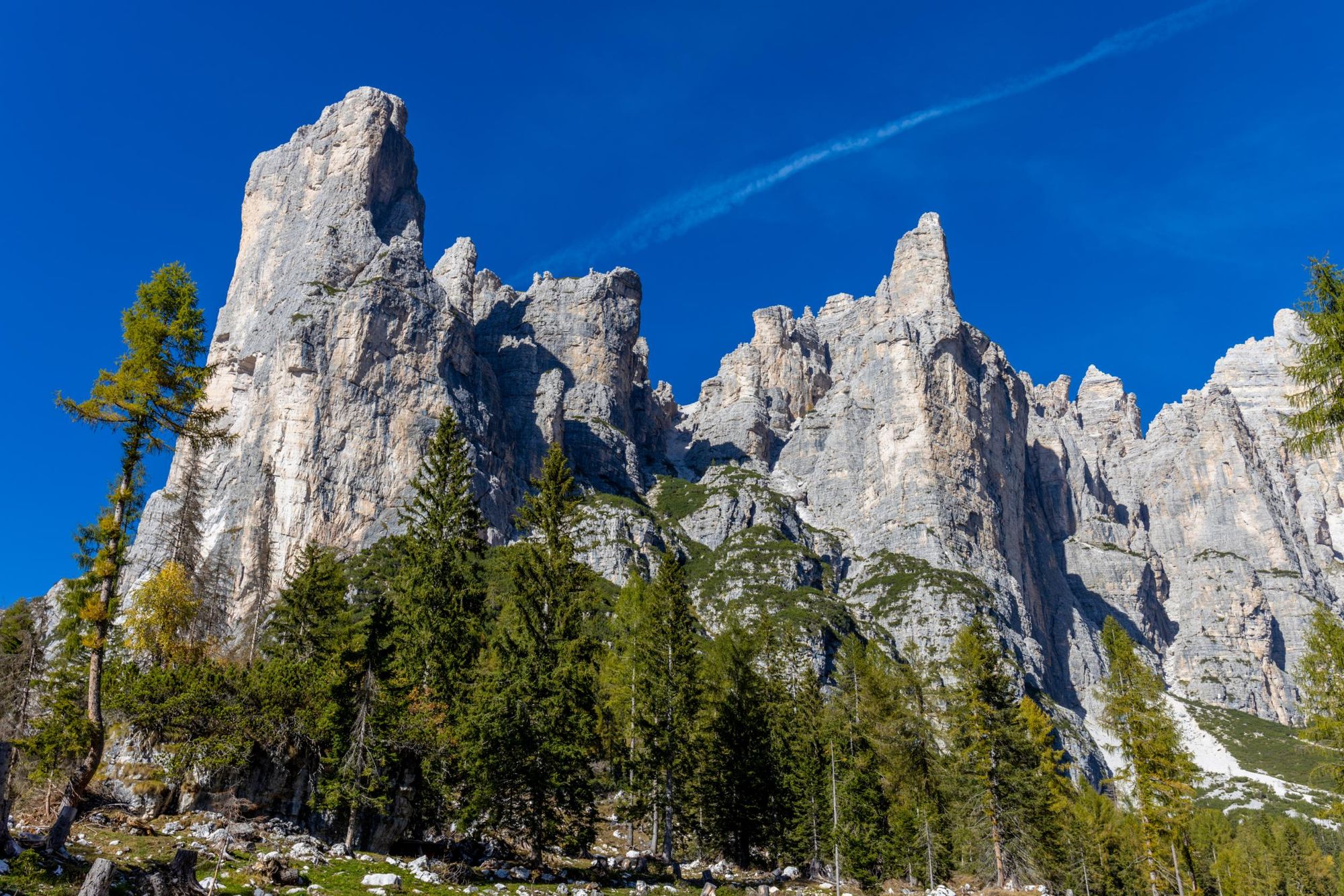
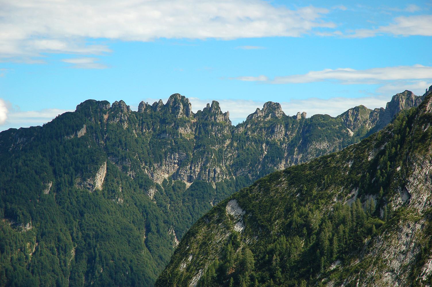
There are several different hiking options to choose from today. If you want to stick to the conventional Alta Via 1 route, take path 401 towards the Forcella Travenànzes, which overlooks a landscape of austere peaks and high rock walls. Continue along path 402 to Passo Falzarego. You then ascend path 441 to Rifugio Averau. On today’s hike, keep your eyes peeled for the famous Cinque Torri rock spires.
Another option is to follow the Lagazuoi tunnels downhill. These are mining tunnels used by World War One troops, and provides a fascinating insight into the past. You’ll need to travel with a head torch to see through the dark, twisting tunnels.
Stage 5: Rifugio Nuvolau – Rifugio Città di Fiume
- Distance: 7.9 miles (12.8km)
- Walking time: 5-6 hours
From Rifugio Nuvolàu, head southwest and descend via a short rock step with a ladder and metal ropes. Follow path 438 through a valley of grooved rock slabs, then ascend briefly to a ridge leading to a gorge. The trail crosses the gorge, navigating slabs of rocks with fixed ropes in some sections.
The route then zigzags sharply downhill before reaching a smoother path through boulders and pastureland. Eventually, it descends gently to Passo Giàu, where a hotel and restaurant await.
From Passo Giàu, take path 436 southeast across grasslands to Forcella di Zonia, then follow the trail to Forcella Giàu where you’ll have stunning views of the Lastoni di Formìn and Croda da Lago. Passing beneath Dolomite cliffs, the path skirts Lago Delle Baste before reaching the Mesolithic site of Mondevàl. Continuing eastward, it climbs to Forcella Ambrizzòla before descending to San Vito di Cadore. After crossing a wooded hill, it passes through pastureland towards Rifugio Città di Fiume.
Stage 6: Rifugio Città di Fiume – Rifugio Coldai
- Distance: 5.7 miles (9.3km)
- Walking time: 3-4 hours
Leave the refuge and descend on path 472 through the woodland. You’ll reach a scree field, and Monte Pelmo looming ahead. Follow the path south west and over a minor crest onto a mountain road. Pass Rifugio Staulanza, then head downhill and turn right at the first bend, following the path into the woodland.
You’ll emerge onto alpine pasture, before climbing up a steep hillside. Follow a dirt road down towards the former summer farm of Malga Pioda, before joining a mule track which zigzags back uphill towards Refugio Coldai.
An alternative route option is to follow the Sentiero Flaibani around Monte Pelmo along the Sentiero Flaibani (a tricky, exposed path with some iron cable to assist you). You can overnight at Refugio Venezia and rejoin the main route at Malga Pioda.
Stage 7: Rifugio Coldai – Rifugio Vazzoler
- Distance: 6 miles (9.8km)
- Walking time: 3-4 hours
The first section of today’s hike is one of Miki’s favourite sections of the AV1.
“I love the climb up to Refugio Tissi,” she says. “You go up through Civetta Mountain and you can see the Marmolada, the Mondeval, and beautiful Coldai Lake down below.”
From Rifugio Coldài, ascend to Forcella Coldài for unparalleled views of Civetta’s towering northern wall, the famed ‘Wall to end all Walls’. Descend to the glacial Lago Coldài, where sheer rock faces reflect in the water. Skirt the lake’s western bank and climb to Forcella di Col Negro, revealing a stunning panorama of Torre d’Alleghe and Civetta’s summit. The trail then dips into Val Civetta before a brief ascent to Rifugio Tissi (2,250m/ 7,381ft), perched near Col Reàn, offering unmatched views over Lago di Alleghe and the vast Civetta.
From Rifugio Tissi, return to Forcella Col de Reàn and take path 560, descending southwest to the scenic Pian de la Lora. Pass the ruins of Casòn de Col Reàn, set beneath towering peaks. Cross Pian di Pelsa under Torre Venezia’s imposing western wall before descending to the lush meadows of Case Faretti. A small road beneath Torre Venezia’s south face leads through dense forest to the tranquil Rifugio Vazzolèr.
Stage 8: Rifugio Vazzoler – Rifugio Carestiato
- Distance: 5.4 miles (8.7km)
- Walking time: 3-4 hours
Leave Rifugio Vazzoler and follow track 555 downhill with epic views of the Civetta massif to accompany you. Where the path forks, head left into a beech woodland. You’ll climb steadily upwards, emerging onto a steep slope. Ahead of you, the west wall of Moiazza looms.
There’s a steep ascent up to Forcella Col dell’Orso, along the flanks of Torre Trieste and Forcella del Camp. A final ascent through more woodland will bring you to the welcoming Rifugio Carestiato.
Stage 9: Rifugio Carestiato – Rifugio Pramperet
- Distance: 13.2km
- Walking time: 4-5 hours
From Rifugio Carestiato, the trail follows path 549 to Forcella del Camp. This section involves a gradual ascent with panoramic views of Moiazza and Civetta. From the saddle, the trail descends through scree and rocky terrain before joining path 554, which traverses beneath the towering Spiz di Mezzodì. A mix of forested paths and open stretches leads to Passo Duran, where a short break can be taken at Rifugio San Sebastiano or Rifugio Tomé.
Crossing the road at Passo Duran, the trail follows path 543, climbing steadily through forests and meadows toward Forcella del Moschesin. This section provides stunning views of the Dolomiti Bellunesi. From the pass, a descent leads into the remote Val Pramper, with a final climb over Forcella della Val Prampera before descending to Rifugio Pramperet, a hut surrounded by rolling pastures and dramatic peaks.
Stage 10: Rifugio Pramperet – Rifugio Pian de Fontana
- Distance: 6.2km
- Walking time: 3 hours
From Rifugio Pramperet, follow path 514, gently upward through alpine meadows before reaching Forcella de Zità Sud (2,395m/ 7,857ft), the highest point of the stage. This steep ascent rewards hikers with breathtaking views over the Pramperet Valley and the surrounding Dolomite peaks. Walk along the crest of the hill to the Van di Zità, which consists of several high limestone basins, reminiscent of lunar craters. Cross sparse pastureland and easy slabs until you reach the bottom of the Van di Zità.
“The Van di Zità is the most difficult part of the Alta Via 1, and can be dangerous,” says Miki. “You have to be very aware of where you put your feet when you walk.”
Follow the Alta Via 1 through the Van de Fora, which is separated from the Van di Zità by Le Presòn (‘the Prison’), a rocky cliff with hollow ‘cells’ inside it. You’ll cross under the Forcella de Erbàndoi, then climb across the underlying ravine until you reach a grassy crag under Le Presòn. You’ll descend steep, grassy cliffs - be careful in wet weather - until you reach the Rifugio Pian de Fontana.
Stage 11: Rifugio Pian de Fontana – La Pissa
- Distance: 11km
- Walking time: 4-5 hours
Stage 11 is the final leg of the Alta Via 1, descending from the high alpine landscapes of the Belluno Dolomites into the forests and valleys below. From Rifugio Pian de Fontana, follow path 514 as it gently ascends to Forcella la Varetta. From here, the trail descends steeply into the Val dei Ross, passing through forests and rocky clearings. The route then joins path 518, which crosses beneath the Schiara massif, offering spectacular views of its jagged peaks.
The descent continues toward Casera di Busc della Baia and winds through dense beech and fir forests, descending steadily to La Pissa, the official endpoint of the Alta Via 1. From La Pissa, you can take a public bus or arrange transport to the nearby town of Belluno.
Alta Via 1 vs. 2: Which is Harder?
Alta Via 2 is a more challenging trekking route than the Alta Via 1. It has greater elevation gain, steeper gradients, and technical sections requiring scrambling.
“On the Alta Via 2, you’ll be hiking at an altitude between 2,000 to 3,000 metres over 15 days. You need to have mountaineering knowledge to tackle difficult sections of the path,” Miki says.
“We used to do treks on the Alta Via 2, but we stopped. People arrived unprepared and were very afraid—and we don’t want to scare people. The Alta Via 1 is easier. It’s shorter, but it’s not for beginners. You need to be careful where you put your feet, and you need to do some training before you come.”
Accommodation: Alta Via 1 Huts
When you hike the Alta Via 1, you’ll be staying in rustic mountain huts known as refugios.
“You are always up in the mountains so you can only sleep in huts— camping is not permitted,” Miki says. “The huts along the Alta Via 1 are not five star hotels, but the atmosphere is always five star. You can eat very well; you sleep very comfortably.
“The huts have big dormitories, where up to sixteen people sleep all together. We don't divide women and men. There are some double rooms, but they might be booked in advance.”
If you’d prefer more upmarket accommodation, a better option might be to base yourself at a hotel in one of the Dolomites’ picturesque towns and head up to the mountains for some day hikes.
When is the Best Time to Hike the Alta Via 1?
The best time to hike the Alta Via 1 is during the months from June to September, when the weather is warmest and most settled. This is also when the refugios are open.
Miki cautions against hiking the Alta Via 1 outside this period, during the winter months in particular.
"It is not possible to go in winter. It's very dangerous. These are places where people go in summer," she says. "We’ve had problems with avalanches these last five years. This is because it’s very cold during the night and very warm during the day, so the snow has no chance to attach to the mountain."
What to Pack for the Alta Via 1?
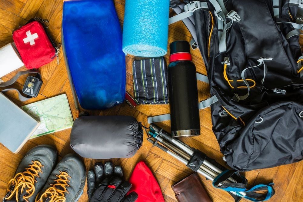
If you’re going to trek the Alta Via, Miki says that the most important thing to bring is a pair of worn-in hiking boots.
“Don't come here with tennis shoes or flip flops—or with brand new hiking boots. You have to be equipped,” she says. “Last year, a young guy came with the trekking shoes that his father had worn thirty two years earlier. After one day, we had to pick him up because he had totally ruined his feet. After that, it’s too late.”
Alongside the following, Miki recommends packing the following:
Clothes
- Lightweight waterproof and windproof jacket
- Breathable wicking layers
- Fleece jacket
- Buff or neck scarf
- Lightweight trousers/shorts/skirts for hiking
- Sunglasses
- Sunhat
- Gloves
- Hiking boots (worn-in)
- Lightweight shoes for refuges
Other
- Sleeping bag liner and pillowcase
- Quick-dry towel
- Universal travel plug adapter
- Power bank or solar charger
- Passports (and visas)
- Travel insurance documents
- Suncream
- Personal first-aid kit (inc. blister treatment such as Compeed)
- Personal items (biodegradable toiletries, sanitary wear etc)
- Toilet kit (toilet paper, biodegradable bags to carry paper out to dispose of)
- Headtorch or torch
- 2 x 1-litre reusable water bottle
- Trekking poles
How to Get to the Alta Via 1
To get to Lago di Braies, fly into Venice’s Marco Polo airport. Catch a bus to Cortina Croce Bianca (in Cortina D’Ampezzo)—which takes around two hours. From here, you can either grab a taxi to Lago di Braies (45 minutes) or you’ll need to catch a Cortina Express bus to Dobbiaco, followed by a local SAD bus to Lago di Braies.
If you go on a guided tour of the Alta Via 1, chances are it’ll include transportation to the start point and from the end point.
Inspired? Check out our Hut-to-Hut Trekking in the Dolomites adventure, which includes sections of the Alta Via 1, and our other Dolomites adventures.