
Climbing Ben Nevis, the highest mountain in the UK, is something most people in Britain will have considered at some point - or at least most people who love the great outdoors. Sitting at 1345m near Fort William, up in the highlands of Scotland, it goes without saying that Ben Nevis is also the highest mountain in Scotland and therefore one of the peaks in the famous Three Peaks Challenge. The other two are the tallest mountain in England, Scafell Pike, at 978m, and the tallest mountain in Wales, Snowdon, at 1085m.
The appeal of climbing Ben Nevis and standing on the highest point in the United Kingdom is obvious, and there are several Ben Nevis routes you can take to the top. Here, we'll guide you through three of the most common routes up Ben Nevis, from the hardest route to the easiest - though of course, despite the fact that the main trail is relatively simple to follow, we should highlight that given the size of the mountain, none of the Ben Nevis walking routes are 'easy'.

Now, as with all of our route guides, remember these are just that: guides. Do not rely on them as your sole form of navigation in the mountains. We’re your starting point, but from here it’s up to you to find out the details of the route and get yourself there and back safely. The maps we’ve embedded are only a rough outline too. We’ve assumed summer (aka not snow!) weather conditions. However, if you’re interested in winter mountains, check out How to Stay Safe in the UK’s Winter Mountains or better still sign up to Climb Ben Nevis in Winter.
Ben Nevis Guide | How to Get There & When to Climb
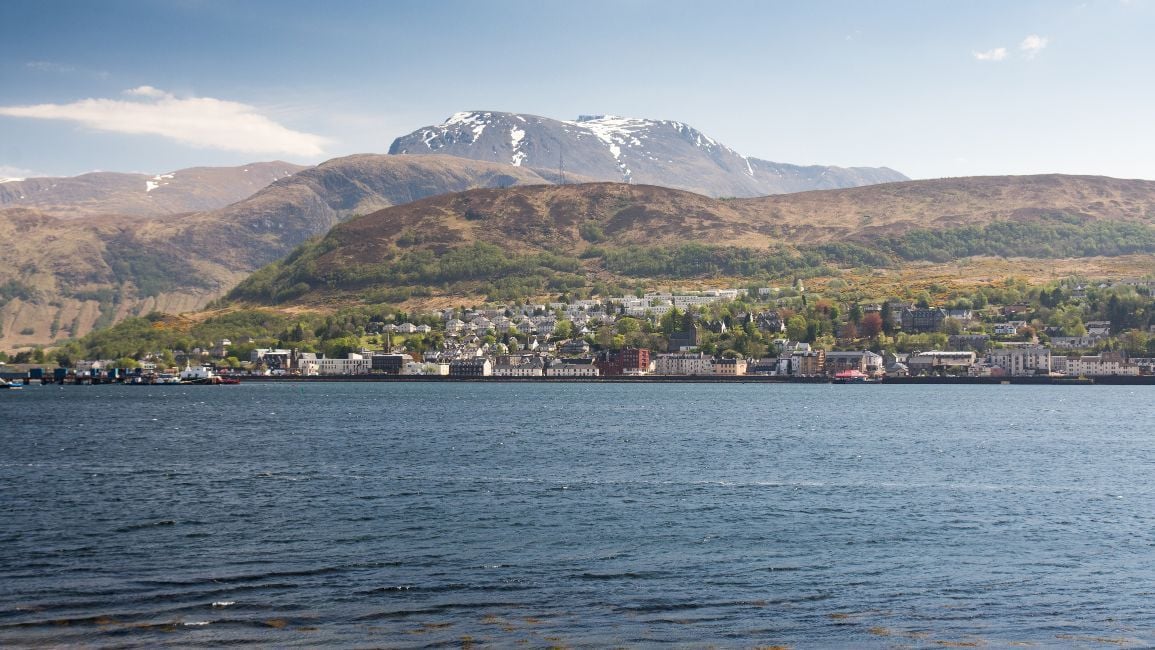
Before we get into the details of the best Ben Nevis routes, we're quickly going to run through how to get to the mountain. As we previously mentioned, the nearest town is Fort William. A lovely wee town with plenty of accommodation, pubs, restaurants and good views, Fort William is also very well served by train. You can get the Caledonian Sleeper train from London Euston, going directly to Fort William, or if you're starting further north, it's a five hour train from Edinburgh or a three hour 45 minute train from Glasgow. The drive from Glasgow is just under three hours, and the drive from Edinburgh is just over that same mark.
So, when to climb Ben Nevis? Summer is the best time of the year to climb Ben Nevis. It's when the sun is more likely to be shining, the skies clear, and the mountains clear of snow. That said, the infamous Scottish weather has a mind of its own, so be prepared for the conditions to change quickly and for the worse, anytime of year. Fort William is a real outdoor hub, so if you're flexible, it's worth looking up what events or outdoor festivals are taking place in the town, and combining your climb with one of those for an extra buzz about town!
There's an outdoor culture in Fort William, so of course, if you're after a private guide for Ben Nevis, or a guided walk, this is a good place to sort that out.
The Three Main Ben Nevis Routes
Here we're going to talk you through three of the main routes up Ben Nevis, the highest mountain in the United Kingdom. We'll start with the route from Glen Nevis, which is the most popular and also known as the Tourist Trail. Then we'll look at the CMD Arête, which is a beautiful, but much trickier route up to the top of the mountain, and finally the lesser known ledge route. Without further ado...
1. Climb Ben Nevis from Glen Nevis
Distance to the Top: 6.5 km (4 miles)
Ascent: 1300m (4275ft)
Rough Time to the Top: 4 hours
Flavour: Wholesome
Almost sounds poetic doesn’t it? Ben Nevis from Glen Nevis. Although can you really call it a rhyme if it’s the same word? We reckon Rabbie Burns could've made it work, though. If you don't know, a glen is essentially a valley with a river running down it, so funnily enough the River Nevis runs below Ben Nevis.
> Check out our full guide to the best hiking in Scotland
Of all the Ben Nevis routes, this Mountain Track is by far the most commonly walked. This used to be known at the Tourist Track by pretty much everyone, but that implied an easy dawdle along a tarmac track in your flip-flops. None of the routes up Ben Nevis tick that box, so they decided to rebrand.
That's an important point to remember: no route up Ben Nevis is the 'Ben Nevis easy route', but that said... this is definitely the easiest route up Ben Nevis. Just know that doesn’t mean it’s easy. You’re comparing it to scrambles and climbs.
Route Description
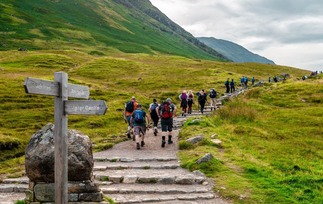
Start from Glen Nevis Youth Hostel. Cross the road and then a wooden bridge over the River Nevis. The path is wide, well made and clearly marked with wooden signposts down here. Head up to where the contouring path from Achintee House meets the one you’re on. You could start your walk from the other end of that path, if you preferred. It’s a little longer, but less steep.
At this junction, head right and continue curving round and ever up the hill in front of you. The path becomes narrower and more rocky here. You’re past your last signpost: here be mountains. Carry on up the gully and then round the swooping bend in the path. You should have a view out over the lochan (which is essentially a Scottish tarn) to your left as the path curves round the top of the gully and back on the ascent up Ben Nevis.
You’ll cross some little streams and then be treated to a series of zig-zags: there are nine in total and you will probably count them. All the time you’re still plodding relentlessly uphill. Finally, the path approaches the plateau – you’re still going uphill, but by comparison it’s flat! Here’s the dangerous bit in poor weather: it’s very easy to wander off the edge of a cliff to your right. There are loads of climbing routes that top out on this cliff, so little paths might not always lead you in the direction you’re hoping! It’s far safer to take a bearing (there’s a reason the bearings are even printed on the Ben Nevis map).
Follow your bearing or, on a clear day, the line of cairns up to the summit. The top trig point and observatory is just to the left of the last cairn. Again it’s worth taking a bearing. On a clear day, you can enjoy views across the whole of the Scottish Highlands. Your best route of descent is probably back the way you came.
2. Ben Nevis via CMD Arête

Distance to the Top: 9km (5.5 miles)
Ascent: 1390m (4550ft)
Rough Time to the Top: 4.5 hours at least
Flavour: Spicy
If you want something a little more hands on and exciting than the Mountain Path, then the Càrn Mòr Dearg Arête might be the route for you. It’s known as the CMD Arête, or even just the CMD for short. Impress the locals before you go by getting your pronunciation of the Gaelic phrase down. "Càrn Mòr Dearg" actually translates as "big red cairn", if you're wondering. The CMD ridge itself is a grade one scramble in the summer. The route up Ben Nevis is longer than the Mountain Path and can be made into a long horseshoe shaped walk if you want.
>You might also like Scrambling in the UK | A Quick Adventure Guide
Route Description
Park at the North Face carpark on the north side of Ben Nevis. It is also possible to do the CMD from the ski centre carpark and cut across to the main path. Possible if the North Face carpark is shut, but a bit out of your way really. From the North Face car park, head out of the forest along tracks heading roughly south. You should reach a large river: Allt a’Mhuillinn. Don’t cross, but instead follow the river uphill along its eastern bank on a decent path. You will see Càrn Beag Dearg rising up on your left and the CMD in the distance ahead, leading up to Ben Nevis.
At this point, you can choose to go off-piste and up the broad nose of Càrn Beag Dearg, then along the peaks to the start of the CMD scramble. Alternatively, you can continue below Càrn Beag Dearg until a boggy path cuts off left. This will take you across the lower slopes of CBD and then up to the summit of Càrn Dearg Meadhonach. Not to be confused with the next peak along, Càrn Mòr Dearg, which gives our scramble route its name. It is a short walk between the summits of CDM and CMD.
Now for the scramble ridge itself. The CMD is a narrow, rocky ridge that curves down from Càrn Mòr Dearg and then up to Ben Nevis. You will have incredible views of the north face of Ben Nevis the whole way. Although it is only a Grade 1 scramble, the ridgeline is very exposed. Skip to about 3:35 in the video to get a feel for it! You should be comfortable walking on loose boulders with a drop either side.
There is a nice big cairn (abseil point) at the end of the CMD. Then it’s just a small hike up the remaining slope to the summit of Ben Nevis. To return, you could reverse your route and scramble all the way back again along the CMD. But that’s probably a bit nuts and you might not have time left before it gets dark. An alternative would be to descend down the Mountain Path until the lochan. At this point, there is a right hand turn that takes you on a good path back down to the North Face carpark.
3. Ben Nevis via the Ledge Route
Distance to the Top: 9km (5.5 miles)
Ascent: 1280m (4200ft)
Rough Time to the Top: 3 hours at least
Flavour: Sweet and Sour
The Ledge Route is the least well trodden of these three routes up Ben Nevis. It’s the same grade of scrambling as the CMD Arête and is technically a more direct route to the summit from the North Face. However, it’s easy to accidentally find yourself in the middle of a rock climbing route if you don’t know where you’re going. Plus, the Ledge Route is considered a one way route by almost everyone. You cannot go back down the mountain the way you came. Skip to two minutes in the video above for the start of the scramble and to 4:58 for the kind of route finding problems you’ll be facing. One for a nice day!
Route Description
Again, start at the North Face Car Park near Torlundy. Follow the paths out of the forest and onwards to reach the river Allt a’Mhuillinn. Pick up the good path beside the river (on the east side) and follow it for several kilometres into the bowl of the mountains, between Ben Nevis and the Carns. Keep going, crossing little streams dropping from the slopes above, until the path stops at the CIC Hut.
From the CIC Hut, head up through the boulders towards the infamous Number Five Gully. However, since we don’t want to do any rock climbing, avoid Number Five and make your way onto the ridgeline. The scrambling of the Ledge Route is Grade 1 in summer, significantly easier than everything else around it. But it’s very easy to stray into ground that’s much more difficult than Grade 1, if you’re not sure of the precise route. If you’re going to do this, look the route up in detail – you don’t want to accidentally find yourself on a rock climb.
Your scramble route tops out on Càrn Dearg (which if you've being paying attention, you should be able to guess means “Red Cairn” in Gaelic). This is not to be confused with the identically-named Càrn Dearg some 2km away on the other side of Ben Nevis. Or indeed Càrn Mòr Dearg (which, remember, is “Big Red Cairn”). We get that it’s hard work coming up with original names for mountains, but seriously guys? From here, walk south until you join up with the Mountain Path and follow it up to the summit of Ben Nevis.
From here you have several options of descent. Either take the Mountain Path and turn at the lochan (as described in the CMD Route) or take it the whole way down into Glen Nevis. Alternatively, if you’re having a very good day, you could complete a horseshoe by descending via the CMD Arête. A big day out, and definitely one of the hardest route up Ben Nevis, but one you’ll certainly remember.
Ben Nevis Difficulty Rating
So, how difficult is it to climb Ben Nevis? Well, it's the highest mountain in the United Kingdom, so it's a challenge. But it's also doable for fit hikers with a bit of experience under their belt. It's far from the most difficult mountain to climb in Scotland. If in doubt, the climb from Glen Nevis via the Tourist Trail is definitely the route to take, as it's significantly easier than the CMD Arête route, or the Ledge route. You can build up to those once you have more experience!
Ready to reach Ben Nevis? You can learn winter skills and summit Ben Nevis or check out our UK hiking holidays for other peaks to climb and trails to hike.