

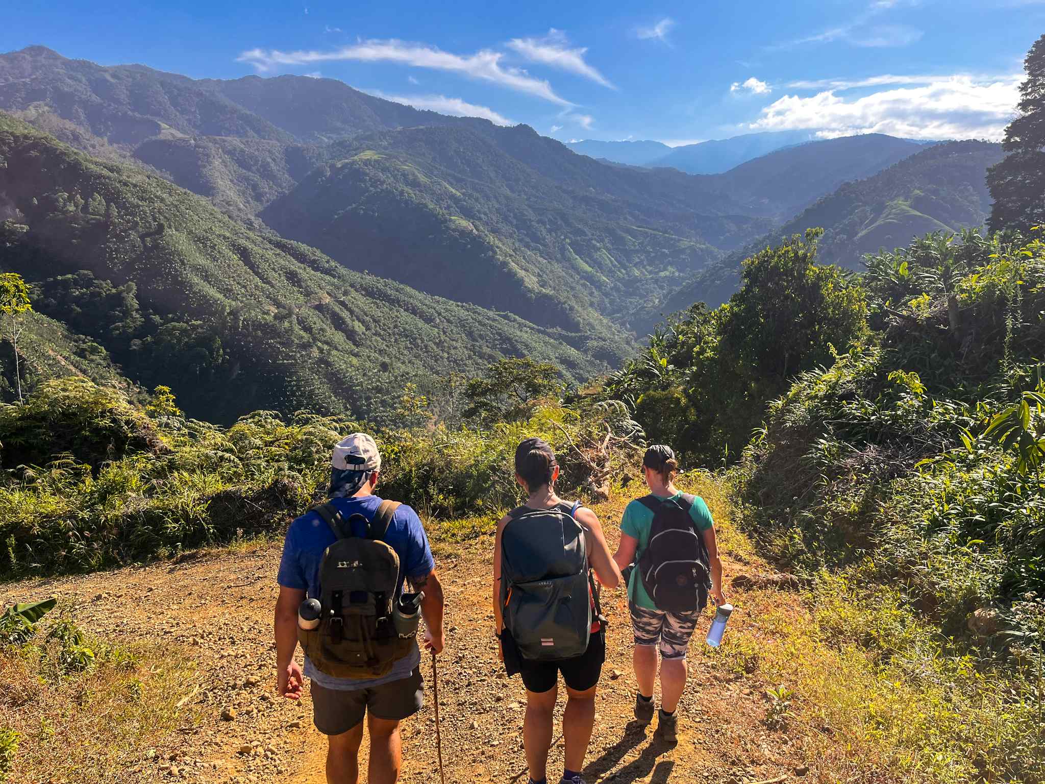
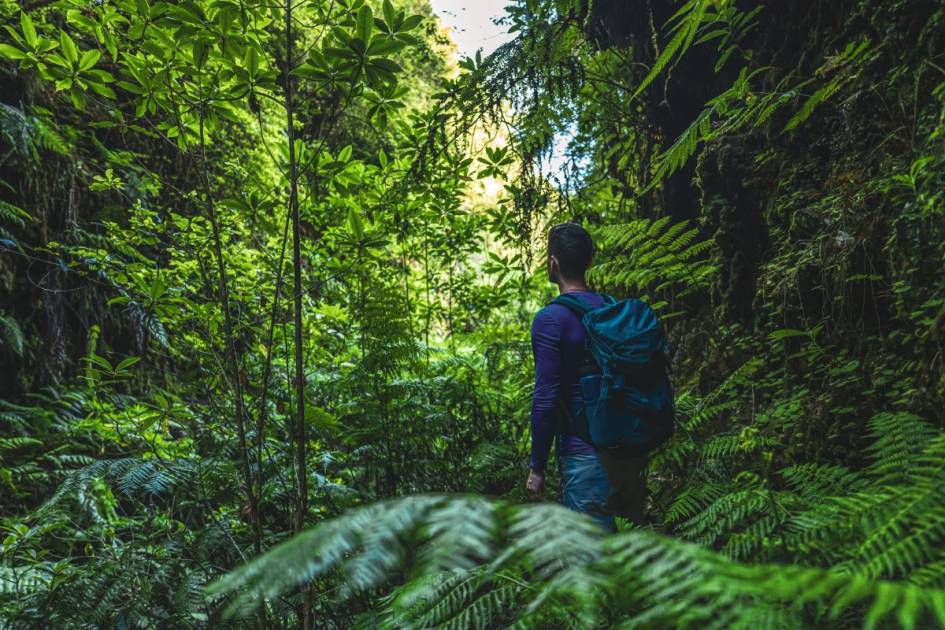
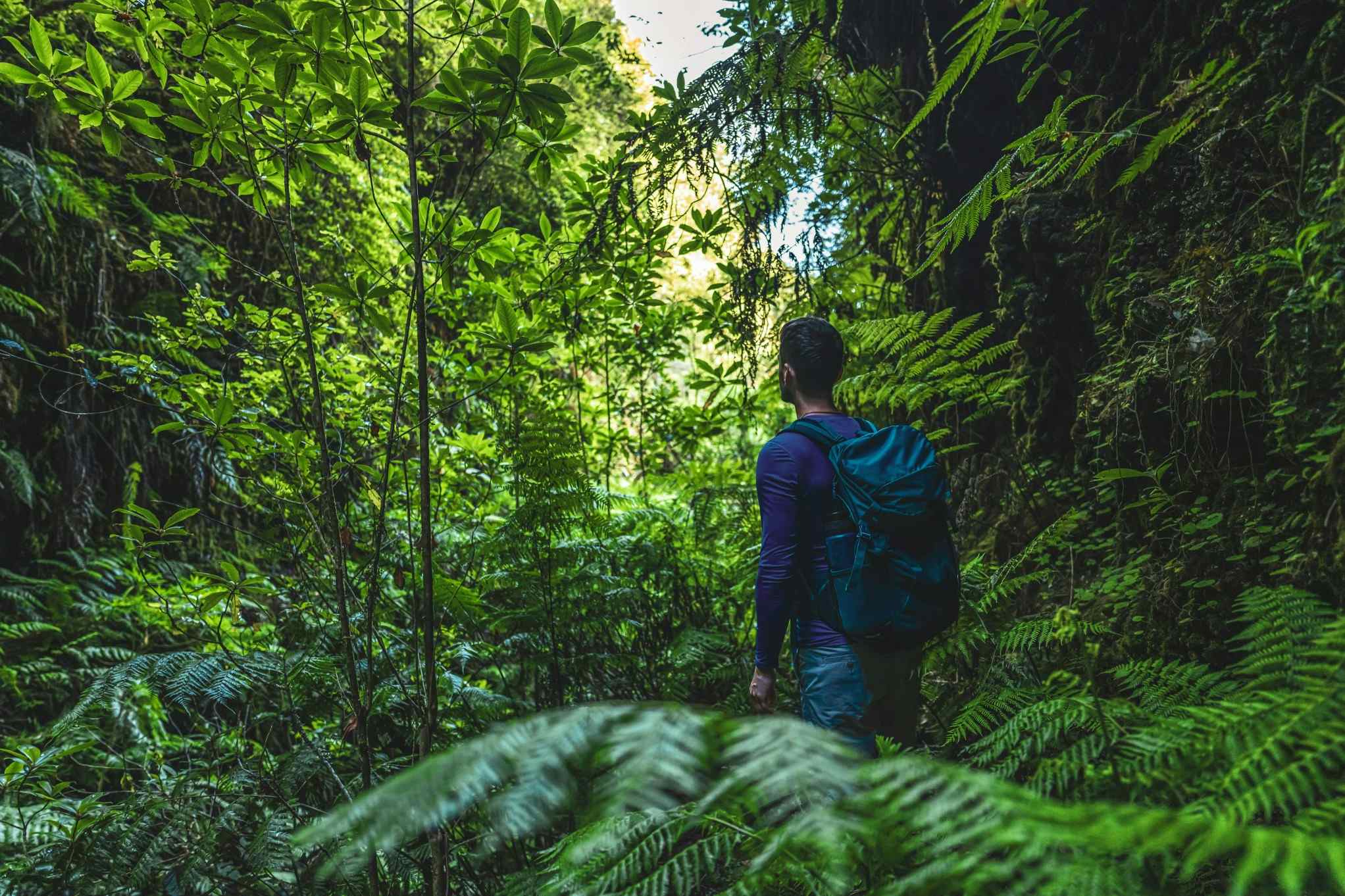
The Camino de Costa Rica is a long-distance trek running 174 miles (280km) through the high mountains and lush, loud rainforests of one of the world’s most biodiverse countries.
Starting on the Caribbean coast in Barra de Parismina, on the shores of the Atlantic, the trail goes on to run through the primary forest and buzzing biodiversity of Barbilla National Park, and includes a section through the Nairi Awari territory, where walkers can hike and camp with indigenous Cabécar guides. The end of the route is marked by an octopus mural in the town of Quepos on the western coast, with views out over the Pacific Ocean.
Our main objective is to help these communities through which the trail passes [...] We also use the trail as a means of ensuring there is protection for biodiversity.
"We wanted it to be as beautiful and as varied as possible," says Conchita Espino, who created the Camino with her husband Marco Marin and a group of friends.
“At the two edges of the coast, the Pacific and Atlantic, it’s very flat. The gravel roads near the Atlantic are lined with beautiful fields of pineapples and bananas. It’s humid and hot and you see the mountains in the distance. On the Pacific side it’s pine and oil palms, and it’s not as hot.
"In the centre of the country, you have mountainous areas with varied vegetation and cool air. At the high point [at 2,338m/7,670ft] you stay in cabins, and you have a little fireplace. That’s not an image most people have of Costa Rica, but it’s quite cool. It’s an agricultural area in a high valley, and it’s not muggy at all.”
Conchita Espino is a Cuban who has lived in Costa Rica for over a decade. She dreamt up the idea for the 16-stage hike after walking the Camino de Santiago in Spain in 2011.
“We were retiring, my husband and I, and he is actually from Costa Rica,” Conchita explains. “Just before we moved here, we hiked the Camino de Santiago. It was a beautiful experience. When we got here, we kept hiking, and we realised that there were all of these beautiful places that nobody knew about or were visiting; even Costa Ricans - like the Barbilla National Park. So we got this idea. Why doesn’t Costa Rica have a Camino?”
It took around four years to design the trek. By 2018, the route was officially open. Key to the concept was the opportunity to provide new income streams to remote communities. “We wanted it to go through villages that needed tourism and wanted tourism,” Espino says.
“It was about connecting the villages and engaging with local guides. There’s about 25 different towns - and we work with them to improve their tourist infrastructure; making shops more attractive, or adding signage so people know that they’re there. Hikers often say that the people that shared traditions and welcomed them into their homes were a very special aspect of the route.”
The Camino de Costa Rica is usually walked in 16 days. “The idea is that you do a stage a day, but some stages are easier than others, so some people do combine the stages,” says Espino.
The Basics:
- Start/Finish: Barra de Parismina/Quepos (thru-hike)
- Distance: 174 miles (280km)
- Walking time: 16 days
- Difficulty: Challenging
- Best for: A coast to coast epic
The most popular time to hike the Camino is between December and April, she adds, “because it’s drier weather,” but ultimately, this is a year-round trail. “At the end of May, June, July and August, it rains in the afternoons," says Conchita. "But what hikers will do is get up early and walk to where they’re going before the rain starts. And the animals are a lot more active during the rainy season.”
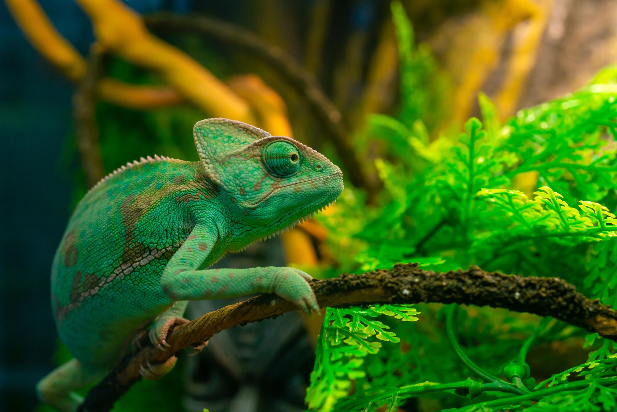
Around four percent of the world’s species can be found in the boundaries of Costa Rica, making it one of the best countries in the world for spotting wildlife. Spending so much time outdoors on the Camino, hikers get to see a lot of it.
“I always wanted to see the famous poisonous snake, the fer-de-lance or terciopelo it’s called here, and I saw it on the trail,” Conchita says, acknowledging that the snake may not be top of every hiker’s must-see list.
When they bloom, the area is filled with these white flowers and their aroma is captivating.
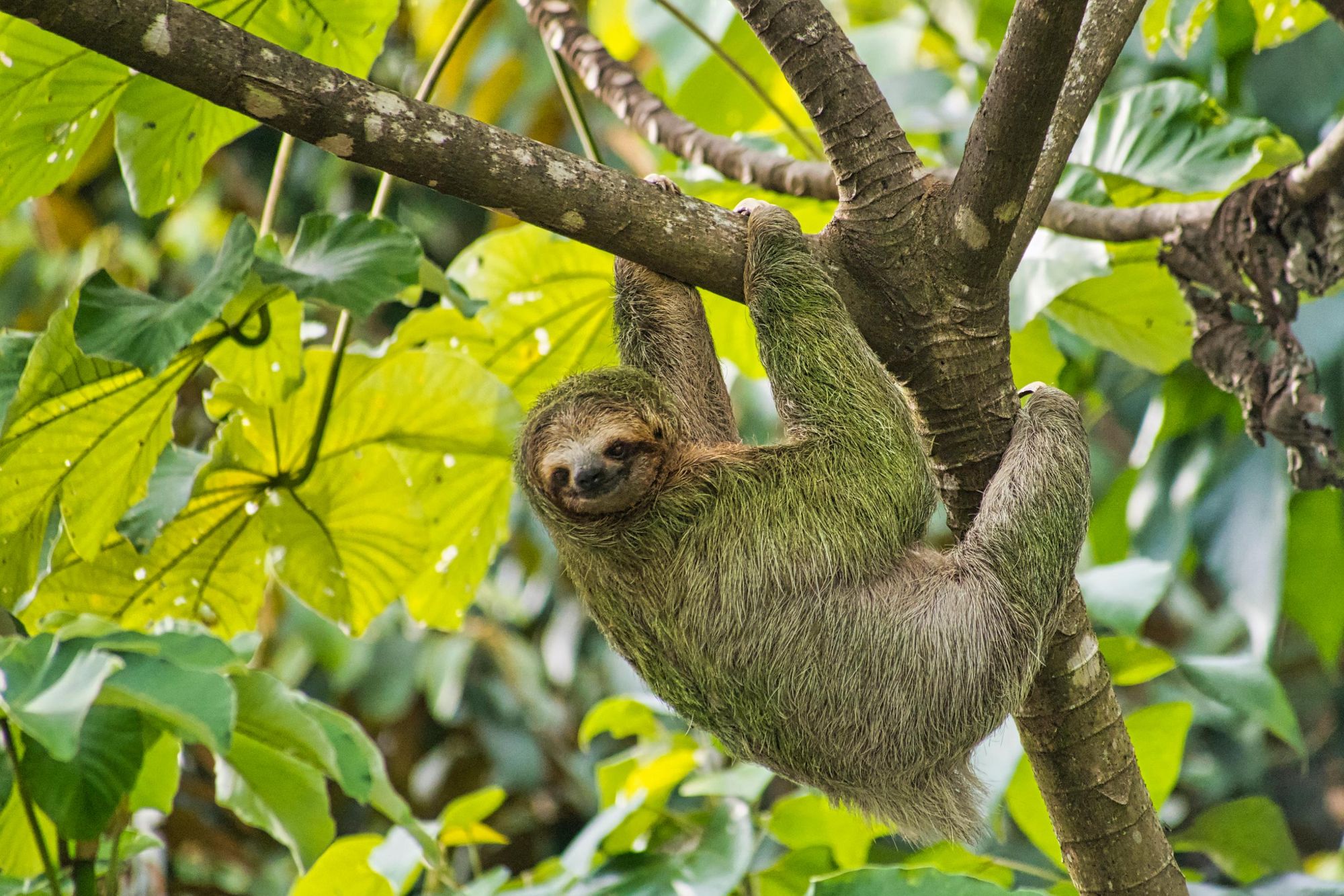
“We also see a lot of sloths and the monkeys that you get here; the howler and the capuchin, for example. Every once in a while you may see a small jaguar - though not everyone sees them. It’s a rare event. The other thing you don’t appreciate is how colourful the insects are. In terms of flora, you have incredible flowers in amazing shapes and colours, and there’s some extraordinary mushrooms through parts of the Camino too.
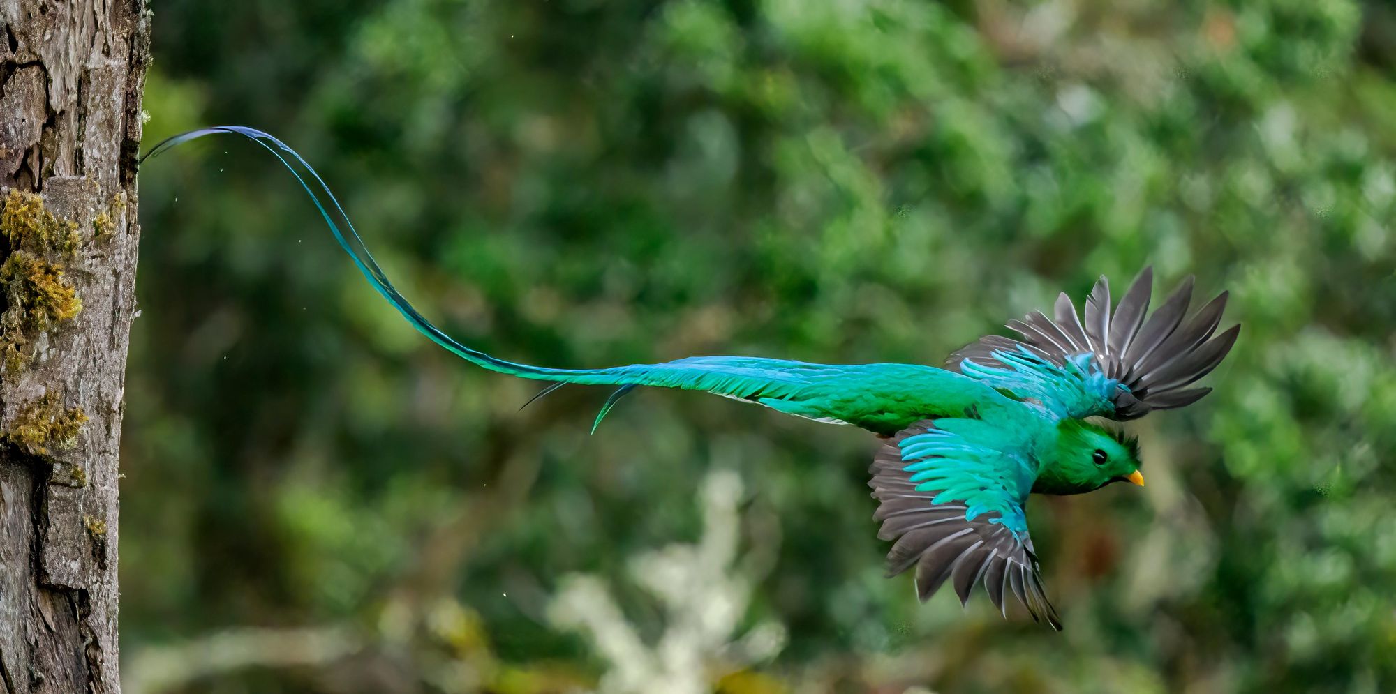
“There’s also an extraordinary variety of birds,” Espino notes. They range from toucans, macaws and hummingbirds, which flutter between the colourful flowers, to lesser-known but equally as colourful birds like the resplendent quetzal, a beautiful cyan bird with a majestic curling tail.

“We also use the trail as a means of ensuring there is protection for biodiversity,” Espino says.
This is one of the pillars of the non-profit Mar a Mar foundation who now manage the route.
“Our main objective is to help these communities through which the trail passes. We designed the trail to go through communities that needed tourism, and since hikers are such an incredible, healthy form of tourism - they appreciate nature and are interested in an authentic experience - they were the ideal people to come."
The most notable example of this is when the route passes through the Nairi Awari territory, which is a 19.3 sq. mile (50km²) area home to around 600 indigenous Cabécar people.
“They were immediately interested in being involved,” says Espino. “This particular group of the Cabécar are the ones living closest to subsistence. There are other groups who develop crafts, or who produce very sophisticated artwork which attracts a lot of tourism, but this particular group didn’t have much organised tourism and they immediately saw the possibilities that come with having hikers come through their territory. It brings in jobs for their young people.”
They immediately saw the possibilities that come with having hikers come through their territory. It brings in jobs for their young people.
The Mar a Mar Foundation, in cooperation with the New Zealand Embassy, was able to build a museum showcasing the tools and traditions of the local people, which has proved a roaring success. “It was done in their traditional style,” she says. “It’s become a big attraction now and a good source of income.” All of this has been set up for, and with, the indigenous locals.
“In the indigenous territory we use their footpaths,” Espino explains. “We don’t change them. It’s their territory. We might help improve it here and there, but it is always under their guidance.
“They want to make sure that they maintain ownership of it and we have no problem with that. They're wary of white people who want to exploit them. They still feel like they're not getting a fair share from the government, but they trust us. We have a very good relationship. We've been there for eight years and we've been helping them to develop a new source of income.”
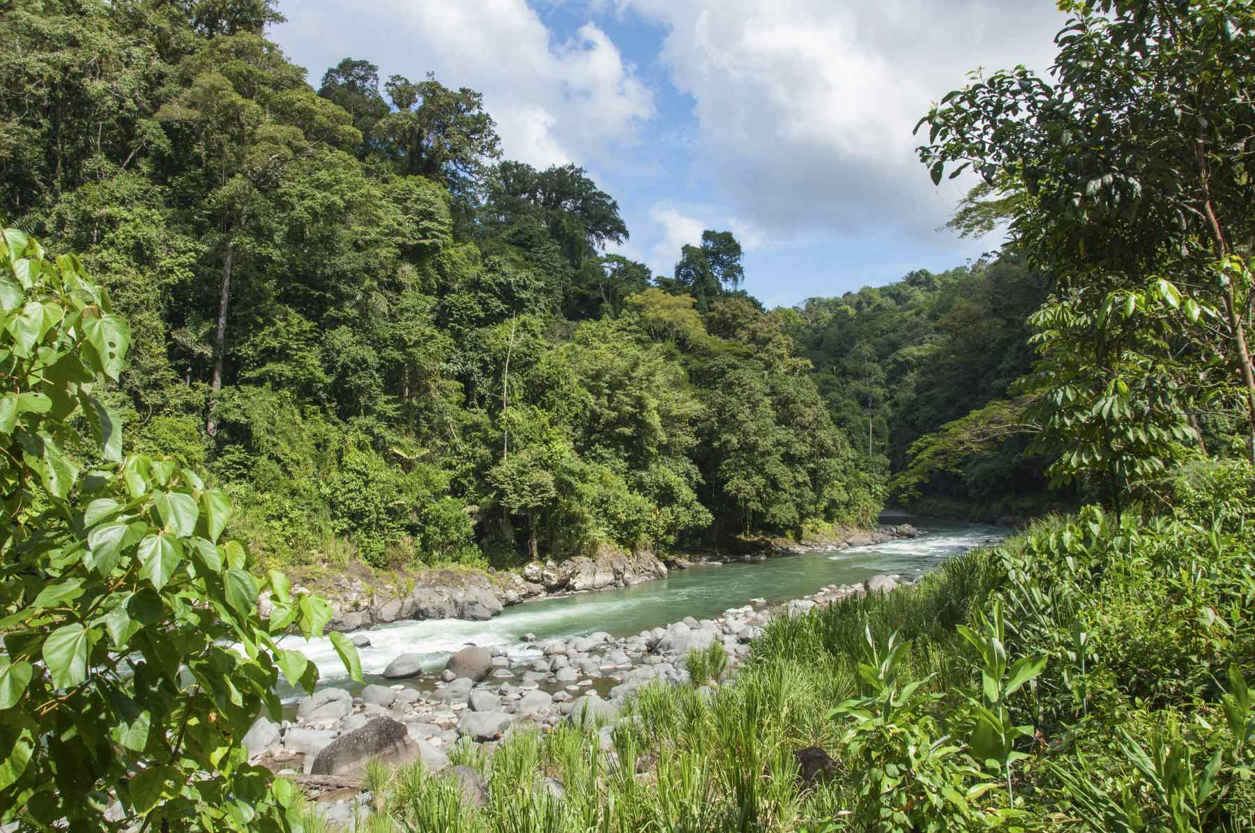
The experience of camping in the Nairi Awari Territory, just below the museum, learning about indigenous culture and then exiting out over the Pacuare river is an obvious highlight of the Camino trek.
Other highlights include the thermal waters of the trail and the famous Tarrazu coffee area of Costa Rica. “There’s beautiful views and this contrast of the red soil and the green plants,” says Conchita.
“When they bloom, the area is filled with these white flowers and their aroma is captivating. There are mountains - high mountains - where you have beautiful views of all the volcanoes.”
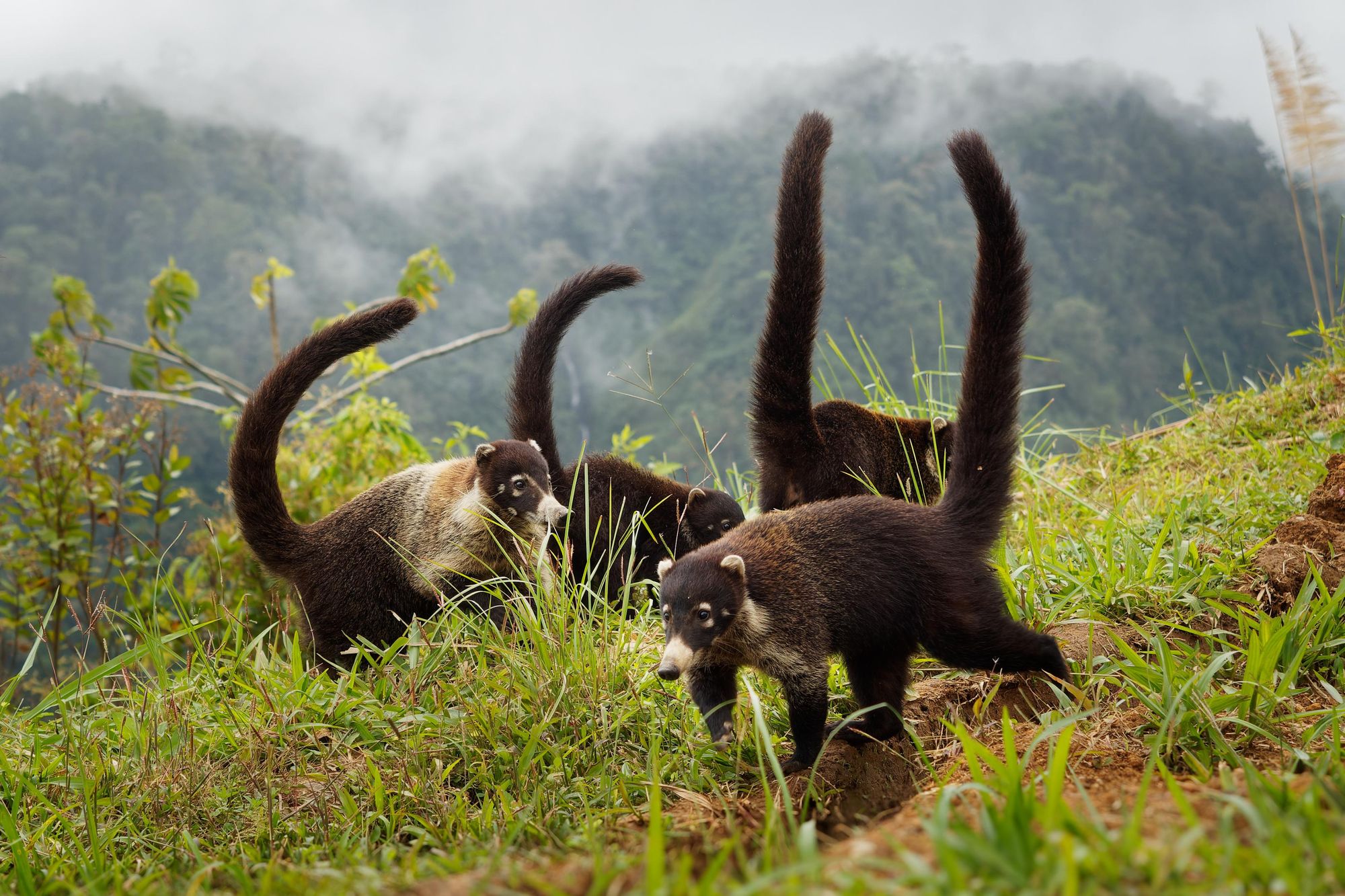
You can spot coatis - which look like a mix of monkeys, raccoons and lemurs - as the trail nears the Tapantí Macizo de la Muerte national park, and you’ll be surrounded by cane fields when you reach Pacayitas de Turrialba, a small village.
From start to finish, the route is one of immersion; whether that be in local culture; on coffee plantations where owls call out above red soil; on high mountain tops, with far-reaching views of layering, lush greenery; in rainforests, where colourful frogs watch on from twigs and leaves - or sitting back and watching the waves of the oceans which bookmark this trail at either end.
The Camino de Costa Rica is a showcase of the raw, intense beauty of the eponymous nation. It is an all-encompassing way to discover Costa Rica.
Inspired? Check out our nine-night Camino de Costa Rica hike now, or learn more on the official website of the 16-stage trek!