

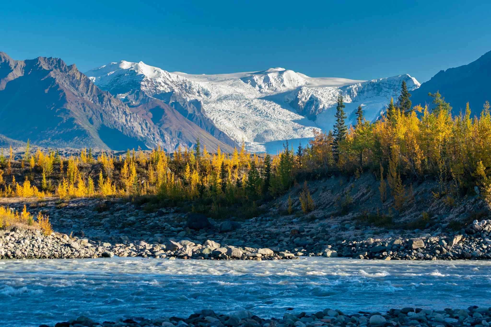
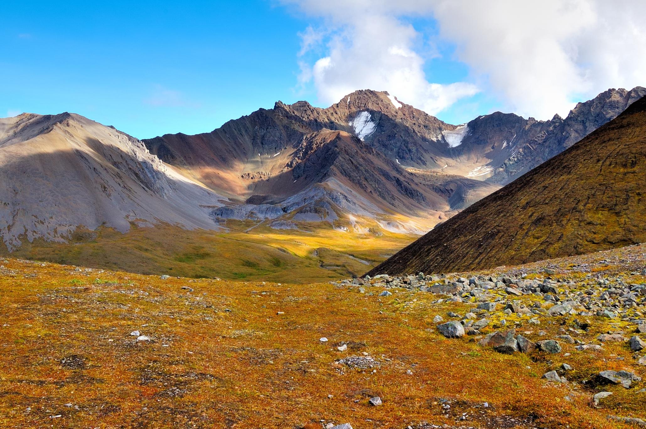
Wrangell-St. Elias, in Alaska, is the largest national park in North America - six times the size of Yosemite. It encompasses the Chugach, Wrangell and St. Elias mountain ranges and boasts the largest collection of mountains over 4,880 metres (16,000ft) in North America.
“Wrangell St. Elias is enormous. It’s larger than the country of Switzerland and only around 65 people in total live in that area on a year-round basis,” says adventure guide Ryan Romito. “Imagine 16 to 18,000 foot mountains out there with large glaciers and icefields. And it butts up against Kluane National Park, among the largest national parks in Canada. So it's just this vast, vast wilderness where you’ll find Alaska’s most iconic wildlife: black bear; brown bear; lynx; dall sheep.”
It’s larger than the country of Switzerland and only around 65 people in total live in that area on a year-round basis.
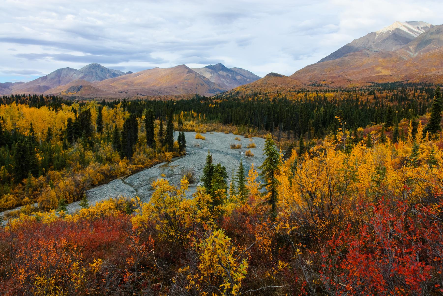
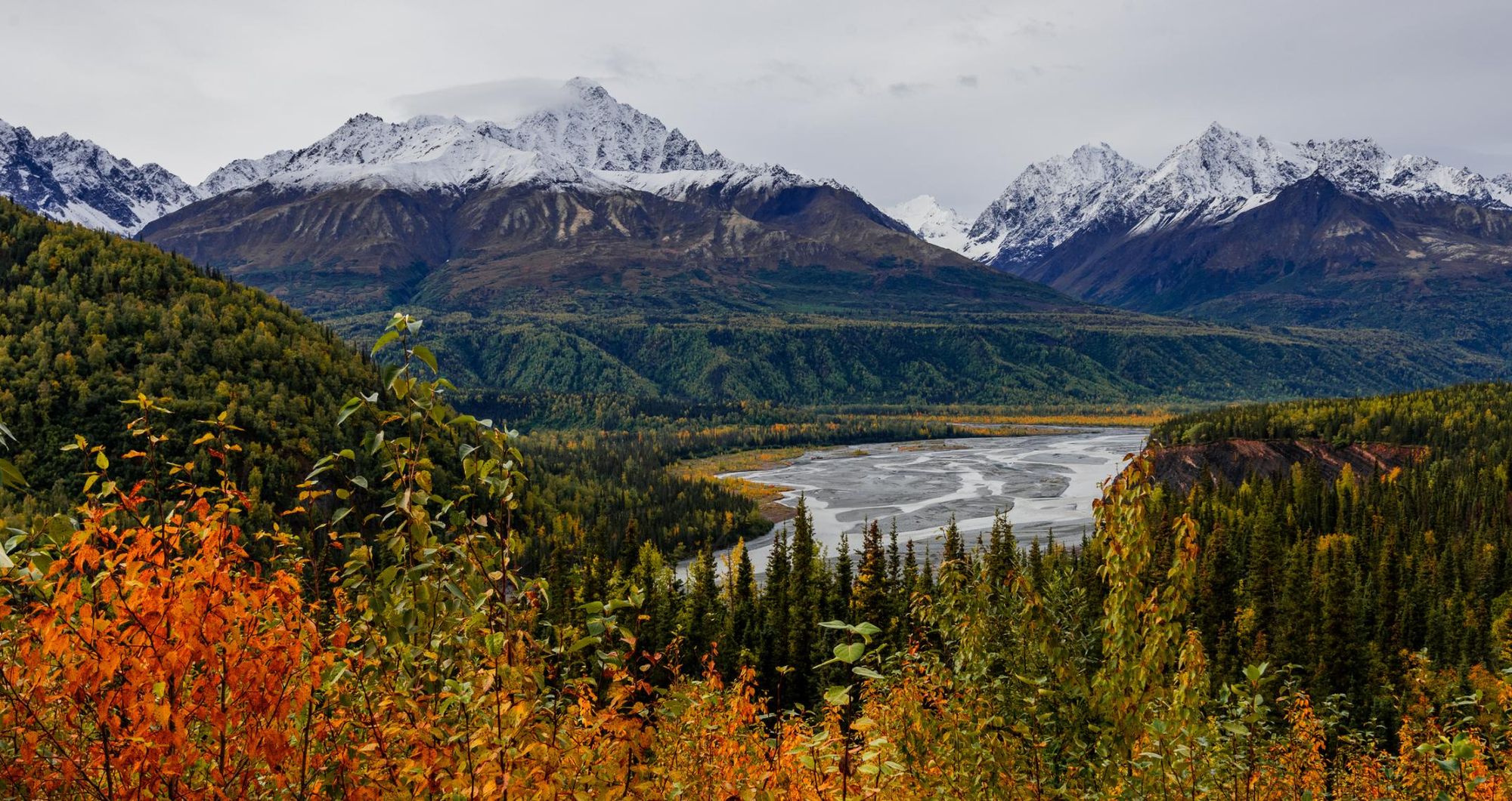
Alongside its mountains and ice fields, you’ll find a diverse range of habitats within the park, from spruce forests to braided rivers and vast tracts of grassland. It stretches all the way from the mountains to the coast, where tracts of temperate rainforest lead down towards pounding surf. Only a small portion of the park is accessible by road or marked trail, allowing for preservation of this wild landscape.
“It’s a question of how adventurous are you? Most people are nowhere close to adventurous enough to get out there. There's still mountains that have not been summited,” Ryan says. “People who are trying to get deeper into the park need to do so by small plane. Now those places are extremely expensive, geared towards extreme outdoors people.

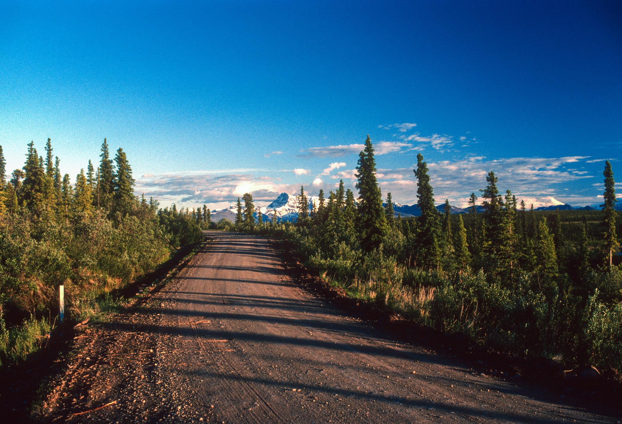
“How most people experience the park is by driving down the McCarthy Road, which is a 63-mile (101km) dirt road that lies across much of the old train tracks that ran out there. The road eventually just dead ends to where there's a footbridge, and from there you have to walk to McCarthy.”
McCarthy is an old mining town with roughly 30 residents, adjoined by the now-abandoned mining town of Kennicott (also called Kennecott). They’re the gateway to the accessible area of Wrangell-St Elias, and as a result, four out of the five hikes we’ve selected begin in this area. You can explore the northern regions of the park by driving down the 42-mile (62km) Nabesna Road; unpaved and intermittently maintained, it often floods after mile 29, and is very much the road less travelled. We’ve selected one hike, the Caribou Creek Trail, accessible via the Nabesna Route, for intrepid adventurers.
These are our favourite hikes in Wrangell-St. Elias National Park:
- The Root Glacier Trail
- The Jumbo Mine Trail
- Dixie Pass Trail
- West Kennecott Glacier Trail
- Caribou Creek Trail
It’s important to note that these route descriptions are only short summaries, designed to inspire but not to serve any navigational purpose. They are not intended to guide you on the route and further mapping and planning will be required if you want to safely walk any of the trails featured. If you plan on hiking away from these trails and into the park’s backcountry, an experienced local guide is definitely needed.
Here’s our guide to the best walks in Wrangell-St Elias, when to visit and where to stay.
The Best Hikes in Wrangell-St. Elias, Mapped
Wrangell-St. Elias attracts backcountry backpackers in search of adventure. However, there are plenty of marked trails within the park - we've mapped some of our favourites.
5 of the Best Hikes in Wrangell-St. Elias National Park
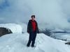
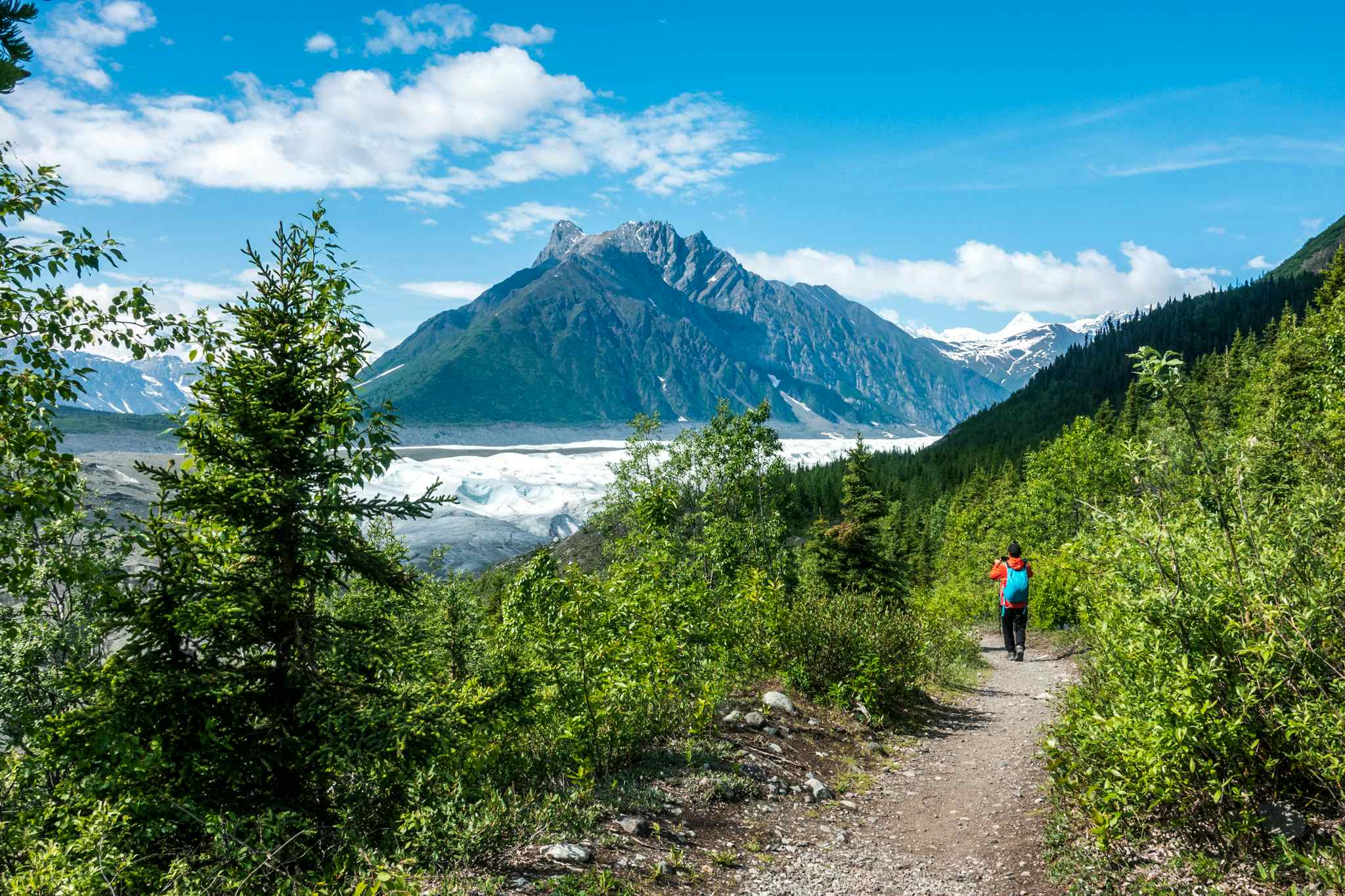
1) The Root Glacier Trail
- Start/Finish: Kennicott (out and back)
- Distance: 4 miles (6.4km)
- Walking time: 2 hours
- Difficulty: Easy
- Best for: Glacier Hiking
From the Kennecott Visitor Centre, walk through the town on the road towards the Root Glacier. After half a mile, the road splits - keep going straight. The trail crosses both Bonanza and Jumbo Creek and winds through the moraine of both the Kennicott and Root Glaciers.
“It's not a very difficult trail; it’s a very gently undulating path,” Ryan says. “You have the mountains on one side and you're overlooking the glacier and coming in and out of the woods for different viewpoints along the ice, and then you get right up to the edge out there towards the end.”
Many people choose to combine this short trail with a guided glacier hike. Once you reach the tongue of Root Glacier, you’ll strap on your crampons and head out over the ice, passing along the ridged ice and past striking blue meltwater pools. You’ll likely be taken to see Stairway Icefall, a 2,133m-high (7,000ft) vertical wall of ice.
2) The Jumbo Mine Trail
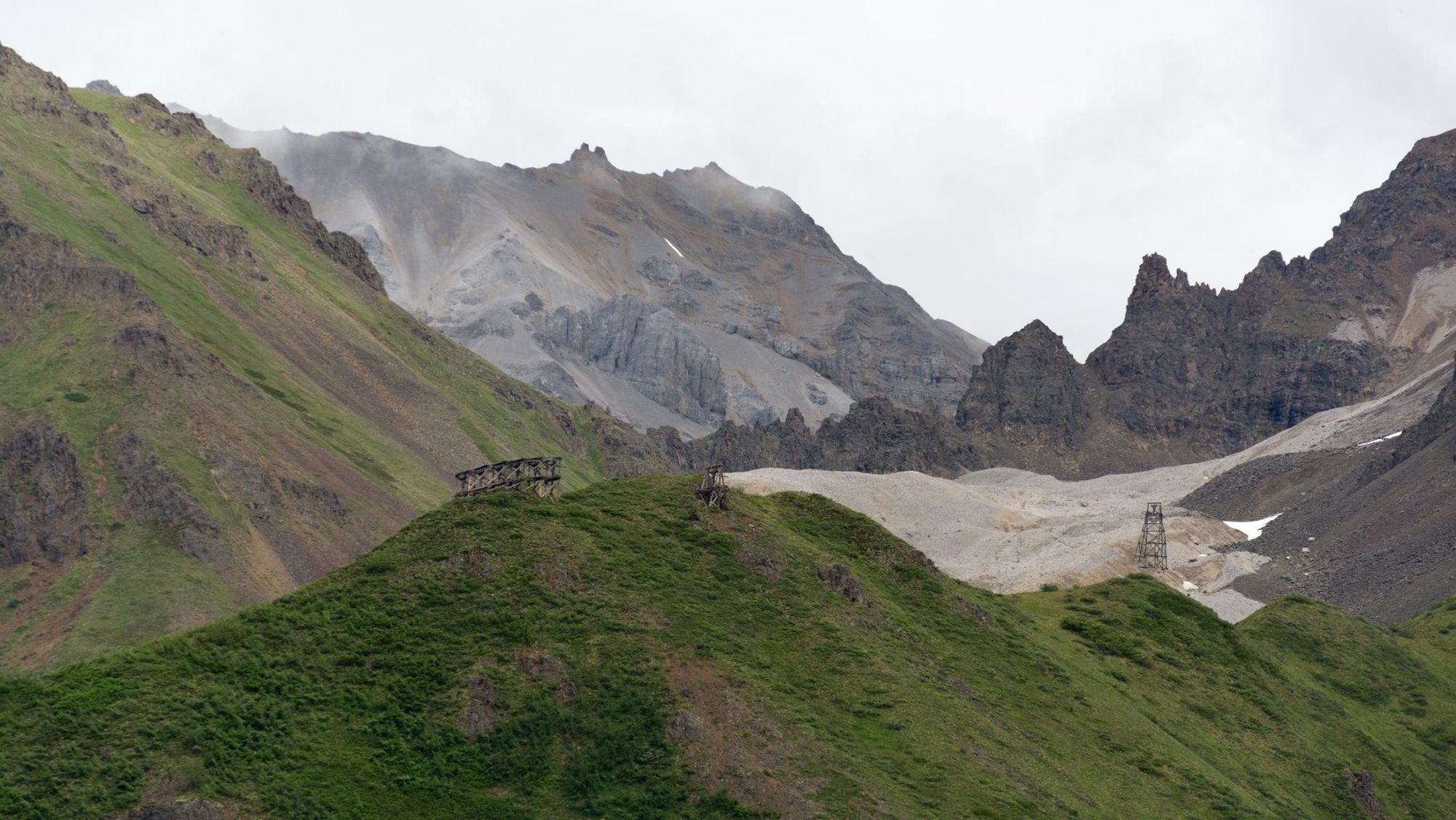
- Start/Finish: Kennicott (out and back)
- Distance: 10 miles (16 km)
- Walking time: 6-8 hours
- Difficulty: Challenging
- Best for: Mountain and glacier views
The Jumbo Mine Trail begins by following the Root Glacier Trail for around half a mile, before turning off to the right, and climbing a steep hill. After around a mile you’ll see a sign pointing towards Jumbo Mine. Follow the trail, which will eventually cross Bonanza Creek - the flow of the river varies across the season, and might result in wet feet - and then take a steep trail to the left towards the old Jumbo Transfer Station, a tumbledown hut with views of the glaciated Chugach Mountains and the more verdant Kennicott Valley.
Continue upwards towards the mine. The trail narrows and winds through rocky and sandy areas before reaching the scree slope leading to the mine. Here, the trail becomes less visible. Climb the slope, crossing some narrow tributaries of Jumbo Creek, and make for the nearest tram cable tower. Follow the path of the tram cables up a limestone slope, and up to the ruined mine; the area is still littered with ruined buildings and old tools. Castle Rock, an austere rock tower, looms over the site.
Ryan says the hike is a strenuous one. “There’s over a thousand metres of elevation gain from Kennicott,” he says. “It's a rarity that you would get a full group of people capable of making it up and back to one of those places. But because the initial path follows the Root Glacier Trail, people can divide up and choose the option that suits them best.”
3) Dixie Pass Trail
- Start/Finish: Kotsina Road (out and back)
- Distance: 18 miles (29.8km)
- Walking time: Overnight
- Difficulty: Moderate
- Best for: Wild alpine scenery
This trail gets you into Wrangell-St Elias’s pristine and remote alpine scenery via a road-accessible trailhead. Begin the trail at Kotsina Road, which branches off from Mile 14.5 of the McCarthy Road. Park in the small layby just after the Nugget Creek Trailhead (3.8 miles/6.1km from the McCarthy Road turnoff). Follow the trail through a woodland and along Strekna Creek. You’ll need to cross the creek at the first confluence (where the stream divides), after which point the trail becomes indistinct. Continue alongside the creek, following the left hand fork to a canyon. You can either wade up the canyon or scramble around it.
The route is a wildlife corridor for bears, so it’s imperative that you take bear-proof food storage containers with you.
After the third confluence, you’ll see a trail zig zagging up a hillside - follow it over the hill and into the bottom of an alpine valley. From here, you’ll need to pick a route up the next hillside towards Dixie Pass. In total, there’s around 1,143m (3,750ft) of elevation gain as you make your way up a rocky slope surrounded by craggy mountains. At certain times of year there might be a covering of snow on the pass.
This is a remote route suitable only for experienced hikers - we’d recommend travelling with a guide. You can camp along the route, although camping at the top of Dixie Pass isn’t recommended. The route is a wildlife corridor for bears, so it’s imperative that you take bear-proof food storage containers with you. For help with planning this trip, contact the Wrangell-St Elias visitor centre.
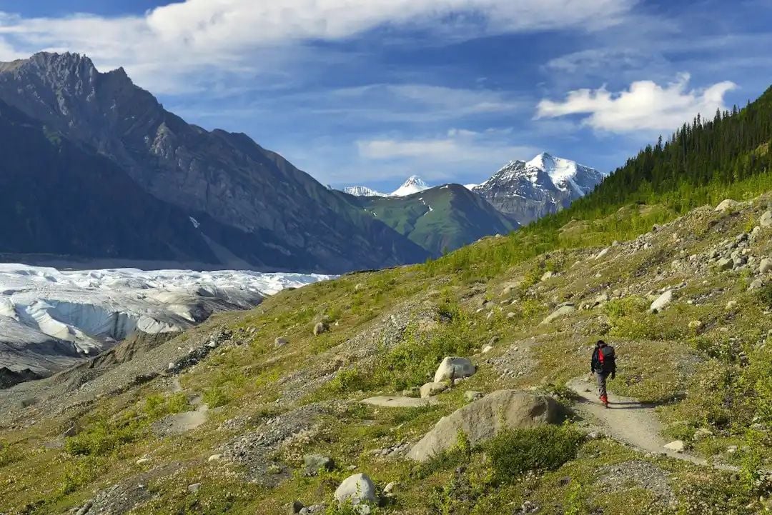
4) West Kennecott Glacier Trail
- Start/Finish: McCarthy (out and back)
- Distance: 2.4 miles (3.9km)
- Walking time: 1-2 hours
- Difficulty: Easy
- Best for: Mellow hiking with glacier views
The trailhead for this hike is located just past the Glacier View Campground on the outskirts of McCarthy. It’s a short, signposted trail across flat land, skirting the side of the mountain - and it will lead you up to the west side of the vast Kennecott Glacier. A mellow, easy hike with a big pay off in terms of views - but Ryan says, you don’t have to stop there.
“Getting to where the maintained area of the trail ends is about as far as most people that are novices go, because you really have to be paying attention beyond there,” he says. “However, it’s also an access point for some of the people that are going further out along the west side of the glacier. And once you get out there, you can continue hiking, meandering round the different glacial lakes there, and even following the rivers and streams.”
In other words, it’s possible you can use this hike as a mini introduction to backcountry hiking. But Ryan cautions against going too far if you don’t have much experience - stay within the sight of the trail end unless you're seriously experienced, or better yet (as always), with a hired, expert guide.
5) Trail Creek Trail
- Start/Finish: Nabesna Road, Mile 29.5 marker (out and back)
- Distance: 20 miles (32.1 km)
- Walking time: 8-10 hours
- Difficulty: Challenging
- Best for: True wilderness
A full day hike beginning at Mile 29.8 of the Nabesna Road. Follow Trail Creek along a marked trail; after four miles (6.4km) you'll reach the mouth of Trail Creek Canyon. Two miles later, the canyon will narrow, and the marked trail ends.
From here, follow the first major path leading off from the canyon, and ascend towards the top of a 1828.8m-high (6,000ft) pass through lush alpine tundra, surrounded by mountains and rocky glaciers, following sheep trails. You'll reach the top of the pass, and can either turn back and return the way you've come, or continue hiking along the Lost Creek Trail.
This is a challenging hike if you complete the entire climb up to the pass, and is best undertaken with a guide.
When is the Best Time to Hike in Wrangell-St. Elias?
Hiking season in Wrangell-St. Elias is from mid-May to mid-September, which is when the McCarthy Road is open. Outside these times, it’s not maintained and could be impassable due to snowfall. You’re likely to find snow on the trails still in mid-May and into June. By mid-June the weather has become warmer, and the wildflowers are starting to bloom.
From mid-July to August is peak season in the park, with long daylight hours and the most stable weather of the year. The average summer temperature is 11°C (53F), with highs of 19.4°C (67F). It’ll get cooler as you transition to autumn, but you’ll be treated to the sight of autumn foliage, and the trails will be quieter. All throughout this period, however, you need to come prepared for all weather conditions, including rain and snow.
“When I spent my summers guiding in Alaska. I used to always say the Scottish phrase, ‘there's no such thing as bad weather, just bad gear’,” Ryan says. ‘I’d tell people that if we just get geared up, we can deal with whatever comes our way.”
What Animals Live in Wrangell-St. Elias?
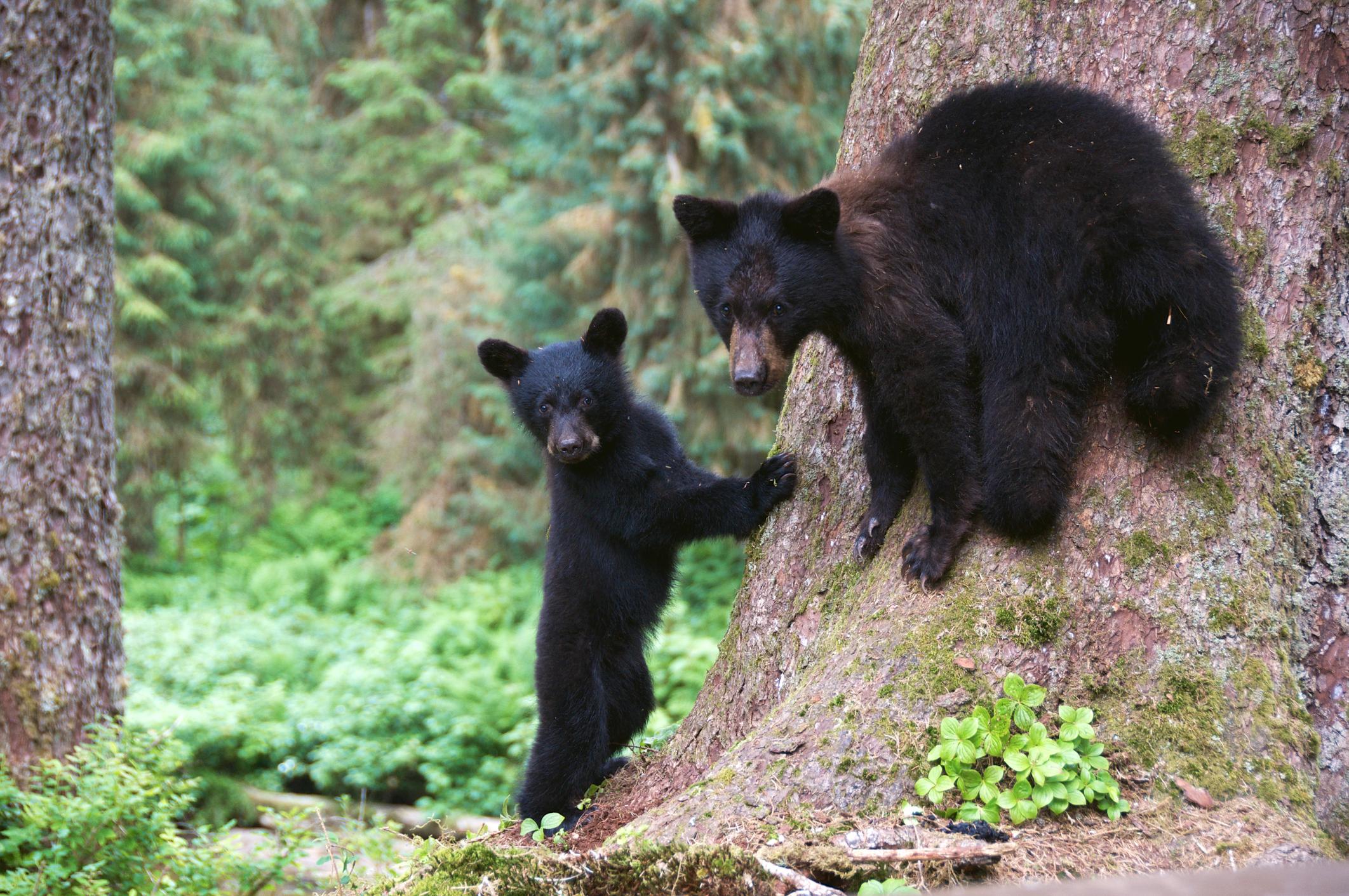
Wrangell-St. Elias is home to a wide variety of animal species, including grizzly bears and black bears. Wolves, coyotes and lynx are other predators residing in the park. You’ll also find dall sheep in the alpine regions, moose and caribou, and small mammals such as beavers and porcupines.
Salmon, trout and Arctic grayling inhabit the park’s rivers and lakes. Golden eagles and peregrine falcons soar on thermals in the skies.
Where to Stay in Wrangell-St. Elias?
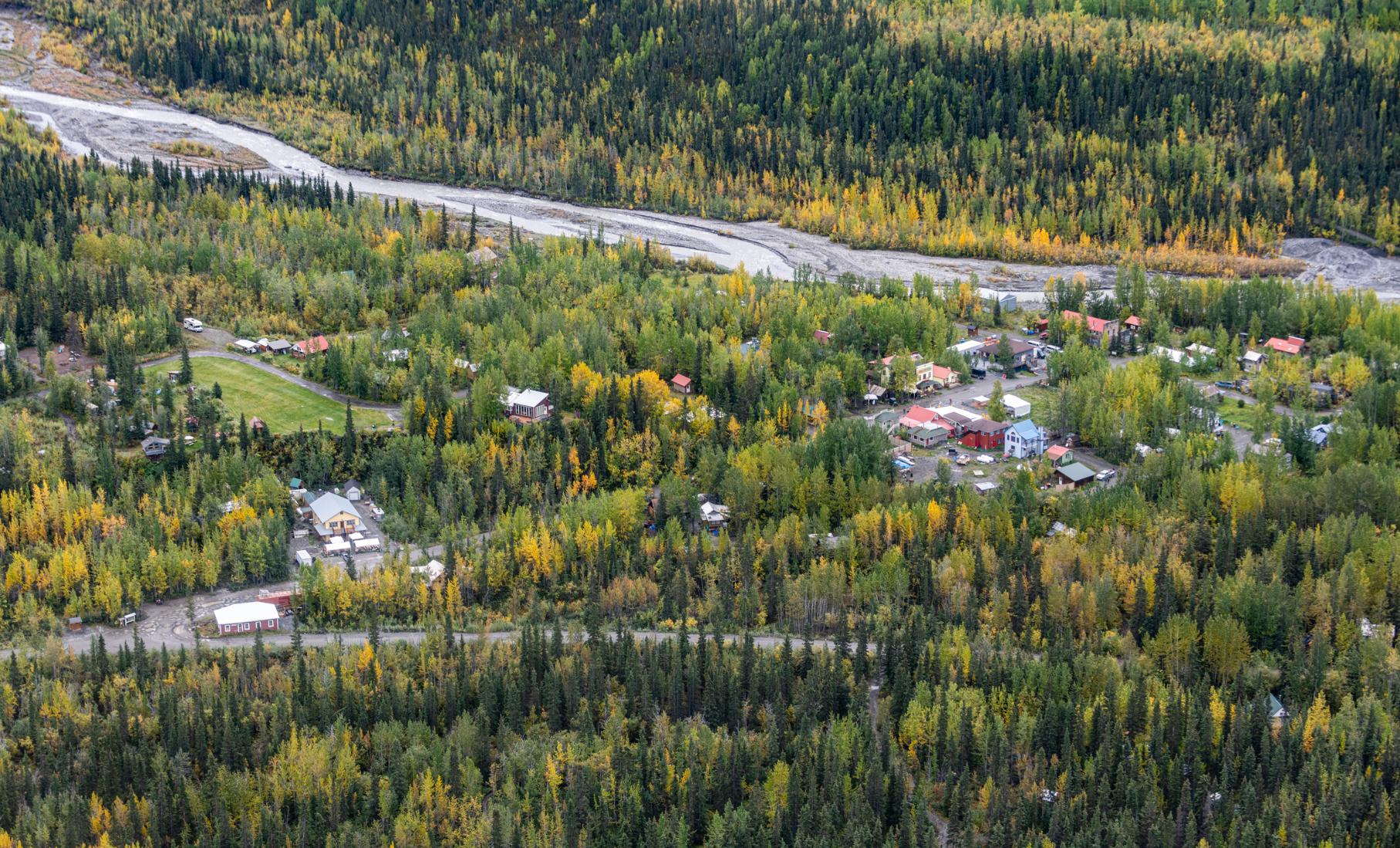
Ryan recommends basing yourself in McCarthy, one of the few towns within the park.
“It’s a really cool little town. A lot of the buildings are still from that time when it became a mining town. So Kennicott was where all the copper milling from the mines happened; McCarthy's where all of the nightlife happened - miners’ nightlife,” he says.
McCarthy has a handful of accommodation options, including several scenic campsites, a couple of B&Bs and some wooden cabins - these cater to a range of different budgets.
From McCarthy, you can take a shuttle van or hike the old Wagon Road to Kennicott, to explore this abandoned mining town with its stunning mountain and glacier backdrop. There are several accommodation options in Kennicott, including a restored mining lodge.
What to Eat in Wrangell-St. Elias?
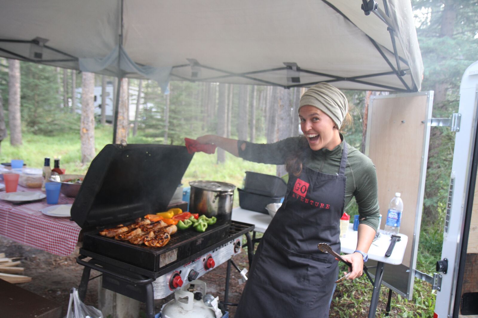
If you’re travelling to Wrangell-St. Elias, we recommend you bring food and camping supplies with you, especially high energy hiking snacks. However, there is a small grocery store in McCarthy, and a few restaurants.
One of the most popular restaurants is The Potato, where you can expect carb-loaded comfort food including the ‘spudnik supreme’, handcut curly fries topped with cheese, sausage gravy, eggs and jalapenos. The Meatza Wagon, a food truck overlooking Kennicott Glacier, is another local favourite. Stop there after a busy day of hiking for subs, tacos and more.
How to Get to Wrangell-St. Elias?
By plane: The closest international airport to Wrangell-St. Elias is in Anchorage. Most travellers to the park fly in here and then hire a car. However, it's also possible to fly to the park from Anchorage. You'll need to take a flight to Gulkana and then one to McCarthy - an option offered by Reeve Air Alaska and Copper Valley Air a few times a week.
By Car: To get to Wrangell-St. Elias, you’ll need either to drive down the 60 mile (96.5km) McCarthy Road, which begins in Chitina and ends near McCarthy, or down the 42-mile (67.5km) Nabesna Road, which turns off the Glenn Highway and heads into the northern reaches of the park. Both roads are gravel - not all car rental companies allow you to drive down unpaved roads, so make sure you find one that does (Alaska Overlander is one option).
If you want to drive beyond Mile 29 of the Nabesna Road, you’ll need a high clearance vehicle like a jeep or SUV, as the road conditions deteriorate from this point.
Inspired? Explore Wrangell-St. Elias with us on our Ultimate Adventure Through Alaska.