
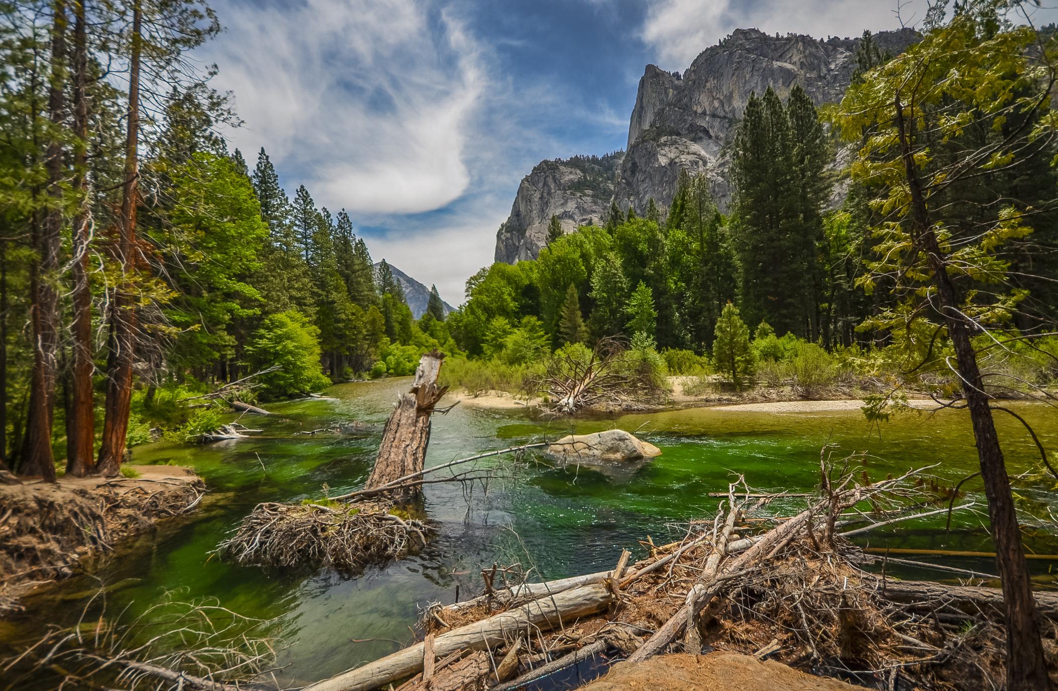
Sequoia and Kings Canyon National Parks are located in the southern Sierra Nevada mountains of California, around 200 miles (320km) from Los Angeles. They are two separate parks that are run as a single unit, and often explored together.
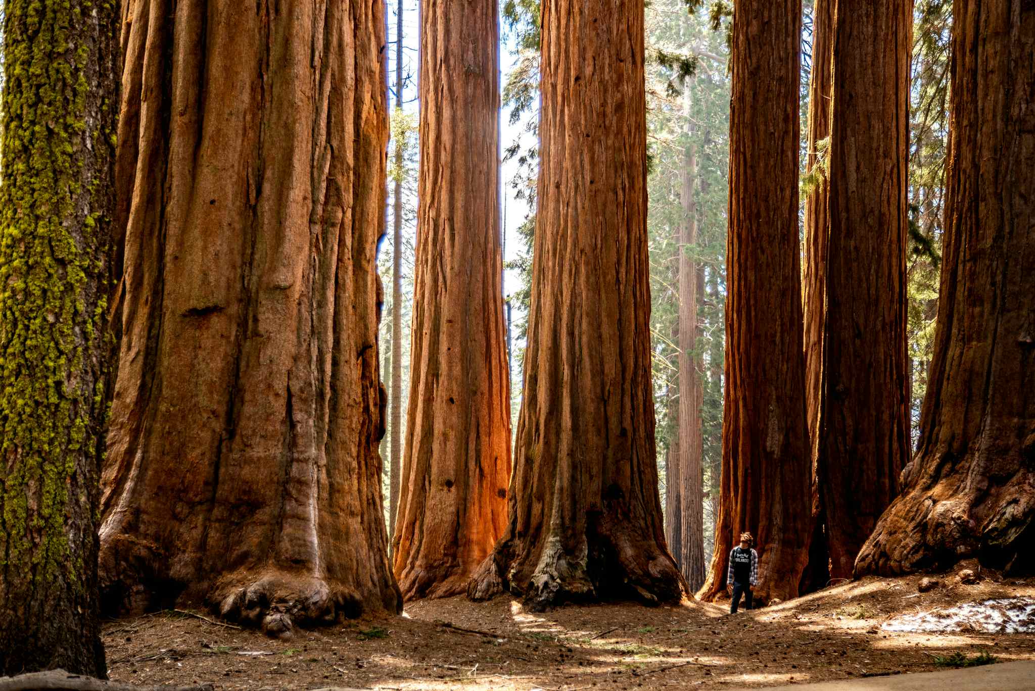
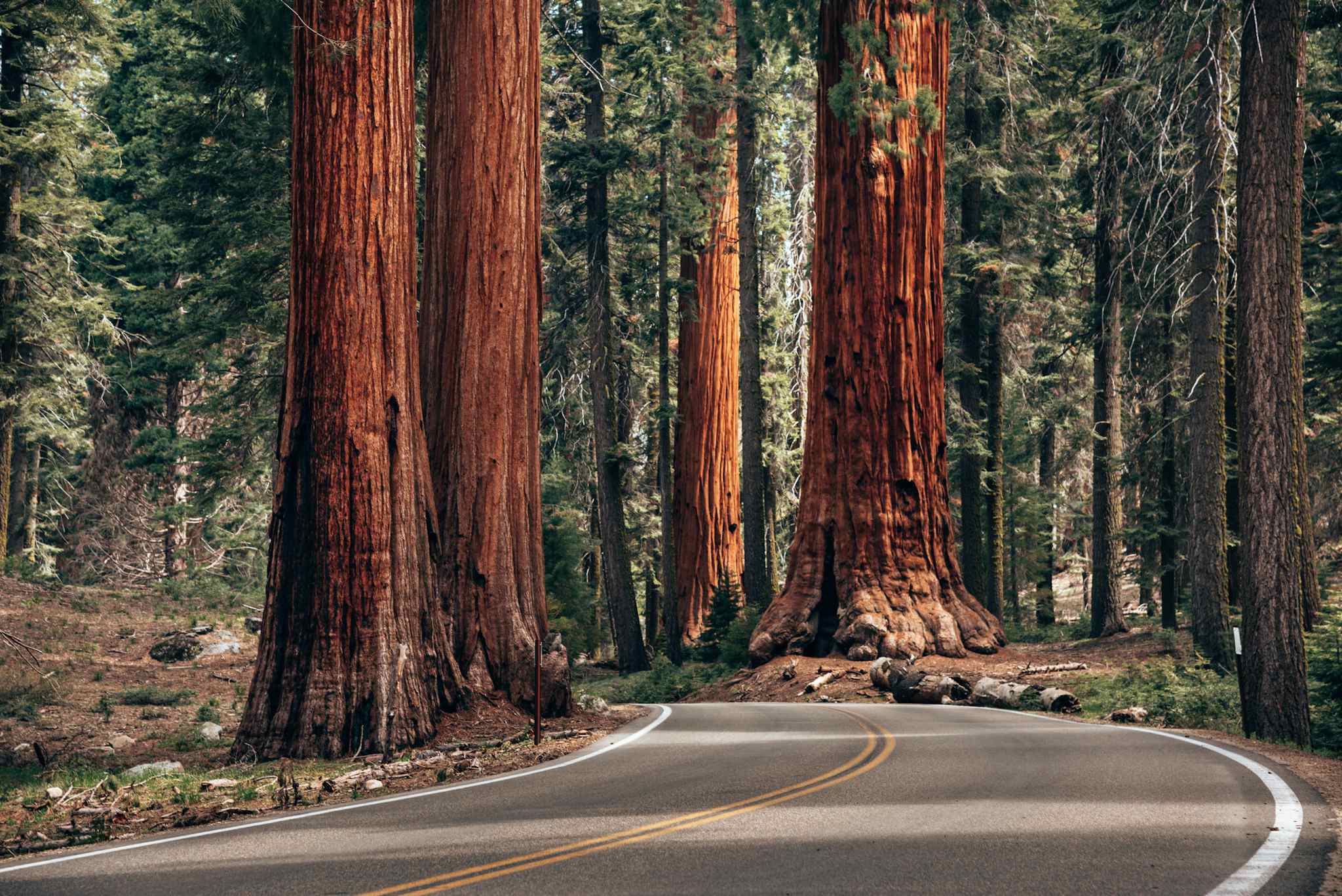
“Once you climb up from the foothills into elevation and you're actually in Sequoia National Park, the name kind of says it all: sequoia trees are the main attraction,” guide Ryan Romito says. “It’s really hard to envision just how magical these trees are until you're face to face with one. The Giant Forest, it's called, is just filled with them. There’s a whole network of trails that weave in and out of each other throughout those sequoia trees.
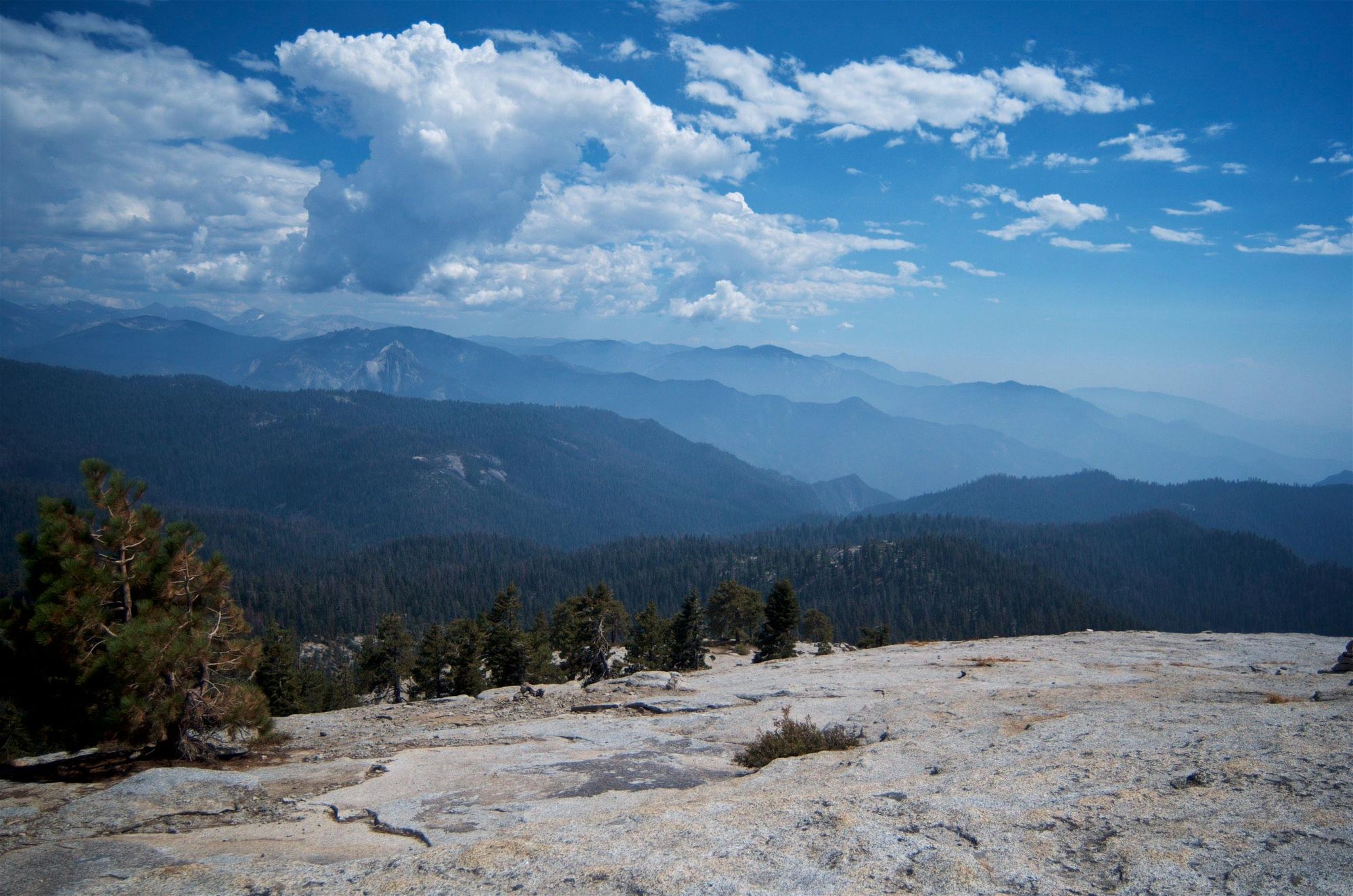
“Undoubtedly, the trees really steal the show. But Sequoia is also in the Sierra and has a lot of those similar features that places like Yosemite or Lake Tahoe are also known for, with granite faces and peaks which glisten as they rise above these valleys.”
It’s really hard to envision just how magical these trees are until you're face to face with one
The great naturalist John Muir was equally enchanted by the adjacent Kings Canyon. “In the vast Sierra wilderness far to the southward of the famous Yosemite Valley, there is a yet grander valley of the same kind,” he wrote. “It is situated on the south fork of Kings River, above the most extensive groves and forests of the giant sequoia, and beneath the shadows of the highest mountains in the range, where the canyons are deepest and the snow-laden peaks are crowded most closely together.”
In Kings Canyon you’ll find two main hiking areas, Grant Grove (home to General Grant Tree) and Cedar Grove, the gateway to the High Sierra. In Sequoia, there are the Foothills, Giant Forest (where you’ll find the giant Sequoias) and Mineral King hiking areas - the latter is a sub-Alpine valley and the highest area accessible by road at 2,375m (7,800 feet). You’ll find numerous marked hiking trails in each of these hiking areas. The only difficulty is choosing which one to do. With Ryan’s help, we’ve selected 10 of the best.
- Little Baldy Dome Trail
- Heather and Pear Lakes via the Watchtower
- Tokopah Falls Trail
- Circle Meadow Loop via General Sherman Tree
- Alta Peak Trail
- White Chief Canyon Trail
- Mist Falls Trail
- Lookout Peak Via the Don Cecil Trail
- Big Baldy Ridge Trail
- Rae Lakes Loop Trail
It’s important to note that these route descriptions are only short summaries, designed to inspire but not to serve any navigational purpose. They are not intended to guide you on the route and further mapping and planning (or a local guide!) will be required if you want to safely walk any of the trails featured. This is particularly important if you want to head out into the backcountry, or are planning an overnight backpacking trip within the park.
Here’s our guide to the best hikes in Sequoia and Kings Canyon National Parks,, when to visit and where to stay.
The Best Hikes in Sequoia and Kings Canyon National Parks, Mapped
The best hikes in Sequioa and Kings Canyon are all accessible by road, as this map indicates. We've broken them down into 'easy' - which will take an hour or two - 'challenging' all day affairs and 'moderate', which is something in between.
6 of the Best Hikes in Sequoia National Park
1. Little Baldy Dome Trail
- Start/Finish: Little Baldy Trailhead, General’s Highway (out and back)
- Distance: 3.4 miles/ 5.4km
- Walking time: 1-2 hours
- Difficulty: Easy
- Best for: Panoramic views of Sequoia National Park
Beginning at the trailhead near Little Baldy Saddle, you’ll hike uphill through dense forest along a series of switchbacks. The trail flattens out as it heads south through a section of forest previously burnt from wildfires - before long, you’ll catch a glimpse of mountains through the trees.
Ryan recommends this trail for people with limited time, as it provides you with amazing panoramic views over Sequoia after a relatively short hike.
“It's not a hugely long trail, but it is at elevation,” he says. “And the nice thing, once you get up to the top, is just being able to look all around you. It’s a bald granite knob and you’re able to see in all directions. It's a really nice one in the morning, as you get that early morning glow out there over Sequoia.”
As the trees clear, the trail winds up onto the south ridge of Little Baldy. Follow the trail and there’s a short ascent along the granite to the top of Little Baldy. Although it’s a short climb, the summit is located at a height of 2,452m/8,044ft, and the views across the park are breathtaking. On a clear day the hulking silhouettes of Mount Silliman and Alta Peak rise out of a sea of sequoias in the east, while in the west you’ll be able to see the granite spires of Castle Rocks.
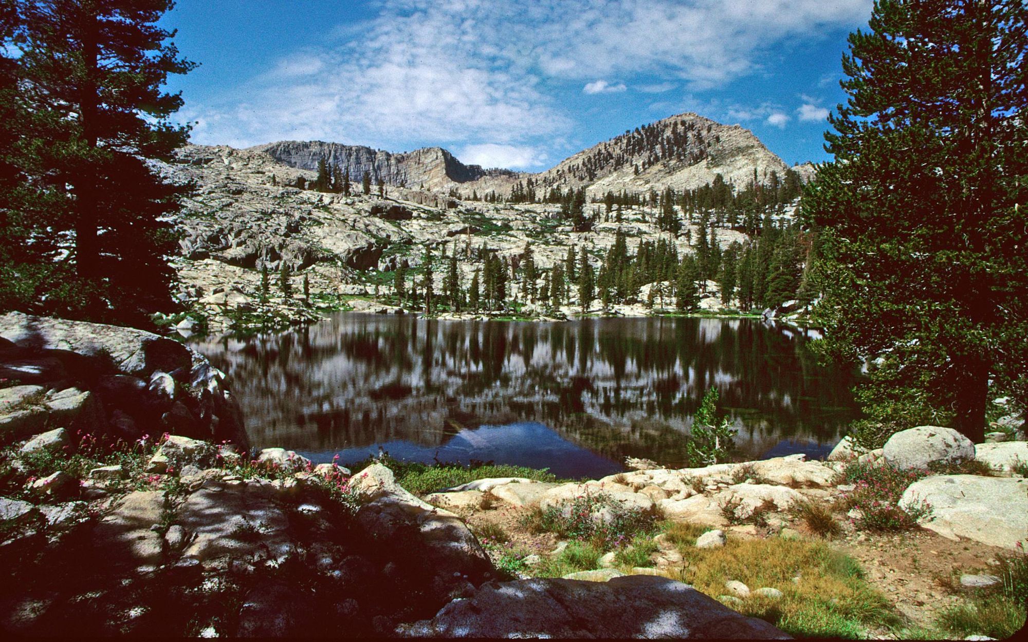
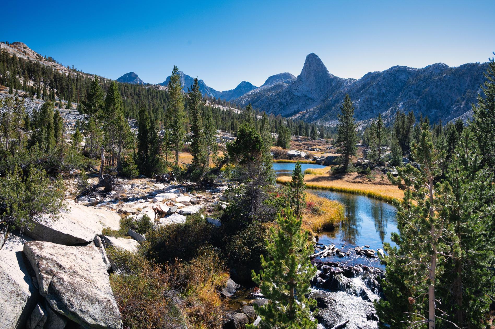
2. Heather and Pear Lakes Via The Watchtower
- Start/Finish: Wolverton Parking Lot (out and back)
- Distance: 12.2 miles/19.6km
- Walking time: 5-6 hours
- Difficulty: Moderate
- Best for: Mountain vistas and Alpine lakes
This hike is a variation of the Lakes Trail, a route taking you past three lakes in the Sierra Nevada - Heather, Emerald and Pear.
“The Lakes Trail there is amazing,” Ryan says. “There’s a route to the Lakes via a place called The Watchtower, where you get more exposure to heights and some amazing views.”
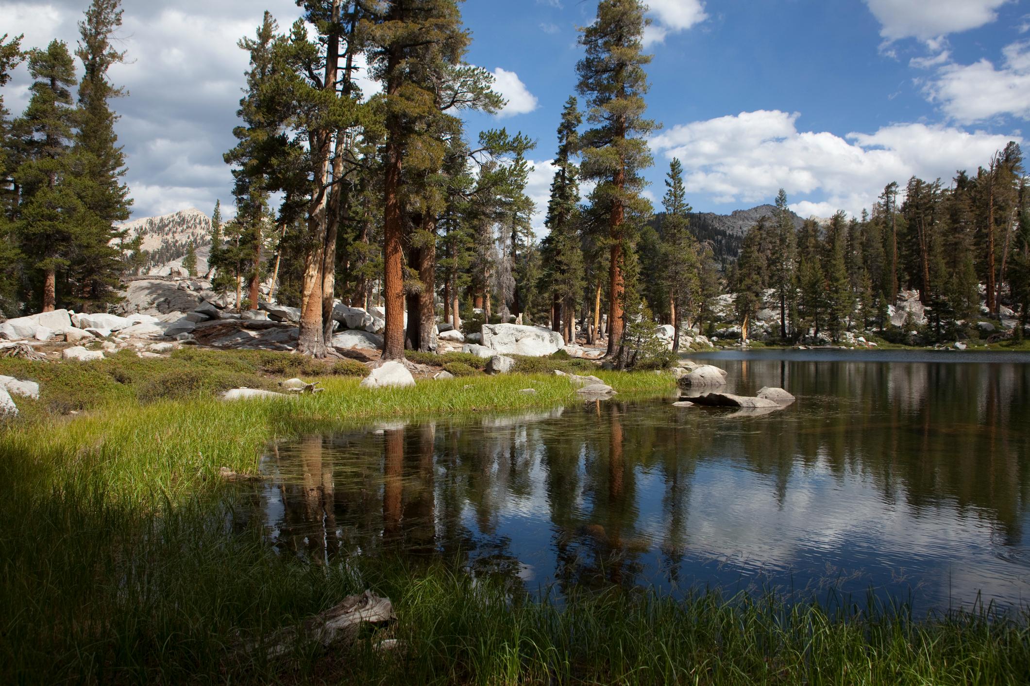
Beginning at the trailhead near the Wolverton parking lot, you’ll follow a path up through pine and fir forest. At the first junction, you’ll see signs for the Watchtower Trail and the Hump Trail - head left along the former. You’ll climb up to a granite outcrop, the Watchtower (2,735m/8,973ft), where you’ll have panoramic views of the Sierra Nevada, with forests clinging to the stony slopes, and Topokah Falls in front of you.
After enjoying the views, follow the path along the cliff - continuing to enjoy the amazing views - until it heads downhill towards Heather Lake, which is surrounded by tall pine trees. Continue along the trail through a granite landscape spotted with wildflowers in summer. You’ll see deep blue Aster Lake on your left and Emerald Lake on your right. Continue on to Pear Lake, which is an ideal spot for a picnic and a swim.
Return along the same trail, but when you reach the junction for the Watchtower Trail and Hump Trail, take the latter for some variation - you’ll have a steep zigzagging ascent and descent, with a view of the Marble Fork Kaweah River canyon.
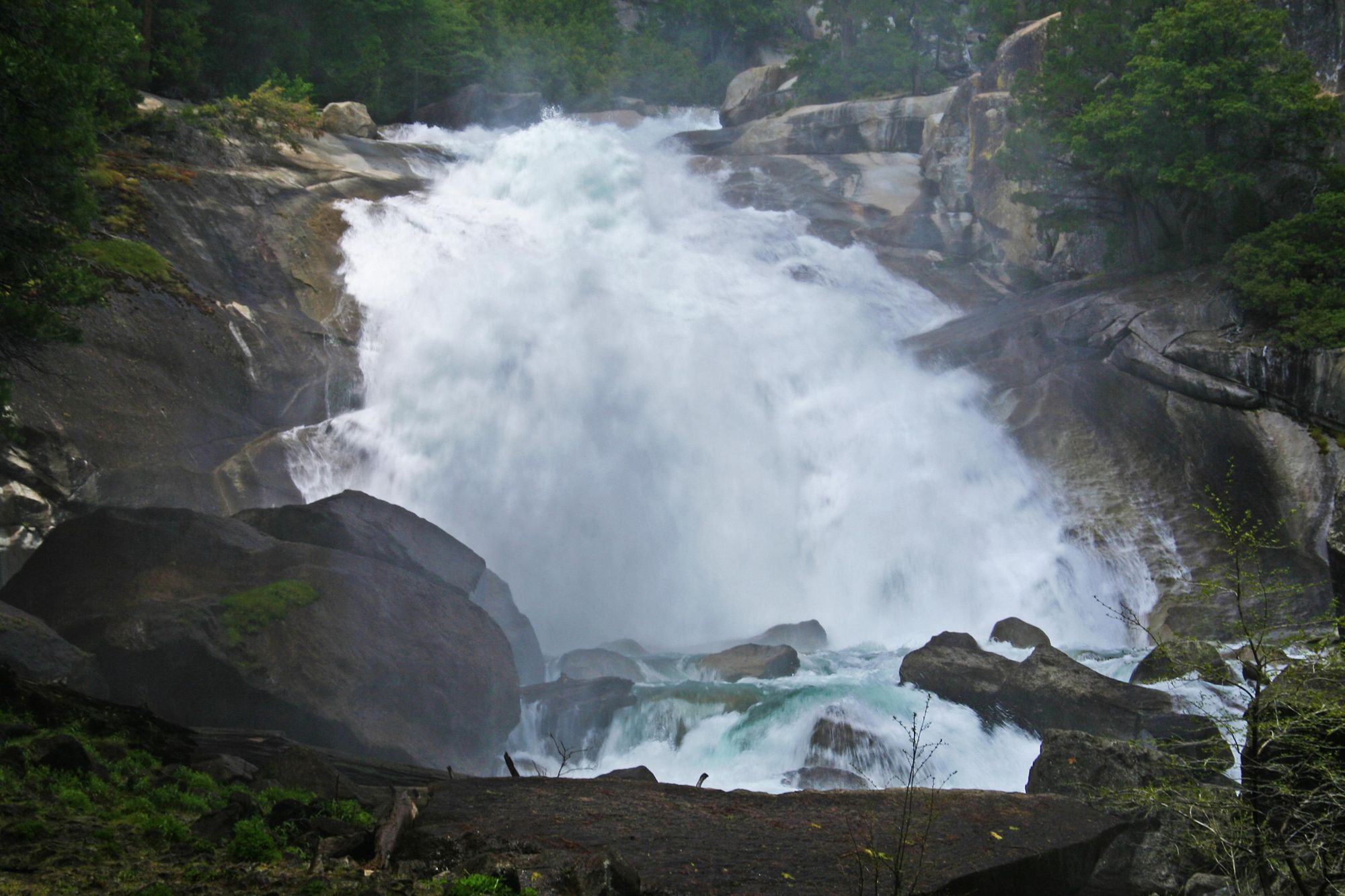
3. Tokopah Falls Trail
- Start/Finish: Tokopah Trailhead, near Lodgepole Campground (out and back)
- Distance: 3.4 miles/5.4km
- Walking time: 2 hours
- Difficulty: Easy
- Best for: Chasing waterfalls
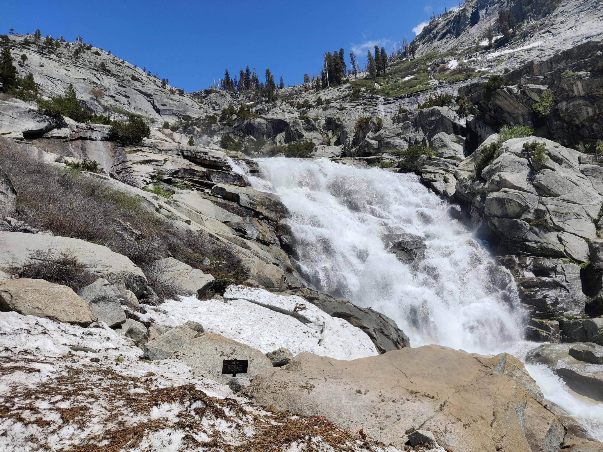
“Tokopah Falls is another really enjoyable hike,” says Ryan of his third recommendation. “It’s not overly strenuous but there’s a really great payoff, looking out into this valley with the waterfalls. “It’s a different style to the more vertical waterfalls in Yosemite; it cascades down the granite but it’s still really massive, and flows really fast after heavy rains, especially earlier in the season.”
The trail to Tokopah Falls begins at a marked trailhead near Lodgepole Campground. It’s a wide, well-maintained trail which climbs gently but steadily through pine woods, following the path of the Kaweah River. Through the trees you’ll catch glimpses of the Sierra Nevada, including the granite watchtower.
The trail crosses a couple of streams where you can cool your feet, before emerging out of the woods. It becomes rougher as you walk the final few hundred metres over the rocks to Tokopah Falls. It cascades down a large granite wall, and is around 365.8m/1,250ft high. After enjoying the view, return the way you came.
4. Circle Meadow Loop via Congress Trail and General Sherman Tree
- Start/Finish: Sherman Tree Trailhead (circular)
- Distance: 4.1 miles/6.7km
- Walking time: 2-3 hours
- Difficulty: Easy
- Best for: Seeing giant sequoias
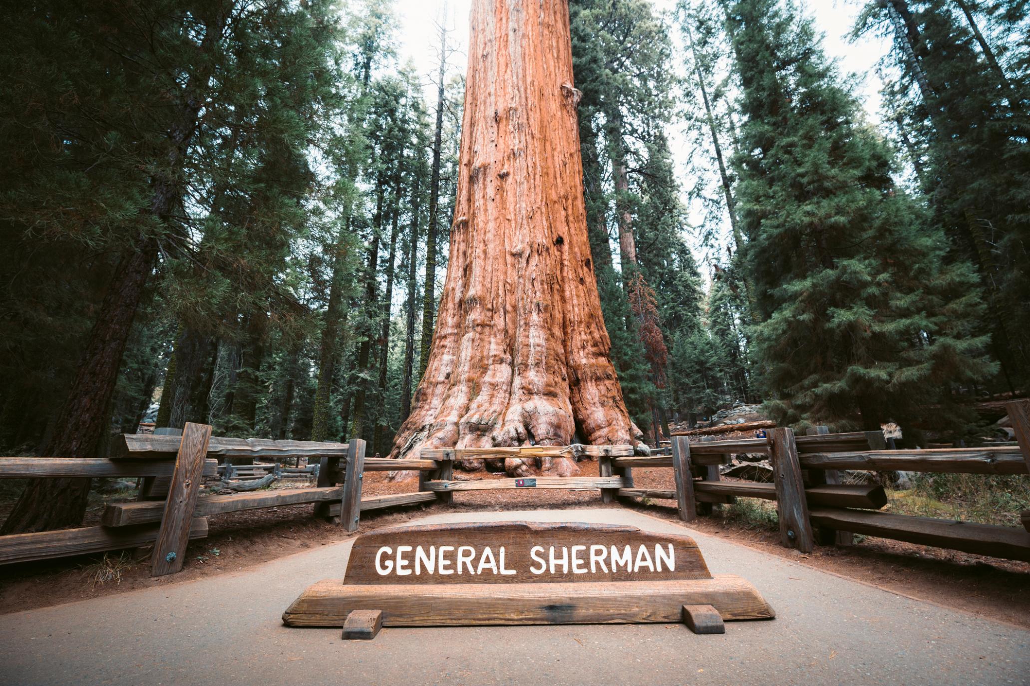
On this hike you’ll see one of the most famous sequoia trees in Giant Forest, the General Sherman Tree - the largest living organism in the world, by volume.
“General Sherman's really famous just because of just how big it is,” Ryan says. “Even though sequoias are not quite the tallest trees in North America, they can get so wide and dense and old that they're significantly larger than most other trees related to the redwoods.”
Considering the trail to General Sherman is under a kilometre long, Ryan recommends combining it with the Circle Meadow Loop for a slightly longer hike. Start by following the Sherman Tree Trail along a paved route which winds through giant sequoia groves - the busiest part of the trail. Stop to admire General Sherman and continue on via the Congress Trail (the crowds thin out here), which continues on through pine forest, with occasional groves of sequoia trees.
Even though sequoias are not quite the tallest trees in North America, they can get so wide and dense and old that they're significantly larger than most other trees related to the redwoods.
You’ll pass McKinley Tree and then a trail junction. Take the middlemost route past an old log cabin, Cattle Cabin, and turn left onto the Circle Meadow Loop. The trail takes you around Circle Meadow, a narrow C-shaped meadow with a knoll in the middle, bordered by towering conifers. Visit in June or July when the wildflowers and lupines are in full bloom for the best views.
The trail leads you towards The Senate, a grove of sequoias - here, reconnect with the right hand side of the Congress Trail, which leads you back along the Sherman Tree Trail to your start point.
5. Alta Peak Trail
- Start/Finish: Lakes Trailhead
- Distance: 13.4 miles/21.7km
- Walking time: 8-10 hours
- Difficulty: Challenging
- Best for: Mountain ascents
This ascent of Alta Peak (3,416m/11,208ft) is a challenging hike as you’ll be completing over 1,200m/3,937ft of ascent across a single day. For this reason, some people do this as an overnight hike, often camping at Panther Gap - you’ll need a wilderness permit to do this.
Begin at the Lakes Trailhead and follow the path east along Wolverton Creek. When you reach an intersection, veer right onto the Panther Gap Trail. The path climbs up through montane meadow surrounded by stony ridges. When you reach Panther Gap - a mountain pass with excellent views of the surrounding forest and mountains - turn left onto the Alta Trail. It takes you across a creek and through another alpine meadow.
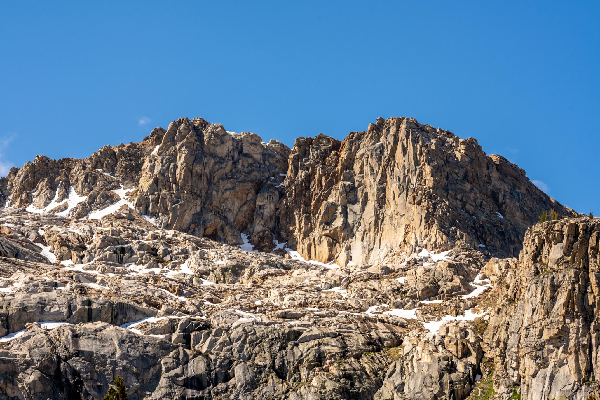
Emerging from the meadow, the trail becomes increasingly steep and rocky as it zig-zags its way up to the summit of Alta Peak. Enjoy the views of the Sierra Nevada from the peak - you’ve earned them.
6. White Chief Canyon Trail
- Start/Finish: Eagle-Mosquito Trailhead (out and back)
- Distance: 7.3 miles/ 11.7km
- Walking time: 4-5 hours
- Difficulty: Moderate
- Best for: Rugged Alpine scenery
This is a lesser-known trail in the Mineral King area of Sequoia National Park, which is known for its high altitude alpine vistas. It's where you’ll find the remains of old mining equipment. Begin at the trailhead, which is at the south end of the Eagle/Mosquito parking area, and follow the trail along the west side of East Fork Kaweah River Valley.
The trail climbs upwards through scrub-covered hillsides dotted with firs and junipers. At the head of the valley you’ll have a view of Vandever Mountain and Farewell Gap. Cross Spring Creek on a wooden bridge and head upwards. Here, the trail forks - take the left one, marked ‘White Chief Canyon’, and you’ll ascend up into the canyon. It’s a steep climb, but you’ll be rewarded with views of the towering Sierra Nevada.
After a couple of miles, the trail levels out and winds through pretty wildflower meadows bordered with rugged cliffs. You’ll pass the ruins of historic Crabtree Cabin before continuing to ascend along the east side of the canyon, crossing a creek and climbing up towards the disused White Chief Mine (3.7 miles/5.9km from the trail head). Beyond the mine, a faint path marked with cairns will take you up past old mining cabins, shafts and canyons to White Chief Bowl, a glacial cirque at the foot of Vandever Mountain. Relax here before heading back the way you came.
The hike takes place over relatively easy terrain, but don’t underestimate it - there’s an elevation gain of 670.5m/2,200ft between the trailhead and White Chief Basin.
4 of The Best Hikes in Kings Canyon National Park
7. Mist Falls Trail
- Start/Finish: Road’s End Trailhead
- Distance: 9.2 miles/14.8km
- Walking time: 4-5 hours
- Difficulty: Moderate
- Best for: A picturesque waterfall hike
This trail begins in front of the permit station at Road’s End. No permits are needed for day hikes, the rangers can provide updates on trail conditions.
You’ll follow the trail through meadows scattered with trees, and pass over Copper Creek bridge. After this, the landscape shifts to a denser forest with thick ferns. At the two mile mark, the path forks. Take the left, signposted ‘Mist Falls and Paradise Valley’, although you can take a brief detour to the right for a scenic view of the South Fork Kings River first.
Continuing on the Mist Falls Trail, the path remains gentle for another mile, before beginning a steeper ascent through a granite boulderscape studded with trees and rocks, including the impressive Sphinx formation. Eventually you’ll reach Mist Falls, so named from the mist that rises into the air during periods of high runoff. Follow a side trail down to the bottom of the falls, or head up to the top to look down on this roaring 13.7m/45ft cascade.
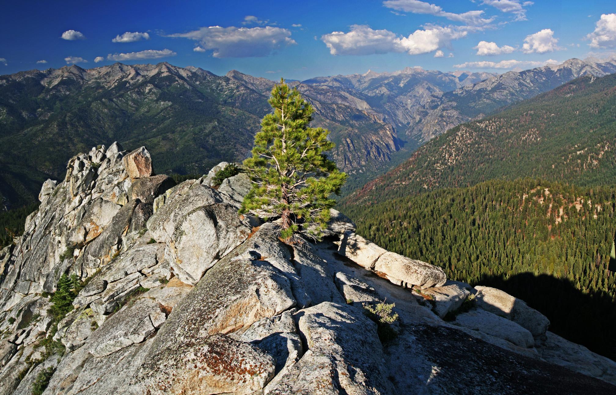
8. Lookout Peak Via the Don Cecil Trail
- Start/Finish: Don Cecil Trailhead (out and back)
- Distance: 10.6 miles/17.1km
- Walking time: 7-8 hours
- Difficulty: Challenging
- Best for: Epic views of King’s Canyon
The trail begins with an uphill climb through a forest of ponderosa pine, oak, and cedar. After just under a mile of hiking, you’ll cross a wooden bridge over Sheep Creek, where the water tumbles over granite into a picturesque grotto. Trail traffic abates after this point (as most people are hiking up to see the waterfall).
Continuing on, the trail ascends the ridge that divides Sheep Creek from a tributary, zig-zagging through the forest. At 3.4 miles (5.5km), the trail crosses the tributary and climbs to Lookout Peak’s summit ridge, where you catch your first view of the glacially carved Kings Canyon. You’ll climb up towards the saddle, through an area of forest which burnt during a 2010 fire, providing you with more open vistas.
From the saddle, follow a faint trail marked by brown posts toward Lookout Peak. It’s a steep, rocky ascent up to the 2,600m (8,531ft) summit, but you’ll be rewarded with views of Kings Canyon, hills carpeted with trees and the high granite silhouettes of the Sierra Nevada.
9. Big Baldy Ridge Hike
- Start/Finish: Big Baldy Ridge Trailhead
- Distance: 4.4 miles/ 7km
- Walking time: 2 hours
- Difficulty: Moderate
- Best for: Big views for a short walk
This short hike in the Grant Grove area of Kings Canyon is popular because of the epic panoramic views it gives you, after only just over an hour of hiking. Beginning at the Big Baldy Ridge Trailhead, you’ll follow a dirt trail up through the conifer forest. In places the trees thin out, giving you views of the granite carpeted slopes beyond.
You’ll catch a glimpse of Big Baldy - a smooth granite ridge - through the trees, and will ascend along a rocky path to the summit. From here you can see Kings Canyon and the distant silhouettes of the High Sierra; the polish granite dome of Little Baldy can be seen to the south east. Hike along Big Baldy Ridge enjoying the views, before rejoining the trail leading you back down through the forest.
10. Rae Lakes Loop Trail
- Start/Finish: Bubbs Creek Trailhead
- Distance: 41.4 miles/ 66.6km
- Walking time: 3-5 days
- Difficulty: Challenging
- Best for: Backpacking through Kings Canyon
If you’re interested in a slightly longer hike, we recommend the Rae Lakes Loop Trail, a 40-mile circuit through the pristine landscapes of Kings Canyon. It’s a popular backpacking route and a permit is necessary to hike and camp along the trail. Tthere’s a limited quota, so make sure you apply in advance of your trip.
Beginning at Bubbs Creek Trailhead at Road’s End, the trail winds through the forest along the South Fork of the Kings River, surrounded by tall pines and granite cliffs. As it ascends, hikers move through lush meadows dotted with wildflowers and cross over several streams.
The final section of the trail takes you down through Paradise Valley, a granite canyon carpeted in conifers, to reach Mist Falls.
The trail continues to climb, leading hikers into higher elevations where the terrain becomes more rugged and the scenery more dramatic. You'll hike up a steep exposed trail towards Glen Pass, the highest point on the loop at 3,635m (10,544ft), where there are breathtaking views of the rugged terrain and the glacial Rae Lakes below. Descend to the lakes, which are encircled by high peaks and make for a scenic campsite.
The final section of the trail takes you down through Paradise Valley, a granite canyon carpeted in conifers, to reach Mist Falls. Here you’ll start to encounter more day hikers. Head back down through the forest and back along Bubb’s Creek to the start point.
A Note on Wildfires
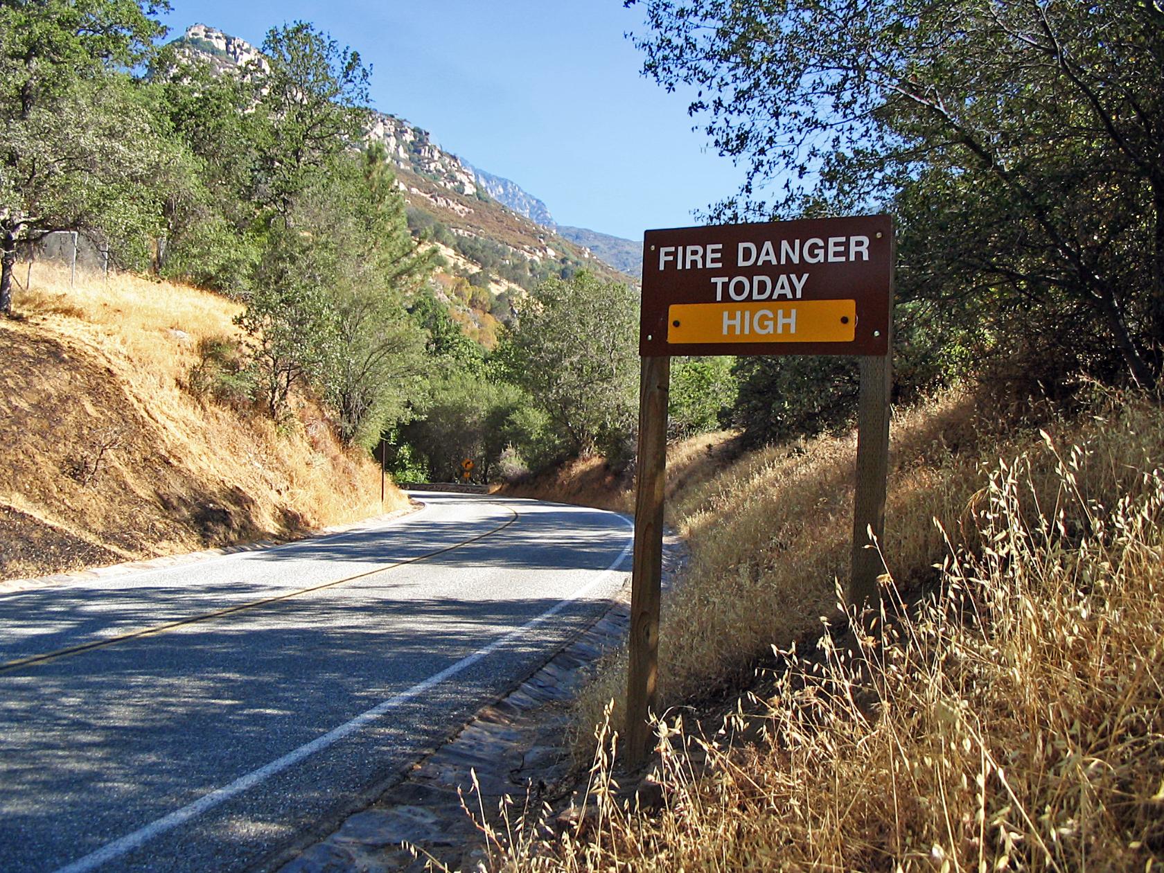
There is a risk of wildfire within Sequoia National Forest due to dry fuels buildup (e.g. fallen logs and leaf litter), drought, climate change, and other stresses. Fire management officials actually light prescribed fires to manage these conditions - and fire ecology is a vital part of the Sierra Nevada landscape, helping clear and fertilise the ground to help sequoias grow. However, human and naturally-igniting fires are a risk, and could rage out of control. For this reason, there are strict fire restrictions within the park during the summer months - check these before you travel.
It's also worth checking the National Parks' Service current fires page before travelling - alongside the location of any fires, it also gives air quality information on an interactive fire and smoke map.
When is the Best Time to Hike in Sequoia and Kings Canyon National Park?
Ryan’s favourite time to hike in Sequoia National Park is during the spring months of late May and June.
“That’s when the wildflowers bloom in the Sierra foothills, and that little pocket is beautiful in the spring,” he says. “It looks like a painting - like scenes of multicolour landscapes - for just a very brief time there in the spring.”
He also enjoys hiking in Sequoia National Park during autumn, when the leaves of the deciduous trees turn red and gold.
“Really, any time except during the winter months,” he says. “Summer is good because of the better weather, and accessibility - everything’s open. But in winter, the road closes. If you want to try cross-country skiing there’s some possibilities, but most people don't go up in the winter because of the accessibility difficulties of the road being closed until about May.”
What Animals Live in Sequoia and Kings Canyon National Park?
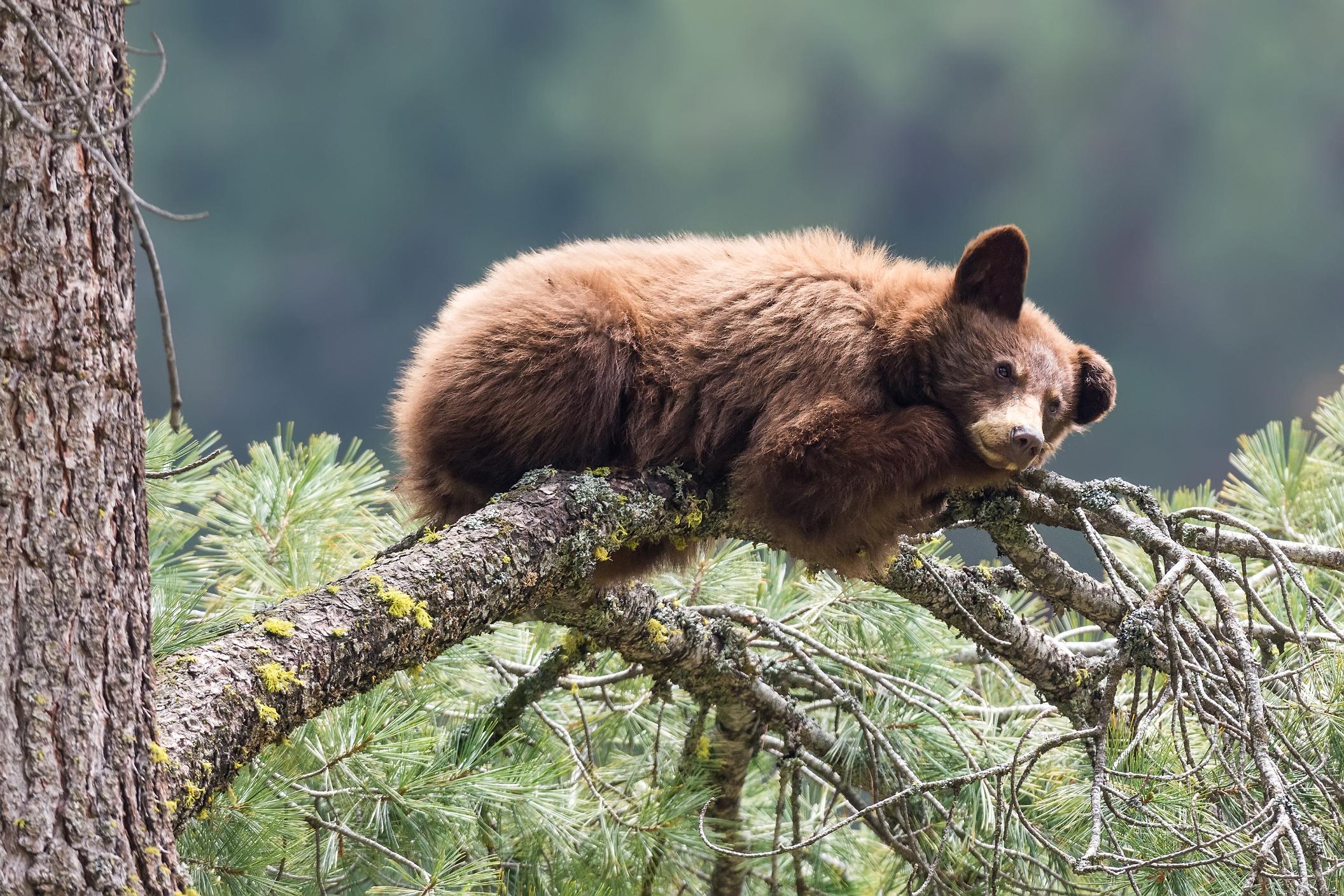
The parks are home to a wide variety of wildlife, including mountain lions and black bears. Chances of seeing the former are incredibly slim, but bears are more common - campers in particular need to take adequate precautions, such as storing food in bear safe containers. You might also see marmots, mule deer or Sierra Nevada bighorn sheep.
Numerous bird species live within the park, including peregrine falcons, golden eagles, rare great grey owls and vibrant mountain bluebirds. Many reptiles also call the park their home, including the rare Sierra Nevada yellow-legged frog and venomous rattlesnakes - the latter can be avoided if you keep to the trail and avoid long grasses.
Where to Stay in Sequoia and Kings Canyon National Park
It’s possible to stay within both Sequoia and Kings Canyon National Park, as there are a range of rustic lodges and campgrounds on offer. In Sequoia National Park you’ll find the Wuksachi Lodge, which tends to be open year-round - it’s located two miles from Lodgepole Village and four miles from Giant Forest Museum.
In Kings Canyon, John Muir Lodge and Grant Grove Cabins can be found within the Grant Grove Area - the former is open from spring through to autumn, the latter year-round. Cedar Grove Lodge services the Cedar Grove area.
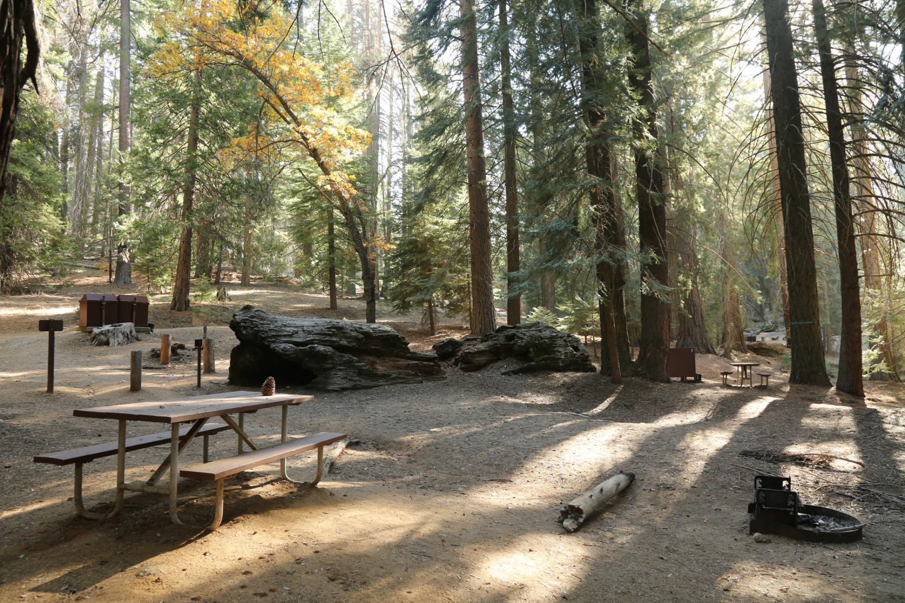
There are 14 campgrounds within the parks, all of which require reservations. Check the National Parks Service website to see which of these are open (some are currently closed due to winter storm damage).
Accommodation within the park gets booked up well in advance, but there’s lots of accommodation options available outside of the park. The picturesque town of Three Rivers, situated in the Kaweah River canyon, has a wide choice of options for sleeping and eating. We recommend Three Rivers Hideaway Campground for campers, and the off-grid Paradise Inn for a luxury option.
What to Eat in Sequoia and Kings Canyon National Parks
There are a handful of places to eat within Sequoia and Kings Canyon National Parks. Check out Wuksachi Pizza Deck in Sequoia National Park, where you can grab pizza and hot sandwiches. Grant Grove Restaurant, in Kings Canyon, offers substantial breakfasts so you can fuel up before hiking, and a range of lunch and dinner options including poke, quesadillas and locally-sourced trout sandwiches.
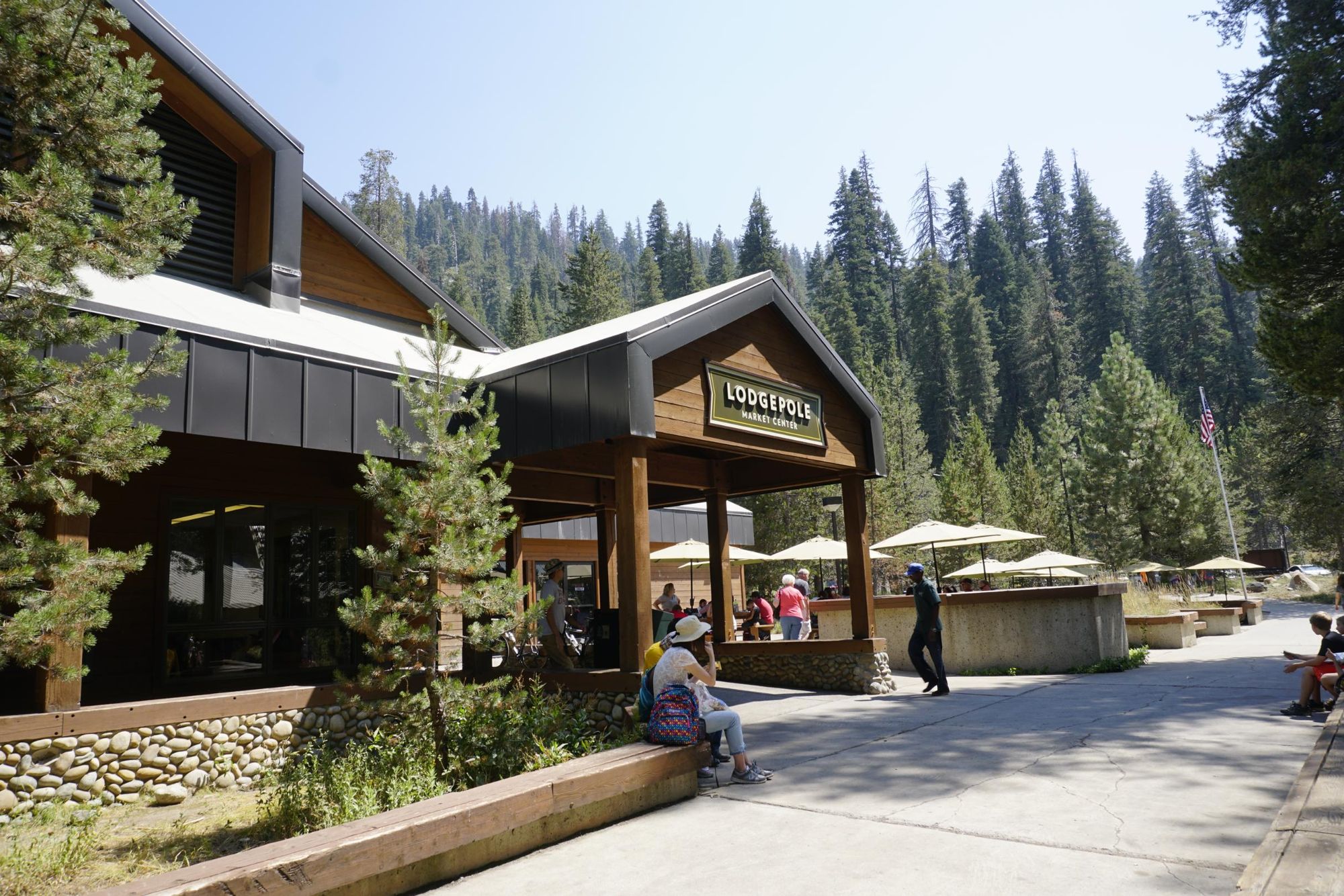
If you’re looking for food whilst you hike, make a stop at Lodgepole Grill, Market and Snack Bar (at Lodgepole Visitor Center) - you’ll be able to pick up sandwiches, salads and hiking snacks to go.
How to Get to (and Around) Sequoia and Kings Canyon National Parks
By Plane: The closest major airport to Sequoia and Kings Canyon National Park is Fresno Yosemite International Airport (FAT), about 90 minutes’ drive away. However, most visitors to the parks will fly into the busier Los Angeles International Airport (LAX) or San Francisco International Airport (SFO) - both located between four to five hours’ drive away - in order to visit more places along the way to the park.
By Train: Catch an Amtrak train to Fresno from Los Angeles (5 hours 37 mins) or San Francisco (4 hours 39 mins). From Fresno, rent a car or grab a shuttle to the parks - the latter is only possible during the summer months.
By Car: Reach the parks via State Route 180 (coming from San Francisco) or State Route 198 (from Los Angeles). Generals Highway connects these two routes and runs from north to south through Sequoia National Park and Kings Canyon. The Kings Canyon Scenic Byway runs east from Cedar Grove to Grant Grove, while the Mineral King Road takes you to the Mineral King area of Sequoia National Park.
Inspired? Check out our Hike the Great National Parks of the Western USA Adventure, which includes a trip to Sequoia and Kings Canyon.