
Looking for the best hikes in Norway? Norway is a dream hiking destination, its rugged terrain shaped by thousands of years of glacial erosion. Much of the landscape is dominated by mountains, with around two-thirds of the country shaped by towering granite peaks and deep fjords carved by glaciers. There are more than 1,000 fjords in Norway; narrow inlets of water encircled by sheer cliffs, some of which are UNESCO World Heritage sites. Nearly half of the country is located within the Arctic Circle, meaning it’s carpeted with snow for the vast majority of the year.
What’s striking about Norway is the emphasis it places on preserving its natural beauty, and making it accessible to travellers and locals alike. Home to 47 national parks—40 on the mainland and seven on the remote Svalbard archipelago—over 10% of Norway is protected land. Exploration of these pristine spaces is encouraged, with well-marked hiking trails serviced both by public transport and mountain hut accommodation. Norway also has a ‘right to roam’ (allemannsretten), meaning people are allowed the freedom to explore remote areas, and wild camp on uncultivated land.
Whether you’re trekking through the arctic tundra of the north, wandering the jagged coastline, or climbing stony peaks for fjord views, you’ll experience the unparalleled beauty the country has to offer. Our top 10 hikes in Norway reflect this diversity, taking you from the Lofoten Islands in the Arctic to the rugged Fjord Coast in the west.
1. Breiskrednosi Summit Hike, Naerøyfjord
2. Trolltunga (Troll’s Tongue) Circuit Hike, Hardangervidda
3. Galdhøpiggen Summit Hike, Jotunheimen National Park
4. Romsdalseggen Ridge, Romsdal Valley
5. Engi to Jashaugbu, Naerøyfjord
6. Ryten and Kvalvika Beach Circuit, Lofoten Islands
7. The Queen’s Route, Vesterålen
8. Pulpit Rock (Preikestolen), Lysefjord
9. Barden and Segla Summit Hike, Senja
10. Hornelen, Fjordkysten
It’s important to note that the route descriptions below are only short summaries, designed to inspire but not to serve any navigational purpose. They are not intended to guide you on the route and further mapping and planning will be required if you want to safely walk any of the trails featured. Norway has a permissive attitude towards hiking and wild camping, but if you lack experience in these areas, we recommend travelling with an experienced local guide.
10 of Norway’s Best Hikes, Mapped
We've mapped our favourite hikes in Norway, and graded them 'challenging' or 'moderate'. The majority are located in the country's northern reaches or in the Westfjords region. This is not to say that there aren't spectacular hikes in the rest of Norway - we just have a deeper knowledge of the regions mentioned.
10 of the Top Hikes in Norway
1. Breiskrednosi Summit Hike, Naerøyfjord
- Start/Finish: Drydal (out and back)
- Distance: 12.8 miles (20.7km)
- Walking time: 10-11 hours
- Difficulty: Challenging
- Best for: Sweeping Naerøyfjord views
At 1,189m (3,900ft), Breiskrednosi is the highest point on the Naerøyfjord; a narrow strip of water with vast, snow covered peaks rising up on either side of it. You begin the hike more or less from sea level, meaning it’s a climb of over 1,000m (3,280ft) across a single day - hence the 'challenging' rating.
Beginning from the trailhead near the small village of Drydal, you’ll hike inland, climbing up through meadows and forest, crossing glacial streams of meltwater. For much of the year, higher altitudes are carpeted in snow, which you’ll crunch over as you climb higher. There’s a final, steep push to the summit, but the views of the mirror-like fjord and its sheer sides make the effort worthwhile.

There’s an alternative route up to the top of Breiskrednosi, beginning in the town of Bakka and following the path up to Rimstigen (725m/2,378ft). It’s also a steep climb at the beginning, but once you reach the summit the path levels off, and you can hike along the top of the fjord to Breiskrednosi.
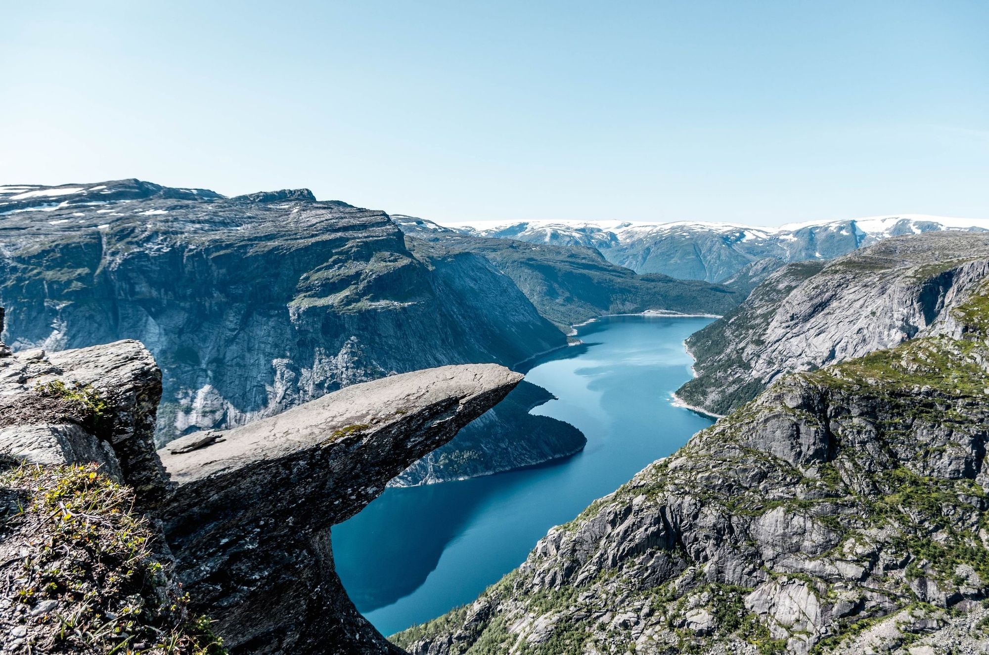
2. Trolltunga (Troll’s Tongue) Circuit Hike, Hardangervidda
- Start/Finish: P2 Skjeggedal (out and back)
- Distance: 16.7 miles (27km)
- Walking time: 10-12 hours
- Difficulty: Challenging
- Best for: the most iconic view in Norway
Jutting out 700 metres above Ringedalsvatnet lake, this dramatic cliff is located deep in the fjord heartland. In English, the name translates as ‘Troll Tongue’. Legend has it that a cheeky troll didn’t believe he would turn to stone when he stuck his tongue out to make fun of the rising sun, and as the sun came up he turned to stone.
The popularity of the hike to this ancient cliff has skyrocketed in recent years (thanks Instagram). The waymarked, 16.7 mile (27km) round-trip from Skjeggedal is now one of Norway’s most popular hiking trails. But be warned: this is not a walk in the park. On average, the route takes between 10 and 12 hours, with some steep ascents.
From the car park P2 Skjeggedal, walk up the narrow paved road to the trailhead at P3 Mågelitopp (you can save time by starting the hike there, but car parking spaces are very limited and require advance registration). Follow the trail as it climbs gently up a valley, before ascending more steeply up a rocky slope to Gryteskaret Pass; considered one of the most challenging stretches of the hike. From here you’ll continue to Trombeskar Pass and descend to a grassy valley. The trail hugs the shore of a small lake, before heading across a mountain plateau, with spectacular views of Ringedalsvatnet.
Climb up to Trolltunga on a rocky path, taking you up through patches of snow and across bridges over meltwater streams. You’ll pass a dam before Trolltunga comes into view, a jutting rock overlooking the lake. Such is the hike’s popularity, there’s likely to be a queue to perch on the rock and enjoy the view (and snap a few pics for the ‘gram). We recommend doing the hike at quieter times of year or setting off early to beat the crowds, so you can be there in time for sunrise.
3. Galdhøpiggen Summit Hike, Jotunheimen National Park
- Start/Finish: Spiterstulen mountain hut (out and back)
- Distance: 8 miles (13km)
- Walking time: 6-8 hours
- Difficulty: Challenging
- Best for: Bagging Norway’s highest peak
At 2,469m (8,100ft), Galdhøpiggen is the tallest mountain in Norway. It’s located in the majestic Jotunheimen mountain range, which translates as ‘Land of the Giants’ and lives up to its name, with more than 250 peaks rising higher than 1,900m (6,233ft). Galdhøpiggen dominates the landscape, with a curved ridgeline up to the summit.
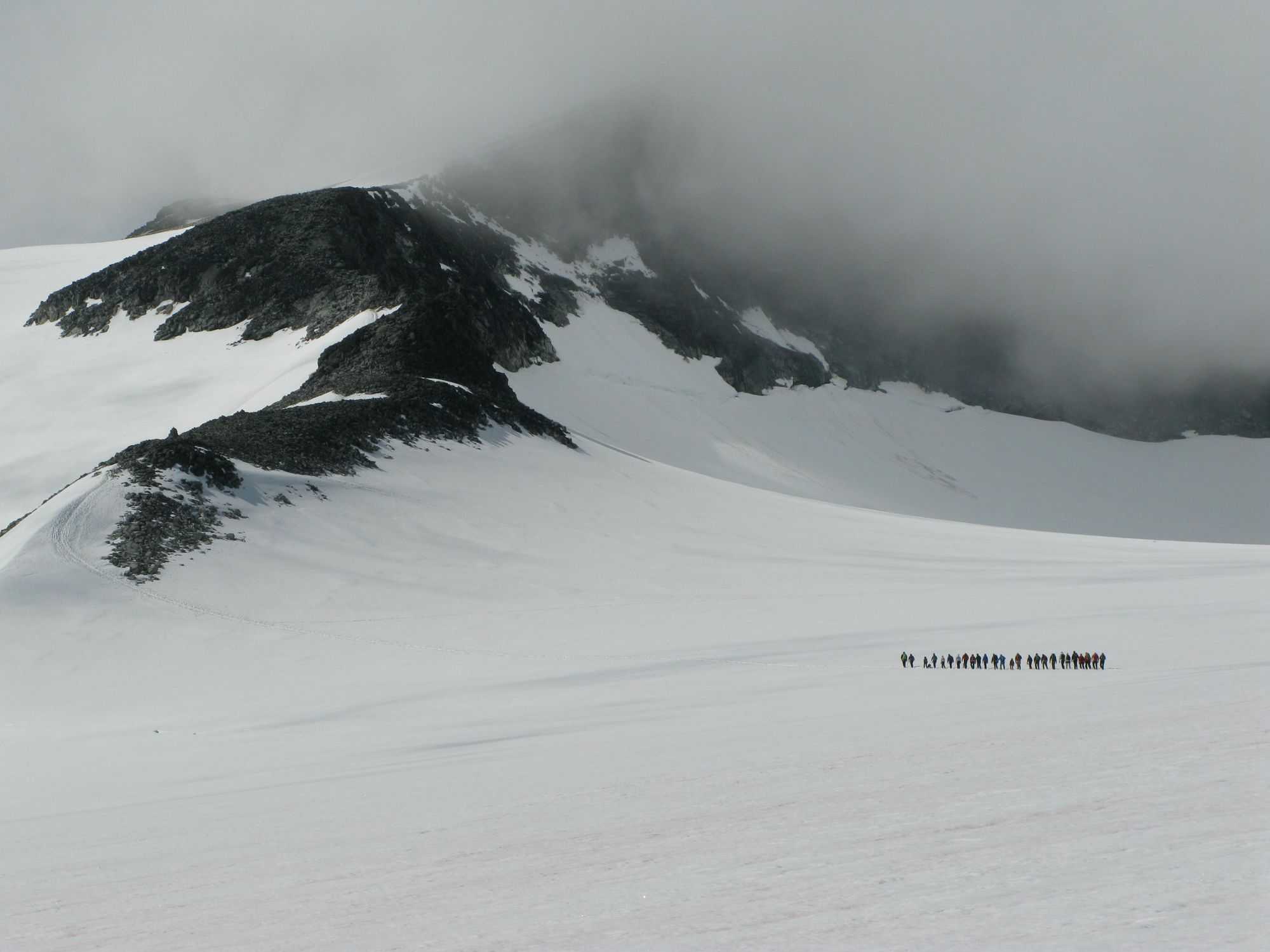
There are two routes up to the summit. We’ve listed the most popular, from Spiterstulen mountain hut, a longer hike with around 1,300 metres (4,265ft) of ascent. There is an alternative route which begins at Juvvasshytta mountain hut and crosses the Styggebreen Glacier - it requires the use of ropes, crampons and a trained guide.

The hike begins near Spiterstulen hut, located at 1,100m/3,609ft. You’ll follow a marked trail through Alpine tundra, threaded with small streams. It’s fairly relentless uphill hiking - 1,300m (4,265ft) of ascent overall - so take some breaks to enjoy the view. As you climb higher, the tundra becomes screel, carpeted in patches of snow.
The trail takes you along a rocky ridge and up two smaller ‘false summits’, Svellnose (2,272m/7,454ft) and Keilhaustopp (2355m/7,726ft). It’s a steep hike up snow-covered rocks and boulders to the very top of Galdhøpiggen from here. Enjoy the panoramic view of the Jotunheimen Mountains and glaciers - you’ve earned it - before the long trek back down.
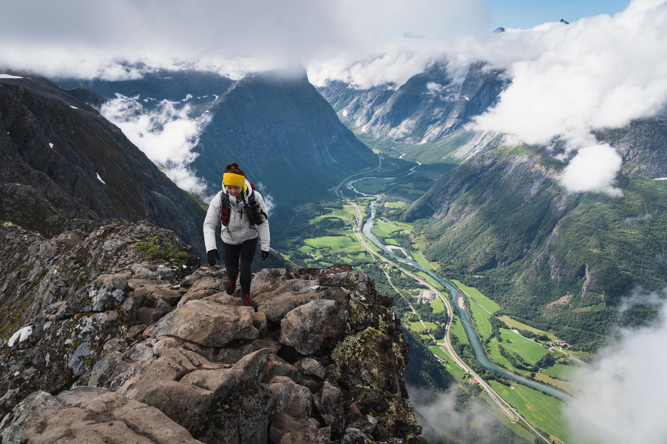
4. Romsdalseggen Ridge, Romsdal Valley
- Start/Finish: Romsdalseggen trailhead (circuit)
- Distance: 6.4 miles (10.3km)
- Walking time: 6-8 hours
- Difficulty: Challenging
- Best for: Rugged ridgelines
The Romsdalseggen is widely considered to be one of Norway’s most beautiful ridge hikes. It begins with a scenic bus ride from the Norwegian Mountaineering Centre (Norsk Tindesenter) in Åndalsnes to the trailhead. The path follows the Tverrelva River, signposted by red T’s. At Hestheia, a rounded hill, the trail steepens as it climbs towards the ridge.
At the top, the towering Trollveggen cliff, Europe’s highest vertical rock face, dominates the view, along with the Dalsida (a valley and protected landscape), and the jagged peaks of Romsdalshorn and Store Venjetind. Looking southwest, you can see the famous mountains of Reinheimen National Park, while the Rauma River winds through Romsdalen Valley below.
Continuing along the ridge, the trail narrows and descends toward Halsaskaret, with a steep section that requires light scrambling, aided by chains. At 1,216m (3,989ft), Mjølvafjellet marks the highest point of the hike. Afterward, the ridge broadens, and there’s a gentle descent to Nesaksla, a viewpoint with a restaurant and panoramic views over the town of Åndalsnes. The final leg of the hike descends the Romsdalstrappa stone steps back to the town - or if you’re tired, you can ride back down on the Romsdalsgondolen, a mountain cable car.
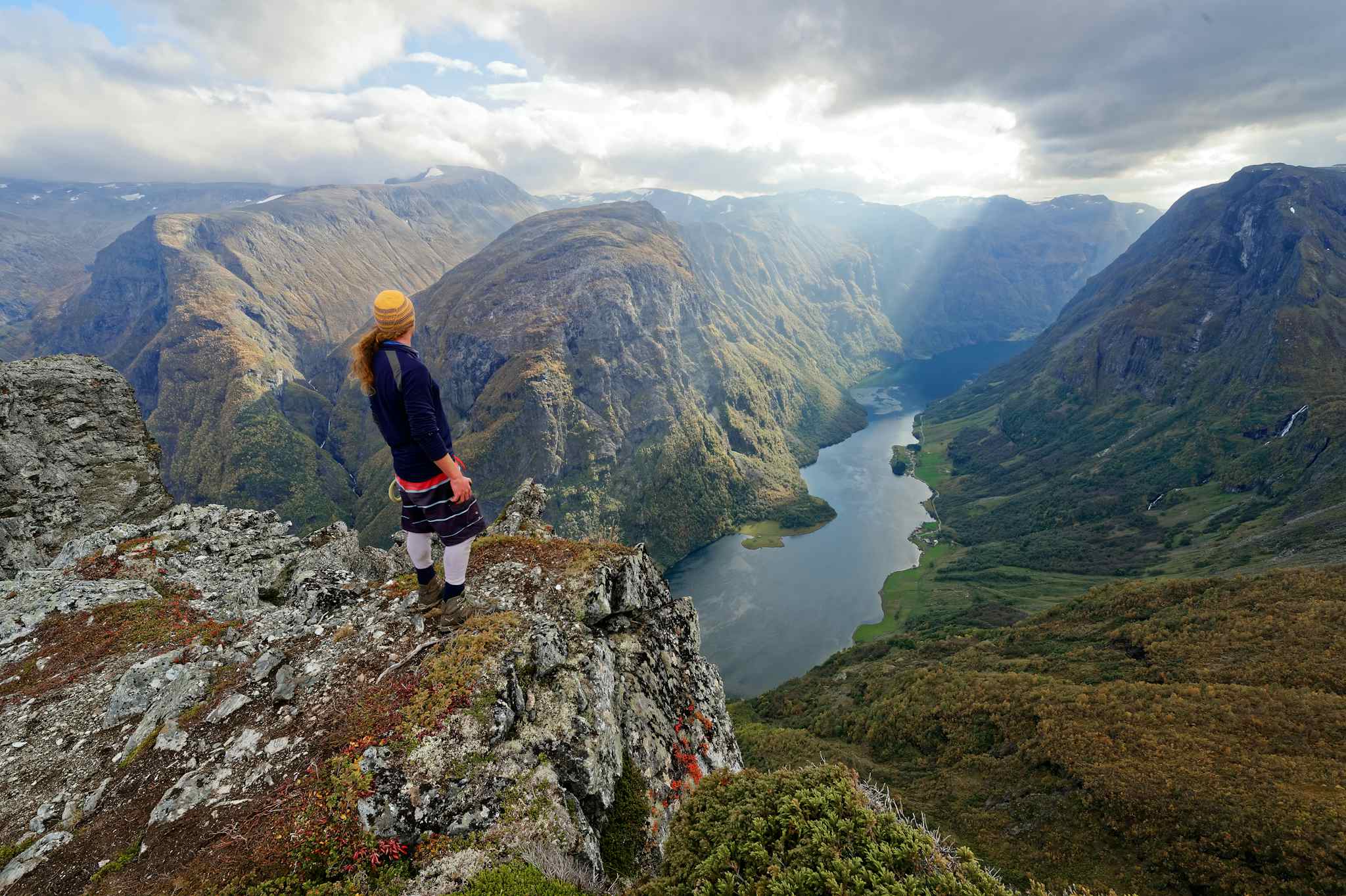
5. Engi to Jashaugbu, Naerøyfjord
- Start/Finish: Engi/Jashaugbu (point to point)
- Distance: 17.3 miles (28km)
- Walking time: 6-7 hours
- Difficulty: Challenging
- Best for: Weekend hut-to-hut hiking
Also known as the Fresvik to Jordalen Heritage Hike, this hiking trail takes you along the old road linking the towns of Fresvik and Jordalen. It’s quieter than some of the more popular hikes on this list, taking you through the backcountry of the Nærøyfjord hiking area. You’ll begin at Engi, a small farming village, and follow a well-marked path to Tundalsselbøen in the verdant valley of Tundalen. Cross the river at Klepp. At the end of the valley, the path leads up to Rjupeskard and across the Gryteskarvbreen glacier.
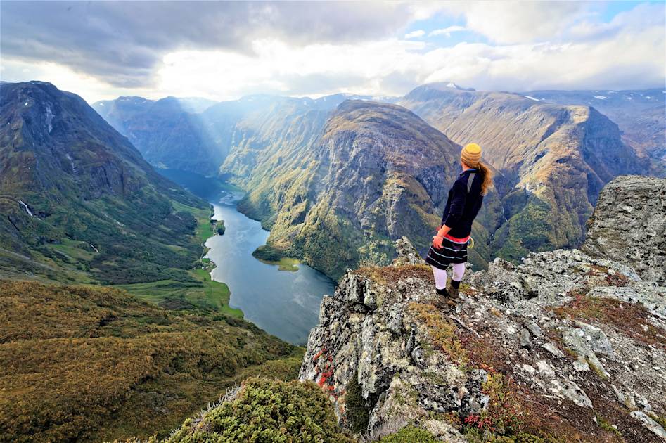
Here, if you want to take a look at the Fresvikbreen glacier, take the right fork (it’ll take you up to an hour up to an hour to read the glacier). If not, follow the singposted path to 'FresvikJordalen'; it continues along Langafonnvatnet Lake and downhill towards the Frevikvarden cairn, most likely set up during the Black Death. From here, it’s roughly another half hour of walking until you reach Jashaugbu, a mountain hut run by the Norwegian Hiking Association (DNT) - you can borrow the key from the tourist information office in Vik.
You can arrange a pick up from Jashaugbu, which is accessible by dirt road, stay overnight and hike back the way you came or continue on the route to the small village of Jordalen. If you choose to hike this route with a guide (which is recommended), transportation to and from trailheads will be arranged for you.
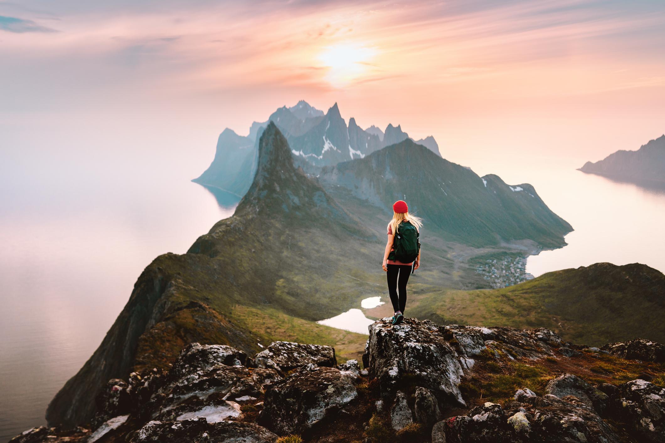
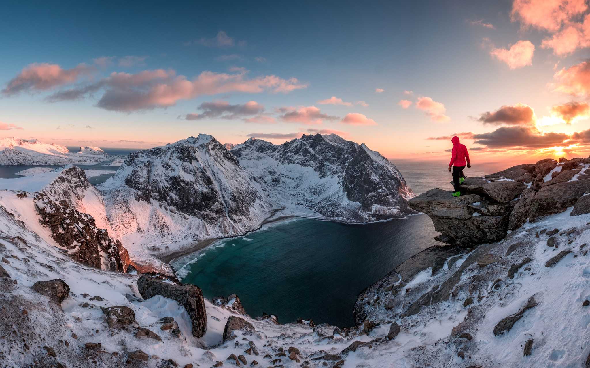
6. Ryten and Kvalvika Beach Circuit, Lofoten Islands
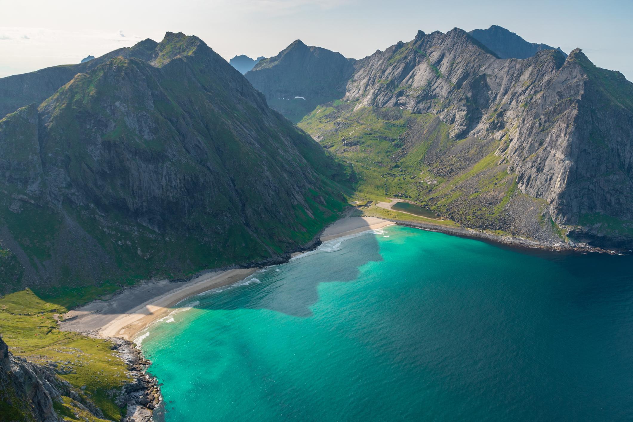
- Start/Finish: Ryten/Kvalvika Beach Trailhead (circuit)
- Distance: 5.6 miles (9km)
- Walking time: 4-5 hours
- Difficulty: Moderate
- Best for: Arctic beaches
Accessible only on foot, isolated Kvlavika Beach is surrounded by steep cliffs. The hour-long trail to the beach is a popular hike on Lofoten, but we recommend incorporating an ascent of Ryten (543m, 1,781ft), a nearby clifftop, to create a circuit hike. The trailhead is on the side of the 806 road from Fredvang - a grassy path through a wooded area.

Follow the trail past two lakes, veering left around the right hand shore of the second one. You’ll head up a rocky path to a boulder field. You’ll see two large boulders where several paths meet - head straight on for the summit of Ryten. After admiring the views of Kvalvika Beach and the ocean beyond, retrace your steps down towards the boulders. Now, turn right to head down to the beach via a grassy path and a series of wooden walkways over the boggy ground. Brave a dip in the icy waters before taking the trail from the beach through birch forest to the start point.
7. Dronningruta (The Queen’s Route), Vesterålen
- Start/Finish: Nyksund (circular)
- Distance: 9.3 miles (15km)
- Walking time: 4-6 hours
- Difficulty: Moderate
- Best for: a bracing coastal hike
The Queen’s Route runs between the historic fishing villages of Nyksund and Stø on the island of Langøya, in the Vesterålen archipelago. It was named after Queen Sonja, who first hiked this route in 1994 - but has been used by the islanders for far longer than this. It consists of two routes - a 6 mile (10 km) high route with an elevation gain of 900m (2,950ft) and a 3 mile (5km) low route, tracing the route along the shoreline. Most people hike it as a round trip, taking the high route to Stø and following the easier route back to Nyksund.
The path picks its way along the coastline, climbing steadily upwards over moorland and rocky outcrops. You’ll pass the white sands of Skipssanden and climb up the rocky ridge to Finngamheia - the steepest sections are equipped with ropes. This is the highest point on the trail at 448m (1,469ft), with panoramic vistas of the Atlantic Ocean and the rugged northern coastline of Langøya. Climb downhill to Stø, where you can stop for lunch.
The ‘low route’ back takes you across marshland and deserted sandy beaches, with a final uphill section before Nyksund for good measure.
8. Pulpit Rock (Preikestolen), Lysefjord
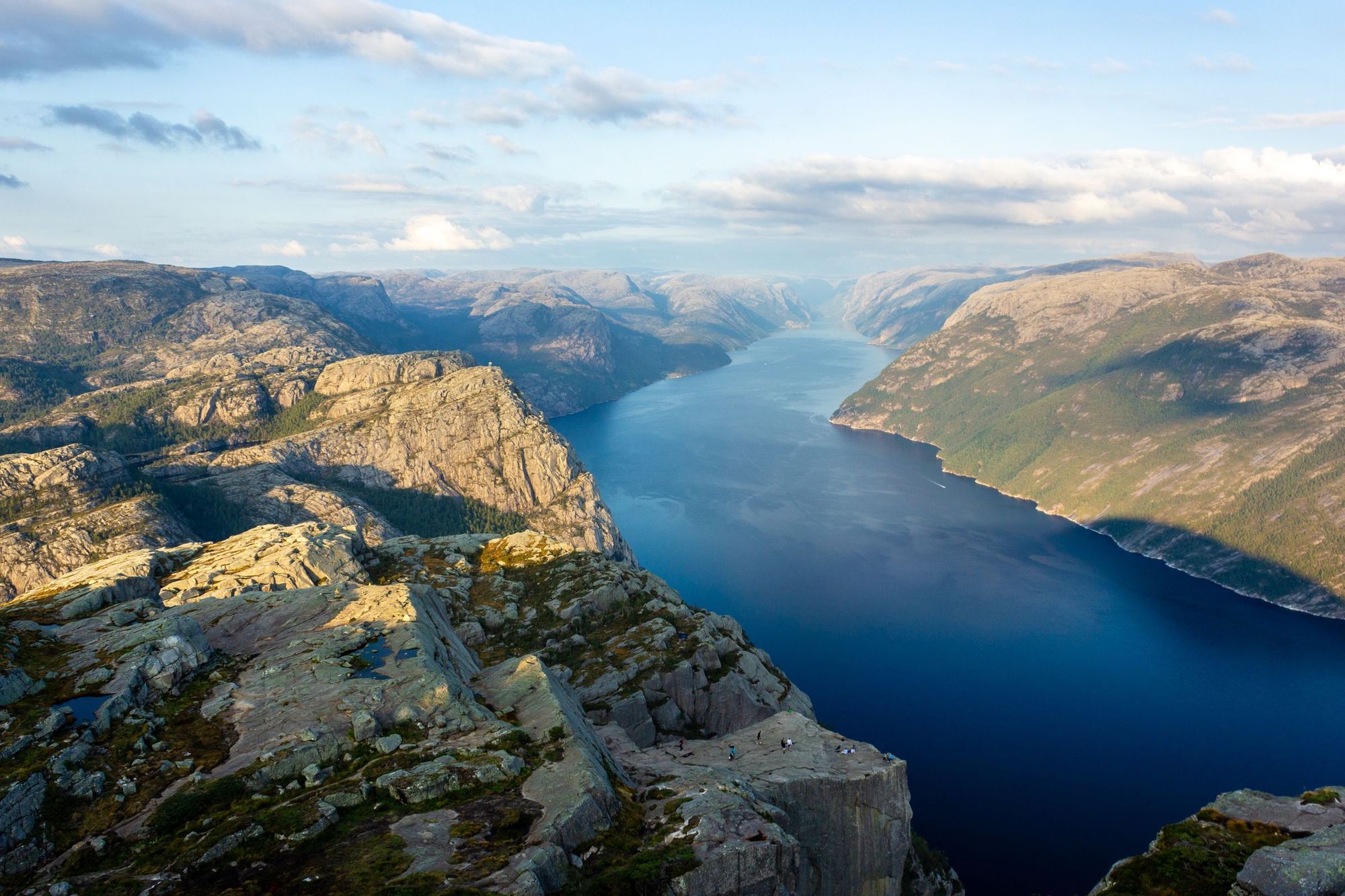
- Start/Finish: Preikestolen trailhead (out and back)
- Distance: 5.4 miles (8.8km)
- Walking time: 3-4 hours
- Difficulty: Moderate
- Best for: Dizzying views
Vistas don’t get much more dramatic than this. Towering a dizzying 604 metres over the Lysefjord, Preikestolen (that’s Pulpit Rock in English) is an ancient mountain plateau formed by the expansion of ice thousands of years ago. Tourists first ventured here at the beginning of the 20th century and since then it has become one of Norway’s most famous landmarks, thanks to its sheer beauty and scale.
Hike to the vertigo-inducing, 25 by 25m ledge from Preikestolen Mountain Lodge. It takes most people around three or four hours to complete the trail. The path ascends around 450m, winding through the forest and climbing up through rocks. It’s been well maintained, with wooden walkways over boggy areas and stone steps built by Nepalese sherpas. There are some wild swimming spots along the way – great if you need to cool off. Once you reach the top, you’ll see for yourself why this spot frequently features on lists of the world’s most spectacular viewing points: it’s got to be one of the best hikes in Norway.
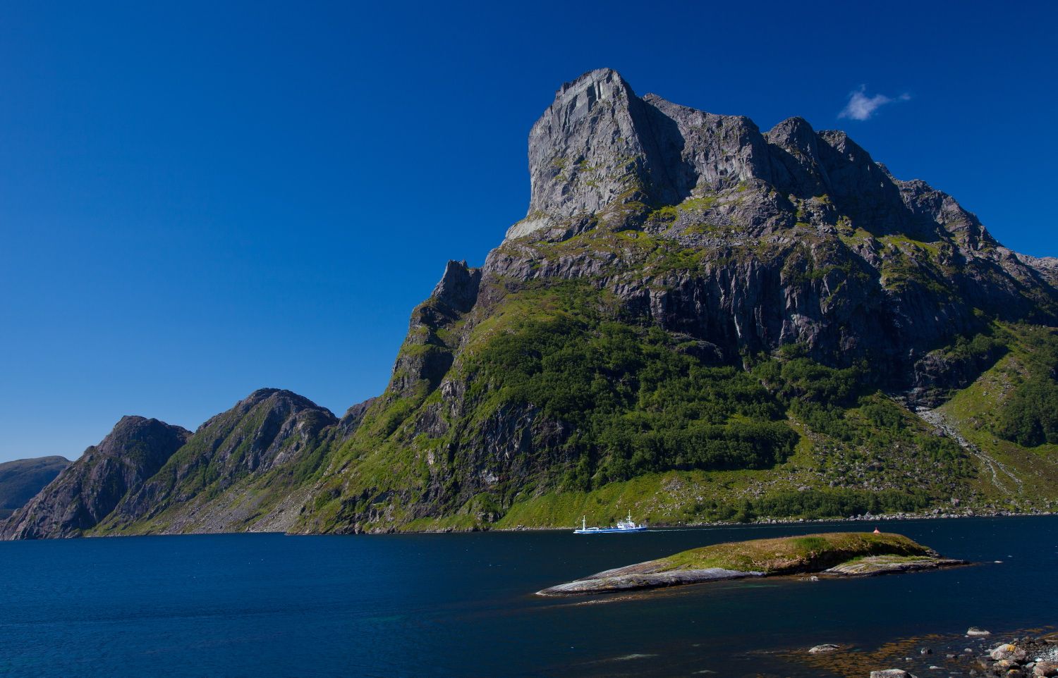
9. Barden and Segla Summit Hike, Senja
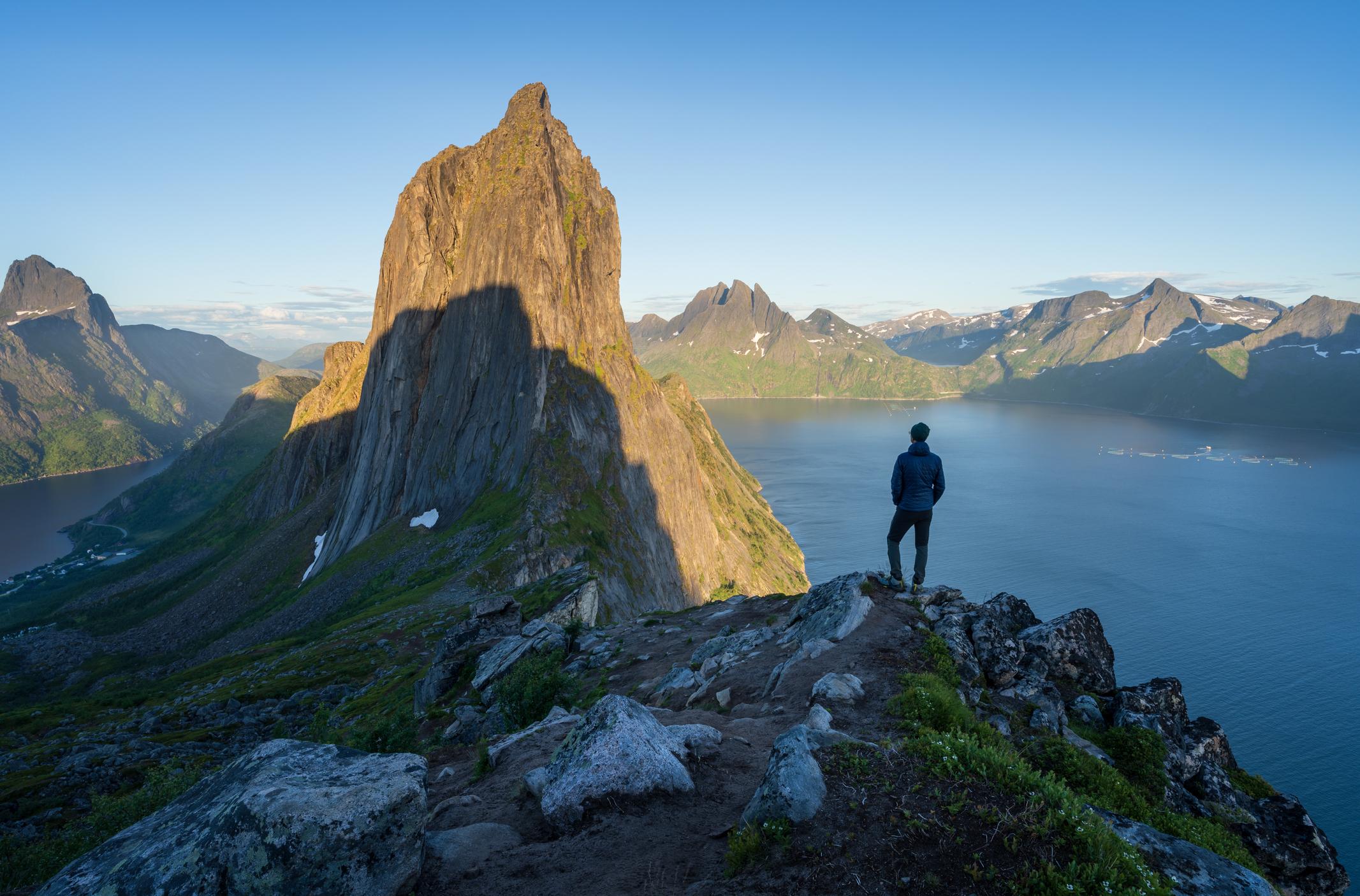
- Start/Finish: Fjorgård car park (circuit)
- Distance: 5.1 miles (8.2km)
- Walking time: 5 hours
- Difficulty: Challenging
- Best for: Exploring a lesser-known Norwegian island
Senja is the second largest island in Norway, located off its Northern Coast. It’s less well known than the Lofoten archipelago but equally striking, with jagged rock peaks sloping steeply down to white sand beaches. One of the most popular hikes on Senja is an ascent of its highest point, Barden, at 659m (2,162ft) - we recommend extending the hike to summit the adjacent peak, Segla (640m/2,099ft), as well. Although both mountains seem small, they’ve got a high prominence and you start hiking more or less at sea level - so you’re in for some long climbs.
Beginning at the trailhead, hike up a gravel path until you reach a signposted fork in the trail: ‘Segla’ to the right; and ‘Barden’ to the left. You’ll follow a walkway of wooden planks over boggy ground, until the views open up and you begin to climb uphill. There’s an exposed rock face requiring light scrambling, but after ascending to the top, the trail flattens out and leads gently up to Barden summit. Enjoy the panoramic views of Mefjord and Ørnfjord, before heading along a rocky ridge towards Segla.
Then there’s another uphill climb to Segla’s summit, and more fjord and ocean views to enjoy. There’s a steep descent down a dirt path through boulder fields, before the trail flattens, leading you through a valley and birch woodland to the trailhead.
10. Hornelen, Fjordkysten
- Start/Finish: Hunskår/ Berleneset (point to point)
- Distance: 7.2 miles (11.7km)
- Walking time: 6-8 hours
- Difficulty: Challenging
- Best for: Spectacular sea and fjord views
Hornelen is Europe’s tallest sea cliff at 860m (2,821ft), dropping sharply down into the Nordfjord below - and offering up spectacular views of the rugged, windswept coastline. There are two routes up to the top - a steeper, more challenging climb from Hunskår or a longer, more gradual ascent from Bremanger - which can either be done as out and back hikes, or combined as a point to point hike.
From Hunskår, you’ll be climbing up over rough grassland, then following cairns and red ‘T’ symbols uphill across a stony plateau (some basic route-finding experience is necessary). You’ll pass by small pools, before reaching a larger lake surrounded by a sheer rock wall. You’ll follow a steep path up to the summit, where you’ll have an exceptional view of the Fjordkysten (Fjord Coast) - deep royal blue fjords, stony mountains and small islands in the ocean. Descend via the gentler route towards Berleneset, or return the way you came.
For those looking for something even more intrepid, some via ferratas have recently been opened taking you up and along the sheer cliffs or Hornelen - these can only be done with a guide.
Bonus Hiking Idea - Hike to a Glacial Ice Cave in Svalbard
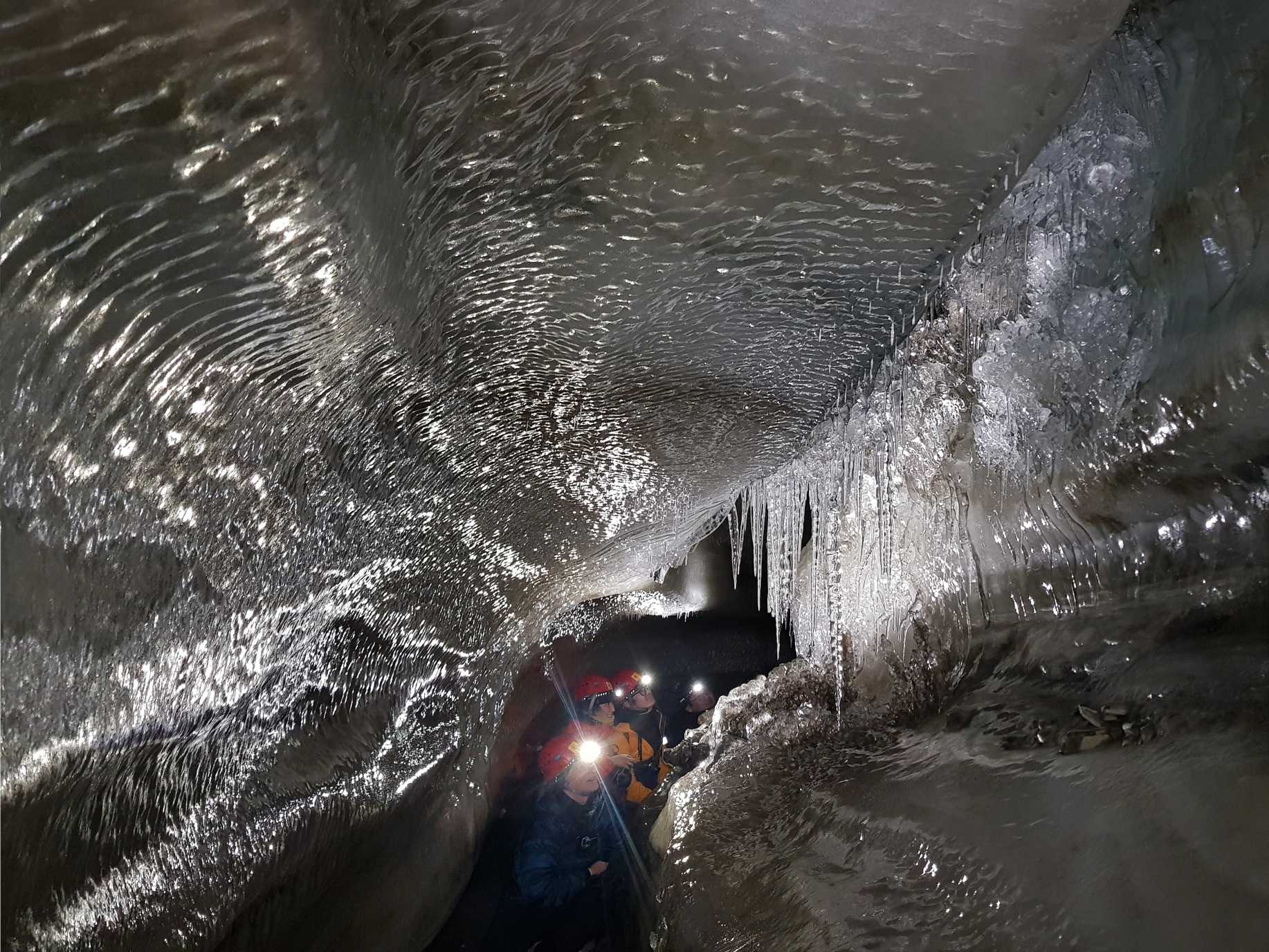
- Start/Finish: Nybyen (out and back)
- Distance: 2.4 miles (4km)
- Walking time: 3-4 hours
- Difficulty: Moderate
- Best for: Ice lovers
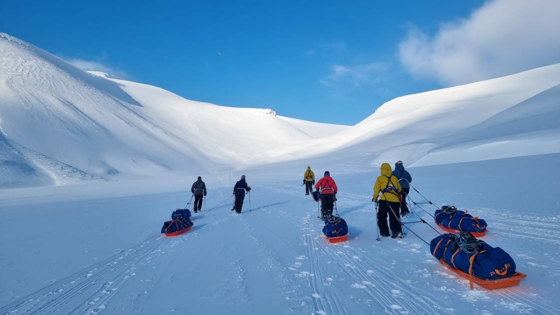
Svalbard, an island high up in the Norwegian Arctic, is a pristine wilderness. We haven’t included any hiking routes from Svalbard on the list as it’s pretty much impossible to hike independently. Due to the threat of polar bears, travellers are only allowed to leave the main settlement of Longyearbyen with an armed guard.
We wholeheartedly recommend booking yourself on a guided hiking trip through Svalbard’s tundra, mountain and fjords. It’s also possible to base yourself in Longyearbyen and do a couple of different day hikes. One of the most unique hiking trips from Longyearbyen is to the nearby Larsbreen Ice Cave.
With your guide, you’ll hike uphill through the main town and the suburb of Nybyen, mountain peaks in front of you and the town receding below you. After hiking uphill for around 350m (1,148ft) you’ll reach the cave. Strap spikes onto your boots and enter the frozen underworld located beneath Larsbreen Glacier. You’ll wander through a labyrinth of tunnels studded with ice crystals. Once you’ve explored, head back downhill to the warmth and comfort of your guest house.
When is the Best Time to Hike in Norway?
The hiking season in Norway is considered to be from May to September, but the best month to hike depends on what region you’re heading to, and whether you’re looking to escape the crowds.
Summer (from June to August) is peak hiking season in Norway. The weather is warm, the days are long (with near 24-hour daylight in the Arctic Circle due to the midnight sun), and the trails are usually free of snow. This is the best time for hiking in areas like the fjords, Lofoten Islands, and Jotunheimen National Park. However, popular trails - such as Trolltunga - will be crowded during these months.
September, in early autumn, is one of our favourite months to hike in Norway. Although the weather is more unpredictable and the days shorter, the vibrant autumn colours and fewer tourists make up for it. From October to April, most trails are harder to access due to snow (and some roads to trailheads might be closed). However, there are some amazing opportunities for snowshoeing and winter hiking in Norway - something we’d recommend you do with an experienced guide.
During May, many trails at higher elevations are still carpeted in snow. However, this is a pleasant time of year for lower elevation walks - and the waterfalls will be more dramatic due to extra meltwater.
What Animals Live in Norway?
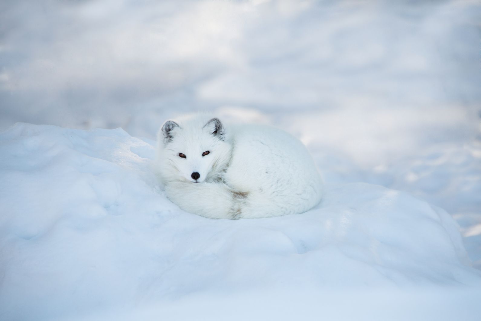
If you go wildlife watching in Norway, there’s a whole lot of different animals you can see, from large mammals to birds of prey. You’ll find reindeer in many parts of the country, and Norway also has one of the largest elk populations in Europe. Eurasian lynxes roam the forests, whilst Arctic foxes live in the forests and tundra of, well, the Arctic. Travel further north to the island of Svalbard and you’ll even find polar bears.
The white-tailed eagle is the largest bird of prey in Norway, and can often be found along its coasts. Puffins also call the coast their home, especially in the country’s northern reaches. Gyrfalcons, the largest falcon species, can be found in Arctic Norway.
Where to Stay in Norway
There are plenty of accommodation options for hikers in Norway, ranging from family-run guesthouses to upmarket hotels. You can also choose a farm stay, which offers accommodation on a working farm, and includes locally sourced ‘field to fork’ meals. Norway also has a range of cabin accommodation, from the red painted ‘rorbu’ (fishermen’s huts) of the Lofoten Islands to the wilderness cabins run by the DNT.
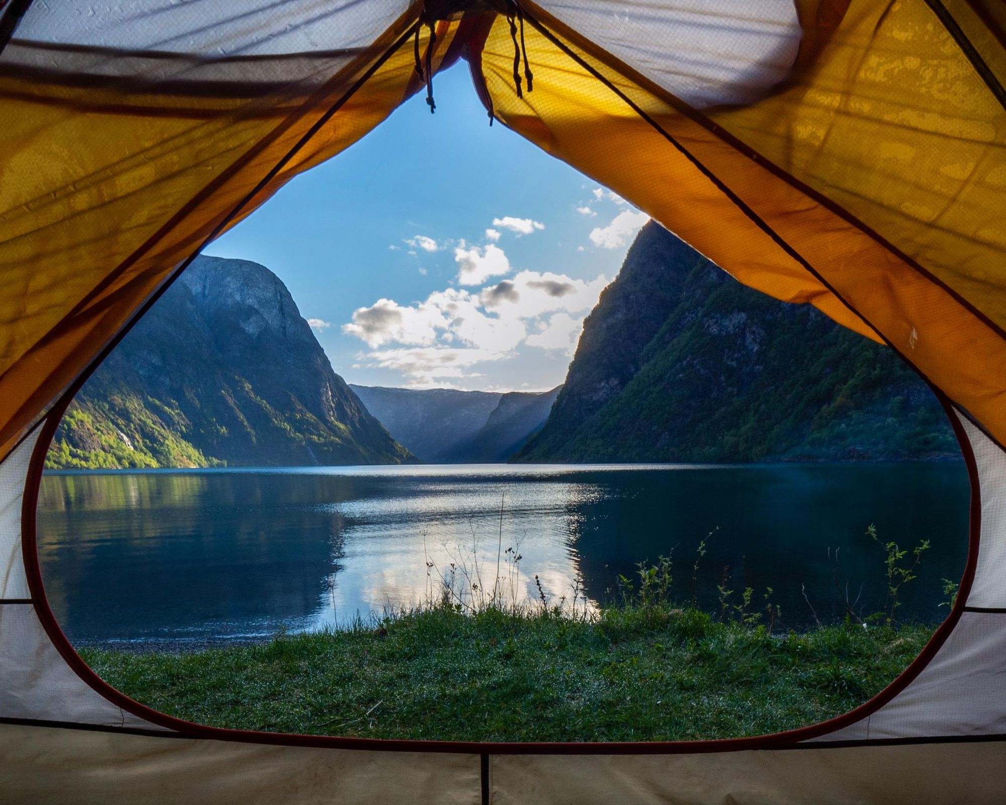
If you want a full immersion in nature, we recommend wild camping - Norway has the ‘right to roam’ ( ‘allemannsretten’), meaning hikers are allowed to camp on uncultivated land.
What to Eat in Norway

Norwegian cuisine is influenced by its coastal geography and its need to preserve food gathered in the warmer months to last through the cold winters. It’s known for its high quality salmon - gravlaks, salmon cured with dill, sugar and salt, is particularly good. Other popular traditional seafood dishes include lutefisk (stockfish preserved in a lye solution) served with bacon cubes and potatoes, and fiskesuppe, a creamy fish soup served with shrimp and potatoes.
Reindeer is also traditionally eaten in Norway, but the country’s national dish is fårikål, a slow-roasted lamb and cabbage stew. Brunost, a brown cheese with a sweet, caramelised flavour, is often eaten with breakfast, while open-faced sandwiches known as smørbrød are popular for lunch.
Norway also has a strong baking tradition, whether that’s cinnamon rolls (kanelboller) eaten with coffee, or kvæfjordkake, a cake made of vanilla sponge, whipped cream, toasted almonds and crunchy meringue.
How to Get to (and Around) Norway
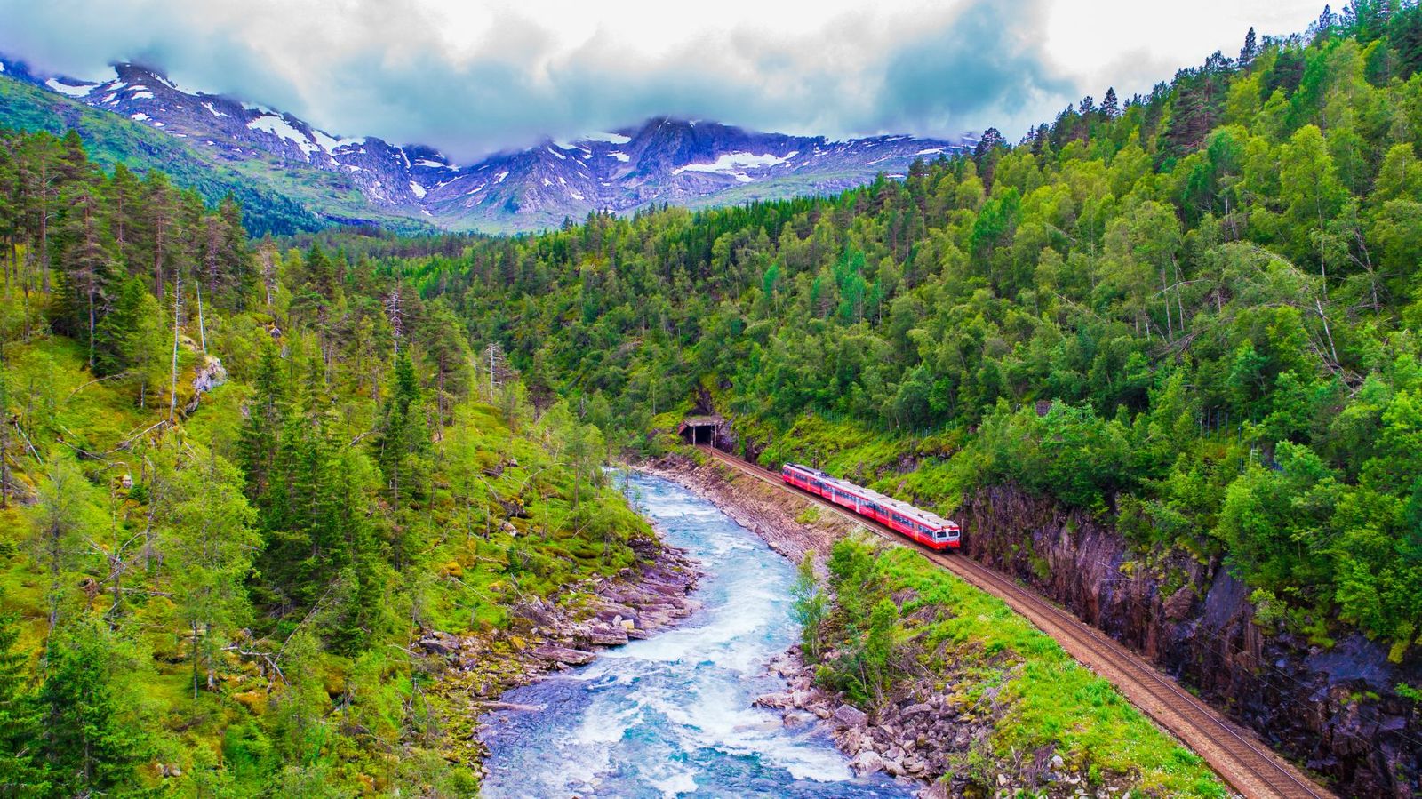
By Train: Norway is well-connected by train both domestically and internationally. Routes like the Oslo-Gothenburg or Oslo-Stockholm line allow travel from the neighbouring countries of Sweden or Denmark. Norway’s rail network, run by Vy, links major cities such as Oslo, Bergen, Trondheim, and Stavanger. The Bergen Line (from Oslo to Bergen) offers breathtaking views of - and access to - the mountains and fjords. Meanwhile, the Flåm Railway runs from Myrdal to the village of Flåm at the head of the Aurlandsfjord - it’s considered one of the most scenic railway journeys in the world.
By Bus: Norway has an extensive bus network. Long-distance buses, such as those operated by Nor-Way Bussekspress and Vy, connect major cities and remote towns. You can also travel internationally to Sweden and Denmark via international services such as FlixBus.
By Plane: Norway's main international airport is Oslo Gardermoen Airport, located just outside the capital. Other major airports include Bergen Airport and Trondheim Airport. Airlines such as SAS, Norwegian, and Widerøe offer both international and domestic flights.
Inspired? Check out our Adventures in Norway, visiting the mountains and fjords.