


The best hikes in Italy are sprinkled all over this enchanting country; where Europe’s most iconic coastlines meet its most distinctive mountains and the continent’s most beloved, famed gastronomy.
The Italian composer Giuseppe Verdi once said “You may have the universe if I may have Italy,” and it’s clear why he would strike such a deal. This is a country as diverse, stunningly beautiful and utterly indulgent as anywhere in the world.
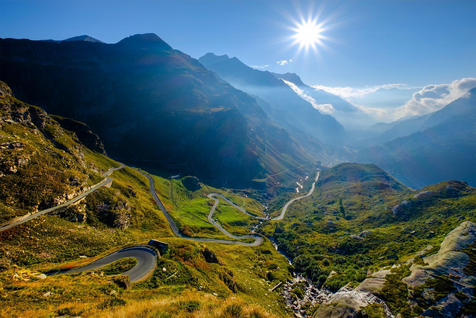
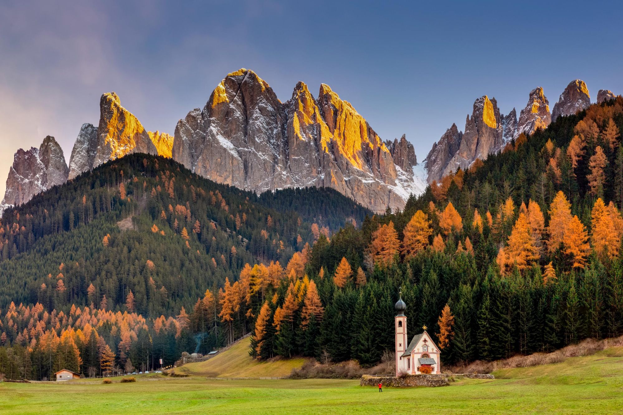
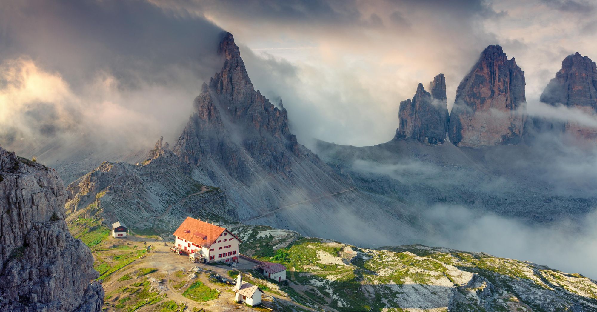
In the north of the country, the Matterhorn, or El monte Cerino as it’s known in Italia, marks the border with Switzerland. In the Dolomites, though, you have some of the most distinctive rock formations in the world, stretching up sharply, like rugged, rocky fingers, up above mountain towns drenched in WW1 history.
In the centre of the country, around Abruzzo, you’ll find hills occupied by bears and wolves, where regenerative rewilding projects are restoring the landscape. While further south sits some of the most famous coastline in the world. High hiking routes hug the clifflines of the Amalfi Coast, while trails up volcanoes like Sicily’s Mount Etna reward walkers with 360-degree viewpoints.
You may have the universe if I may have Italy.
From the Prosecco hills to the mountain huts, agriturismos and bustling cities, this is also a land world renowned for its food - angelic levels of pizza and pasta.
So, when putting together our list of the best hikes in Italy, we’ve sought to represent all that diversity, from the Italian islands and mountain summits to coastlines and lush national parks. We've also focused on trails exclusively in Italy (and thus, not included excellent routes like the Matterhorn Circuit).
- The Alta Via 1, Dolomites
- Sentiero del Pellegrino, the Italian Riviera
- The Tratturo Magno, Abruzzo
- Mount Etna, Sicily
- The Selvaggio Blu, Sardinia
- The Prosecco Trail, Veneto
- Alta Via Canavesana, Gran Paradiso National Park
- Sentiero Degli Dei, Amalfi Coast
- Punta Gnifetti, Monte Rosa
- The Alta Via 2, Dolomites
It’s important to note that these route descriptions are only short summaries, designed to inspire but not to serve any navigational purpose. They are not intended to guide you on the route and further mapping and planning (or, ideally, a local guide) will be required to safely walk any of the trails featured.
Here’s our guide to the best walks in Italy, when to go hiking and where to stay.
The Best Hikes in Italy: Mapped
The best hikes in Italy are spread out around the country and islands. While this map does not show the exact route or starting point of those hikes featured in this list, it does give you an idea of how they are distributed around Italy.
10 of the Best Hikes in Italy
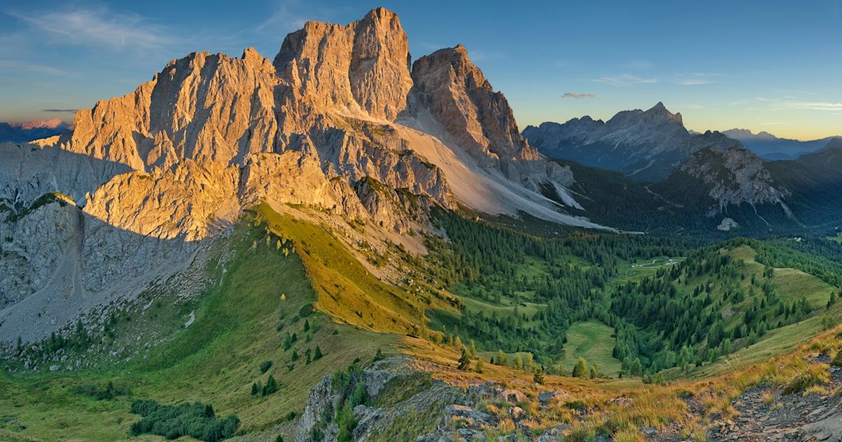
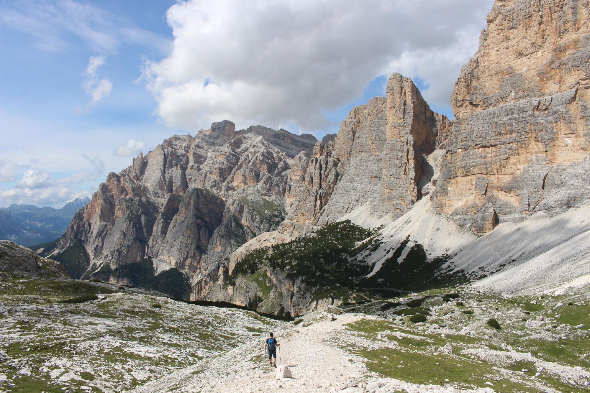
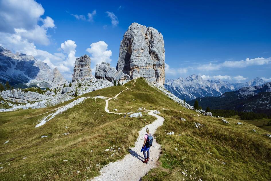
1. The Alta Via 1, the Italian Dolomites
- Start/Finish: Lago di Braies to La Pissa bus stop (multi-day hike)
- Distance: 75 miles (120km)
- Walking time: 8-11 days
- Difficulty: Moderate/Challenging
- Best for: A first hut-to-hut in the Dolomites
The phrase ‘Alta Via’ translates as “High Route”, and so, you’ll actually find a lot of different ‘Alta Via’ routes across the country. This one (as well as the Alta Via 2 in the Dolomites, which we’ll get to later), is the best known in the country. It’s the perfect introduction to hut-to-hut hiking in the Dolomites.
The Dolomites are like no other mountains in the world. They spike, jut and rise like they intend to puncture the sky. Close to the Austrian border, in the northeast of Italy, this relatively straightforward, but remarkably beautiful route, is well waymarked and takes you through most of the range. Roughly 80% of the Dolomites can be seen from the Alta Via 1 trail - from the famous Cinque Torri to the sprawling greenery below the Falzarego pass.
You’ll go village to village, refugio to refugio, staying in high quality huts (particularly on the north section of the route) and eating superb mountain cuisine as you go. There’s WW1 history along the way, as the area was the site of a huge, high-altitude battle between the Austro-Hungarian Empire and Italy, so expect to pass ruined barracks and trenches in amongst the scenery.
To walk the AV1, you’ll need to hike between five and eight hours each day (with a lot of ups and downs) for eight to 11 days. There’s no technical hiking, unless you choose to add on a via ferrata. You can book a private room or a bed in a hut dormitory, but be sure to book in advance.
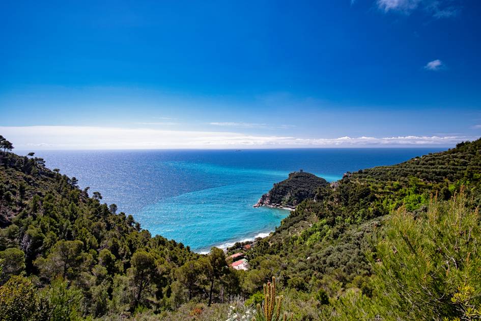
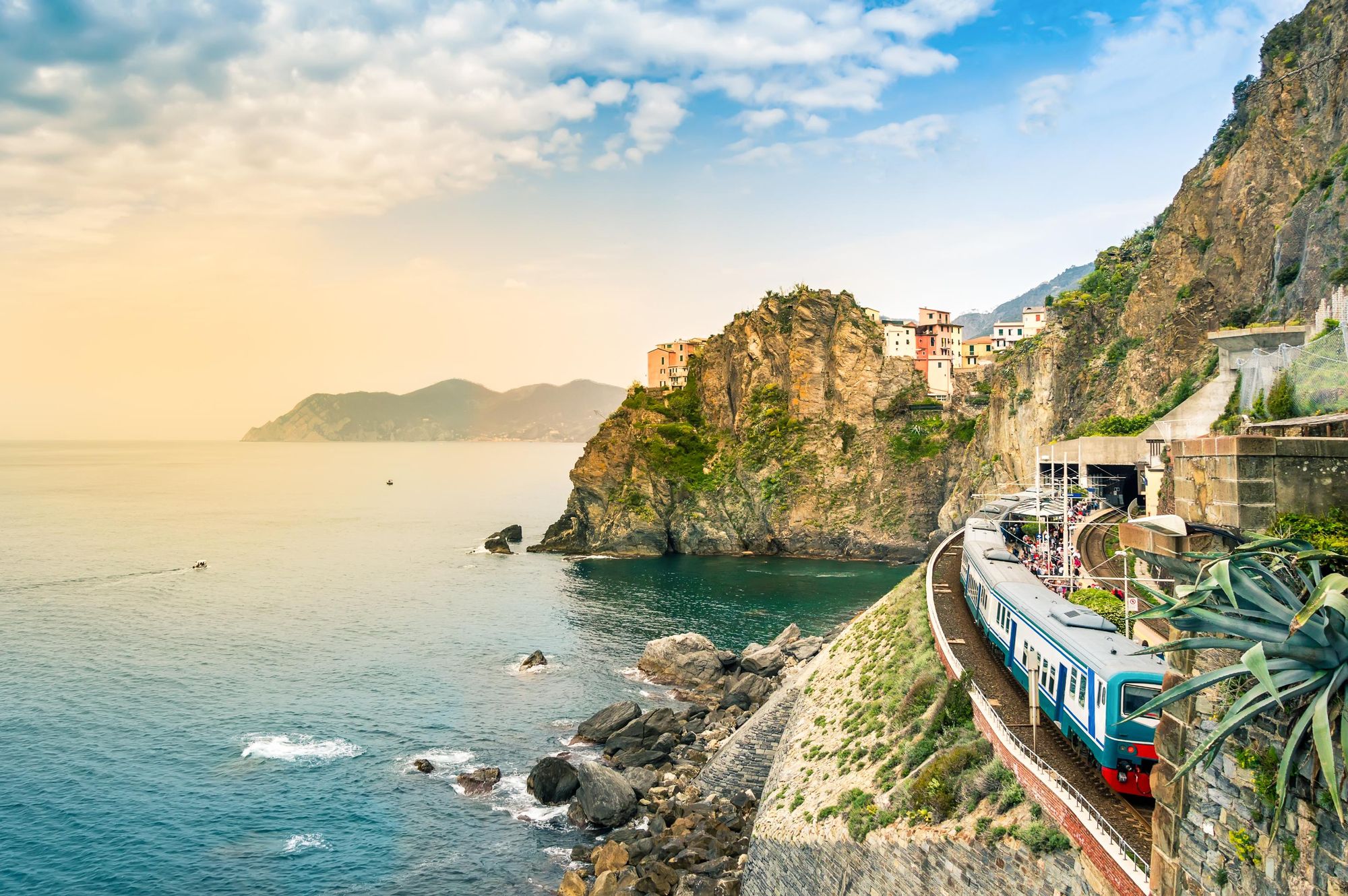
2. Sentiero del Pellegrino (The Pilgrim’s Path), the Italian Riviera
- Start/Finish: Varigotti to Noli (loop or out-and-back)
- Distance: 7.4 miles (12km)
- Walking time: approx. 4 hours
- Difficulty: Moderate
- Best for: A simple, beautiful day hike
Noli and Varigotti are two of the best known towns on the Italian Riviera of Italy, which sits in the north of the country, just 87 miles (140km) east of Nice, France.
Varigotti is a bright commune in Liguria where buildings run along the beachside and the streets have marks of both Romans, Lombards and Saracens. You can discover the remains of old Arab settlements and the lighthouse of La Superba rises high over the village. Noli is a classic Italian seaside village; tucked away on a peaceful inlet, characterised by historic narrow streets and surrounded by hillsides and greenery. This beautiful route connects the two in a loop.
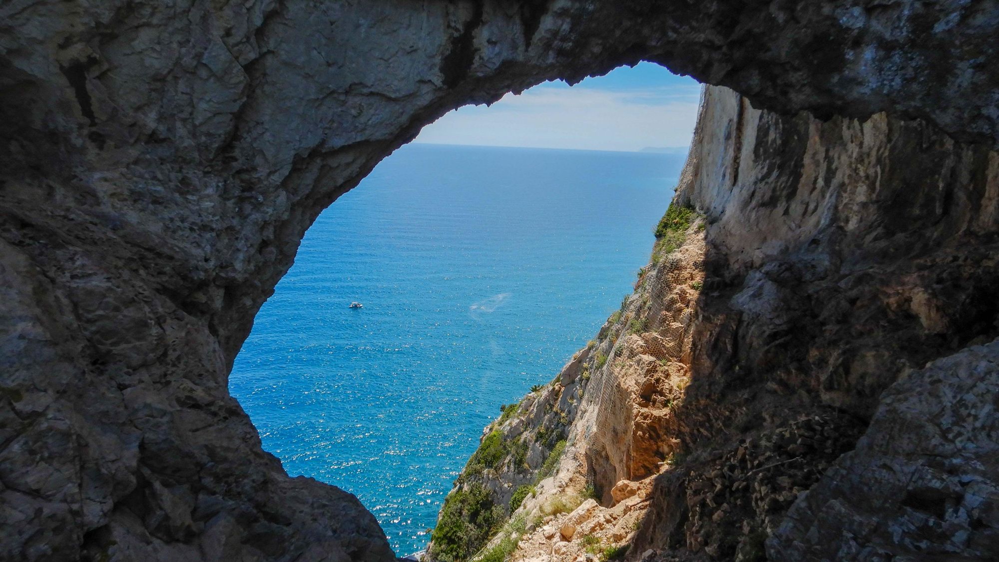
Take in the views from Punta Crena cliff and pass the Counterfeiters Cave, also known as the Grotta dei Briganti (or Bandits' Cove)...
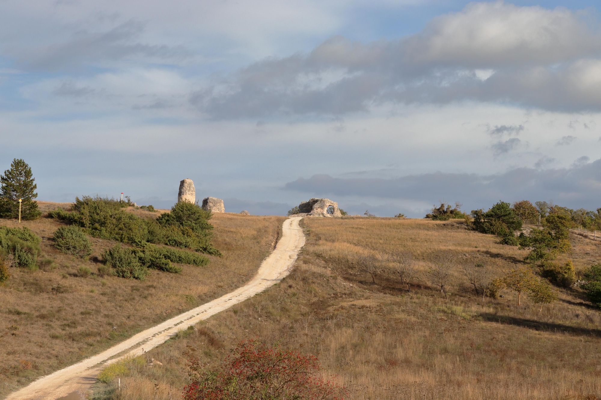
Perhaps the biggest challenge on this route comes right at the start, climbing steeply out of Varigotti from Via Strada Vecchia. The benefit of this is that you get far-reaching views of the surrounding greenery, and out over Saracens Bay, quickly. On the route, you’ll pass the historic Church of San Lorenzo, as well as the Torre delle Streghe - also known as the Tower of the Witches. It was built in the 16th century to protect the border and today is a tall, stone ruin.
Take in the views from Punta Crena cliff and pass the Counterfeiters Cave, also known as the Grotta dei Briganti (or Bandits' Cove), a cave carved into the cliff which is perfect for a quick break. It’s like a window over the Mediterranean.
The finale will see you walk through maritime pine forest to reach the mediaeval village of Noli. You can return the way you came or walk a deeper route - with careful navigation - to Varigotti.
3. The Tratturo Magno, Abruzzo
- Start/Finish: L’Aquila to Foggia
- Distance: 151 miles (244km)
- Walking time: 10 days
- Difficulty: Challenging
- Best for: A transhumance experience
Also known as Il regio tratturo L'Aquila-Foggia (the L'Aquila-Foggia sheep track), this long-distance trek through the Chieti province is the oldest of its kind in Italy. The route is a tratturo, meaning a natural ground path created by moving herds of livestock.
Specifically, it’s an ancient sheep track used by the Vestini (an Italic-speaking, Osco-Umbrian people) to drive livestock to market as early as the 7th century BC. The track was solidified by King Alfonso V of Aragon, in 1447, and later became known as The Royal Shepherd’s Path.
The route leaves L’Aquila (and the mountains of Gran Sasso, Sirente and Majella in Abruzzo), passing through vineyards and hills and stopping at quaint Italian villages like Portocannone and Campomarino on the way over to the Fortore River, Tavoliere and Foggio, on the banks of the Adriatic Sea. This is the only tratturo which brought shepherds in contact with the sea.

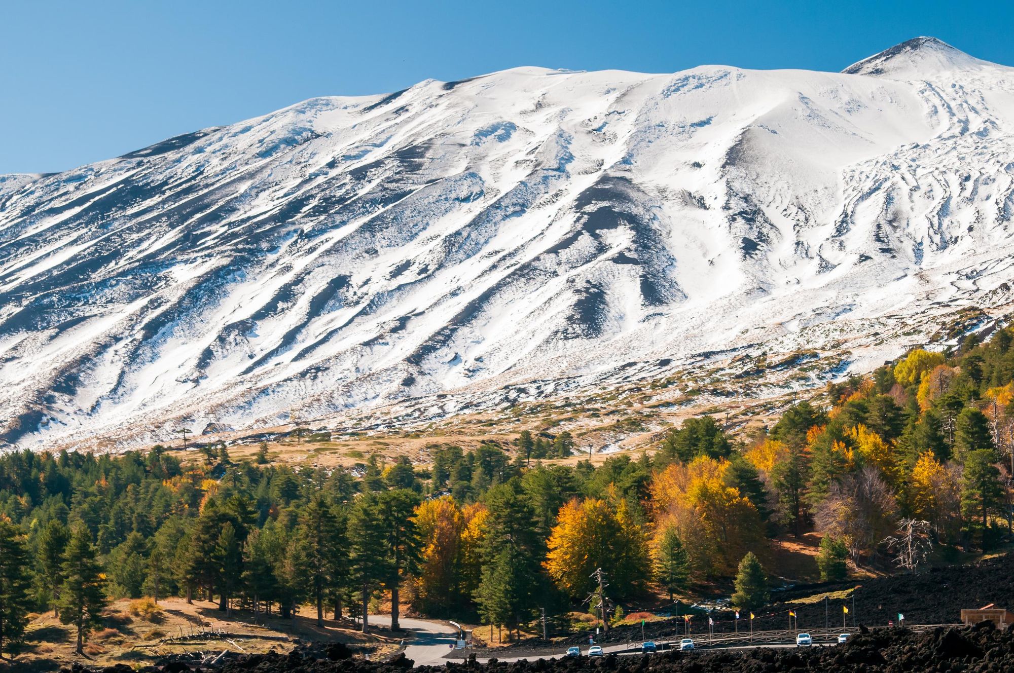
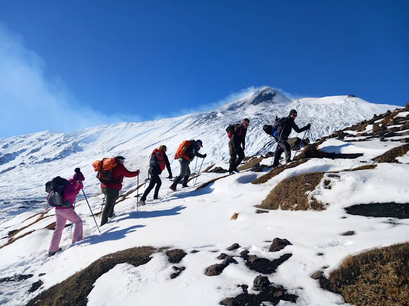
4. Mount Etna, Sicily
- Start/Finish: Etna Mountain Station to summit (out-and-back)
- Distance: 550m (1,804ft) of ascent
- Walking time: 4-5 hours
- Difficulty: Moderate
- Best for: Mixing fire and ice
There are many ways to climb Mount Etna, the mighty, 3,369m (11,053ft) active volcano on the east coast of Sicily.
Most ascents take place from Etna South, where there’s a visitor centre and a car park. From here, you can book tours lasting roughly six hours and usually starting at 9am which will take you to the summit of the mountain. Choose this route and you’ll have a fairly simply but scenic walk, where you’re able to look out over Sicily without too much effort.
That’s ideal for some.
What really made us include Etna on this list though is the winter ascents that are possible - often in deep snow. Walking up this Sicilian beauty in the height of winter is a true tale of fire and ice; passing cinder cones and extinct craters, surrounded by a white blanket. If weather conditions are right, you can head to the summit area of Etna accompanied by a specialist volcano guide. This involves taking a 4WD vehicle from the mountain station up to Torre Del Filosofo at around 2,900m (9,514ft), and then hiking the final 450m to the central craters, which sit at 3,350m (10,990ft).
Not only is a guide strongly recommended for safety reasons on Etna, it’s actually essential to book an organised tour to go above 2,900m (9,514ft) on the mountain. This is owing to a rule introduced back in 2013 to ensure the safety of tourists.
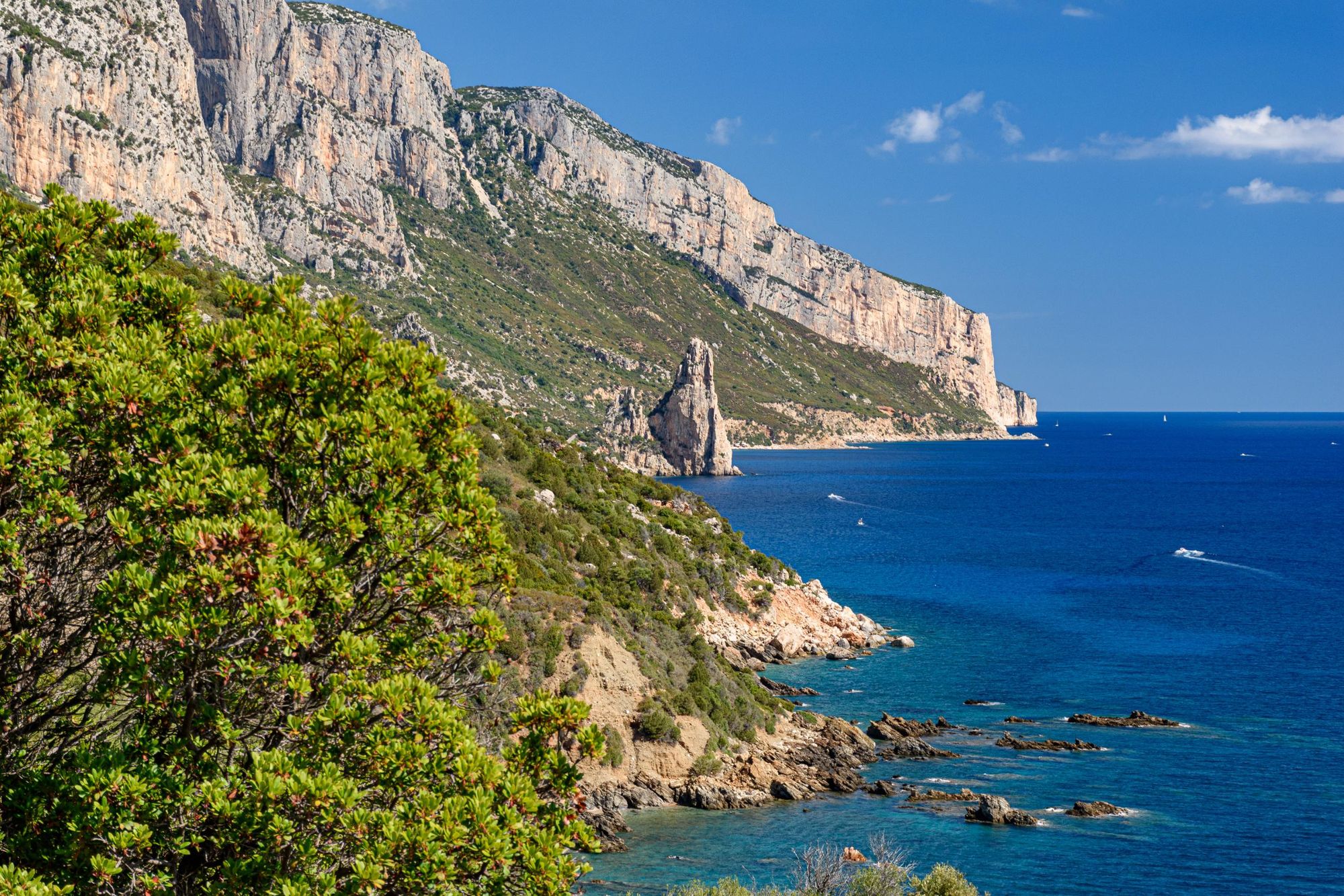
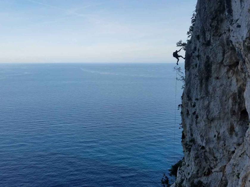
5. The Selvaggio Blu, Sardinia
- Start/Finish: Pedra Longa to Cala Sisine (multi-day hike)
- Distance: 30 miles (45km)
- Walking time: 4-7 days
- Difficulty: Challenging
- Best for: An extreme coastal trekking route
The Selvaggio Blu trek in Sardinia is often described as Italy’s toughest trek. Many go even further and describe the route along the isolated Mediterranean coastline, on limestone rocks and cliffs, as the toughest trek in the world. In reality, this is more of a mountaineering expedition than a walk - hence why despite the short distance, it takes four and seven days to complete.
The route involves abseiling and graded climbs, and route-finding on the Selvaggio Blu - i.e. knowing which of the trails in the area to actually follow - is famously challenging. So what do you get in return? The route has an almost mythical status at this point - an infamous challenge, through tree-stacked ravines, and over, under and through all sorts of limestone rock - all beside sharp, huge cliffs.
Think steep, sharp rocks jutting out the water, amidst the scents of strawberry trees, juniper and olive groves.
This trail is an ode to the Mediterranean Sea. You’ll discover hidden coves which are otherwise unreachable and walk past olive trees dotted around cliffs coloured by euphorbias. Think steep, sharp rocks jutting out the water, amidst the scents of strawberry trees, juniper and olive groves. This is a route for experienced outdoors folk, but it's also one of real beauty. To trek it, you’ll need extensive mapping and a great local guide (even water is hard to come by here, and requires planning). This isn't one to go alone, unless you're a seriously experienced mountaineer.
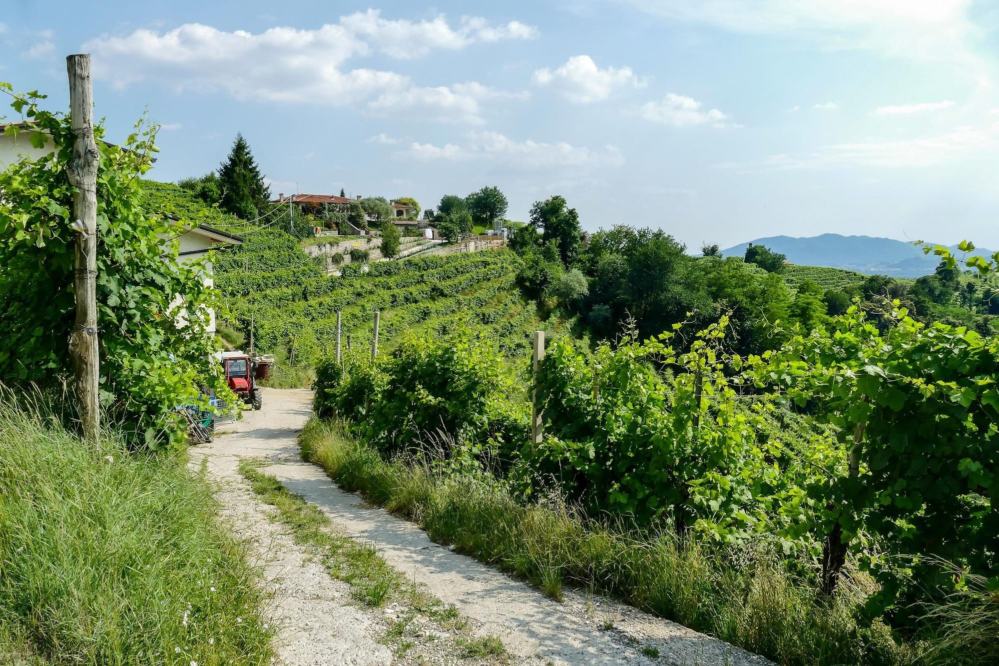
6. The Prosecco Trail, Veneto
- Start/Finish: Vidor to Vittorio Veneto (multi-day hike)
- Distance: 32 miles (52km)
- Walking time: approx. 4 days
- Difficulty: Moderate
- Best for: Prosecco lovers
We don’t have to justify this one too much, do we? The Prosecco Trail is exactly what you think it is - a multi-day hiking route which runs through the UNESCO-protected hills famed for producing that sparkly stuff you love to drink on celebratory occasions/days that end in ‘y’.
The path runs through towns and villages, including Colbertaldo, the southern hills of Valdobbiadene, Col San Martino, Farra di Soligo and Premaor di Miane. Picture rolling hills, vineyards, historic hamlets with hilltop churches or abbeys looking out on lush valleys; and the world’s best prosecco. There’s also WW1 history along this route and a lot of local folklore to discover. But let’s face it, the main reason to walk this four-stage beauty is to get out and immerse yourself in the nature of Italy, then sample the sublime gastronomy that’s produced from all that greenery when you get back.
A glass of prosecco at an agriturismo after a day of hiking never tasted so good.

7. Alta Via Canavesana, Gran Paradiso National Park
- Start/Finish: Pont Canavese (multi-day loop)
- Distance: 90 miles (144km)
- Walking time: 12 days/stages
- Difficulty: Challenging
- Best for: Fastpacking, or a long, multi-day hike
There are a lot of day hikes to love in Gran Paradiso National Park, which became Italy’s first national park when it was named as such in 1922. The Alta Via Canavesana (AVC) is a 12-stage route through the Orco Valley which enters the south of the national park, starting and ending in Pont Canavese.
This is a landscape of glacial valleys and rolling ridgelines looking out over serrated peaks. The Orco Valley is well known for crack climbing, and while no technical skills are required on this trek, it is demanding. This is a route built on walking routes covered by the Club Alpino Italiano (CAI) - with over 11,000m (36,725ft) of elevation gain.
Elsewhere in the park, highlights include the remarkable lakes at the Col Nivolet Plateau...
Travel between Lago de Ceresole and the Soana Valley on Royal Hunting Paths trails commissioned by Savoy King Victor Emmanuel II. Experience tranquil, quiet landscapes, rugged landscapes and glacial lakes as you go. Stay in mountain huts which are small, basic and friendly. Most have dormitories with shared bathrooms and rustic but delicious food (think pasta, polenta or local meats).
Elsewhere in the park, highlights include the remarkable lakes at the Col Nivolet Plateau, which is backdropped by mountain summits. One of the highest walkable passes in the Alps leads to Col Rosset (3,025m/9,925ft) and the Col Bassac Derè pass to Valgrisenche is steep and scenic.

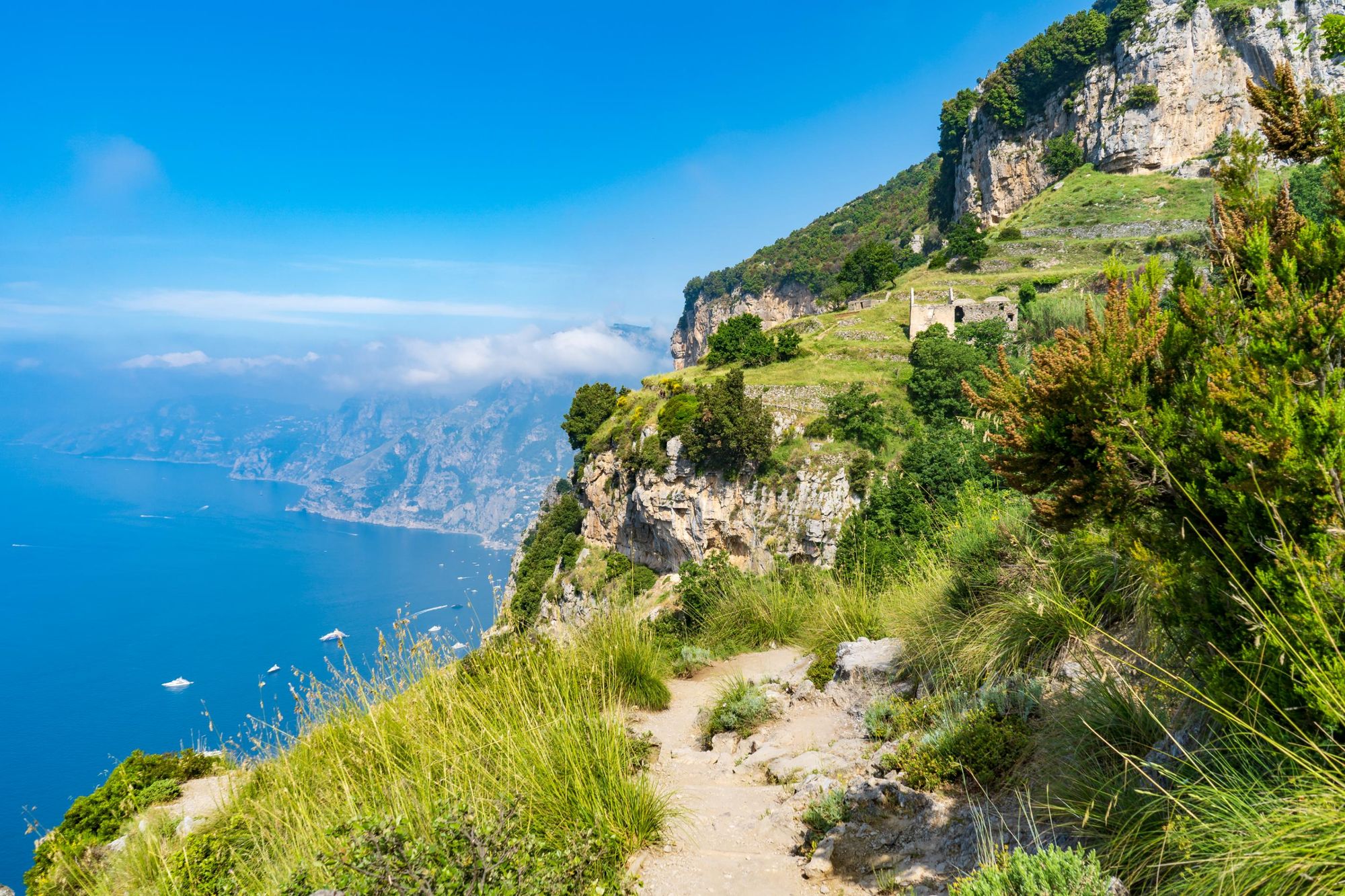
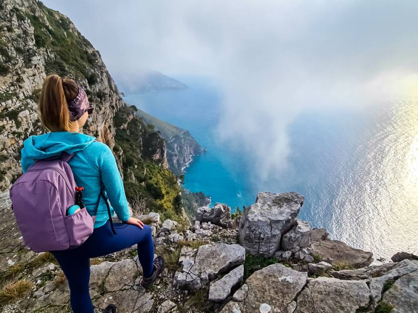
8. Sentiero Degli Dei (Path of the Gods), Amalfi Coast
- Start/Finish: Bomerano to Nocelle/Positano (point-to-point)
- Distance: 7.5 miles (12km)
- Walking time: approx 3 hours 30 mins
- Difficulty: Moderate
- Best for: Iconic views of the Amalfi Coast
The Path of the Gods - known as the Sentiero Degli Dei in Italian - is the most famous walk on the Amalfi Coast. It runs from Bomerano, a high town near Agerola (where a lot of Italian mozzarella is produced and exported) to Nocelle - a historic town just above Positano.
Within moments of stepping onto this trail, you’ll be walking beside raw, rugged cliffs which rise high on your right and drop starkly down to the Tyrrhenian Sea on your left. The view out to the water is far-reaching, and doesn’t relent. This dusty, waymarked trail is extremely engaging; one long viewpoint along this legendary coast. A few miles in you’ll have to choose to take either the high or the low route. The views on both are great, so we’d recommend whichever is less busy.
The layering beauty of Positano, built vertically onto the rock face, comes into view for the final third of this trek. And after entering Nocelle (and grabbing some fresh lemon juice), you can walk down to the famous town. Of course, owing to its popularity, this path gets busy. We’d recommend walking it in the off-season and starting early. Equally, the extent of overtourism in Positano can be overwhelming (it's so bad that people often have to queue to walk down the narrow streets), so it can be worth planning your exit before arriving - perhaps on a ferry to Amalfi.
The real secret here is that there are other trails, similar to the Sentiero Degli Dei, which can be found on these same mountains, but at higher altitude. Hire a guide and ascend to the top of Monte Avvocata (1,014m/3,327ft) or climb Monte Molare (1,444m/4,737ft), the highest mountain on the Amalfi Coast, for spectacular views without the crowds - reaching all the way out to Mount Vesuvius.
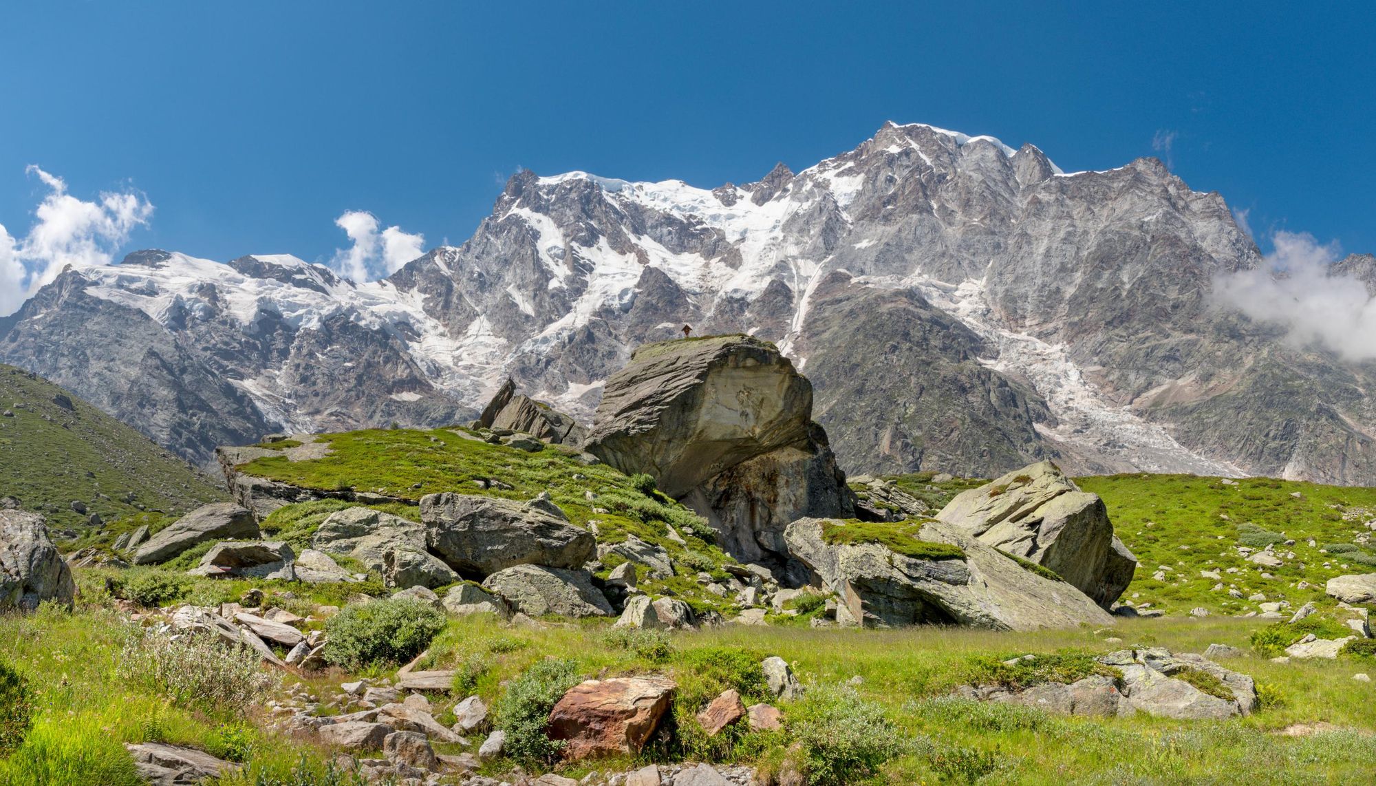
9. Climb Punta Gnifetti, Monte Rosa
- Start/Finish: Staffal (out-and-back ascent)
- Distance: Changeable depending on route
- Walking time: 2-3 days
- Difficulty: Challenging
- Best for: A serious mountain summit
Monte Rosa (4,634m/15,203ft) is the second highest mountain in the Alps (behind only Mont Blanc). The mountain straddles Switzerland and Italy, southeast of Zermatt and east of Breuil-Cervinia. Now, while the highest peak on the Monte Rosa massif is the Dufourspitze, we’ve opted instead to include an ascent of Punta Gnifetti (also known as Signalkuppe).
This peak is 4,554m (14,940ft) and commonly reached from Staffal in the Italian Alps. From here, you’ll take the cable car to Punta Indren, hike up a glacier of the same name (all the time surrounded by momentous alpine peaks and valleys), and then you’ll base yourself at the Mantova mountain hut at 3,498m (11,476ft).
Then up to the summit of Punta Gnifetti - one of western Europe’s highest spots...
This is the ideal spot from where to ascend Monte Rosa. Leaving the hut and climbing up the Garstelet Glacier, you’ll later transition onto the Lys Glacier, passing along the base of the Vincent Pyramid (another famous Monte Rosa summit).You'll ascend to the Col du Lys (4,248m/13,937ft), then it's a high-altitude, exposed crossing along the top of the Grenz Glacier to Col Gnifetti, then up to the summit of Punta Gnifetti - one of western Europe’s highest spots.
Take a break at the Margherita Hut (Europe’s highest mountain hut) on your way down.
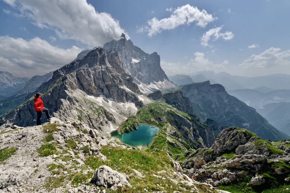
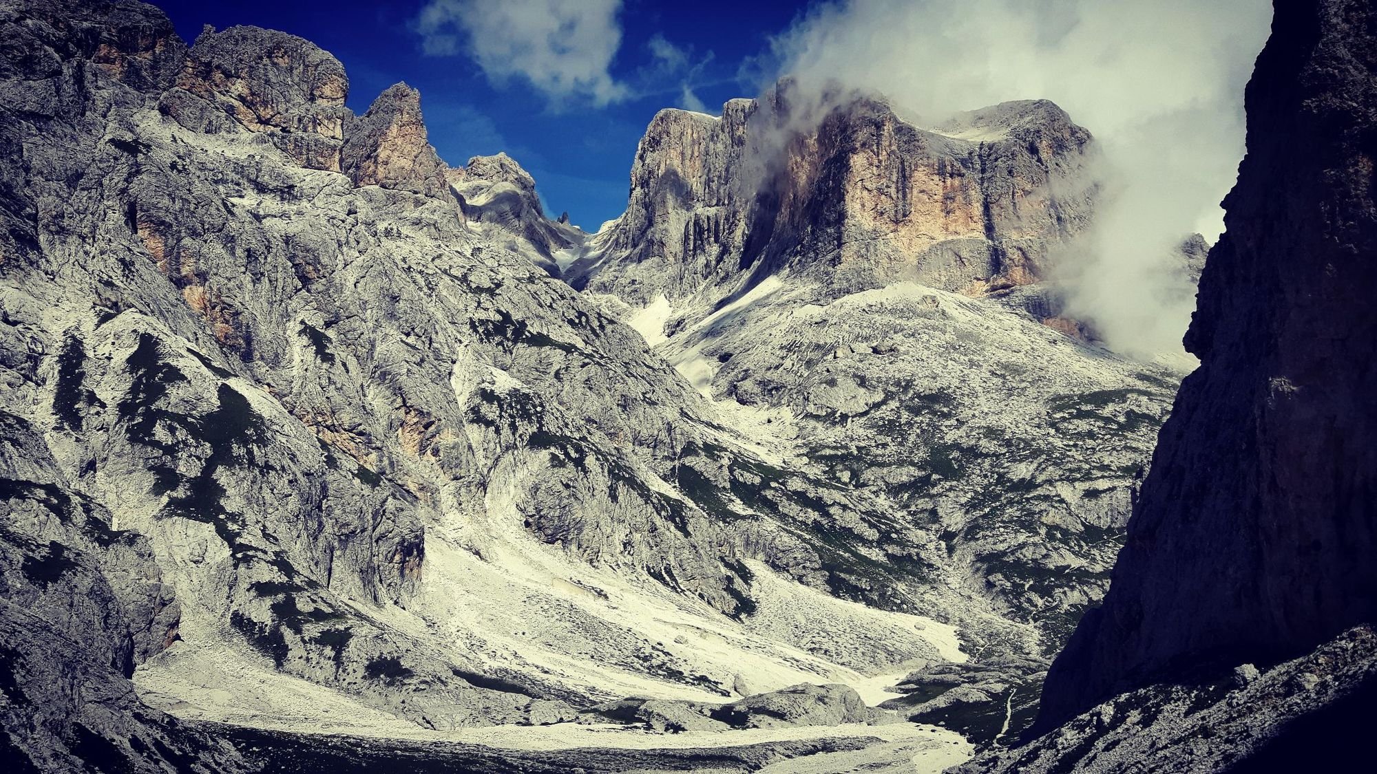
10. The Alta Via 2, Dolomites
- Start/Finish: Bressanone (Brixon) to Passo Croce d’Aune (multi-day hike)
- Distance: 108 miles (174km)
- Walking time: 10-15 days
- Difficulty: Challenging
- Best for: A demanding hike in the Dolomites
We started with the Alta Via 1 through the Dolomites, which is the perfect introduction to both the range and to hut-to-hut hiking in Italy. We’re ending with the Alta Via 2, which is also in the Dolomites, but which is a more challenging long-distance hike than its predecessor. It’s ideal for those who have already done the AV1, or for experienced hikers exploring the Dolomites.
Known as the Alta Via delle Leggende (High Route of Legends), this journey from the baroque beauty of Bressanone to the Renaissance-flair of Feltre is well waymarked, and will take you past the iconic Sella rock group, the Marmolada, which at 3,342m is the highest mountain in the Dolomites, and into the lush valleys and ferocious peaks of Puez-Odle Nature Park. Each stage ends at an alpine refuge, like AV1, so you’ll be going hut to hut in the Dolomites - with all the sunrise and sunset-beauty, dormitories and dreamy pasta that bring.
When is the Best Time to Hike in Italy?
If you’re taking on a route like the Alta Via 1 or 2 then you are limited to the hiking season (when the refugios will actually be open). This usually runs from July to September. Even in June there can be snow in the higher passes, and the weather again takes a turn for the worse as you get into September.
These months are roughly the same for hiking around Italy. Of course, if you go a little earlier or later, the trails will be slightly less crowded, and you might even get some beautiful spring or autumn weather, but do check that any mountain huts you want to use will definitely be open.
You are likely to find snow on Mount Etna in Sicily from December through to March.
What Animals Live in Italy?
In the Dolomites, look out for marmots, chamois, alpine ibex, and roe deer. You also get smaller animals, like badgers, foxes, squirrels and mountain hares, as well as woodpeckers, owls and mountain swallows.
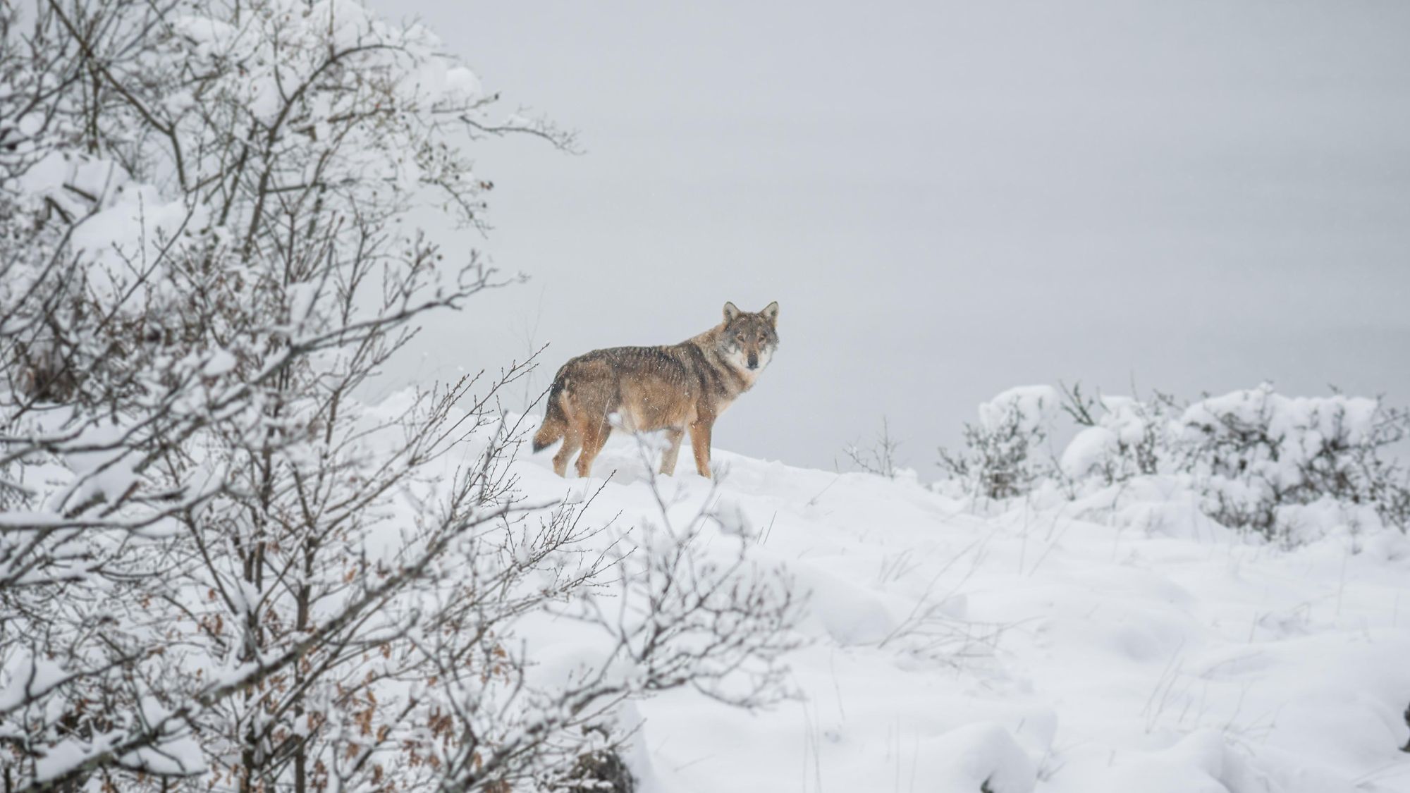
Around Abruzzo - perhaps the best place for wildlife watching in Italy - you should look out for Apennine wolves, chamois and Marsican brown bears. There are rewilding projects ongoing in this area which are looking to restore the ecosystem, based around these key species.
On the Amalfi Coast, you might spot loggerhead sea turtles, dolphins, sharks and barracudas in the water, while on Sicily, and around Mount Etna, look out for wild cats, porcupines and foxes.
Where to Stay Around Italy?
Like any other country, the cities of Italy are buzzing with a range of hotels and hostels for all budgets. Where things get more interesting in Italy is with mountain refugios and agriturismos.
Refugios: A refugio is simply a mountain hut. There are over 1000 rifugios in the Dolomites, making it one of the best networks of mountain huts on our planet. They are typically in mountainous or remote areas. Most refugios don’t open until June (as snow can make them impossible to reach before this), and tend to close in late September, when the snow returns.
While you will occasionally have the option to book a private room, you’re much more likely to be staying in a dormitory if you’re at a refugio, with anywhere from four to 24 beds. With that in mind, it may be a good idea to bring ear plugs (to block the snores). There is usually running water and showers at these huts, though expect to pay a small surplus for use of the latter.
You have to e-mail in advance to book a spot, and booking is essential as space is strictly limited. The price can be anything from €30-80 per night depending on whether you get half-board, bed and breakfast and so on. If you join the Club Alpino Italiano or Società degli Alpinisti Tridentini and stay at one of their huts, then you’ll get a discount when you book (which can be up to 50%).
Agriturismos: If you’re staying in a remote area in Italy, or visiting somewhere known for its rolling hills and cuisine, ditch the hotel hunt and book yourself into an agriturismo. These are often described as farm stays. In practise, you’ll usually be staying at an independently-owned business - often a working farm - and staying in a rustic private room or annex on-site. Expect fresh breakfasts, roosters roaming around outside your window and a relaxed atmosphere.
What to Eat in Italy?

We’re assuming that if you’re heading to Italy, you’re going to be stuffing your face with pizza and pasta. They make it here like nowhere else in the world.
We have a special place in our heart for the gastronomy around Naples and the south. Look out for the mark of Associazione Verace Pizza Napoletana (AVPN), a non-profit founded in 1984 to promote and protect pizza truly made in the Neapolitan style, with ingredients from the area. And in terms of pasta, we’re huge fans of alla Nerano, made with courgettes, provolone del Monaco (cheese), parmesan, garlic, basil and pepper. And despite the name, pasta Genovese is another local classic in this region, with a sauce made of slow-cooked onions, beef and white wine.
In a mountain hut in Italy, you’ll usually find pasta bolognese, spaghetti aglio e olio (a simple, tasty dish with olive oil, garlic, and red pepper flakes) and carbonara. You’ll also get polenta (boiled cornmeal), which can be soft or hard, and served with meat, mushrooms or cheese.
How to Get to (and Around) Italy?
By train: There are regular high-speed trains which connect Italy to neighbouring countries and beyond. Eurail or Interrail are who to look for in that regard. For domestic trains, Trenitalia is the main operator. Tickets are affordable but must be validated before you board to avoid a fine.
By plane: There are 15 major airports in Italy. For the Dolomites or the Prosecco Hills, Venice is a good option. Also in the north (and close to the Alps) are the Milan, Bergamo and Turin airports. Bologna, Pisa and Florence are slightly further south. Rome is where to fly for Abruzzo, while for the Amalfi Coast, fly to Naples. The closest airport to Mount Etna on Sicily is Catania.
By bus: Local bus, train and metro tickets in major cities tend to cost €1.50-2.
Inspired? Check out our range of adventure holidays in Italy!