
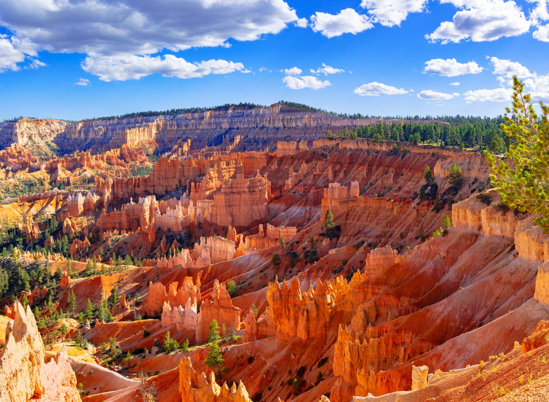
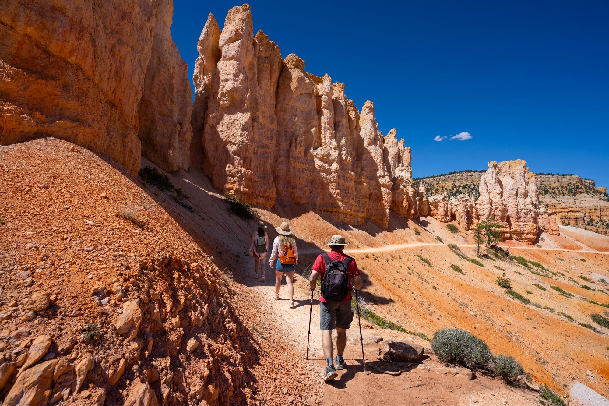
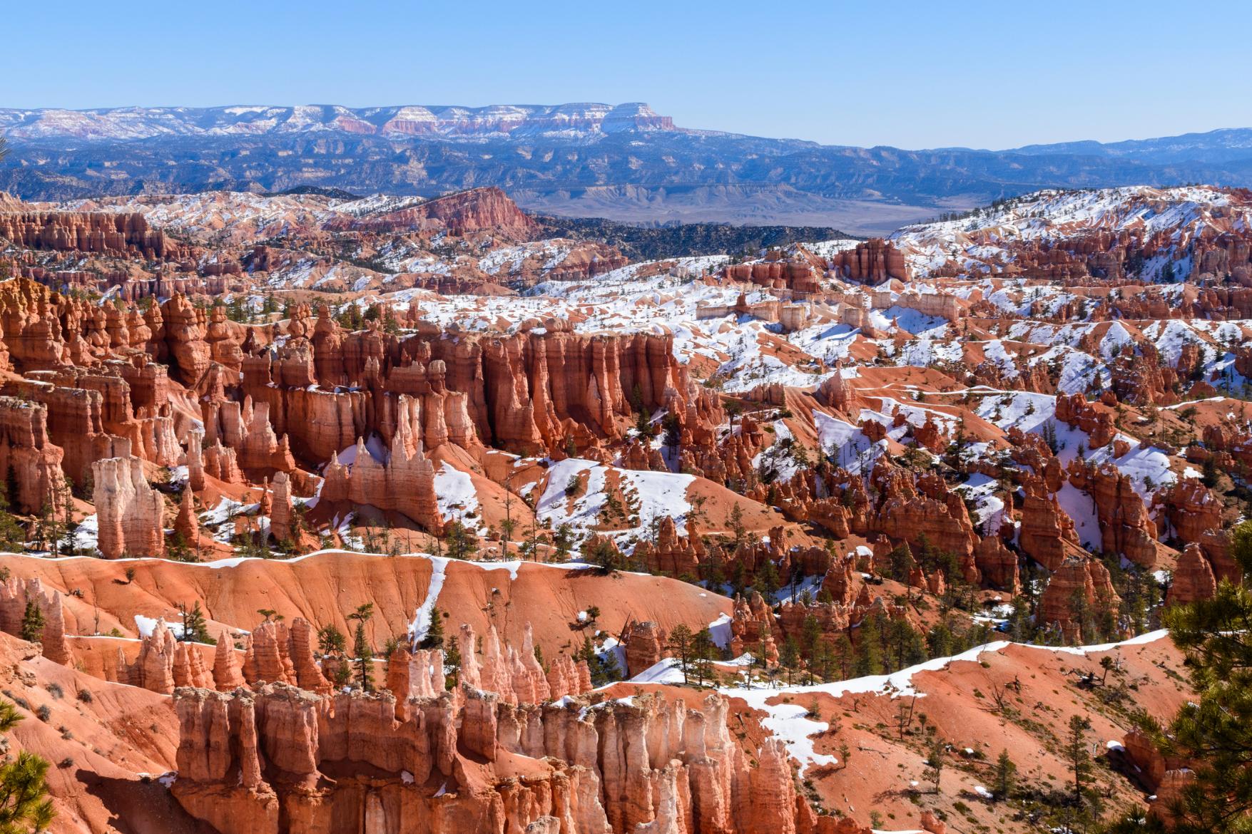
Bryce Canyon National Park in Utah is famed for having the largest collection of hoodoos in the world - that’s thin spires of rock formed by erosion - some of which are up to 45m (150ft) tall. Despite the name, Bryce Canyon isn't actually a canyon at all. It consists of a series of natural amphitheatres carved out into the soft sedimentary rock of the Colorado Plateau; large bowl-shaped rock formations formed by the drainage of seasonal rains and snowmelt over millennia.
“You’re at one of the higher exposed levels of sedimentary rock on the Colorado Plateau, so you're looking over a lot of different ancient formations composed of rocks like sandstone and limestone,” says adventure guide Ryan Romito. “Iron in the rock oxidises so you get these red, orange and pinkish hues, and through those are these veins of white and grey."
“Exposed is all this sedimentary rock and it gets such heavy weathering that it is under constant reformation - you have all of these towering hoodoos and other rock formations. Looking down from above it's very otherworldly. There's a trail along the rim, but getting down into the amphitheatre is certainly the highlight. That's where you can really get up close. In every direction, every rock formation is different.”
There are numerous hiking trails throughout Bryce Canyon National Park, many of which are connected, allowing you to combine them. With Ryan’s help, we’ve selected our favourites - a mix of popular routes through the iconic Bryce Amphitheatre - which has the largest hoodoo collection in the park - and those which are a little more off the beaten track and challenging. These are:
1. The Rim Trail
2. The Queen’s Garden/ Navajo Combination Loop
3. Riggs Spring Loop
4. Under The Rim Trail
5. Fairyland Loop
It’s important to note that these route descriptions are only short summaries, designed to inspire but not to serve any navigational purpose. Most trails are well signposted in the park, but we would still recommend further mapping and planning (or a local guide!) to safely walk any of the trails featured.
Here’s our guide to the best hikes in Bryce Canyon National Park, when to visit and where to stay.
The Best Hikes in Bryce Canyon, Mapped
The majority of the marked trails are in the north of the park, taking you through the iconic Bryce Ampitheatre. But head to the south and you'll find some more challenging backcountry routes through the desert scrub and pine forests as well as rocky formations.
The Top 5 Hiking Trails in Bryce Canyon National Park
1. The Rim Trail
- Start/Finish: Bryce Point/ Fairyland Point, point-to-point
- Distance: 5.5 miles (8.9km)
- Walking time: 2-3 hours
- Difficulty: Easy
- Best for: A bird’s eye view of Bryce Amphitheatre
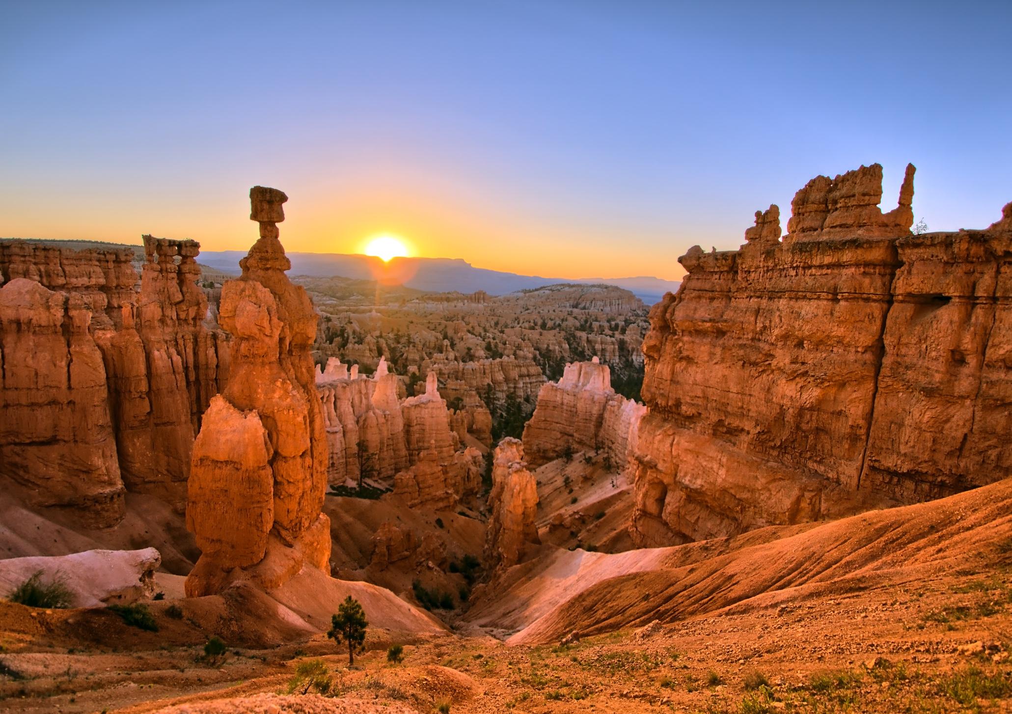
This hike starts at Bryce Point and follows a clearly marked trail round the top rim of the Bryce Amphitheatre, a rocky depression filled with rows of hoodoos. The route connects to viewpoints Inspiration Point, Sunrise Point and Sunset Point - from the latter you can see Thor’s Hammer, a 45m/150ft high rock spire, one of the most famous hoodoos in the park - ending at Fairyland Point.
The route connects to viewpoints Inspiration Point, Sunrise Point and Sunset Point...
Many visitors to the park walk only a short section of the Rim Trail (normally the paved and accessible section between Sunrise and Sunset Points), but it’s an easy walk to complete it in its entirety, as there is very little elevation gain.
The walk can be done point to point between May and September thanks to a seasonal shuttle service. Outside of this season you will need to walk back the way you came, which will double the hiking time and distance.
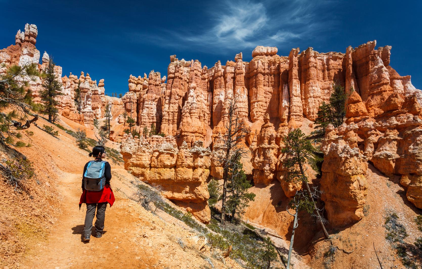
2. The Queen’s Garden/ Navajo Combination Loop
- Start/Finish: Sunset Point Trailhead
- Distance: 2.9 miles (4.6 km)
- Walking time: 2-3 hours
- Difficulty: Moderate
- Best for: Views from the top and bottom of the canyon
This is the most popular hike in Bryce Canyon, and one which Ryan recommends to first time visitors.
“Queen’s Garden is probably the most popular trail in the park,” he says. “It's epic down there - you’re just weaving in and out of these very different contrasting spires and rock formations. Then you combine it with the Navajo Loop, which has these switchbacks up along the canyon walls.”
Begin your hike at Sunset Point Trailhead and hike along the Rim Trail to Sunrise Point, a viewpoint with a breathtaking panorama of the hoodoos and multi-hued cliffs of Bryce canyon. From here, descend the Queens Garden Trail, a 0.8-mile (1.2km) path into the valley. The trail will fork - continue right to remain on the Queens Garden Trail. Enjoy exploring the towering hoodoos along the trail, passing through rock arches and photographing the formations.
You’ll pass through pine forest to reach the Navajo Loop Trail. There are two different branches—Wall Street or Two Bridges—both of which zigzag up the canyon. The Wall Street route is sometimes closed during winter (as it’s narrower and steeper). But both lead in the same direction back up the canyon to Sunset Point, and involve around 167m (550ft) of elevation gain.
3. Riggs Spring Loop
- Start/Finish: Rainbow Point
- Distance: 8.8 miles (14.2 km)
- Walking time: 4-6 hours
- Difficulty: Moderate
- Best for: Exploring Bryce Canyon’s forest
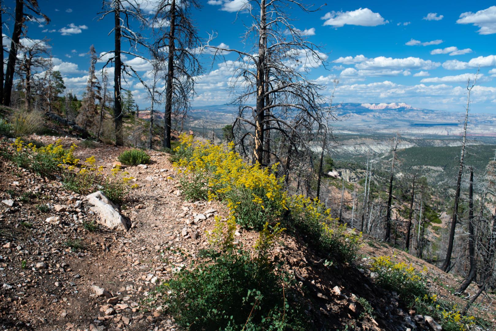
Most of the hikes in the park take you around the famous Bryce Ampitheatre, but the Riggs Spring Loop can be found in the south of the park, in its backcountry area. This means that while you’ll get brilliant views of the Bryce hoodoos, you’ll also be able to experience the park’s forest of spruce and towering ponderosa pines. The other attraction to this route is that backcountry camping is allowed in designated areas (although you need a permit first) - so you’ll get a real wilderness experience. For this reason, although this hike can be completed in a day, many people do it as an overnight backpacking trip.
Head east from Rainbow Point and hike across forested slopes to the Promontory - a sandstone outcrop - before the trail splits. Then head south, descending steadily down into the canyon. You’ll hike through the woods beneath the Pink Cliffs (which will be visible through the trees), before reaching Coral Hollow, a campsite within the ponderosa forest, north of Blueberry Spring. The second camping area is located at Riggs Spring, at the junction of the Lower Podunk Creek route - you’ll have an excellent view of the Rainbow Point plateau looming above.
The next part of the walk takes you back up onto the plateau, climbing 243.8m (800ft) up to the Yovimpa Pass. The elevation gain is gradual, over around a mile and a half. Before hiking back to Rainbow Point, stop to take in the views at Yovimpa Point, one of the highest viewpoints in the park. On a clear day you have what the National Parks Service refers to as “one of the grandest, and longest views in the park, extending over 100 miles (161km) across the tops of the colourful “steps”, or cliffs, of the Grand Staircase.” Below you are the beautifully rain-sculpted Pink Cliffs, and to the southeast, the distant silhouette of Navajo Mountain.
4. Under The Rim Trail
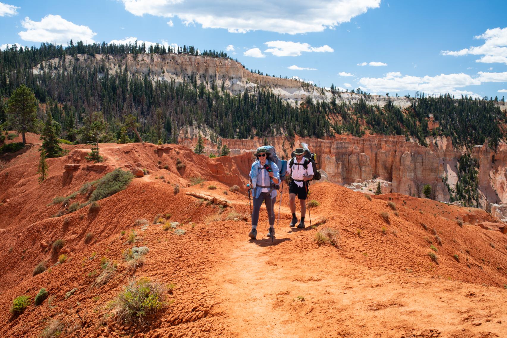
- Start/Finish: Rainbow Point/Bryce Point, point-to-point
- Distance: 22.9 miles (36.9km)
- Walking time: 2-3 days
- Difficulty: Challenging
- Best for: Multi-day hiking in Bryce Canyon
This is the longest marked hiking trail in Bryce Canyon National Park. As the name implies, it takes you underneath the base of the Paunsaugant Plateau. Glimpses of sandstone cliffs and hoodoos are rare, but instead you’ll experience the solitude of Bryce Canyon’s forests and scrubland.
You’ll hike across the scenic red sandstone Ponderosa Ridge, which is studded with tall ponderosas, and head slowly downhill towards Black Birch Canyon Creek.
If you decide to do the hike over two days, you’ll set out from Rainbow Point, passing several trail junctions (including the Riggs Spring junction and the Bristlecone Loop junction) - following the signs for Under the Rim trail. You’ll hike across the scenic red sandstone Ponderosa Ridge, which is studded with tall ponderosas, and head slowly downhill towards Black Birch Canyon Creek. As you approach the first campsite, Iron Spring, you’ll catch a glimpse of the hoodoos in the distance.
You’ll briefly head out of Bryce Canyon and into the adjacent Dixie National Forest, before the trail winds back in and past the junction for Agua Canyon Connector Trail. Keep walking past it, continuing to head gradually downhill through the forest.
5. Fairyland Loop
- Start/Finish: Fairyland Point (circular)
- Distance: 7.9 miles (12.7km)
- Walking time: 3-4 hours
- Difficulty: Moderate
- Best for: Hoodoo views without the crowds
Due to its longer length, the Fairyland Loop hike has fewer crowds than other trails, but has equally exceptional views of the Bryce Ampitheatre and other rock formations within the park
The trail begins at the top of the canyon, at Fairyland Point. Head southwest along the trail, tracing the canyon rim along a clearly marked trail, soaking up the views of the rock formations below. When you reach Sunset Point you’ll descend into the canyon, passing the Chinese Wall rock formation (a large sandstone cliff). The landscape begins to change, the pine trees dotting the trail.
At around the halfway point you’ll see a signpost to Tower Bridge, a rock formation that resembles London’s iconic bridge. It’s a detour of 0.4 miles (out and back) if you want to go and take a look. After this, continue along the trail, which weaves gently in and out through hoodoos and pines, before climbing back up to the rim of the canyon and rewarding you with sweeping views.
When is the Best Time to Hike in Bryce Canyon?
Bryce Canyon can be visited year round, although the most popular months of the year for hiking are between June and August, as the weather is at its warmest (the average high in August is around 25°C). However, you’ll also encounter the most crowds then. Ryan recommends visiting earlier, in the spring (between March and May).
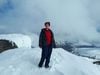
“The park is located at altitude; you’re closing in on 8,000 feet (2,438m) when you get there,” he says. “So early in the season it can still be cold. But the nice thing is if you do get a chance to visit when there's just a little bit of snow leftover. It makes for such incredible contrast with the rocks. Bryce is one of my favourite places to see in the snow just because of that vivid contrast.”
From September onwards, the weather becomes wetter but the crowds lessen. From November through February you can experience snow. This means you can try out winter sports such as snowshoeing or cross country skiing, but services are limited.
What Animals Live in Bryce Canyon?
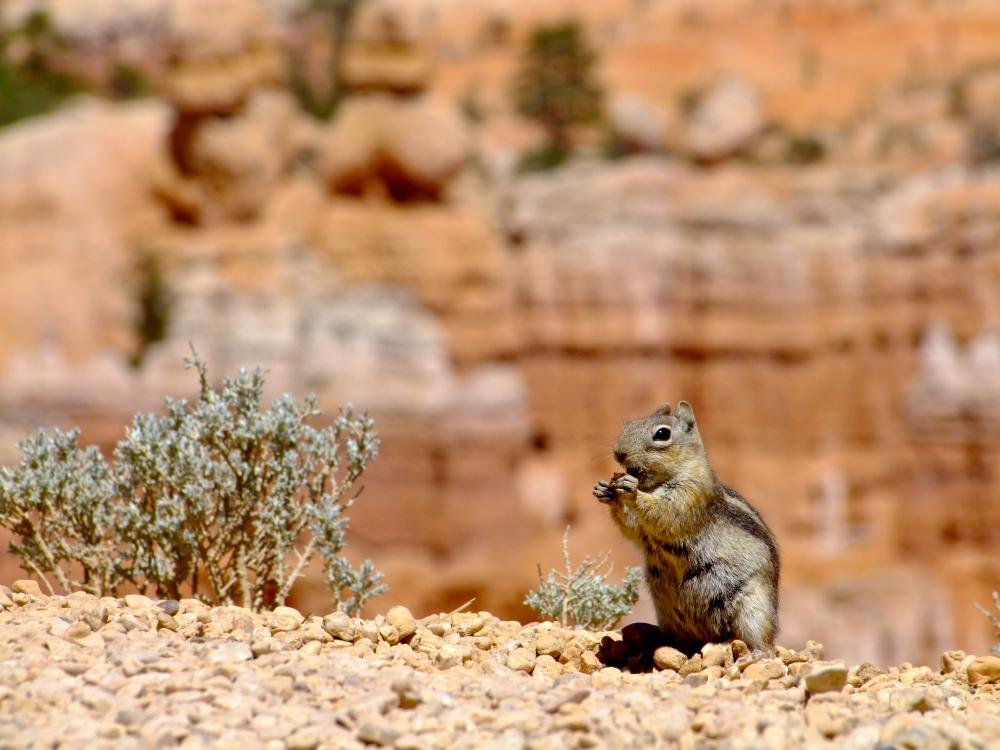
There are plenty of animals, reptiles and birds living on the high plateaus or in the desert scrub of Bryce Canyon. Mule deer graze in meadows and on forest edges, while coyotes can often be heard howling at night.
There are mountain lions inhabiting the park, but they are rarely seen by visitors. Chances are you’ll catch sight of rock squirrels or golden-mantled ground squirrels on your hike - both of which are more accustomed to people.
There are mountain lions inhabiting the park, but they are rarely seen by visitors.
Look out for tiger salamanders and rattlesnakes as you walk, and turn your eyes skyward in search of red-tailed hawks or mountain bluebirds; their electric blue feathers contrast vividly with the sandstone.
Where to Stay in Bryce Canyon
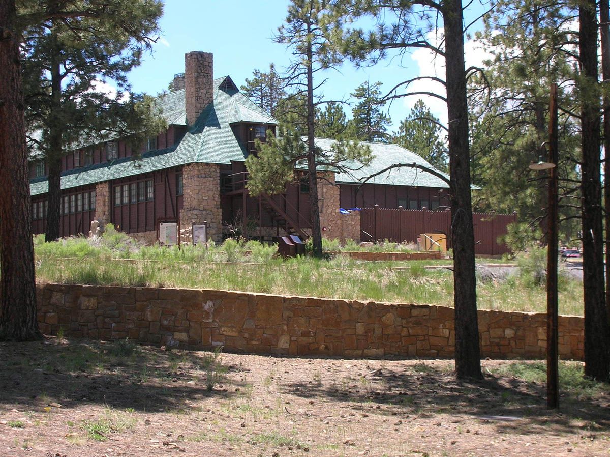
The Lodge At Bryce Canyon is the only accommodation situated within Bryce Canyon itself, offering a range of rooms and cabins. You can also camp. There are two campsites in Bryce Canyon National Park: North campground (open year-round) and Sunset campground (closed in winter); both are suitable for both tents and RVs.
The limited options to stay within the park mean that accommodation is booked up in summer months, so make sure that you book in advance. There are more places available outside the park, in Bryce Canyon City (which is actually a small community) and Tropic, a ranching community with rustic lodges and cabins to rent.
What to Eat in Bryce Canyon

There are two restaurants within Bryce Canyon National Park - Valhalla Pizzeria (the speciality here is obvious) and Bryce Canyon Lodge. The latter serves up stacked plates of quesadillas, brisket and lighter options - it’s known for its soup and salad lunch buffet, which often includes its signature elk chilli.
More dining options can be found just outside the park, where you’ll find a diner, steak restaurant and even a grill house with a Western-themed dinner show.
How to Get to (and Around) Bryce Canyon
By Plane: The closest international airports to Bryce Canyon are located in Las Vegas and Salt Lake City - both are around 275 miles (442km) and just over four hours’ drive away.
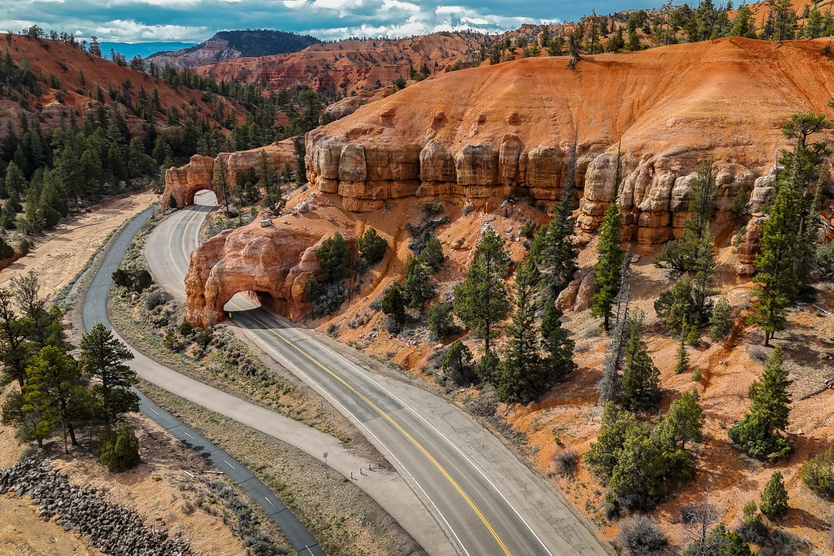
By Car: Most visitors to Bryce Canyon travel by car - it’s located off Highway 63 and easily accessible. Take Highway 15 north from Las Vegas or south from Salt Lake city to reach it.
By Bus: There are no public bus services to Bryce Canyon National Park, but you can get a Greyhound Bus to Bryce Canyon City. From here, it’s possible to catch the shuttle bus that runs through Bryce Canyon National Park, and runs from April through October. The bus stops at points of interest, including trailheads, making it useful for hikers.
Read more:
- 10 of the Best Hikes in Sequoia and Kings Canyon National Park
- 5 of the Best Day Hikes in Yosemite National Park
- 5 of the Best Hikes in Wrangell St-Elias National Park
Inspired? Check out our Hike the Great National Parks of the USA adventure, which includes a trip to Bryce Canyon.