

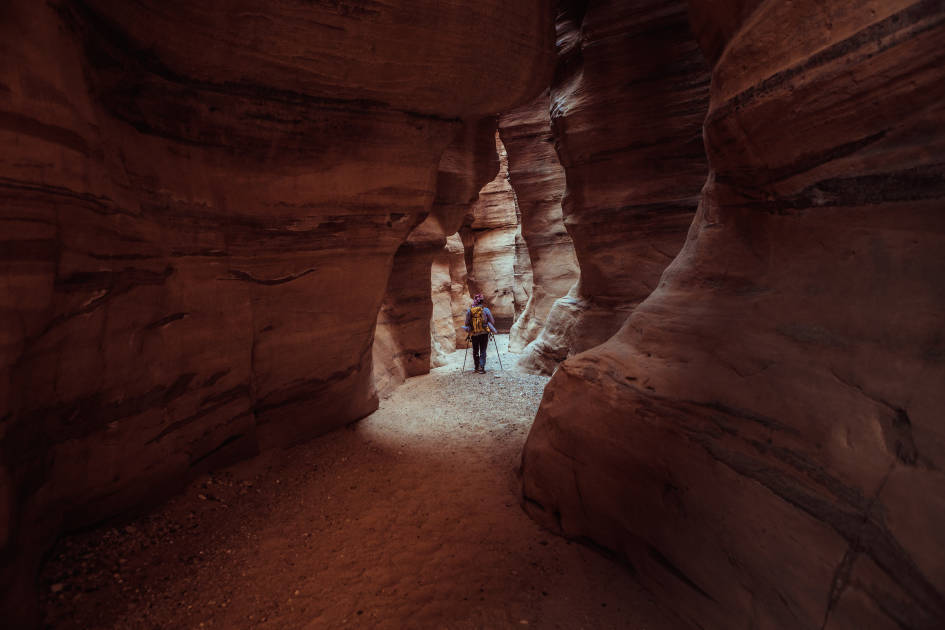
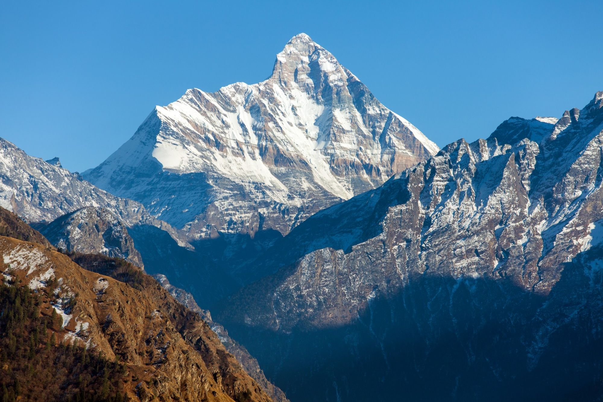
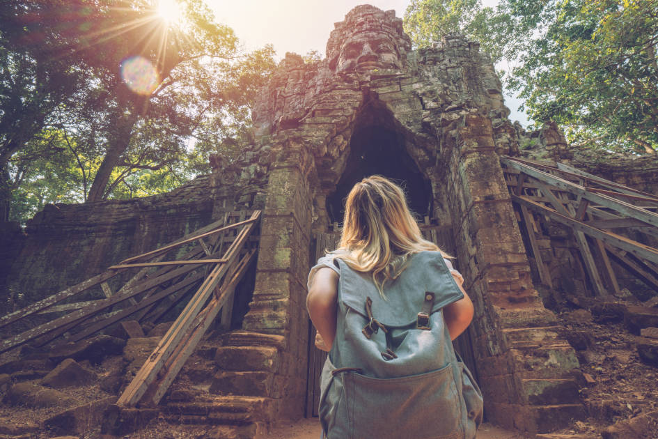
The best treks in Asia lead you through the foothills of the Nepalese Himalayas, offering up views of Everest and the vast, towering Annapurna massif. They take you through the steamy jungles of Borneo and the red sand deserts of Jordan. The variety of landscapes is mind-blowing.
Asia is the largest and diverse continent in the world - both culturally and geographically - consisting of 48 different countries. It boasts both the highest and lowest points on earth; Mount Everest (8,850m) and the Dead Sea (430m below sea level) respectively. It also has the biggest climatic extremes out of any continent, which leads to a wide variety of different flora and fauna. This list of the best hikes in Asia have been selected with this diversity in mind. And we’ve also selected treks of different lengths, from thousand kilometre epics to quick and easy day hikes.
We’ve included some of the continent’s most iconic treks, such as the Everest Base Camp hike in Nepal and Japan’s UNESCO-designated Kumano Kodo. But we also wanted to showcase less well-known routes - such as the newly-designed Pamir Trail through the mountains of Tajikistan - which allow you to experience less crowded trails as well as spreading economic benefits to remote regions which see little tourist footfall.
The hiking descriptions below mustn’t be considered substitutes for a decent map or an experienced guide. Rather, they are intended as inspiration - to open your eyes to the myriad possibilities Asia has to offer trekkers.
The Best Hikes in Asia, Mapped
This map shows the start points for all the hikes listed in this guide, organised into difficulty level.
The Best Multi-Day Hikes in Asia
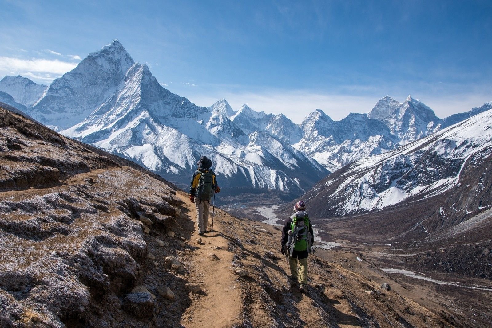
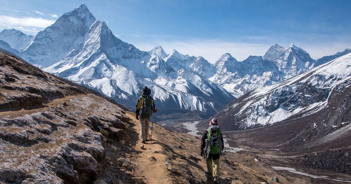
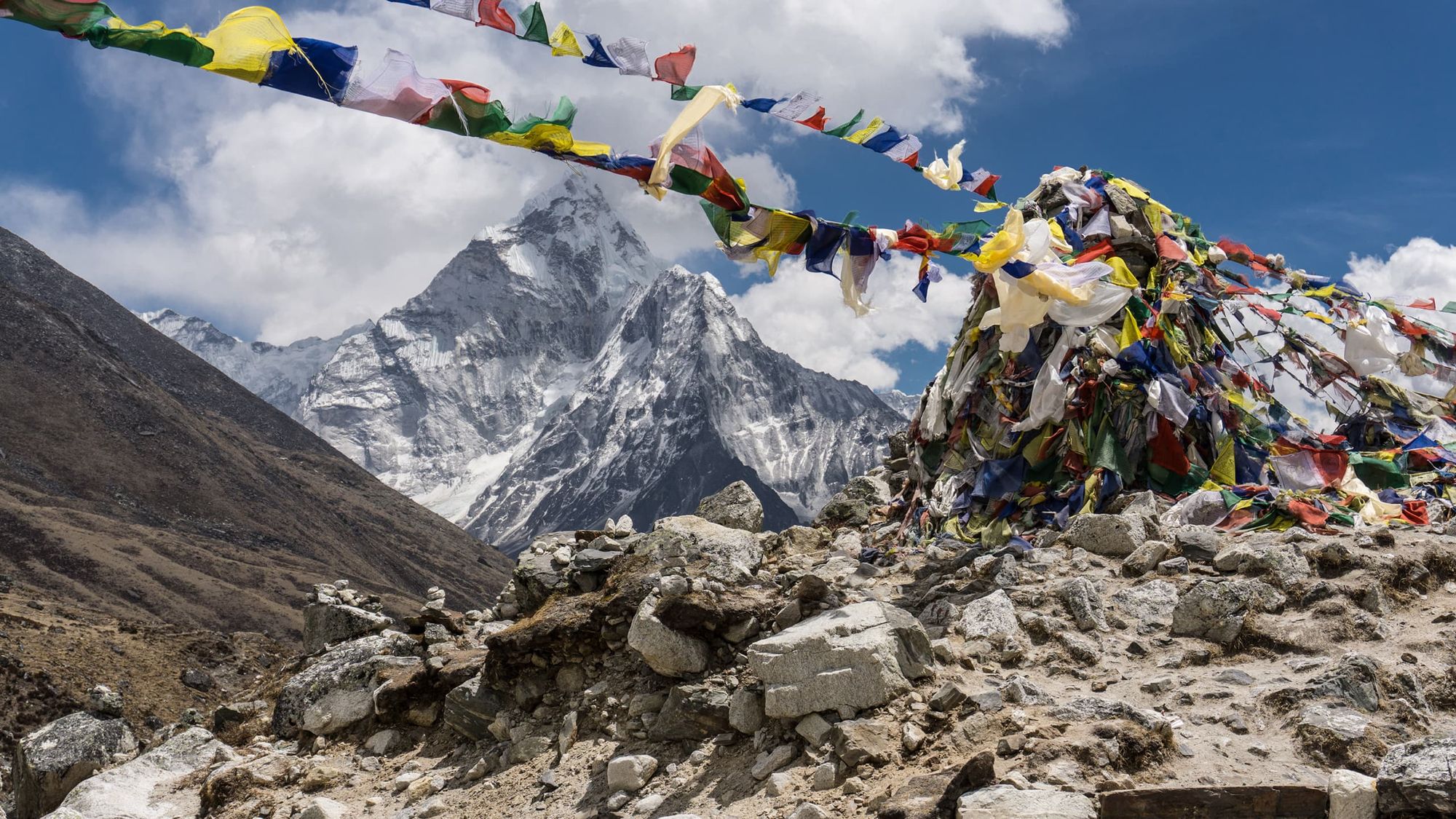
1. Everest Base Camp, Nepal
- Perfect for: An iconic Himalayan trek
- Level: Challenging
- Distance: 68 miles/110km
- Duration: 11-12 days
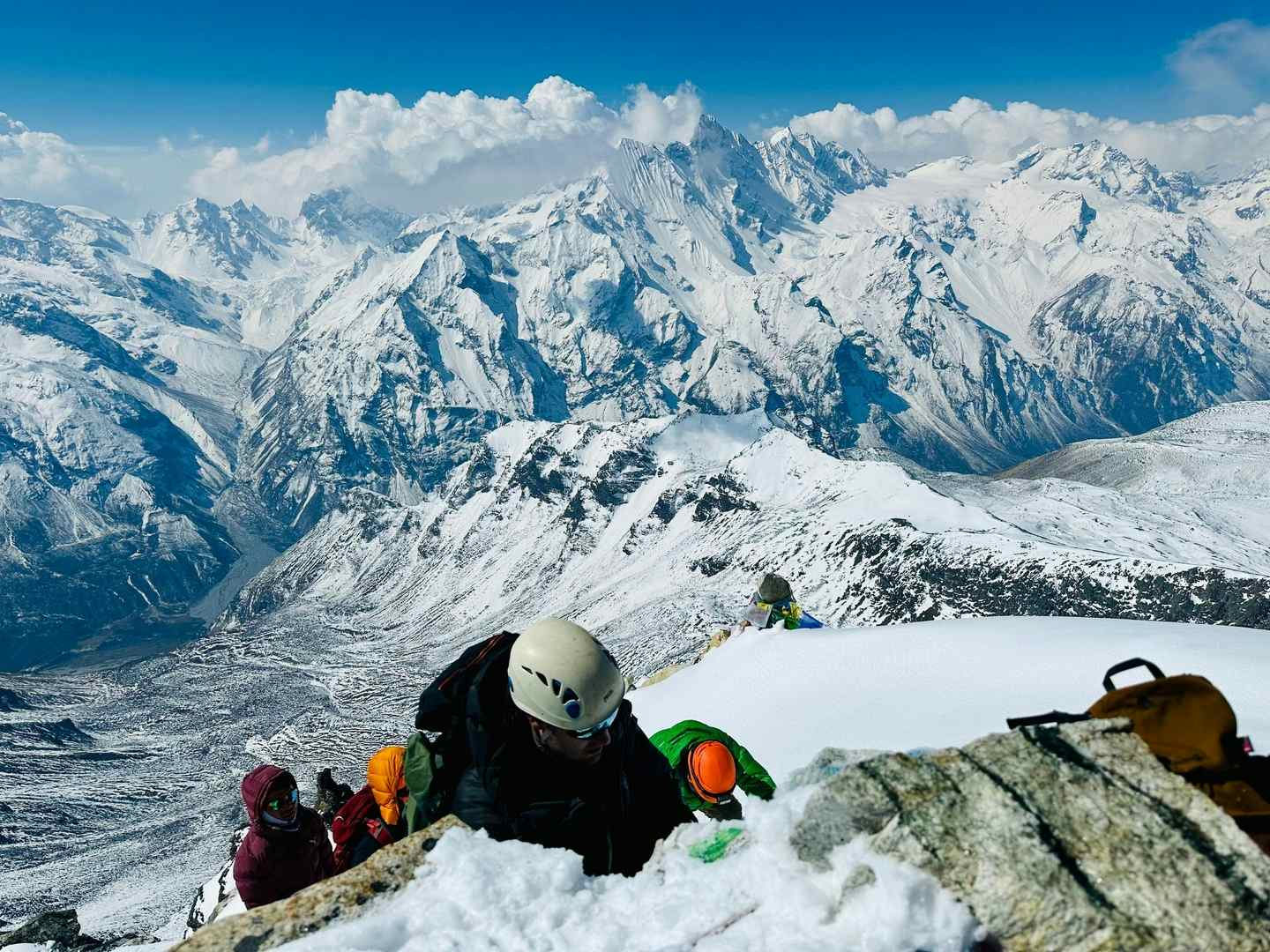
The Everest Base Camp trek takes you on an immersive journey through the Khumbu region in Nepal, providing trekkers with breathtaking views of the Himalayas, the ‘roof of the world’. Follow in the footsteps of explorers such as Sir Edmund Hillary as you cross through Alpine forests, high-altitude pastures and across glacial moraine on your way to Everest Base Camp.
The trek begins in Lukla and heads through pine forest to Namche Bazaar, crossing the infamous Hillary Suspension Bridge. As you head northeast to Tengboche (3860m), the altitude increases. Passing by the famous Yeti scalp Gompa, you'll reach Dingboche (4410m), where acclimatisation is key. Continuing to Lobuche (4910m), you'll trek across scree and boulders towards Everest Base Camp (5380m). On the return journey, you’ll complete an ascent of Kala Patthar (5550m) before descending to Pangboche.
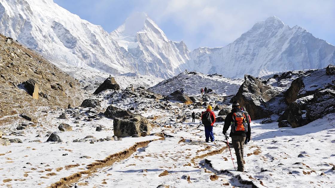
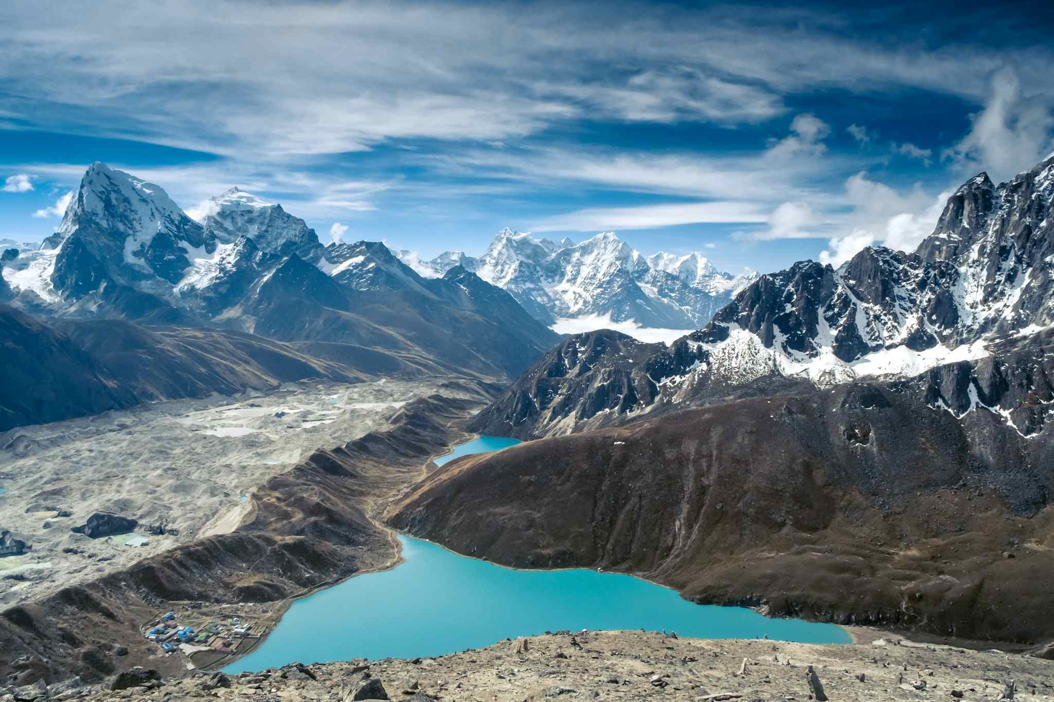
2. Gokyo Lakes Trek, Nepal
- Perfect for: A more challenging alternative to the EBC trek
- Level: Challenging
- Distance: 82 miles/132km
- Duration: 14-16 days
The Gokyo Lakes Trek is an alternative route to the normal Everest Base Camp trek. Both begin at Lukla and head up to Namche. It's at Khyangjuma where the two diverge. While the traditional route follows the Khumbu Valley to the base camp and returns the same way, the Gokyo Lakes Trek ventures westward through the picturesque Gokyo Valley, returning via the Khumbu Valley to create a circular walk.

The Gokyo Valley is adorned with mirror-like glacial lakes. Trekkers have the option to ascend Gokyo Ri for unparalleled views of the Himalayas before descending to Gokyo village and crossing Cho La pass (5,420m). Despite being longer and more challenging than the Everest Base Camp trek, the Gokyo Lakes route is considered a scenic and less crowded alternative. However, the increased difficulty and cost should be taken into consideration when deciding between the two treks, each offering its own unique adventure through the majestic landscapes of the Himalayas.
Read more: Gokyo Lakes vs. Everest Base Camp: What’s the Difference?
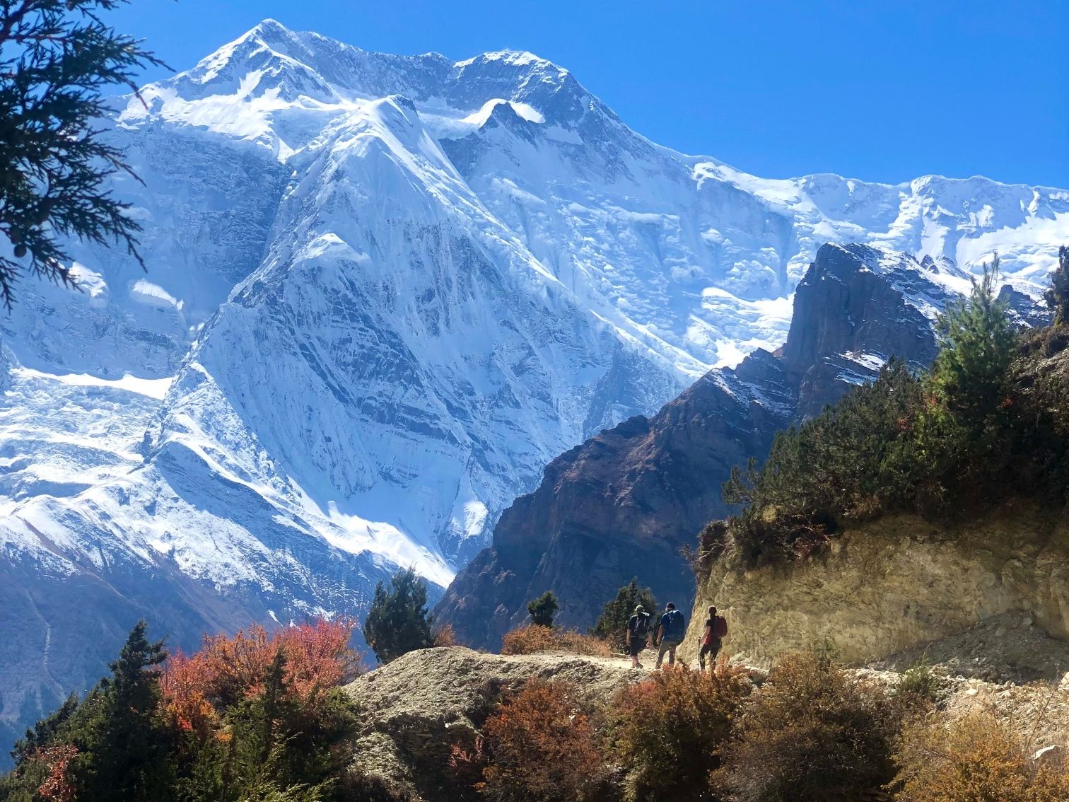
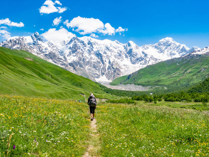
3. Annapurna Circuit, Nepal
- Perfect for: Crossing the world’s highest navigable mountain pass
- Level: Challenging
- Distance: 161 miles/260km
- Duration: 15-16 days
The Annapurna Circuit is one of the most popular treks in Nepal, renowned for its diverse landscapes - from lush rhododedron forest to the arid mountainscapes of the Mustang Valley and the snow-capped mountains beyond. A highlight of the journey is the Thorong La - the world’s highest navigable mountain pass at 5,416 metres - a formidable challenge due to the high altitude it reaches.

The trail begins in the remote village of Tal and winds through the Marshyangdi River valley, climbing upwards through rhododendron forest. You'll pass through remote villages like Chame and Pisang, and stay in traditional Himalayan teahouses . The trail continues past monasteries and through the Mustang Valley, gradually ascending to higher altitudes. The climax is reached at Thorong La pass before a descent to Muktinath and concluding the journey in Jomsom, where the deepest canyon on earth, the Kali Gandaki River, awaits exploration.
Read more: Everything You Need to Know About Trekking Annapurna
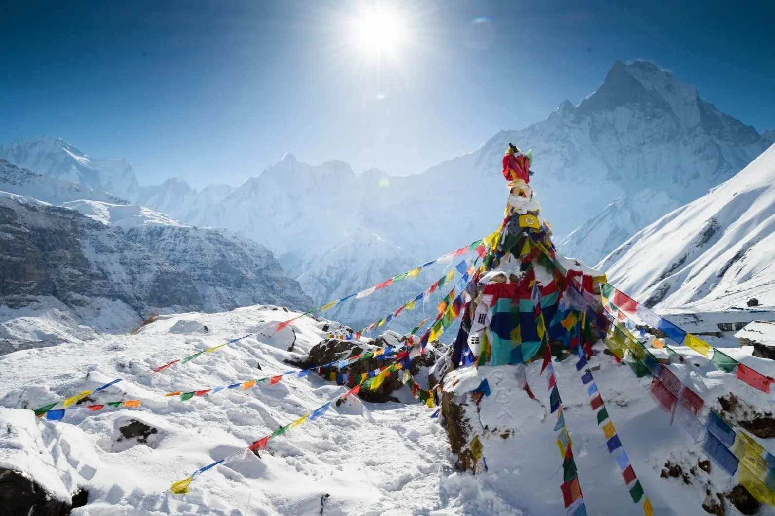
4. Annapurna Sanctuary Route, Nepal
- Perfect for: Dramatic views of the Himalayas
- Level: Challenging
- Distance: 68 miles/110km
- Duration: 10 - 12 days
The Annapurna Sanctuary trek leads adventurers to the Annapurna Base Camp, nestled in a high glacial basin known as the Annapurna Sanctuary. This trek offers up breathtaking mountain views that will leave you speechless, including Hiunchuli, Gangapurna and Annapurna I and II. The Sanctuary, an ecologically unique area encircled by the Annapurna massif, is accessed through a single entry point between Hiunchuli and Machapuchare, with its isolation contributing to its distinct flora and fauna.
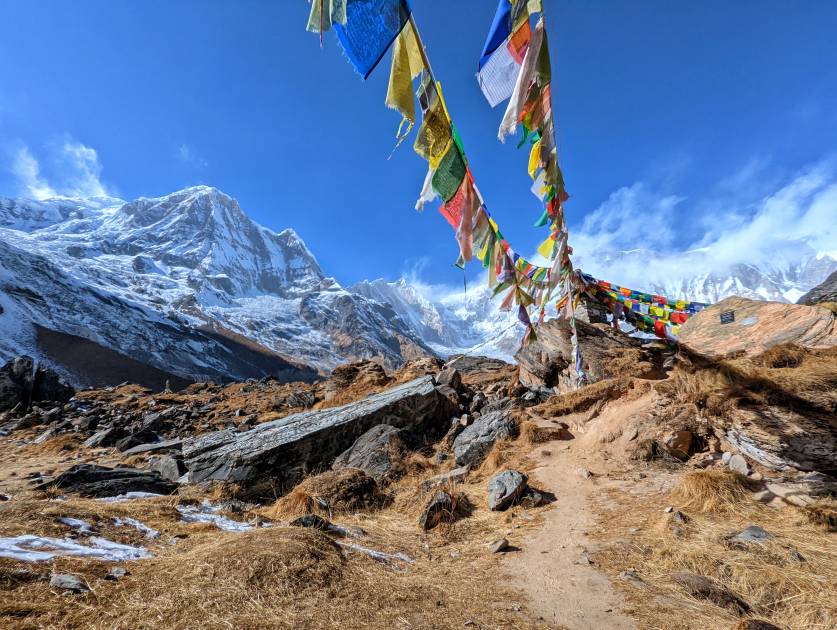
Starting near Pokhara, the route ascends through forests, past waterfalls and Nepali villages, gradually winding into the snow-blanketed landscape of the Himalayas towards Annapurna Base Camp. The Annapurna Sanctuary trek is less challenging than the Annapurna Circuit trek, as there are no high passes to cross - you’ll ascend to elevations of around 4,100m - and it’s a little shorter.
Read more: Annapurna Sanctuary Trek or Annapurna Circuit Trek?
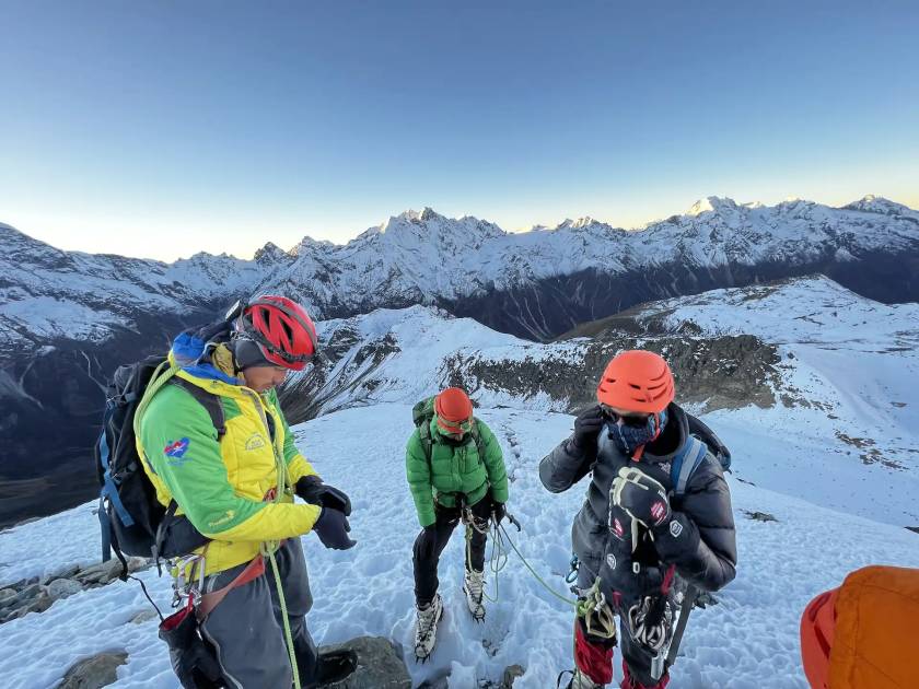
5. Langtang Valley and Yala Peak (5,500m), Nepal
- Perfect for: Non-technical climbing in the Himalayas
- Level: Challenging
- Distance: 60 miles/97 km
- Duration: 8-9 days
A trek of two halves - you’ll hike through the lush forests of the Langtang Valley before heading above the treeline to climb glaciated Yala Peak, one of the few non-technical peaks in the Himalayas. The trek commences in Syabrubesi and crosses Bhote River suspension bridge before weaving through dense forests, with glimpses of snow-capped peaks.
You’ll ascend steadily, passing Langtang village, a resilient community still rebuilding from the 2015 earthquake. The path continues through Tamang settlements to Kyanjin Gompa, where you'll acclimatise at 3830m and explore local attractions, including a cheese factory and Langtang Lirung's glaciers.
The toughest part of the trek is the journey to Yala summit (5500m). It generally takes approximately eight hours, with the last 700m requiring ropes, crampons and ice axes. Your reward is panoramic views of the Langtang range and Shishapangma. Afterwards, descend to Kyanjin Gompa before retracing your steps back to Syabrubesi, where you can toast to your accomplishments and bid farewell to the Himalayas.
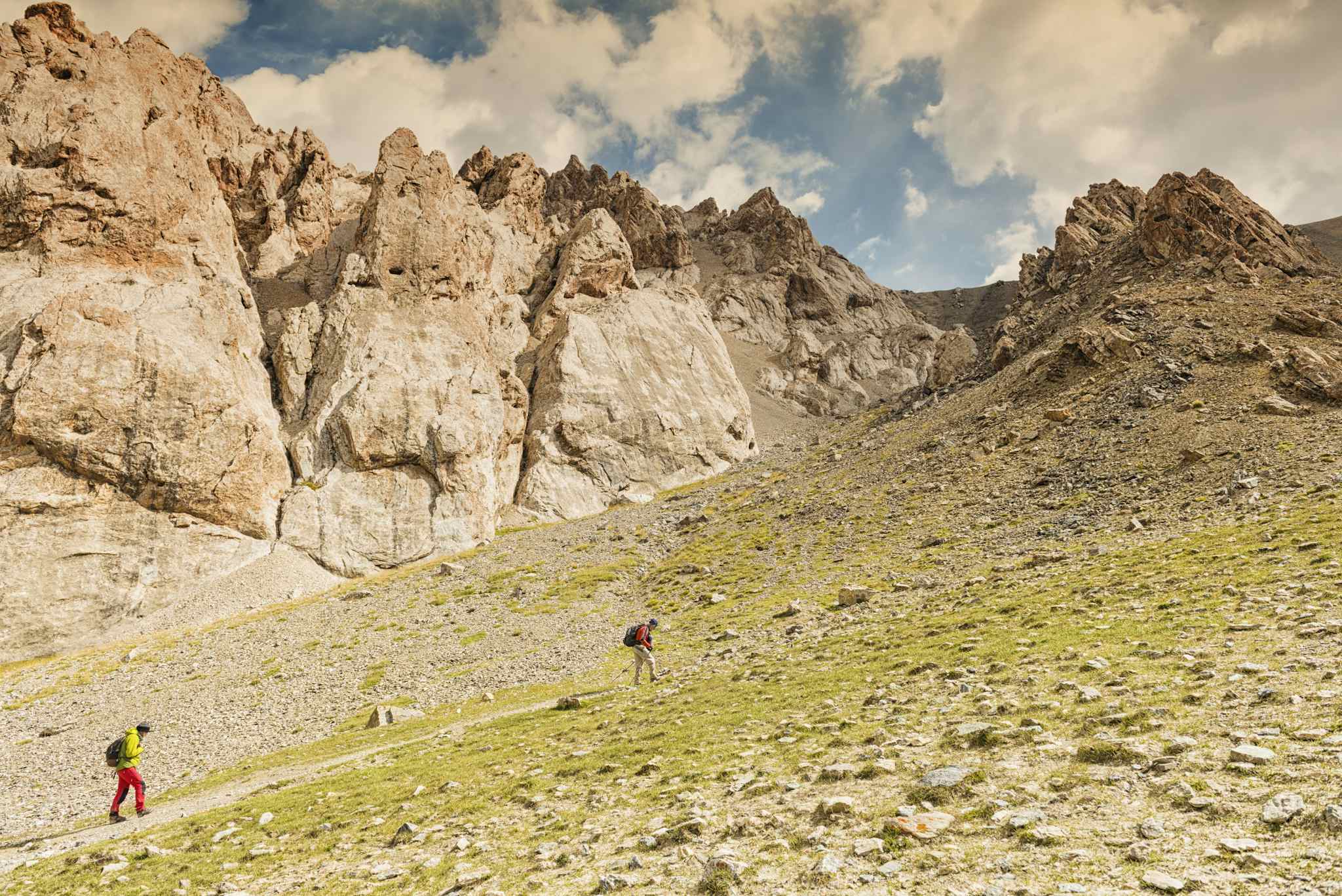
6. Issyk Kul Lake and the Jukku Valley, Kyrgyzstan
- Perfect for: Quiet trails and unique Kyrgyz culture
- Level: Challenging
- Distance: 61 miles/99km
- Duration: 7-8 days
This trek in Kyrgyzstan takes you through the remote Tian Shan mountains, passing through ‘jailoo’ - Kyrgyz summer pastures - past sandstone cliffs and up high passes. It begins at Issyk Kul, one of the world's highest alpine lakes. You’ll trek through the historic Jukkuchak Valley, once part of the ancient Silk Road, culminating in a challenging yet rewarding climb to the summit of Jukku Pass. Traverse the Arabel Syrt, a highland ecosystem, and marvel at crystalline lakes before returning to Issyk Kul.

One of the highlights of this trek - apart from the scenery - is getting to learn more about Kyrgyz culture. You’ll meet semi-nomadic shepherds, as well as traditional eagle hunters. At night, you’ll bed down in yurts, gaining an insight into local customs and traditions.
Read more: 5 of the Best Hikes in Kyrgyzstan's Tian Shan Mountains
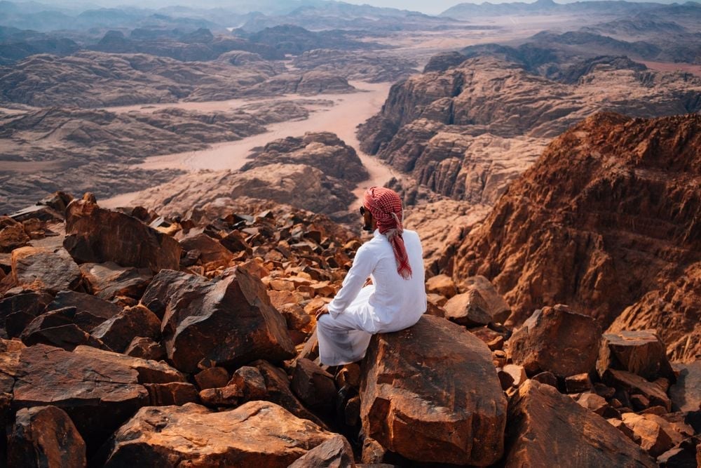
7. Jordan Trail, Jordan
- Perfect for: Complete immersion in Jordan’s diverse landscapes
- Level: Challenging
- Distance: 419 miles/675km
- Duration: 35 - 45 days
The Jordan Trail spans 420 miles from Umm Qais in the north to Aqaba in the south, passing through Jordan's capital Amman, the historic city of Petra and the vast red sand desert of Wadi Rum. It follows ancient trade routes, and in doing so connects these popular attractions with smaller villages, which don’t normally see the economic benefits of tourism.
You might not have enough annual leave to hike the entire Jordan Trail, and opt to do part of it. One of the most scenic sections is the 74 mile (120 km) section of the trail between Wadi Rum and Petra, which passes through remote ‘wadis’ or river valleys, Bedouin villages and past sandstone rock formations - this takes around six days. The trek is rated as challenging due to its length and heat; the north of the trail also has quite a lot of elevation gain.
Read more: The 675 km Hiking Trail Through the Heart of Jordan
8. The Pekoe Trail, Sri Lanka
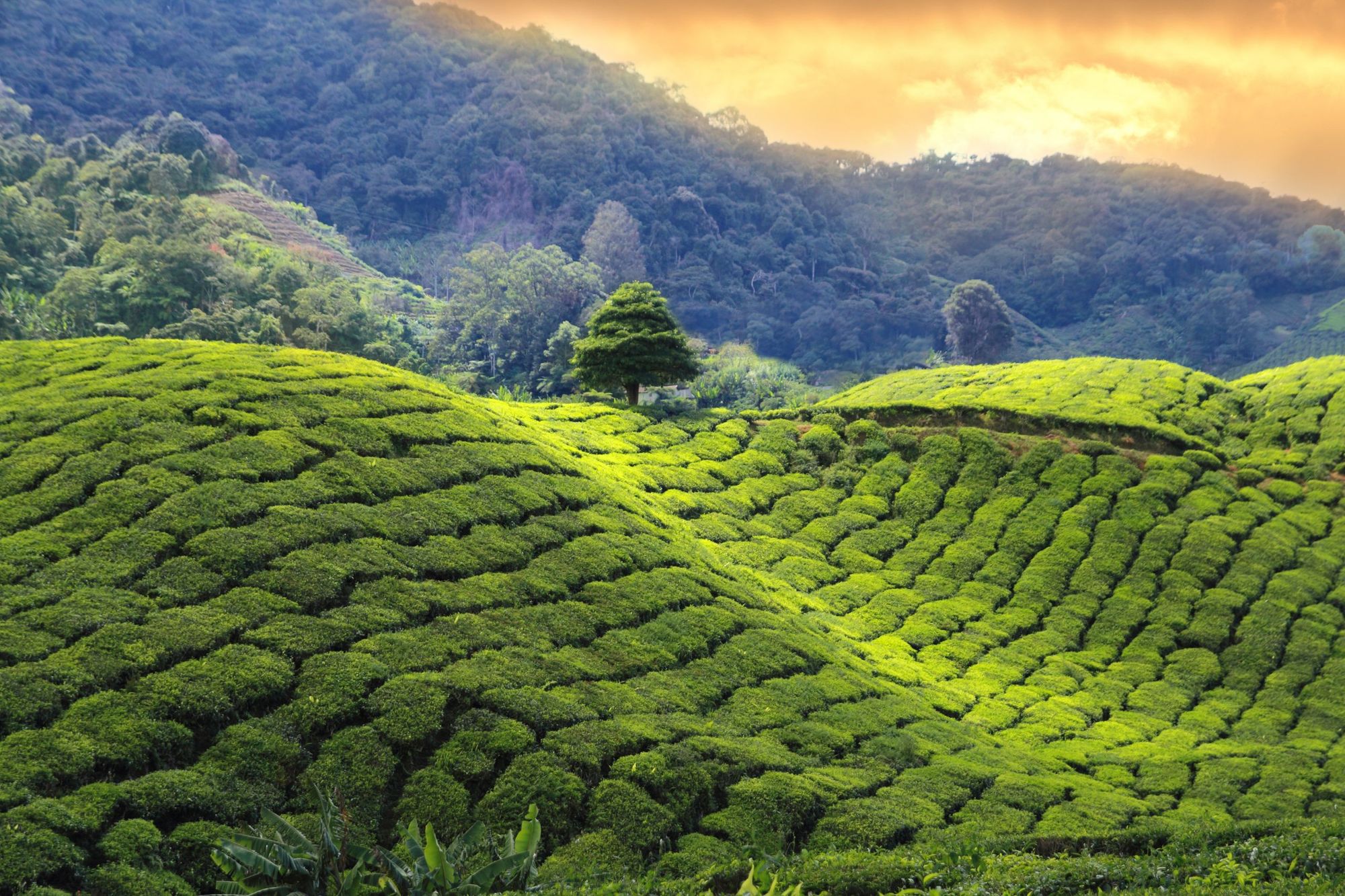
- Perfect for: Exploring the Sri Lankan highlands
- Level: Moderate
- Distance: 186 mile/300km
- Duration: 16-22 days
The Pekoe Trail winds through the tea-carpeted highlands of Sri Lanka, from the Hanthana Mountains near Kandy to the hill station of Nuwara Eliya, dubbed ‘Little England’ thanks to its colonial bungalows and relatively cool climate. Named after the renowned black tea grown in Sri Lanka, the Pekoe Trail leads past historic Loolkandura Estate, the first tea plantation in the country, and the scenic Nine Arch Bridge, reflecting the colonial legacy of the region's tea industry.
The trail is broken into 22 stages, so can be completed in short sections or as part of a longer multi-day hike. If your time is limited, we recommend stage 10 in the Horton Plains National Park - a high-altitude plateau carpeted with cloud forest and grassland, known for its rich biodiversity.
Read more: The New 300 Km Hiking Trail Through Sri Lanka’s Highlands
9. Kumano Kodo (Nakahechi section), Japan
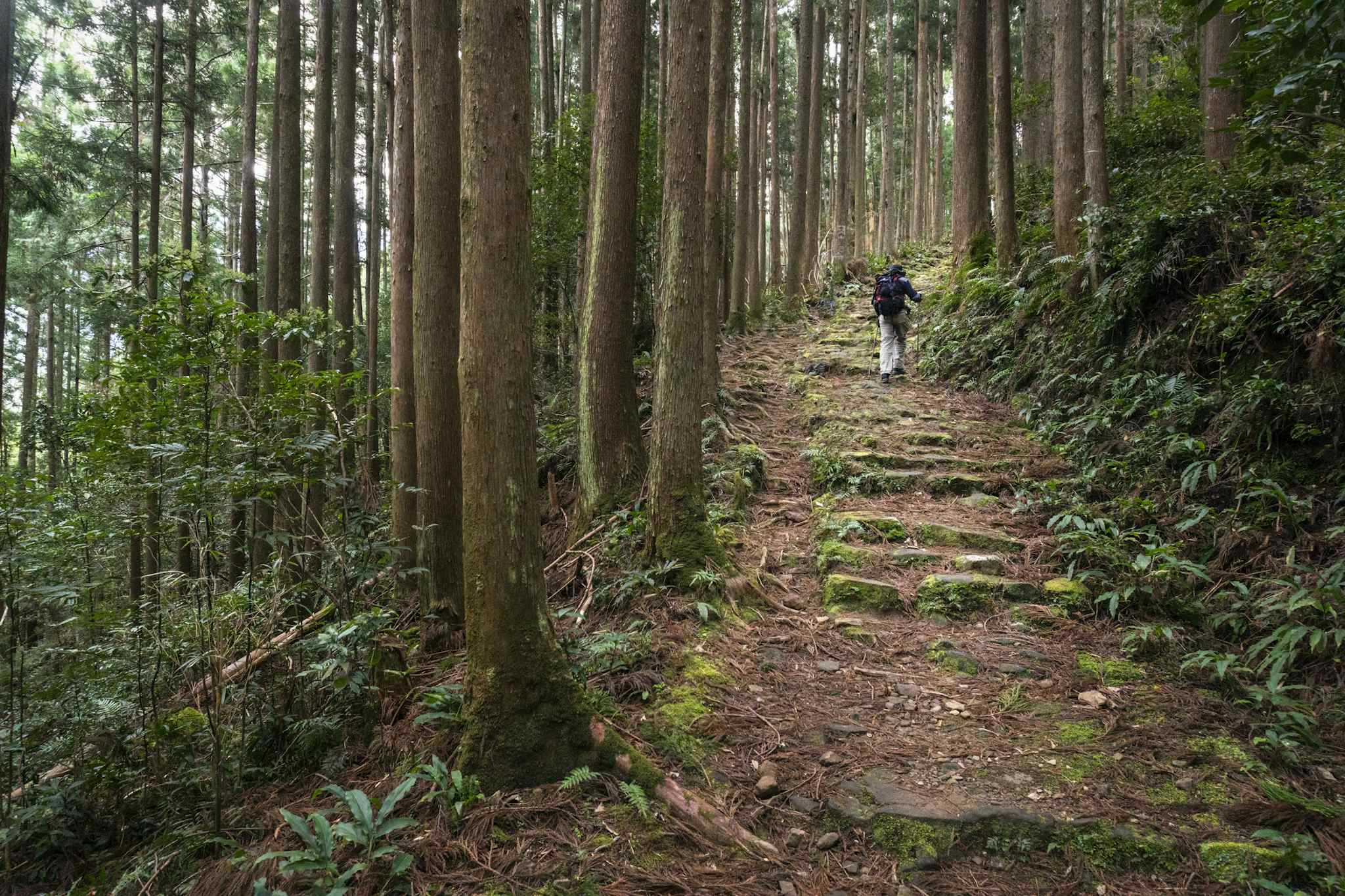
- Perfect for: Tracing ancient pilgrimage routes through Japan
- Level: Moderate
- Distance: 42 miles/68km
- Duration: 3-5 days
The Kumano Kodo is a network of trails in Japan’s Kansai region linking three religious Kumano shrines (Hongu Taisha, Hayatama Taisha and Nachi Taisha) - the word ‘Kodo’ means old ways, as the routes have been used by pilgrims for over a thousand years. They are the only pilgrimage routes besides the Camino de Santiago to be designated a World Heritage site.
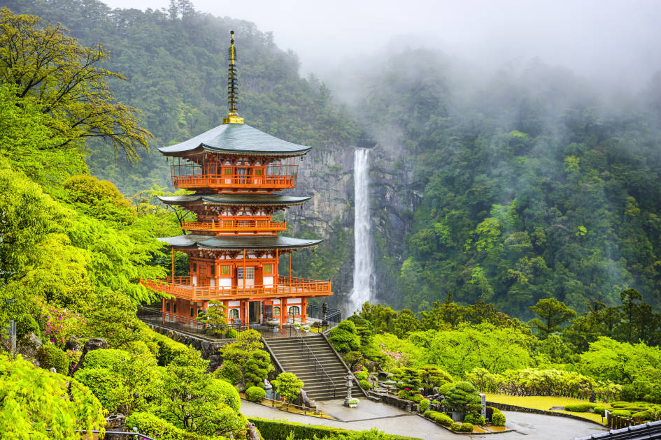
The Nakechi section of the trail begins in Takijiri Ōji and travels east across the mountains towards the grand shrines. It’s also known as the ‘imperial route’ as it was extensively used by the Imperial family from the 10th century. It begins with a gradual ascent to the Sakura-toge Pass, then winds through pine and cedar forest towards Hyakken-gura Peak, where you’ll have sweeping views of Wakayama's mountainous terrain. It descends to Koguchi village, before a challenging uphill trek to Funami-toge Pass - boasting vistas of the Pacific Ocean and Katsuura fishing village on clear days - and descending to Kumano Nachi Taisha.
10. Curzon Trail, India
- Perfect for: Exploring a little-known area of the Indian Himalayas
- Level: Challenging
- Distance: 38.5 miles/62km
- Duration: 4-6 days
The Curzon Trail (also known as the Kuari Pass Trek) runs through the Nanda Devi region, one of the remotest and unspoilt areas of India's Himalayas. It’s named after Lord Curzon, once the Viceroy of India, who walked in the region during 1905, and its highest point is the Kuari Pass (3,860m), making it relatively low-level for a trek in the Himalayas.
The route begins on the outskirts of Joshimath and follows a path along a glacial river, passing through coniferous forest and the traditional village of Rumni before climbing to a high plateau. From there you’ll continue uphill to Ramni Pass (3064m), and descend into a verdant valley of glades and meadows. A couple of days later you’ll tackle the Kuari Pass - you’ll be surrounded by a panoramic view of 6,000 to 7,000 metre high mountains. The best view comes during the descent, when the majestic peak Nanda Devi (7,816m) reveals itself.
Read more: 5 Unmissable Treks in the Indian Himalaya
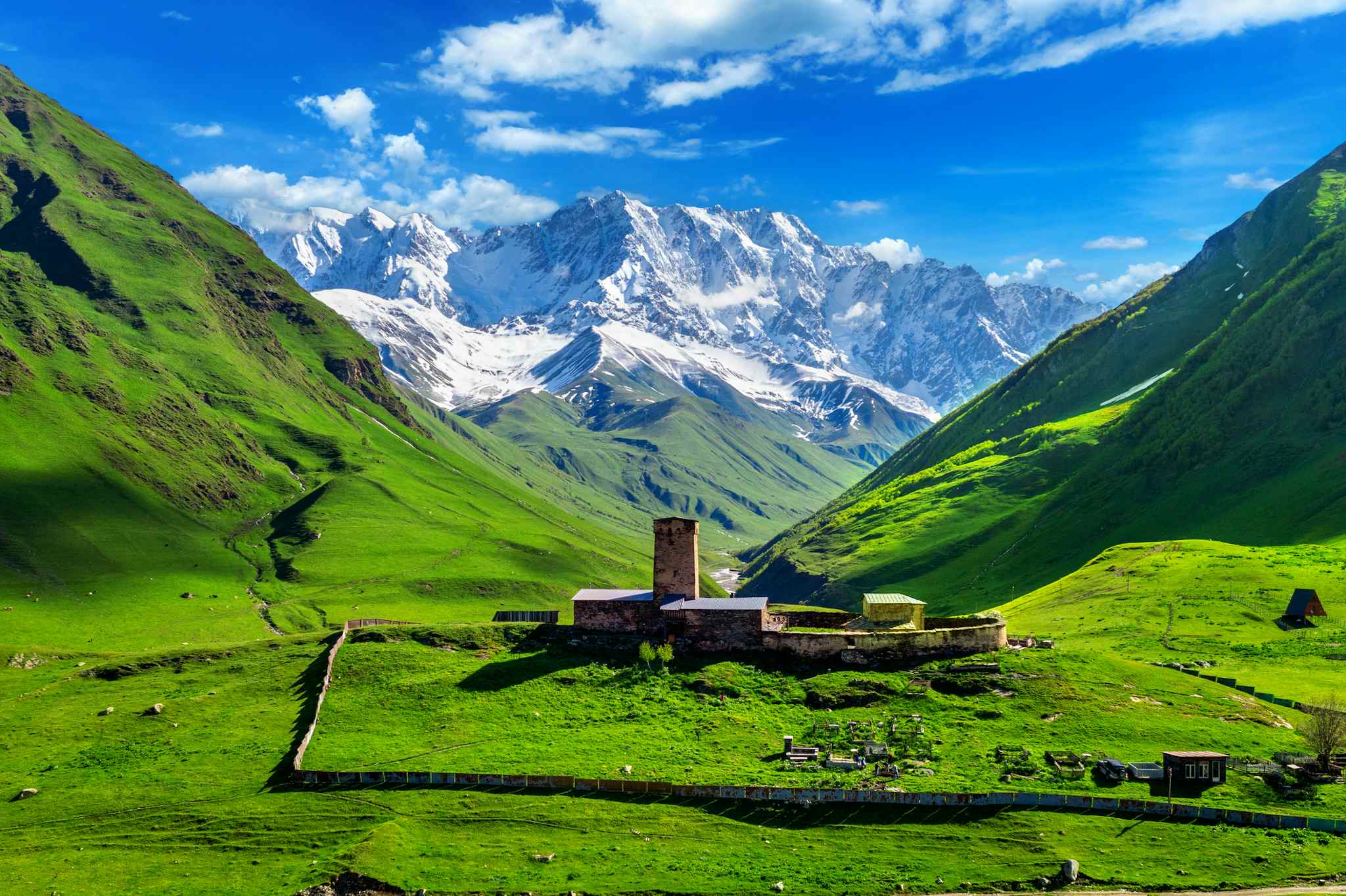
11. Transcaucasian Trail (Upper Svaneti section), Georgia
- Perfect for: Immersion in Georgia’s mountain scenery
- Level: Challenging
- Distance: 87 mile/140km
- Duration: 5-7 days
The Transcaucasian Trail is an ambitious project to create a long distance trail more than 1,864 miles (3,000 km) in length through the Greater and Lesser Caucasus Mountains in Armenia, Georgia and Azerbaijan. It will connect over 20 national parks and protected areas, as well as remote villages which will benefit from tourism. The trail is not yet complete, but several sections are open, including an 87 mile (140km) section through the Upper Svaneti Region of Georgia.
The Upper Svaneti section of the TCT begins in Chuberi, in the Nenskra Valley, and ends in UNESCO-designated Ushguli, one of the highest continually-inhabited settlements in Europe. You’ll cross five mountain passes, including Guli Pass (2,954m), where you’ll have a view of the serrated peaks of Ushba massif, as well as the Guli glacier. Accommodation is in guesthouses in mountain villages, and there are also numerous wild camping opportunities.
Read more: Hiking in Georgia: 5 of the Best Treks in the Caucasus Mountains
12. The Pamir Trail, Tajikistan
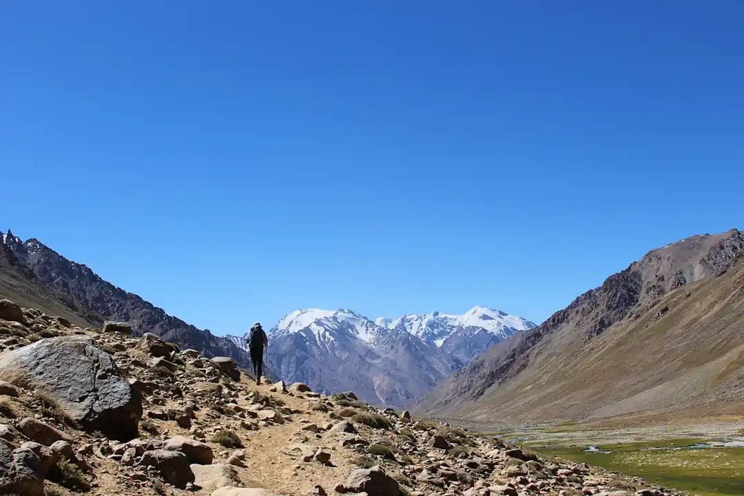
- Perfect for: Untouched trails and wild mountain scenery
- Level: Challenging
- Distance: 674 miles/1,084km
- Duration: 40 - 65 days
The Pamir Trail is a long-distance trail across the remote Pamir Mountains of Tajikistan; despite being one of the world’s most mountainous countries, it’s very under-the-radar as a trekking destination. So far, the trail consists of nine sections, broken down into 78 stages and totalling over 1000 kilometres in length - but some sections have yet to be finalised.

If you only have time to walk a section of the Pamir Trail, we recommend stages 67 - 70 (a total of 39 miles / 63 km). It begins in Irkt, where there is a manned Meteo Station with a sauna - you can warm up after a dip in the glacial waters of Sarez Lake. You’ll then climb the Burghumol Pass (3,925m) to reach the Langar Dara Valley, where the verdant meadows and trees on the valley floor contrast with the rocky, snow-capped mountains on either side. You’ll cross rivers and meander through valleys to reach two high-altitude lakes - Zaroshkul Lake (4,520m) and Tshakhin Lake (4,340m). Then there’s over 1000 metres of descent to the Kavk natural hot springs, where you can soothe your aching limbs.
Read more: The Woman Using Tourism to Fight for Female Empowerment in Tajikistan
13. The Lycian Way, Turkey
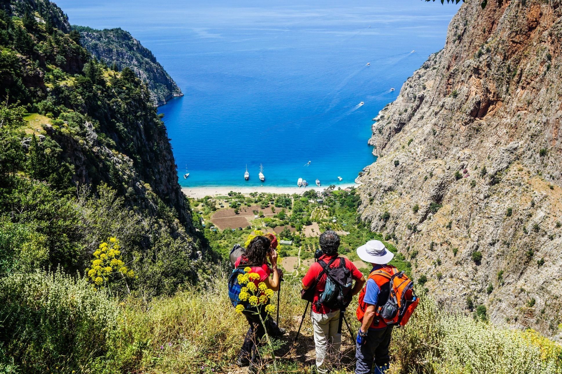
- Perfect for: Traversing Turkey’s Turquoise Coast
- Level: Moderate
- Distance: 335.5 miles/760km
- Duration: 25-35 days
The Lycian Way is Turkey’s first long-distance footpath. It follows the Lycian coast in southern Turkey from Ölüdeniz (just south of Fetiye) to Geyikbayırı (a village near Antalya). You’ll follow old Roman roads and mule tracks along rocky ocean-facing slopes, along plateaus where strawberry and carob trees grow and through aromatic spruce forests; passing plenty of deserted coves on the way.
Most hikers tend to walk a smaller section of the Lycian Way - public transport along the trail is good, and hiking can be combined with other activities such as kayaking or paragliding. We recommend walking the trail from its start point to Patara, 37.2 miles (60 km) away along the coast. You’ll pass through the gorgeous Butterfly Valley - so named for its profusion of butterflies - and the Lycian Patara Ruins, including an ancient amphitheatre.
Read more: 10 of the Best Hikes in Turkey
14. Bali Coast to Coast trek, Indonesia
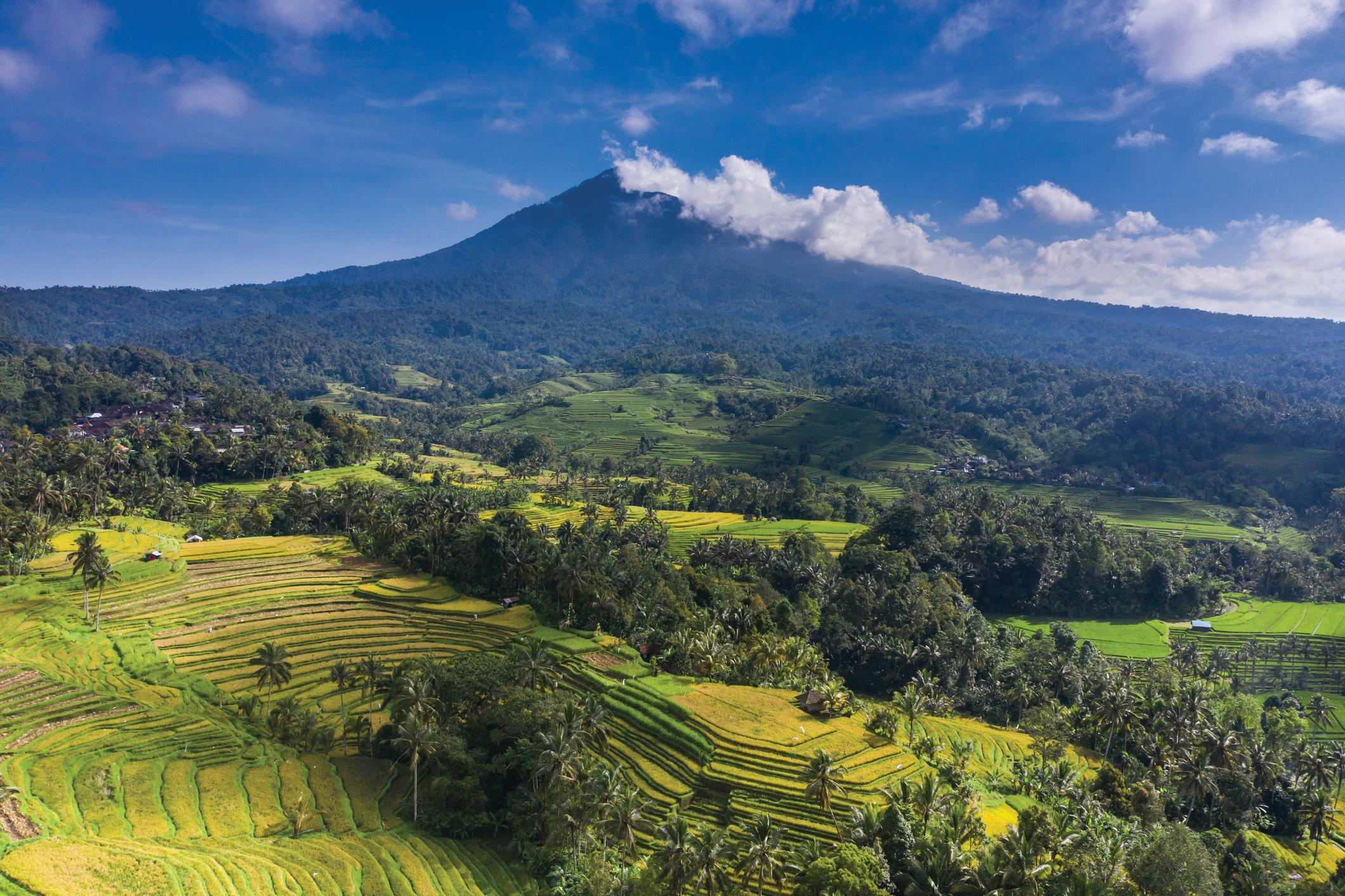
- Perfect for: Immersion in Balinese landscape and culture
- Level: Challenging
- Distance: 74 miles/119km
- Duration: 9-11 days
Bali’s newest coast to coast trail begins in the south of Bali, and takes you through the heart of the island to the Aling-Aling waterfall, the final stop before you hit the north coast. You’ll pass through cacao and coffee plantations, rice paddies and quiet villages - where villages still used UNESCO-protected agricultural methods - before a challenging night hike to the top of Mount Batakaru (2276m), Bali’s second-highest volcano -arriving in time to witness an ethereal dawn.
After this ascent, you'll hike down the other side of the volcano, and the landscape then changes to lush jungle, with plenty of panoramic views of Bali’s forest-carpeted highlands. You’ll pass plunging Dedari Waterfall (hard to reach if not on this long-distance route) before descending back down through cultivated fields and plantations towards the coast. This trek gives you the chance to experience Balinese life away from the resorts, and experience its diverse landscapes.
The Best Day Hikes in Asia
15. Tiger Cave Temple Hike, Thailand
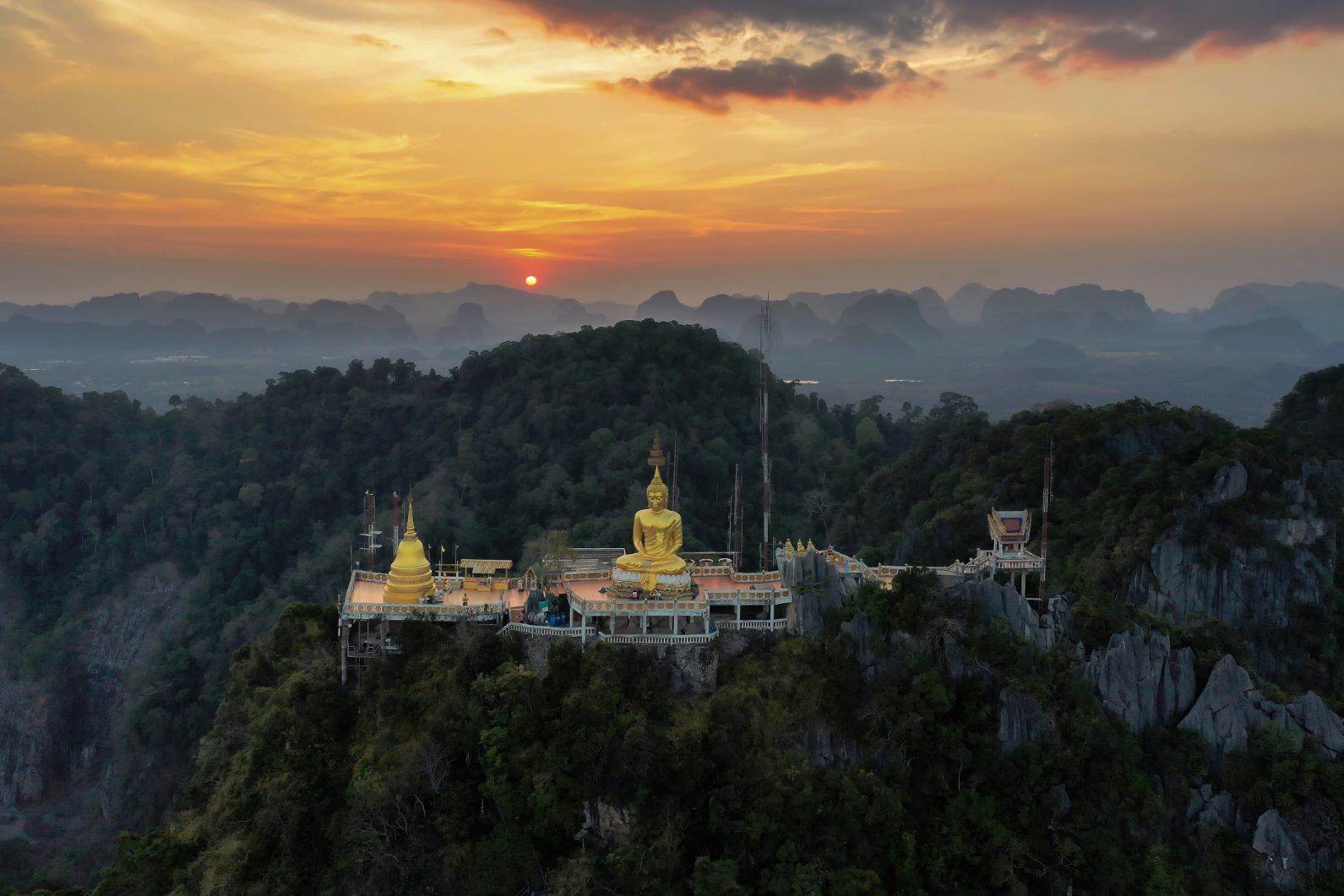
- Perfect for: Getting those steps in
- Level: Moderate
- Distance: 3 - 4 hours
- Duration: 3 miles/5km
The Tiger Cave Temple is located in Thailand’s Krabi province, at the top of a limestone peak around 270 metres high. At the base is a religious complex, where Buddhist monks still live and pray, and which includes a natural cave system. A monk went to meditate in these caves in 1975, returning with tales of roaming tigers, which is how the temple got its name.
To reach the Tiger Cave Temple, you’ll need to climb up 1,260 stone steps. We’d recommend doing the hike early in the morning or late afternoon to avoid the fierce midday heat - it makes the hike a lot more difficult. On the way up to the top there are several viewpoints where you can stop for a break. You’ll be accompanied by both tourists and locals on your climb, as well as troops of monkeys (make sure your bags are closed, as they’re light-fingered). At the top you’ll find a platform with a large golden Buddha statue in the centre, and you’ll have views of the adjacent peaks and the fields below.
Read more: The 1,260-Step Staircase to Tiger Cave Temple in Thailand
16. The River of 1000 Lingas, Cambodia
- Perfect for: Exploring sacred sites in the Cambodian jungle
- Level: Easy
- Distance: 7 miles/12km
- Duration: 3 hours
Cambodia is known for its ornate temples and sites of religious significance - and Kbal Spean, or ‘River of a Thousand Lingas’ is one of its lesser known attractions. The riverbed at Kbal Spean features ancient carvings of Hindu deities and numerous lingas, believed to date back to the reign of King Udayadityavarman II in the 11th century. While lingas are phallic symbols, in Hinduism they hold deeper significance, representing both creation and destruction. The waters of Kbal Spean flow into the Siem Reap River and eventually reach Angkor Wat; the lingas were carved to purify and bless the waters before they reached these iconic temples.
You can reach Kbal Spean through a jungle trek into the heart of Phnom Kulen National Park. After a briefing from the park ranger, head into the jungle towards the river. Stop to visit the reclining Buddha statue at Preah Ang Thom pagoda on the way. After admiring the lingas at Kbal Spean, continue on the path upwards to Phnom Kulen waterfall. It’s an easy hike, but make sure you bring enough water with you - especially in the hot season.
17. Elephant Cave & Ma Da Valley, Vietnam
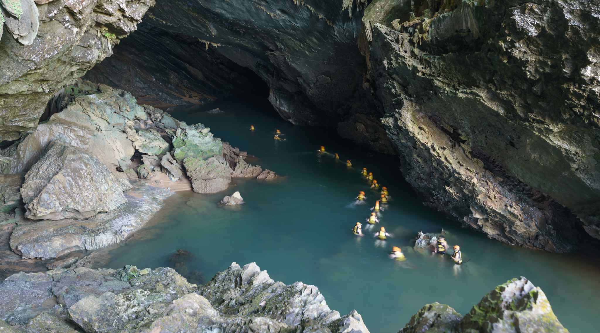
- Perfect for: Cave swimming and jungle trekking
- Level: Moderate
- Distance: 10.5 miles/17km
- Duration: 7- 8 hours
This hike takes you through Ma Da Valley into the heart of Vietnam's Phong Nha-Ke Bang National Park - limestone caves and cliffs surrounded by lush jungle. You’ll hike through the forest on a rocky path, which gradually gets steeper until you arrive at Elephant Cave, which is 60m high and 300m deep - so named for the elephant-shaped stalactites in its entrance. Afterwards you’ll head deeper into the jungle, crossing rivers to reach Ma Da Lake, with brilliant blue waters encircled by limestone walls.
You have two options: to camp near Ma Da Lake overnight; or to continue on your way and keep this as a day hike. Either way, once you’ve refreshed yourself with a swim, you’ll hike across watercourses and scramble up limestone rocks to Tra Ang Cave - it only opened to tourists in 2016 and sees few visitors. Don helmets and head torches to swim the 600m length of the cave, or explore the area on foot. You’ll then follow the Tra Ang River Trail to the end of your hike.
18. Ban Gioc Falls Hike, Vietnam
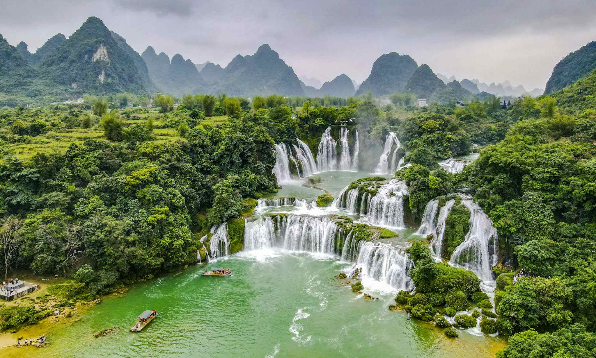
- Perfect for: Chasing waterfalls
- Level: Easy
- Distance: 5 miles/8km
- Duration: 2-3 hours
This hike in northern Vietnam takes you along trails used for hundreds of years by local villagers, and leads to Ban Gioc Falls, a plunging series of cascades which shares a border with China. After Iguaçu, Victoria and Niagara Falls, Ban Gioc are the biggest falls to form a border between two countries.

You’ll hike along the Quây Sơn River before climbing up 200 steps to reach a viewpoint overlooking the waterfalls and beyond into China. Near the falls you'll also find the Truc Lam Ban Gioc Pagoda, a serene Buddhist temple.
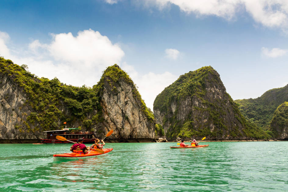
19. Cat Ba, Vietnam
- Perfect for: An easy hike with great views
- Level: Easy
- Distance: 1.8 miles/3km
- Duration: 2-3 hours
Cat Ba is the largest island in Vietnam’s Halong Bay, known for its pristine beaches and rugged, jungle-carpeted interior. There are several nature trails on the island, but we like the one taking you up to the top of Ngu Lam Peak (225m), because of the views it offers.

You’ll reach Cat Ba by using a ferry - wherever you’re coming from, you’ll likely need to transfer via Cat Hai island. The hike begins in Kim Giao Forest; a quiet, biodiverse swathe of forest where the soundtrack to your hike is birdsong and the chirp of insects. It’s around a 200 metre climb to the top of Ngu Lam peak - expect dramatic views of jungle-covered mountains from the summit.
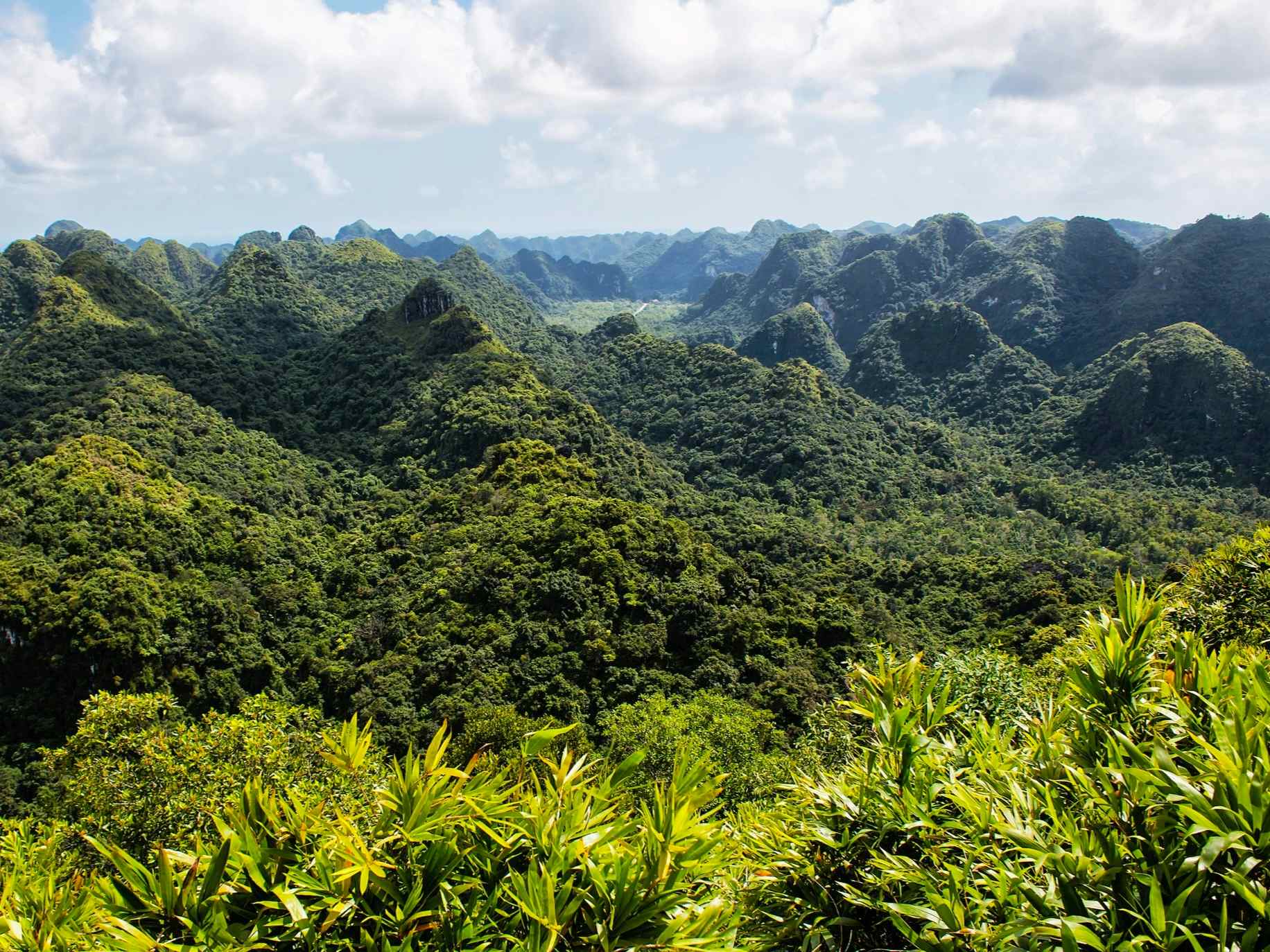
20. Bengoh Waterfalls trek, Borneo
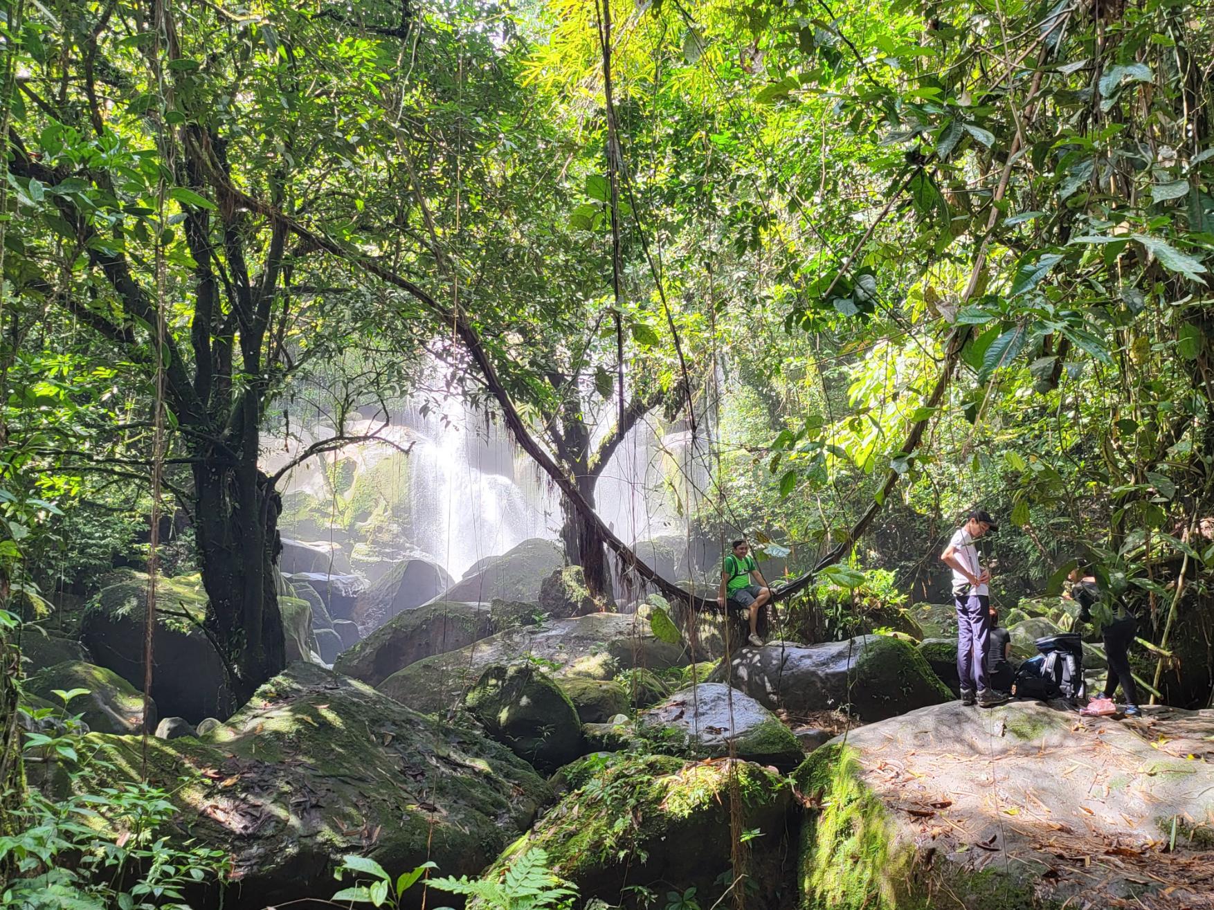
- Perfect for: Waterfall dips and jungle hikes
- Level: Easy
- Distance: 3.7 miles/6km
- Duration: 3 hours
Bengoh Lake is located in the Sarawak region of Borneo, an area often compared to Jurassic Park thanks to its misty mountains and primaeval, untouched rainforest. On this easy day hike to two of Bengoh’s most scenic waterfalls, you’ll be able to explore some of the best scenery in the region.
To reach the trailhead, you’ll need to take a short boat trip across Bengoh Lake - a tranquil lake encircled with mountains - until you reach Bengoh Dam. You’ll set off on a hike towards Pee’an (which means ‘curtain waterfall’), followed by Susung waterfall. You’ll pass through virgin rainforest, often likened to Jurassic Park, where you’ll find a variety of flora and fauna, from pitcher plants to exotic mushrooms and large twisting liana vines. Retrace your steps to Pee’an, where you can go for a dip before the hike back to the dam.
Inspired? Check out our hiking adventures in Asia.