


Six and a half of the best hikes in Snowdonia National Park?
What do you mean six and a half?
Read on and you'll soon find out.
Snowdonia, formally known as Eryri, is home to the country's biggest mountains - and it's right next to the sea. Its highest peak, Snowdon (Yr Wyddfa) at 1085m, gets the bulk of the attention. That's not surprising, given it gives the national park its name, but there is so much more to hiking in Snowdonia than Snowdon. There are over 2000 square kilometres to explore here, making it one of the biggest national parks in the UK.
Outside of the Snowdon massif, the main ranges in Snowdonia are the Glyderau, Carneddau, Rhinoggs, Moelwyns and the mountains around Cadair Idris.
The path winds slowly around the inside of the horseshoe with a short steep section at the end to reach the standing stone on Snowdon's ridge.
For anyone new to Welsh and trying to get their face around pronouncing the language, here are a few quick tips. Dd is a "th" sound, y is an "i" sound (as in "in") and au is pronounced the same as "eye". That should be enough to stop you embarrassing yourself - now, back to hiking. Each range has its own characteristics and we'll certainly include them in this list of the best hikes in Snowdonia.
We've been walking in Eryri for years. So when choosing the best hikes in Snowdonia, we looked back at our own personal favourite routes - great, adventurous hikes we've walked in the rain, sun or shine - and some of Snowdonia national park's signature hiking routes, which we just couldn't leave off the list.
Finally, before we lace up our hiking boots and run for the hills, it's worth remembering that route descriptions are only outlines to help you plan your trip.
Make sure you investigate the route properly yourself and come full equipped to deal with whatever weather Snowdonia might throw at you. These routes have deliberately been chosen to be hikes without scrambling, but the ground can get difficult very quickly if you stray off the path.
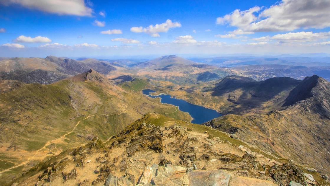
1. Snowdon from Llanberis (via Pyg Track)
- Distance: 8.5 miles (14km)
- Ascent: 700m
- Start Point: Pen y Pass (Bus from Llanberis)
- Best For: This is, in our view, the best route up Snowdon.
We know we started by saying that there's more to Eryri than Yr Wyddfa, but we can't exactly leave the main mountain off the list of Snowdonia hiking routes.
There are plenty of ways to climb Snowdon - and they are all good in their own way. You'll probably end up walking all of them if you spend enough time in North Wales! But for this list, we've chosen a circular route based from Llanberis. The hike starts from Pen y Pass and finishes back in Llanberis. There are regular buses from Llanberis to Pen y Pass, but obviously check the timetable before you go.
It is possible to park at Pen y Pass, but this is becoming increasingly difficult in recent years. Due to the sheer popularity of a very small car park, the parking charge is extortionate and you often have to book a slot long in advance. Basically, the bus is the best option.
Route Description
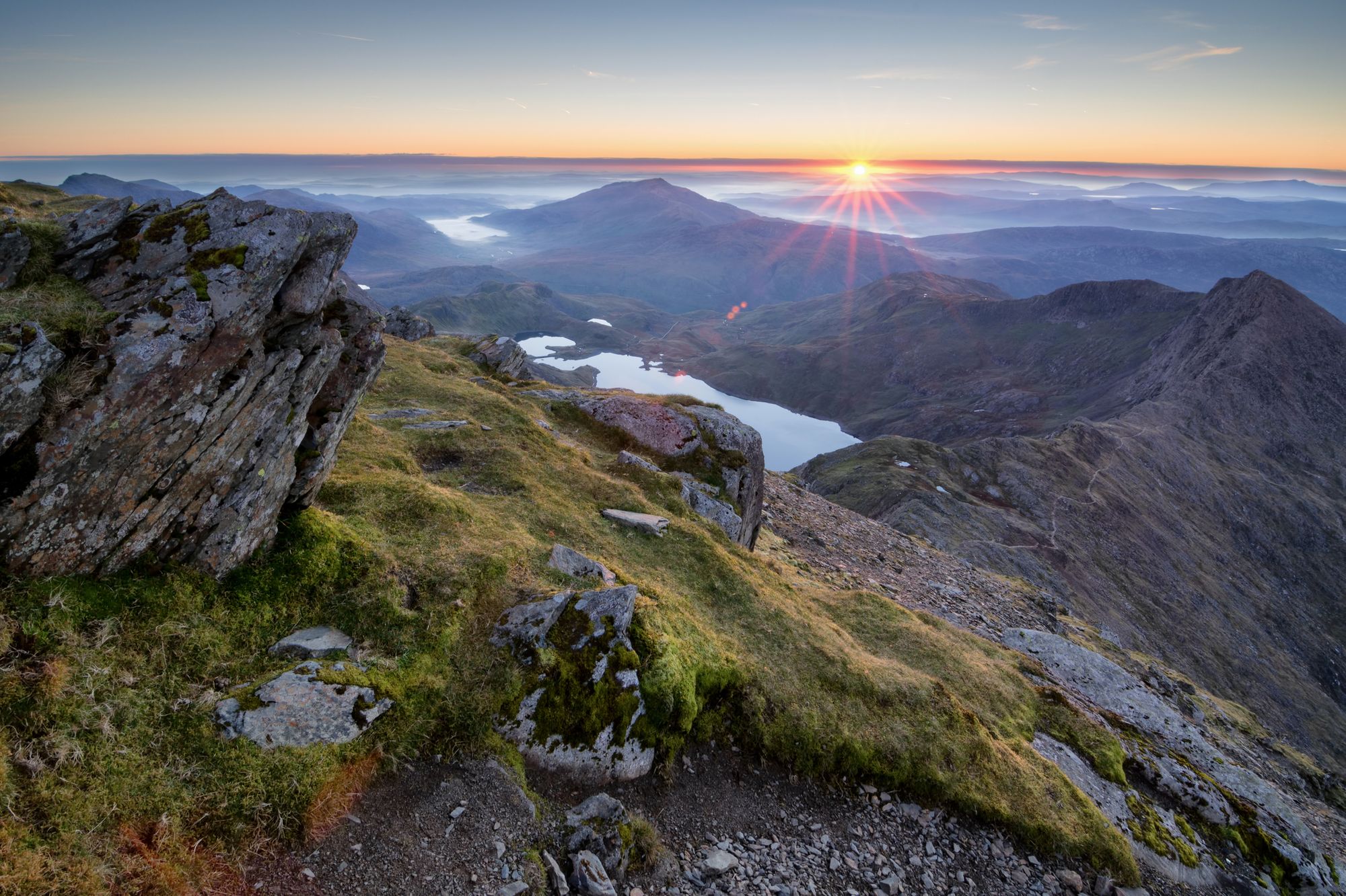
From Pen y Pass, take the path from the north corner of the car park up a broad stony track. Eventually, a drystone wall crosses the path. Climb over the stile and continue a slow ascent above the lake below. Do not be tempted by the steep ridgeline option on your right - this is a scramble route.
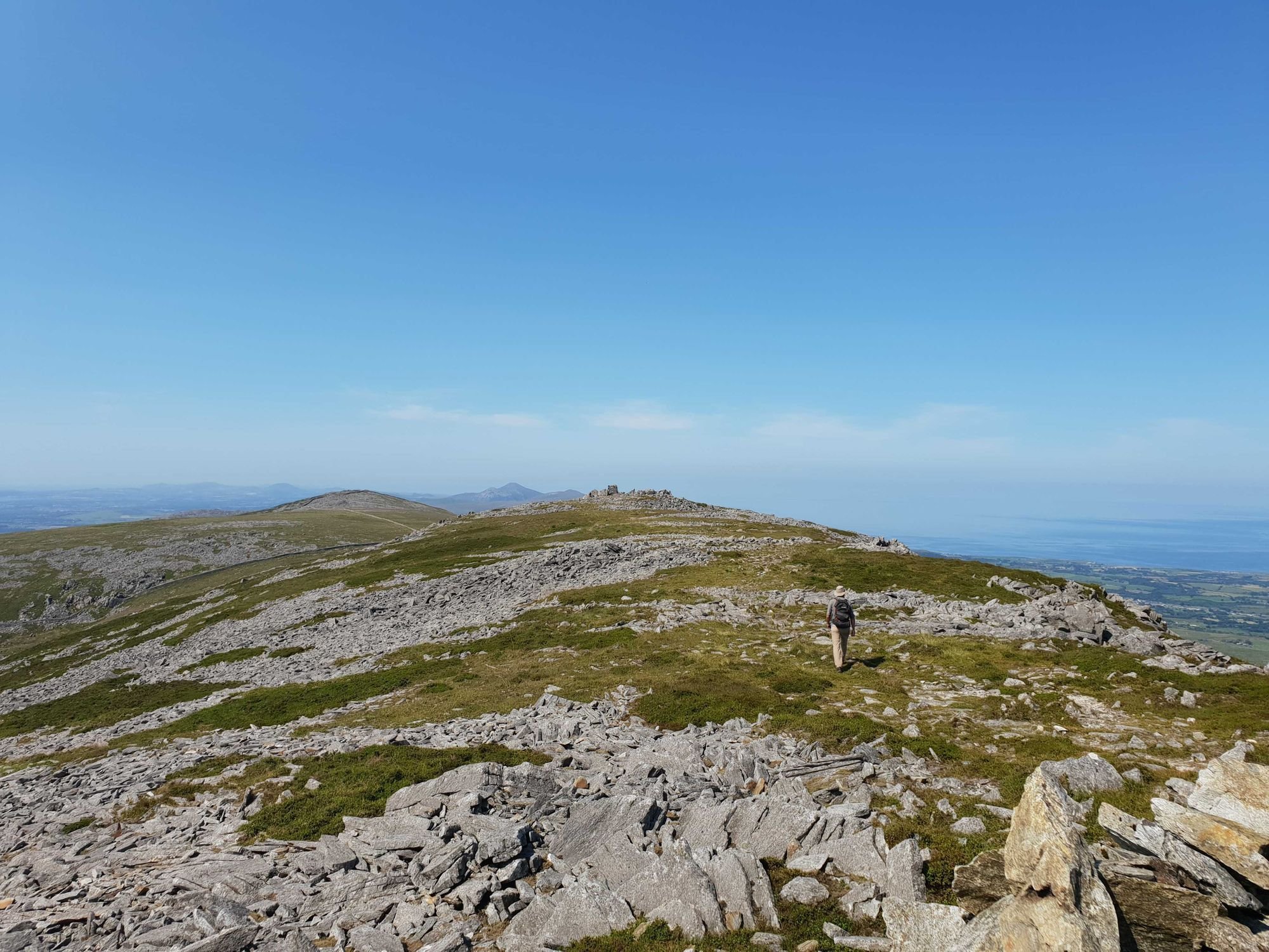
You are now on the Pyg Track. It's uncertain where the name comes from, perhaps it's named after the pass ("moch" means pig) or maybeit was used to carry black tar ("pyg") to the copper mines on Snowdon. But don't expect to see any pigs on it during your hike! The path winds slowly around the inside of the horseshoe with a short steep section at the end to reach the standing stone on Snowdon's ridge. Turn left and climb the last section, including the steps up to the trig point on the summit.
To descend, retrace your steps to the marker stone. Then, instead of turning right onto the Pyg Track, continue roughly north along the ridge and downhill. This is the Llanberis Path and follows the course of the railway line. Eventually, the footpath comes out at the end of a small road. Turn right and follow the road, then signs, into Llanberis.
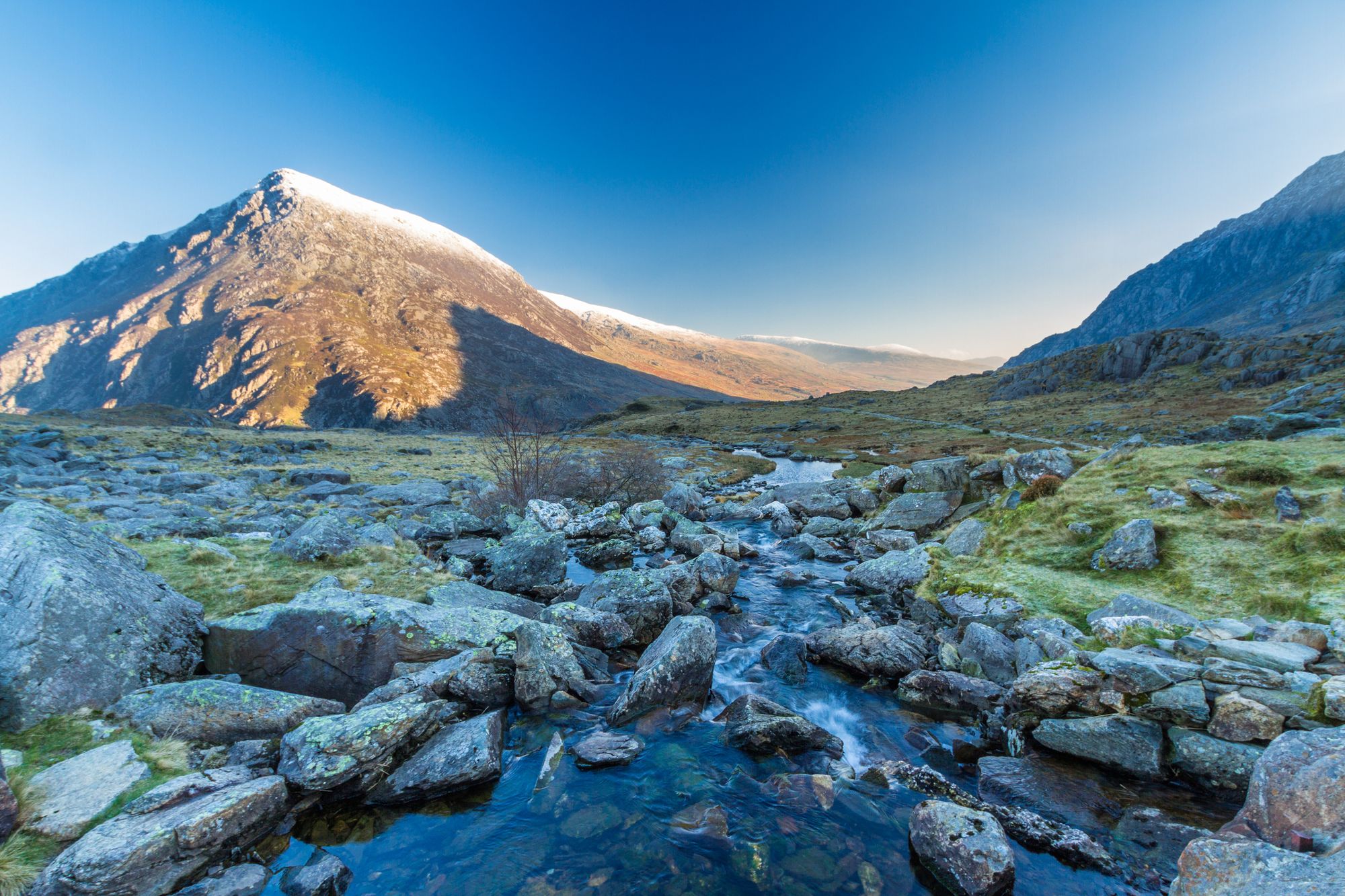
2. Glyderau Circular Hike (from Ogwen Valley)
- Distance: 8 miles (13.5 km)
- Ascent: 1200 m
- Start Point: Gwern Gof Uchaf
- Best for: Views of the Castle of the Wind.
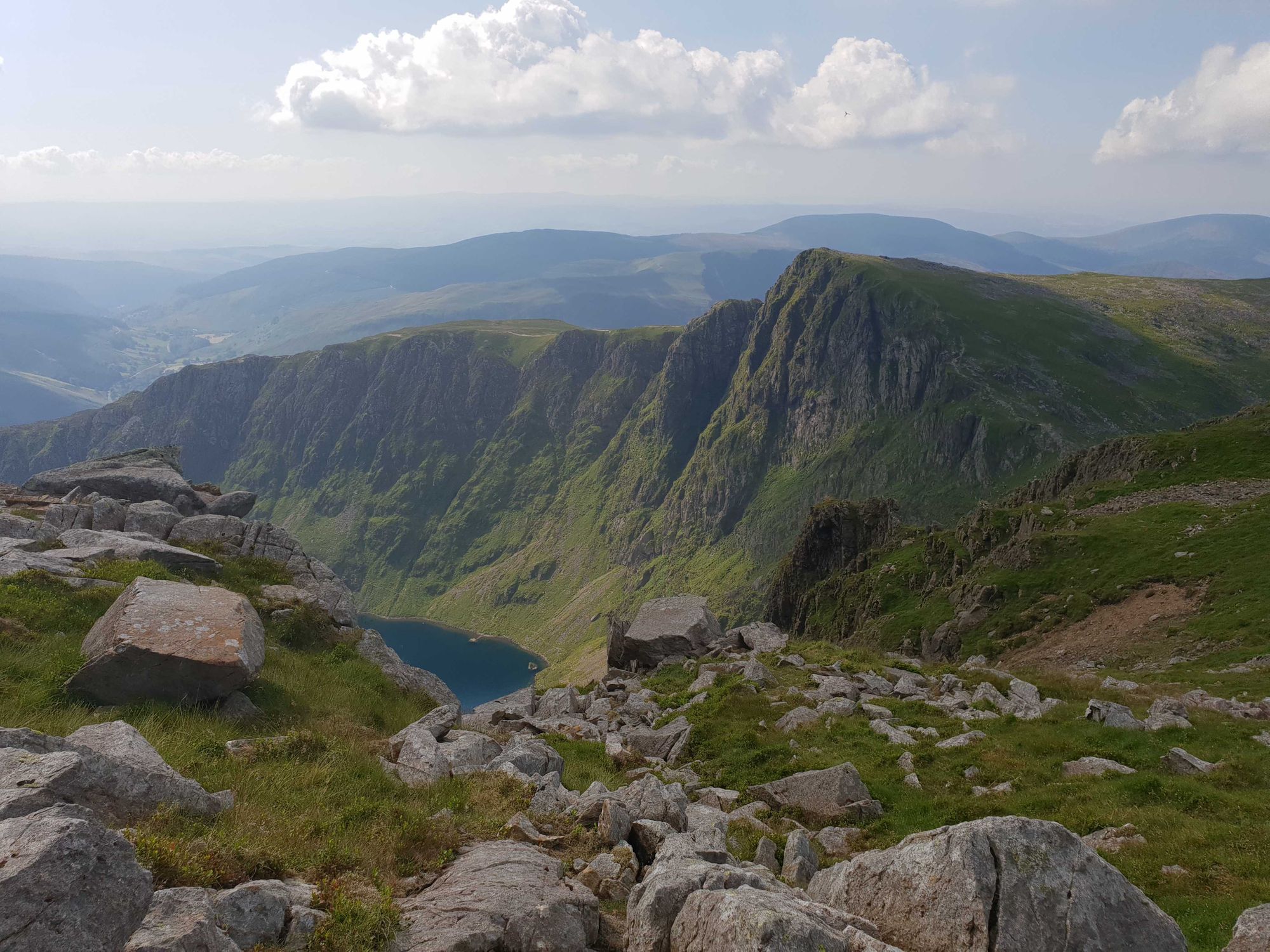
The Glyderau are the long line of mountains just over the valley from Snowdon. On a clear day, you will have sweeping views of Snowdon and its surrounding peaks when you reach the main ridgeline. Note that although this is a similar length to the Snowdon hike, this is a huge step up in terms of ascent and route finding.
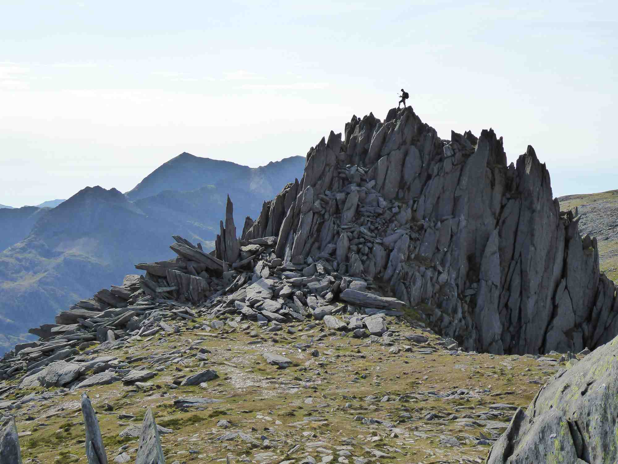
If you can't think of a better way to spend a day than being surrounded by rock (not the musical kind) you'll love this hike. The word Glyder derives from the Welsh for pile of rocks and that's a very good way to sum up the range - if a little bluntly. It's a very pretty pile of rocks. Tryfan in particular is home to numerous scramble routes and rock climbs. We've chosen a route that avoids all the scrambling, but if you'd like to make it more technical, you could take the north ridge of Tryfan and Bristly Ridge up to Glyder Fach.
Route Description
Start at the campsite and car park at Gwern Gof Uchaf. From here, the only way is up. Climb over the stile and cross the stream to find the footpath towards Tryfan, the pyramidal mountain already towering above you. If you look closely, you'll be able to see a long horizontal groove across the side of the slope you're facing. This is Heather Terrace and where you are heading.
Although this is a similar length to the Snowdon hike, this is a huge step up in terms of ascent and route finding.
Ascend over Tryfan Bach and left onto Heather Terrace. This is a very popular area for climbers and scramblers - but you're not going up that way! Walk the length of the terrace and take a path alongside a drystone wall. At the second stile, you will see the start of your path up Glyder Fach (don't cross the wall, that's another scramble route).
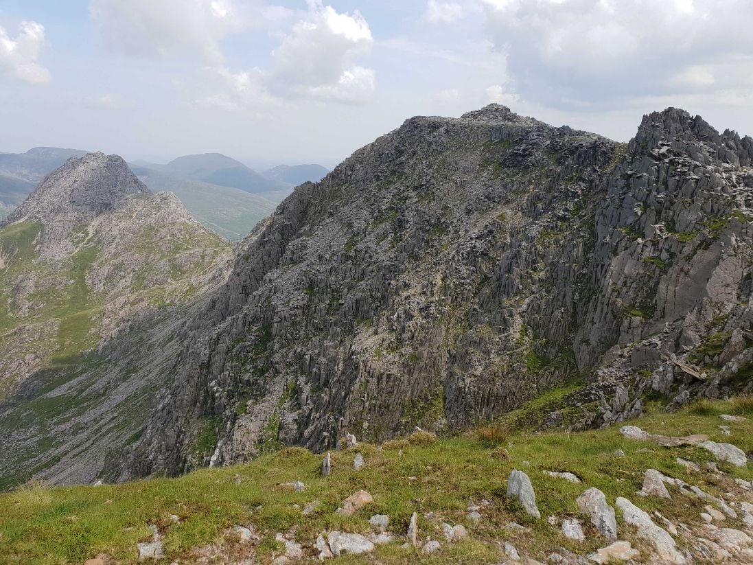
Finally, the ascent will ease off and you'll be presented with the summit of Glyder Fach, a wide open ridgeline with great views to your left and the Castle of the Wind. This jagged crown of rock looks very much like a castle, or perhaps the entrance to a dragon's lair. Continue along the ridgeline to Glyder Fawr, down to the small lake Llyn y Cwm and straight up the broad side of Y Garn.
Pass the summit and descend down the north eastern ridgeline on a small path to the north end of Llyn Idwal. Continue around the lake, south, until you reach the path on your left that cuts across the base of Y Gribin to Llyn Bochlywd. From here descend towards the road and either follow the wall or take the pavement back to your start point.
3. Carneddau Ridge Peak Bagging
- Distance: 13 miles (21km)
- Ascent: 1100 m
- Start Point: Car park near Rowen
- Best for: A long day of summit bagging.
The Carneddau are an often forgotten group of mountains to the north of Snowdon and the Glyders. The best way to do it is in one complete day hike, north to south, but that will probably involve juggling two cars or practicing puppy eyes on a friend with a car and no interest in hiking. If you can pull it off, it's a wonderful day out. Although, do try and choose a day with good weather, as it's a long hike to get off the ridge once you've committed.
Route Description
Start from the small car park at the end of the road west of Rowen, at the north end of the range and to the east of the main ridge. Yeah, it's a bit hard to get to! From the car park, immediately start you ascent, following an old Roman road. Just past the standing stones, turn left and continue uphill along the nose of the ridge, following the wall to Drum.
From here, your quest is to simply stay high on the main ridgeline. You'll pass over the peaks of Foel-fras, Carnedd Uchaf, Foel Grach and Carnedd Llywellyn on your way south. From Carnedd Llywellyn, the ridge narrows in and becomes much more craggy on either side. Choose the south-east spur to reach Carnedd Dafydd and the pyramidal Pen yr Ole Wen overlooking the Ogwen Valley.
From here, your quest is to simply stay high on the main ridgeline.
If your knees haven't quite given way yet, you can finish directly down some 700m of vertical descent for a short but steep end to the day. This will take you straight to Idwal Cottage and the nearest cafe. Otherwise, descend along the eastern ridge towards Afon Lloer and follow the gentler path along the river, down to Llyn Ogwen.
3.5 The Welsh 3000s
- Distance: 30 miles (48km)
- Ascent: 3700 m
- Start Point: Pen y Pass or Bwlch y Ddeufaen, depending on direction
- Best for: The ultimate day out in Snowdonia.
The Welsh 3000s are all the mountains in Wales over 3000ft. Handily, they're all in Snowdonia and there are only 15 of them. The reason we're only counting this as half a route is because we've already described most of this route.
Take the first three Snowdonia hikes listed in this article, put them together and what have you got? Basically the Welsh 3000s route, with a few modifications.
If going on a linear, peak bagging extravaganza from the Carneddau, through the Glyderau and on to Snowdon sounds epic we have just the thing for you. Check out our guide to the Welsh 3000s. There is some scrambling involved, so you might prefer to do it with a local guide. This is a monster route.
4. Cadair Idris (via the Minffordd Path)
- Distance: 6.2 miles (10km)
- Ascent: 850 m
- Start Point: Car park at Minffordd
- Best for: A shorter hikes in Snowdonia.
It isn't a long Snowdonia trek, but it's certainly a classic. Cadair Idris is a mountain surrounded with much local legend. Its name means 'Chair of Idris' and one story tells that Idris was a giant, who lives in the range. Folklore also says that Llyn Cau, the lake in the centre of the horseshoe, is supposedly bottomless - and if you spend a night on the summit, you'll come down in the morning either mad or a poet. It might be worth the risk if you're desperate to level up on iambic pentameter.
The hike is fairly short, so would make a relatively easy walk in Snowdonia. It's a clear circuit usually completed clockwise. This area is a National Nature Reserve, protected for its geology and habitats. Rare alpine flowers still grow on its slopes, a legacy of the last Ice Age. There are a couple of options for start points, but as far as we're concerned, climbing Cadair Idris via the Minffordd Path is the best way to do it. We love it so much, we also included it into our best hikes in Wales list.
Route Description
Walk through the car park and past the public toilets towards the woods. The path goes past the cafe and up to a gate beside the river Nant Cadair. Go through the gate and start the long ascent up to Llyn Cau beside the river - count the steps through the trees!
At the junction, turn left and you'll go round the corner to get your first view of Cadair Idris. Take the path on the left again to head up onto the end of the horseshoe. Follow it round, over the top of Craig Cwm Amarch, and up to Penygadair and the trig point that marks the summit of Cadair Idris. Although the views back across the horseshoe are impressive, you can see all the way to the sea on the other side.
Rare alpine flowers still grow on its slopes, a legacy of the last Ice Age.
Descend along the broad slope north east and over the stile to Mynydd Moel. Watch out for jets flying a loop in the valley below you. To return to your start point, take a short off-path section south until you pick up a path alongside the fence. Follow it all the way down to a stile next to an old wall, where you can cross for a lesser seen view of the Cadair Idris horseshoe.
Finally, follow the path downhill through the purple heather and across a slate slab bridge to join back up with the track through the woods.
5. Nantlle Ridge Hike
- Distance: 7.5 miles (12km)
- Ascent: 800m
- Start Point: Rhyd Ddu car park
- Best for: A long hike with an opt-out introduction to scramble.
The Nantlle Ridge is best known for its striking wedge-shaped ridge that snakes from the side of Snowdon towards the coast. The traditional route includes a Grade 1 scramble, but it is possible to walk around almost all of the scrambling. Simply drop down to your left below the crest of the ridge. On a clear day, you'll have Snowdon on one side and the sea on the other.
This is another linear route, but without any convenient bus connections. For now, you'll have to juggle some two-car logistics or persuade an excellent friend to drop you off and pick you up. Or, if you're moving fast, turn it into a circular walk with several kilometres along the road back to your start point.
Route Description
From Rhyd Ddu car park, the starting point for some people about to climb Snowdon, cross the road and take a path through fields west and out into Open Access Land. Continue on the grassy path all the way up Y Garn, over the wall and onto the rock-strewn summit. From here, you'll have a clear view of the start of the ridge. Either cross back over the wall to avoid any scrambling or stay on the west side, clambering over the rocky crest.
At the end of the wall, simply continue along the ridge staying as close to the crest as you are comfortable with. Either way will provide a gently undulating ridge with views across Snowdonia. From the tall, slate obelisk at Mynydd Tal-y-mignedd, follow the south ridgeline downhill and then up the narrow path above Craig Pennant. Again, it's possible to turn this into a scramble if you'd like, but otherwise stick to the path and easier terrain.
The route now levels out into a broad, flat ridge pointing towards the coast. There are a few cairns and small tops to stroll between until the trig point at Garnedd Goch. Take the steep descent path to the right of the drystone wall and cut off right above the crags, making a slow descent with the reservoir Llyn Cwm Dulyn on your left. The path drops down and joins to the nearest road head where there is a small amount of parking for a pick up, but not necessarily phone signal.
6. The Snowdonia Slate Trail
- Distance: 83 miles (134km)
- Ascent: 3500 m
- Start Point: Bangor
- Best for: Seeing the lesser-known Snowdonia - in full.
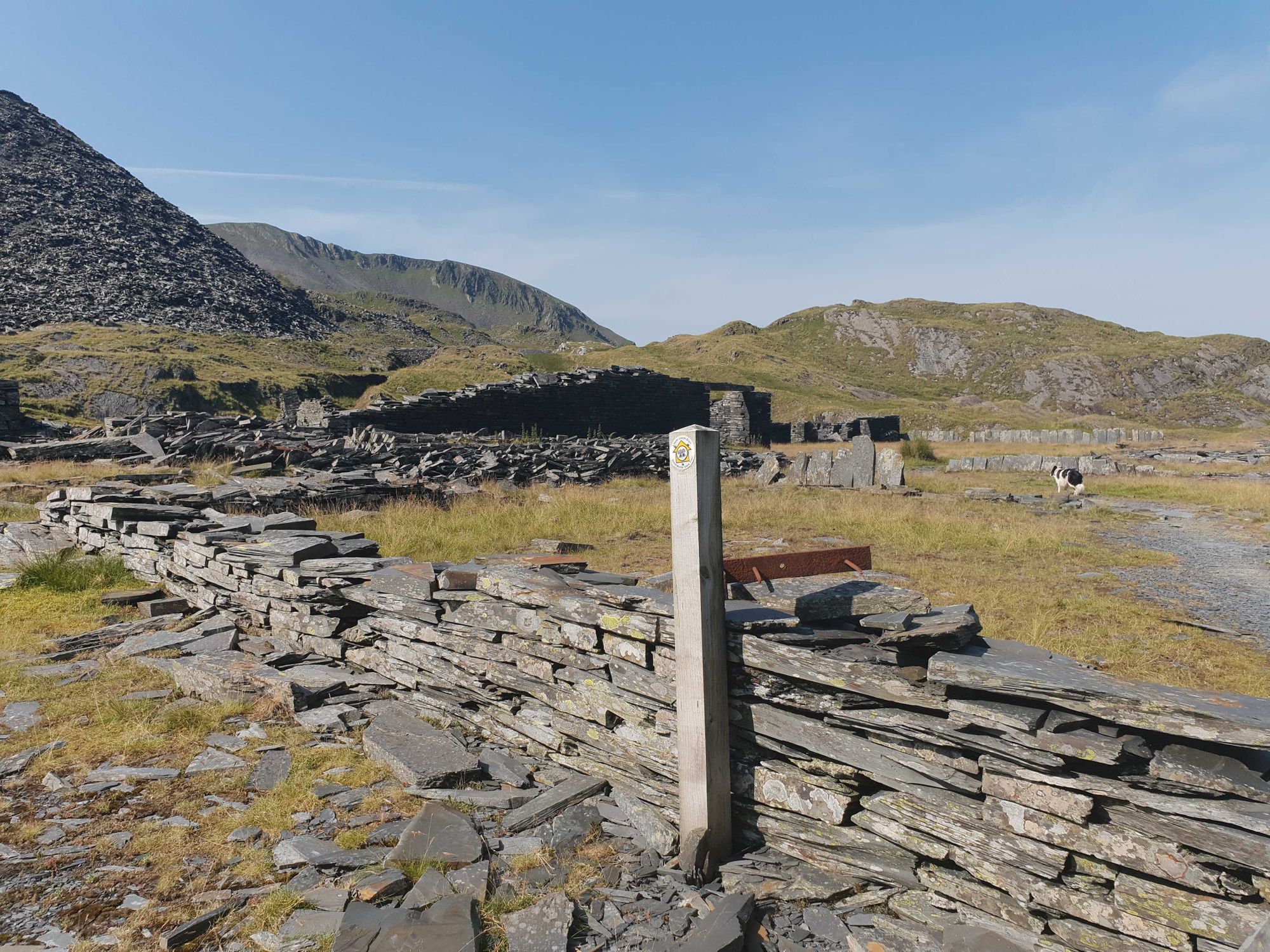
The whole of North Wales slate landscape has recently been recognised with UNESCO World Heritage status. Quarries in Wales helped to roof the industrial revolution. In the late 1800s, quarries were producing hundreds of thousand tonnes of slate roof tiles.
As part of this celebration of local heritage, the Snowdonia Slate Trail was created. It is a circular route starting and finishing in Bangor, designed to take in some of the lesser visited parts of Snowdonia. And, of course, as much slate heritage as possible.
Route Description
The Snowdonia Slate Trail passes between and around the main mountain ranges. It's less about slogging up and down hills, more about culture and landscape. With all the ruined buildings, quarries and mine works to explore, it's certainly a historical adventure never mind one of the best walks in Snowdonia National Park.
Enjoyed this article? You might also be interested in:
- 7 of the Best Things to Do in Eryri National Park That Aren't Hiking!
- The Much Better Adventures Guide to the Welsh 3000's Route
Inspired? Check out our Snowdon Challenge, a trek up Snowdonia's highest peak. Or browse of our hiking holidays in the UK.